
The Journal
36 Journal Sq,
Jersey City, NJ 07306
$3,085 - $7,000
Studio - 3 Beds
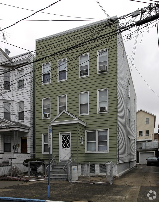
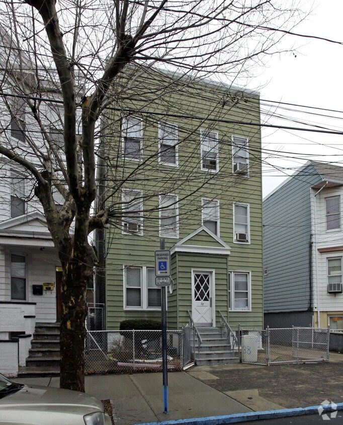

Explore your new home at 38 Wales Ave. This community can be found in Jersey City at 38 Wales Ave in the 07306 area. The professional leasing staff is waiting to show you all that this community has to offer. Be sure to check out the apartment floorplan options. Experience a new standard at 38 Wales Ave.
38 Wales Ave is an apartment community located in Hudson County and the 07306 ZIP Code. This area is served by the Jersey City Public School District attendance zone.
Situated along the Hackensack River, Jersey City's West Side neighborhood provides everything you would want in a community: terrific local shops and restaurants, highly-rated schools with nearby universities, comprehensive mass transit, walkable streets, and a huge park on the river – Lincoln Park, which covers 273 acres.
From West Side, you can easily reach all parts of Jersey City as well as Newark and New York City using the buses and trains. This Jersey City destination lies close to Journal Square, a transportation hub in the city.Saint Peter's University sits near the neighborhood, with Rutger's University not far way. The West Side area features some of Jersey City's best dining experiences and amenities, making it a quiet, urban neighborhood within a bustling city.
Learn more about living in West Side-HudsonCompare neighborhood and city base rent averages by bedroom.
| West Side-Hudson | Jersey City, NJ | |
|---|---|---|
| Studio | $1,276 | $2,767 |
| 1 Bedroom | $1,652 | $3,282 |
| 2 Bedrooms | $1,983 | $4,396 |
| 3 Bedrooms | $2,028 | $5,359 |
| Colleges & Universities | Distance | ||
|---|---|---|---|
| Colleges & Universities | Distance | ||
| Walk: | 15 min | 0.8 mi | |
| Drive: | 3 min | 1.1 mi | |
| Drive: | 5 min | 2.7 mi | |
| Drive: | 13 min | 4.6 mi |


Transportation options available in Jersey City include West Side Avenue, located 2.5 miles from 38 Wales Ave. 38 Wales Ave is near Newark Liberty International, located 7.4 miles or 13 minutes away, and LaGuardia, located 14.8 miles or 33 minutes away.
| Transit / Subway | Distance | ||
|---|---|---|---|
| Transit / Subway | Distance | ||
|
|
Drive: | 5 min | 2.5 mi |
|
|
Drive: | 7 min | 2.9 mi |
|
|
Drive: | 7 min | 3.1 mi |
|
|
Drive: | 7 min | 3.2 mi |
|
|
Drive: | 7 min | 3.2 mi |
| Commuter Rail | Distance | ||
|---|---|---|---|
| Commuter Rail | Distance | ||
|
|
Walk: | 15 min | 0.8 mi |
|
|
Drive: | 6 min | 2.8 mi |
|
|
Drive: | 8 min | 3.3 mi |
|
|
Drive: | 8 min | 3.5 mi |
|
|
Drive: | 12 min | 5.2 mi |
| Airports | Distance | ||
|---|---|---|---|
| Airports | Distance | ||
|
Newark Liberty International
|
Drive: | 13 min | 7.4 mi |
|
LaGuardia
|
Drive: | 33 min | 14.8 mi |
Scores provided by
Traffic
ActiveAirport
CalmBusinesses
BusyScores provided by
HowLoud What is a Sound Score Rating? A Sound Score Rating aggregates noise caused by vehicle traffic, airplane traffic and local sources. How It WorksTime and distance from 38 Wales Ave.
| Shopping Centers | Distance | ||
|---|---|---|---|
| Shopping Centers | Distance | ||
| Drive: | 4 min | 1.7 mi | |
| Drive: | 4 min | 1.8 mi | |
| Drive: | 6 min | 2.3 mi |
| Parks and Recreation | Distance | ||
|---|---|---|---|
| Parks and Recreation | Distance | ||
|
Liberty Science Center
|
Drive: | 9 min | 3.2 mi |
|
Liberty Landing Marina
|
Drive: | 10 min | 3.7 mi |
|
Laurel Hill Park
|
Drive: | 9 min | 3.8 mi |
|
Ellis Island National Monument
|
Drive: | 15 min | 4.6 mi |
|
Hudson River Park
|
Drive: | 15 min | 5.6 mi |
| Hospitals | Distance | ||
|---|---|---|---|
| Hospitals | Distance | ||
| Drive: | 5 min | 2.1 mi | |
| Drive: | 6 min | 2.9 mi | |
| Drive: | 9 min | 3.7 mi |
| Military Bases | Distance | ||
|---|---|---|---|
| Military Bases | Distance | ||
| Drive: | 13 min | 6.8 mi | |
| Drive: | 16 min | 7.0 mi | |
| Drive: | 31 min | 15.2 mi |
What Are Walk Score®, Transit Score®, and Bike Score® Ratings?
Walk Score® measures the walkability of any address. Transit Score® measures access to public transit. Bike Score® measures the bikeability of any address.
What is a Sound Score Rating?
A Sound Score Rating aggregates noise caused by vehicle traffic, airplane traffic and local sources.


