
Presidential Towers
555 W Madison St,
Chicago, IL 60661
$1,692 - $6,604
Studio - 2 Beds
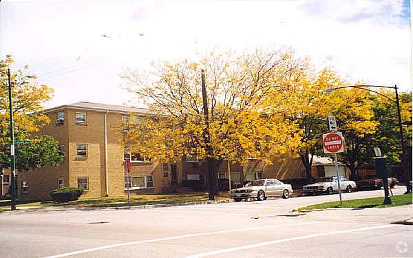
Experience a new place to live at 3757-3759 W 59th St. The 60629 location is an ideal place for residents. You'll experience a wide selection of features and amenities at this community like convenient on-site parking options, smoke free options, and high-speed internet access. The leasing staff is waiting to show you all that this community has to offer. Visit 3757-3759 W 59th St today.
3757-3759 W 59th St is an apartment community located in Cook County and the 60629 ZIP Code. This area is served by the Chicago Public Schools attendance zone.
Nine miles southwest of downtown Chicago, Illinois, the city's West Lawn neighborhood sits in a key location for access to transportation and recreation. Chicago Midway International Airport lies immediately to its west, and the expansive 323-acre Marquette Park and golf course to the east give residents easy entry to these top-city amenities. Residents enjoy the neighborhood's own West Lawn Park, featuring more than 16 acres of land and facilities. The park includes an auto shop, fitness center, gym, ice skating rink, and handball/racquetball courts.
West Lawn has a richly diverse population. Availability of homes for rent and easy commutes using mass transit attract many residents to this well-established community. Locals gather at the popular West Lawn branch of the public library. You also find neighbors at Mr. C's Midway Bar watching sports or quenching their after-work thirst with beverages brewed locally.
Learn more about living in West LawnCompare neighborhood and city base rent averages by bedroom.
| West Lawn | Chicago, IL | |
|---|---|---|
| Studio | $618 | $1,658 |
| 1 Bedroom | $1,384 | $2,054 |
| 2 Bedrooms | $1,542 | $2,599 |
| 3 Bedrooms | - | $3,112 |
| Colleges & Universities | Distance | ||
|---|---|---|---|
| Colleges & Universities | Distance | ||
| Drive: | 5 min | 2.5 mi | |
| Drive: | 14 min | 6.1 mi | |
| Drive: | 14 min | 7.0 mi | |
| Drive: | 15 min | 9.0 mi |


Transportation options available in Chicago include Midway Terminal, located 1.1 miles from 3757-3759 W 59th St. 3757-3759 W 59th St is near Chicago Midway International, located 2.4 miles or 5 minutes away, and Chicago O'Hare International, located 22.1 miles or 40 minutes away.
| Transit / Subway | Distance | ||
|---|---|---|---|
| Transit / Subway | Distance | ||
|
|
Walk: | 21 min | 1.1 mi |
|
|
Drive: | 3 min | 1.4 mi |
|
|
Drive: | 4 min | 2.0 mi |
|
|
Drive: | 6 min | 3.0 mi |
|
|
Drive: | 7 min | 3.5 mi |
| Commuter Rail | Distance | ||
|---|---|---|---|
| Commuter Rail | Distance | ||
|
|
Drive: | 7 min | 3.4 mi |
|
|
Drive: | 8 min | 3.8 mi |
|
|
Drive: | 11 min | 5.5 mi |
|
|
Drive: | 10 min | 5.7 mi |
|
|
Drive: | 15 min | 7.5 mi |
| Airports | Distance | ||
|---|---|---|---|
| Airports | Distance | ||
|
Chicago Midway International
|
Drive: | 5 min | 2.4 mi |
|
Chicago O'Hare International
|
Drive: | 40 min | 22.1 mi |
Scores provided by
Traffic
-Airport
-Businesses
-Scores provided by
HowLoud What is a Sound Score Rating? A Sound Score Rating aggregates noise caused by vehicle traffic, airplane traffic and local sources. How It WorksTime and distance from 3757-3759 W 59th St.
| Shopping Centers | Distance | ||
|---|---|---|---|
| Shopping Centers | Distance | ||
| Drive: | 3 min | 1.2 mi | |
| Drive: | 3 min | 1.3 mi | |
| Drive: | 3 min | 1.4 mi |
| Parks and Recreation | Distance | ||
|---|---|---|---|
| Parks and Recreation | Distance | ||
|
Marquette Park
|
Drive: | 4 min | 2.1 mi |
|
Gage Park
|
Drive: | 5 min | 2.3 mi |
|
McKinley Park
|
Drive: | 8 min | 4.1 mi |
|
Ogden Park
|
Drive: | 9 min | 4.4 mi |
|
Dan Ryan Woods
|
Drive: | 10 min | 5.0 mi |
| Hospitals | Distance | ||
|---|---|---|---|
| Hospitals | Distance | ||
| Drive: | 5 min | 2.5 mi | |
| Drive: | 10 min | 5.0 mi | |
| Drive: | 10 min | 5.4 mi |
| Military Bases | Distance | ||
|---|---|---|---|
| Military Bases | Distance | ||
| Drive: | 45 min | 27.6 mi | |
| Drive: | 48 min | 29.8 mi | |
| Drive: | 56 min | 32.7 mi |
What Are Walk Score®, Transit Score®, and Bike Score® Ratings?
Walk Score® measures the walkability of any address. Transit Score® measures access to public transit. Bike Score® measures the bikeability of any address.
What is a Sound Score Rating?
A Sound Score Rating aggregates noise caused by vehicle traffic, airplane traffic and local sources.

3757-3759 W 59th St
Chicago, IL 60629


