
$2,300
/ Month
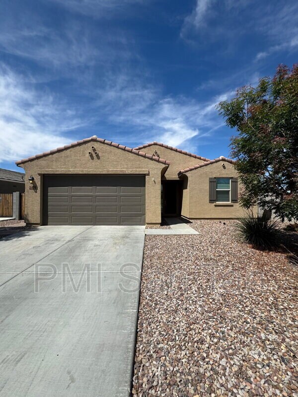
36578 N Tatonga Trail
Queen Creek, AZ 85140
2 Weeks Ago
|
Edit
Favorites
-
Bedrooms
4
-
Bathrooms
3
-
Square Feet
--
36578 N Tatonga Trail

Favorites
About This Home
$2,500 deposit
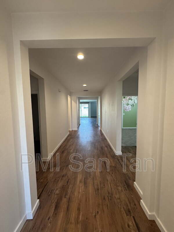
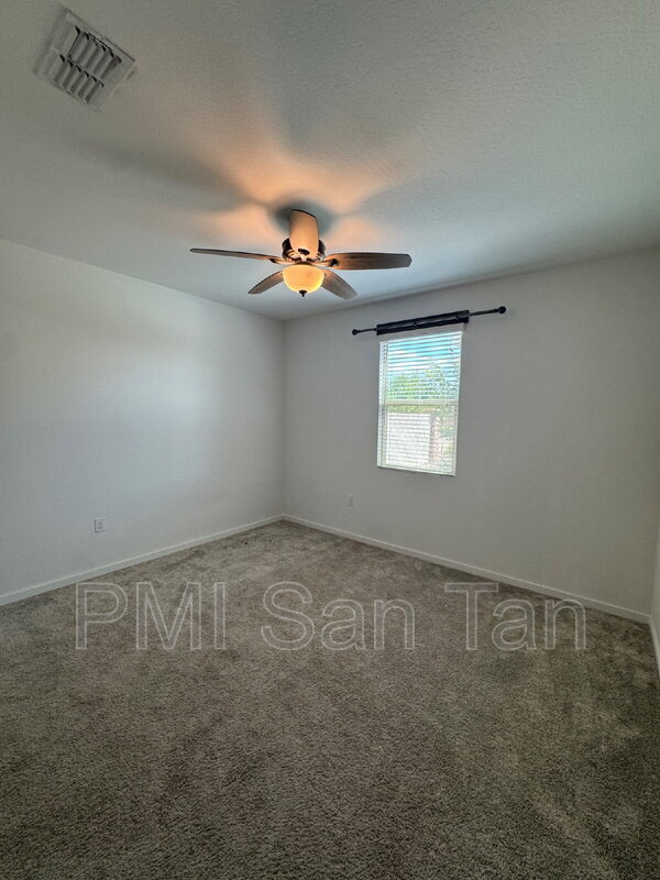
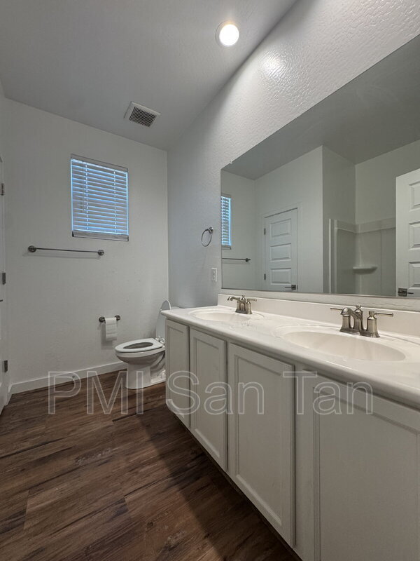
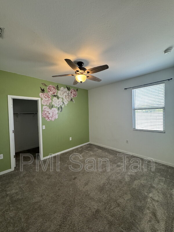
This stunning 4-bedroom, 2.5-bathroom residence welcomes you with its elegant design and thoughtful amenities. Expansive living spaces provide ample room for entertaining guests or enjoying cozy family nights in. With three full bathrooms, morning routines are effortless. The home's layout seamlessly integrates style and functionality, making it perfect for any lifestyle. Natural light floods through the windows, creating a warm and inviting atmosphere throughout. Whether you're enjoying a quiet evening on the patio or exploring the local amenities, this house truly feels like home. Discover the perfect blend of elegance and comfort at 36578 North Tatonga Trail.
36578 N Tatonga Trail is a house located in Pinal County and the 85140 ZIP Code. This area is served by the J O Combs Unified School District attendance zone.
* Price shown is base rent. Excludes user-selected optional fees and variable or usage-based fees and required charges due at or prior to move-in or at move-out. Price, availability, fees, and any applicable rent special are subject to change without notice.
* Square footage definitions vary. Displayed square footage is approximate.
Fees and Policies
The fees listed below are community-provided and may exclude utilities or add-ons. All payments are made directly to the property and are non-refundable unless otherwise specified.
- Dogs Allowed
-
Fees not specified
- Cats Allowed
-
Fees not specified
Contact
Location
Get Directions
The residents of San Tan Valley, located about an hour's drive southeast of Phoenix, take special pride in their community since they were the ones who chose its name only a few years ago. This newest addition to Phoenix's outlying areas consists of gracious homes for rent, often on large lots and in gated communities. Families in this area appreciate the excellent schools, and many love the fact that they drive past horse farms on their way to recreation in the nearby San Tan Mountains.
During the winter, spring, and fall, you can find your neighbors hiking at San Tan Mountain Regional Park, playing in the splash pad at Founders' Park, or riding horses at the Horseshoe Park & Equestrian Centre. Most people are new to this modern neighborhood, so many residents find it easy to make friendly connections as they relax on their porches viewing the desert sunset.
Learn more about living in San Tan Valley
Education
| Colleges & Universities | Distance | ||
|---|---|---|---|
| Colleges & Universities | Distance | ||
| Drive: | 23 min | 11.2 mi | |
| Drive: | 24 min | 11.6 mi | |
| Drive: | 33 min | 17.0 mi | |
| Drive: | 32 min | 19.7 mi |
36578 N Tatonga Trail is within 23 minutes or 11.2 miles from Arizona State Univ., Polytech. It is also near Chandler-Gilbert C.C., Mesa and Chandler-Gilbert C.C., Pecos.
Schools


Public Elementary & Middle School
Grades K-8
580 Students
Attendance Zone
Public Elementary School
Grades PK-5
514 Students
Attendance Zone
Public Middle & High School
Grades 6-12
1,176 Students
Attendance Zone
Private Elementary, Middle & High School
Grades K-12
Nearby
Private Elementary, Middle & High School
Grades PK-12
97 Students
Nearby
School data provided by
 The GreatSchools Rating helps parents compare schools within a state based on a variety of school quality indicators and provides a helpful picture of how effectively each school serves all of its students. Ratings are on a scale of 1 (below average) to 10 (above average) and can include test scores, college readiness, academic progress, advanced courses, equity, discipline and attendance data. We also advise parents to visit schools, consider other information on school performance and programs, and consider family needs as part of the school selection process.
View GreatSchools Rating Methodology
Data provided by GreatSchools.org © 2026. All rights reserved.
View GreatSchools Rating Methodology
Data provided by GreatSchools.org © 2026. All rights reserved.
Getting Around
 What do Walkability, Transit, Drivability, and Bikeability mean?
Walkability measures the walking distance to day-to-day needs.
Transit measures access to public transportation.
Drivability measures congestion, parking availability, and access to major roads.
Bikeability measures the suitability for cycling.
How It Works
What do Walkability, Transit, Drivability, and Bikeability mean?
Walkability measures the walking distance to day-to-day needs.
Transit measures access to public transportation.
Drivability measures congestion, parking availability, and access to major roads.
Bikeability measures the suitability for cycling.
How It Works
Somewhat Walkable
Walkability
30
/ 100
Exceptionally Drivable
Drivability
100
/ 100
Fairly Bikeable
Bikeability
40
/ 100
Scores provided by
-
Soundscore™
-
/ 100
Traffic
-Airport
-Businesses
-Scores provided by
HowLoud What is a Sound Score Rating? A Sound Score Rating aggregates noise caused by vehicle traffic, airplane traffic and local sources. How It WorksYou May Also Like
Similar Rentals Nearby


What Are Walk Score®, Transit Score®, and Bike Score® Ratings?
Walk Score® measures the walkability of any address. Transit Score® measures access to public transit. Bike Score® measures the bikeability of any address.
What is a Sound Score Rating?
A Sound Score Rating aggregates noise caused by vehicle traffic, airplane traffic and local sources.
36578 N Tatonga Trail
Queen Creek, AZ 85140