
$2,450
/ Month
363 Hoover Ave
Bloomfield, NJ 07003
Today
|
Edit
Favorites
866-201-6210
-
Bedrooms
2
-
Bathrooms
1
-
Square Feet
--
-
Available
Available Now
Highlights
- Main Floor Bedroom
- Living Room
- Laundry Room
- Fenced
363 Hoover Ave

Favorites
About This Home
Available Now
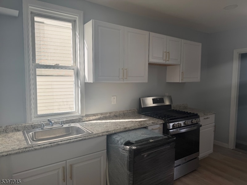
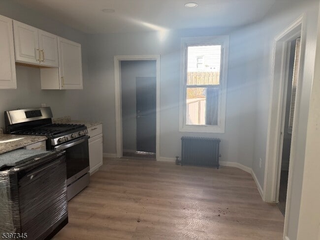
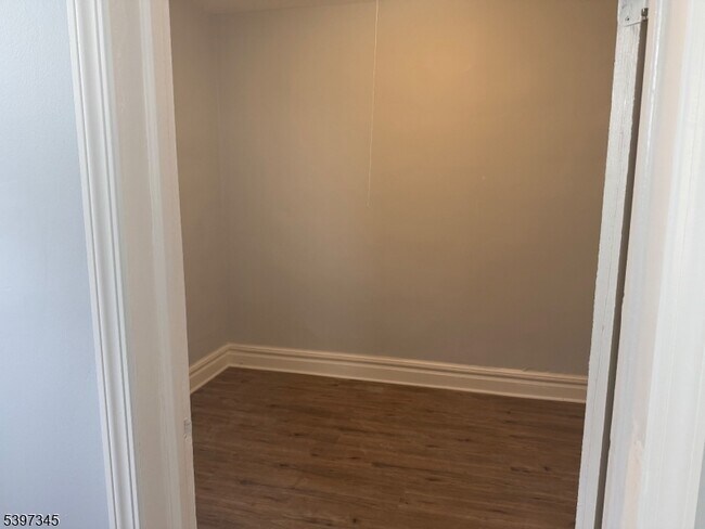
Experience comfortable, modern living on the first floor of a updated two-bedroom, one bath apartment in Bloomfield. This tidy, eat-in kitchen unit has been fully renovated and includes an in-unit washer and dryer for added convenience. All utilities are included in the rent, so you'll enjoy hassle-free living with one easy monthly payment. Shared backyard. Street parking, pets are happily considered. Bloomfield offers a charming, walkable-town vibe with local shops, eateries, and parks, and easy commute to NYC.
363 Hoover Ave is a house located in Essex County and the 07003 ZIP Code. This area is served by the Bloomfield Board Of Education attendance zone.
* Price shown is base rent. Excludes user-selected optional fees and variable or usage-based fees and required charges due at or prior to move-in or at move-out. Price, availability, fees, and any applicable rent special are subject to change without notice.
* Square footage definitions vary. Displayed square footage is approximate.
Home Details
Year Built
Built in 1912
Bedrooms and Bathrooms
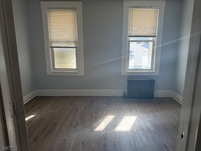
Main Floor Bedroom
1 Full Bathroom
2 Bedrooms
Interior Spaces
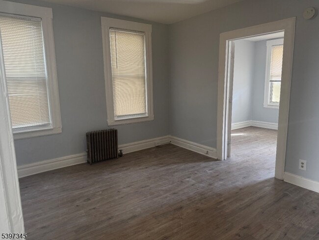
Living Room
Laminate Flooring
2-Story Property
Kitchen
Gas Oven or Range
Dishwasher
Laundry
Laundry Room
Listing and Financial Details
Assessor Parcel Number 1602-00696-0000-00019-0000-
Tenant pays for cable t.v.
Lot Details
27 Sq Ft Lot
Fenced
Parking
On-Street Parking
Utilities
Radiator
Gas Water Heater
Community Details
Fees and Policies
Contact
- Listed by PINA PAGLIUCA | GardenStateMLS#NJ
- Phone Number
- Contact
-
Source
Garden State Multiple Listing Service, LLC
Copyright © 2025 Garden State MLS, LLC. All rights reserved. All information provided by the listing agent/broker is deemed reliable but is not guaranteed and should be independently verified.
Location
Get Directions
Amenities
- Washer/Dryer
- Dishwasher
- Range
- Refrigerator
- Fenced Lot
Located 12 miles from Manhattan, Bloomfield combines small-town atmosphere with metropolitan accessibility. This Essex County township features established neighborhoods with housing options from classic single-family homes to contemporary apartment communities. The historic Bloomfield Green, anchored by the Presbyterian Church dating to 1794, serves as the town center. With two NJ Transit stations connecting to New York City and Newark, Bloomfield offers convenient transportation options for commuters. Current rental data shows one-bedroom apartments averaging $2,012, while three-bedroom units average $2,828.
Brookdale Park, spanning 77 acres, provides recreational opportunities with walking paths and athletic facilities. The downtown area near Bloomfield College features local shops and dining establishments. The Garden State Parkway and other major routes make commuting convenient from Bloomfield.
Learn more about living in Bloomfield
Education
| Colleges & Universities | Distance | ||
|---|---|---|---|
| Colleges & Universities | Distance | ||
| Drive: | 3 min | 1.6 mi | |
| Drive: | 11 min | 5.3 mi | |
| Drive: | 12 min | 5.5 mi | |
| Drive: | 13 min | 7.2 mi |
363 Hoover Ave is within 3 minutes or 1.6 miles from Bloomfield College. It is also near Montclair State University and Caldwell College.
Schools


Public Elementary School
Grades PK-2
154 Students
Nearby
Public Elementary School
Grades K-6
345 Students
Attendance Zone
Public Middle School
Grades 7-8
965 Students
Attendance Zone
Public High School
Grades 9-12
2,029 Students
Attendance Zone
Private Elementary & Middle School
Grades PK-8
160 Students
Nearby
Private Elementary, Middle & High School
127 Students
Nearby
Private Elementary School
Grades PK-5
Nearby
Private Elementary School
Grades 1-2
32 Students
Nearby
School data provided by
 The GreatSchools Rating helps parents compare schools within a state based on a variety of school quality indicators and provides a helpful picture of how effectively each school serves all of its students. Ratings are on a scale of 1 (below average) to 10 (above average) and can include test scores, college readiness, academic progress, advanced courses, equity, discipline and attendance data. We also advise parents to visit schools, consider other information on school performance and programs, and consider family needs as part of the school selection process.
View GreatSchools Rating Methodology
Data provided by GreatSchools.org © 2026. All rights reserved.
View GreatSchools Rating Methodology
Data provided by GreatSchools.org © 2026. All rights reserved.
Transportation options available in Bloomfield include Grove Street, located 2.8 miles from 363 Hoover Ave. 363 Hoover Ave is near Newark Liberty International, located 11.4 miles or 20 minutes away, and LaGuardia, located 24.5 miles or 43 minutes away.
| Transit / Subway | Distance | ||
|---|---|---|---|
| Transit / Subway | Distance | ||
|
|
Drive: | 6 min | 2.8 mi |
|
|
Drive: | 6 min | 3.1 mi |
|
|
Drive: | 6 min | 3.3 mi |
|
|
Drive: | 7 min | 3.6 mi |
|
|
Drive: | 7 min | 3.8 mi |
| Commuter Rail | Distance | ||
|---|---|---|---|
| Commuter Rail | Distance | ||
|
|
Drive: | 4 min | 1.5 mi |
|
|
Drive: | 4 min | 1.6 mi |
|
|
Drive: | 4 min | 1.6 mi |
|
|
Drive: | 4 min | 2.1 mi |
|
|
Drive: | 5 min | 2.8 mi |
| Airports | Distance | ||
|---|---|---|---|
| Airports | Distance | ||
|
Newark Liberty International
|
Drive: | 20 min | 11.4 mi |
|
LaGuardia
|
Drive: | 43 min | 24.5 mi |
Time and distance from 363 Hoover Ave.
| Shopping Centers | Distance | ||
|---|---|---|---|
| Shopping Centers | Distance | ||
| Drive: | 4 min | 1.5 mi | |
| Drive: | 4 min | 1.9 mi | |
| Drive: | 5 min | 2.7 mi |
363 Hoover Ave has 3 shopping centers within 2.7 miles, which is about a 5-minute drive. The miles and minutes will be for the farthest away property.
| Parks and Recreation | Distance | ||
|---|---|---|---|
| Parks and Recreation | Distance | ||
|
Van Vleck House & Gardens
|
Drive: | 6 min | 2.4 mi |
|
Presby Memorial Iris Gardens
|
Drive: | 8 min | 4.3 mi |
|
Branch Brook Park
|
Drive: | 9 min | 4.5 mi |
|
Edison National Historic Site
|
Drive: | 12 min | 5.3 mi |
|
Richard W. DeKorte Park
|
Drive: | 14 min | 6.1 mi |
363 Hoover Ave has 5 parks within 6.1 miles, including Van Vleck House & Gardens, Branch Brook Park, and Edison National Historic Site.
| Hospitals | Distance | ||
|---|---|---|---|
| Hospitals | Distance | ||
| Drive: | 10 min | 4.6 mi | |
| Drive: | 8 min | 5.0 mi | |
| Drive: | 9 min | 5.4 mi |
363 Hoover Ave has 3 hospitals within 5.4 miles, the nearest is Essex County Hospital Center which is 4.6 miles away and a 10 minute drive.
| Military Bases | Distance | ||
|---|---|---|---|
| Military Bases | Distance | ||
| Drive: | 25 min | 15.2 mi | |
| Drive: | 32 min | 20.2 mi |
363 Hoover Ave is 15.2 miles from Military Ocean Terminal, and is convenient to other military bases, including Governors Island Support Center.
You May Also Like
How do I access Social Services in New Jersey?
Statewide service is free, confidential, multilingual and always open. Three easy ways to reach Social Services in NJ: Dial 2-1-1; text your zip code to 898-211; or chat at https://www.nj211.org
Similar Rentals Nearby


What Are Walk Score®, Transit Score®, and Bike Score® Ratings?
Walk Score® measures the walkability of any address. Transit Score® measures access to public transit. Bike Score® measures the bikeability of any address.
What is a Sound Score Rating?
A Sound Score Rating aggregates noise caused by vehicle traffic, airplane traffic and local sources

363 Hoover Ave
Bloomfield, NJ 07003