
$800 / Month
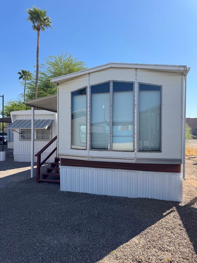
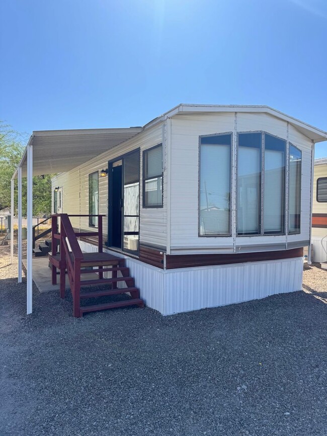
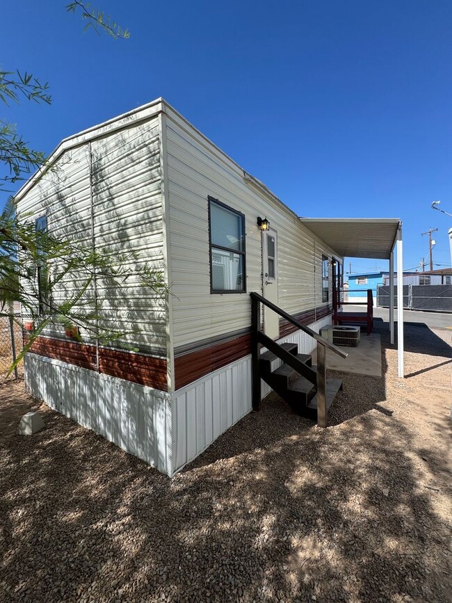
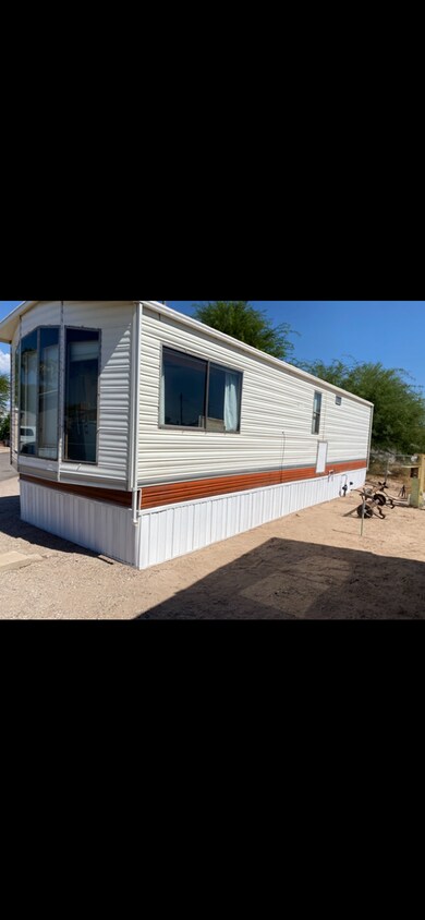
3600 E Benson Hwy Unit 4
Tucson, AZ 85706
Today
Favorites
520-651-6203
-
Bedrooms
1
-
Bathrooms
1
-
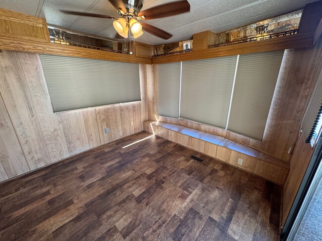
Square Feet
400 sq ft
-
Available
Available Now
3600 E Benson Hwy Unit 4

Favorites
Not to be confused with the enclave within the city of Tucson, South Tucson refers to the entire southern portion of Tucson. There are a wide variety of rentals in this area, from affordable apartments to spacious houses and everything in between.
Residents enjoy access to a wide variety of amenities in this region, including Tucson Mountain Park in the west, Kino Sports Complex in the east, Pima Air and Space Museum in the southeast, and Tucson International Airport in the southernmost stretches of the community. Convenience to Interstates 10 and 19 connects the region to the heart of Downtown Tucson and beyond.
Learn more about living in South Tucson
Education
| Colleges & Universities | Distance | ||
|---|---|---|---|
| Colleges & Universities | Distance | ||
| Drive: | 14 min | 5.2 mi | |
| Drive: | 12 min | 8.2 mi | |
| Drive: | 16 min | 8.7 mi | |
| Drive: | 15 min | 9.1 mi |
3600 E Benson Hwy Unit 4 is within 14 minutes or 5.2 miles from Pima C.C., Desert Vista Campus. It is also near University of Arizona and Pima C.C., Community Campus.
Transportation options available in Tucson include Sl/Congress/4Th Av, located 7.7 miles from 3600 E Benson Hwy Unit 4. 3600 E Benson Hwy Unit 4 is near Tucson International, located 3.7 miles or 8 minutes away.
| Transit / Subway | Distance | ||
|---|---|---|---|
| Transit / Subway | Distance | ||
| Drive: | 12 min | 7.7 mi | |
| Drive: | 13 min | 7.9 mi | |
| Drive: | 11 min | 8.0 mi | |
| Drive: | 11 min | 8.1 mi | |
| Drive: | 12 min | 8.2 mi |
| Commuter Rail | Distance | ||
|---|---|---|---|
| Commuter Rail | Distance | ||
|
|
Drive: | 12 min | 7.8 mi |
| Airports | Distance | ||
|---|---|---|---|
| Airports | Distance | ||
|
Tucson International
|
Drive: | 8 min | 3.7 mi |
Time and distance from 3600 E Benson Hwy Unit 4.
| Shopping Centers | Distance | ||
|---|---|---|---|
| Shopping Centers | Distance | ||
| Drive: | 3 min | 1.3 mi | |
| Drive: | 4 min | 1.5 mi | |
| Drive: | 4 min | 2.0 mi |
3600 E Benson Hwy Unit 4 has 3 shopping centers within 2.0 miles, which is about a 4-minute drive. The miles and minutes will be for the farthest away property.
| Parks and Recreation | Distance | ||
|---|---|---|---|
| Parks and Recreation | Distance | ||
|
Augie Acuna Los Ninos Park
|
Drive: | 4 min | 1.5 mi |
|
Sunnyside Park
|
Drive: | 6 min | 2.3 mi |
|
Thomas Jay Regional Park
|
Drive: | 5 min | 3.1 mi |
|
Mission Manor Park
|
Drive: | 11 min | 4.3 mi |
|
Freedom Park
|
Drive: | 10 min | 5.4 mi |
3600 E Benson Hwy Unit 4 has 5 parks within 5.4 miles, including Augie Acuna Los Ninos Park, Sunnyside Park, and Thomas Jay Regional Park.
| Hospitals | Distance | ||
|---|---|---|---|
| Hospitals | Distance | ||
| Drive: | 5 min | 2.9 mi | |
| Drive: | 15 min | 8.0 mi | |
| Drive: | 14 min | 8.9 mi |
3600 E Benson Hwy Unit 4 has 3 hospitals within 8.9 miles, the nearest is Banner - University Medical Center South Campus which is 2.9 miles away and a 5 minute drive.
| Military Bases | Distance | ||
|---|---|---|---|
| Military Bases | Distance | ||
| Drive: | 9 min | 3.8 mi | |
| Drive: | 12 min | 7.4 mi | |
| Drive: | 78 min | 67.1 mi |
3600 E Benson Hwy Unit 4 has 3 military bases within 67.1 miles, the nearest is Tucson Airport Air Guard Station which is 3.8 miles away and a 9 minute drive.
You May Also Like
Similar Rentals Nearby


What Are Walk Score®, Transit Score®, and Bike Score® Ratings?
Walk Score® measures the walkability of any address. Transit Score® measures access to public transit. Bike Score® measures the bikeability of any address.
What is a Sound Score Rating?
A Sound Score Rating aggregates noise caused by vehicle traffic, airplane traffic and local sources
3600 E Benson Hwy
Tucson, AZ 85706