$1,800
/ Month
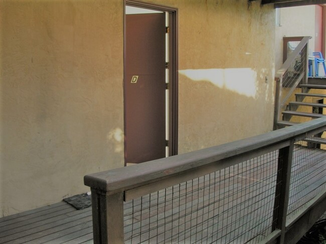
360 Panoramic Way Unit D
Berkeley, CA 94704
2 Weeks Ago
Favorites
360 Panoramic Way Unit D

Favorites
Check Back Soon for Upcoming Availability
| Beds | Baths | Average SF |
|---|---|---|
| Studio Studio 0 Br | 1 Bath 1 Bath 1 Ba | 300 SF |
Fees and Policies
The fees below are based on community-supplied data and may exclude additional fees and utilities.
- Dogs Allowed
-
Fees not specified
- Cats Allowed
-
Fees not specified
- Parking
-
Street--
Details
Utilities Included
-
Water
-
Trash Removal
-
Sewer
Lease Options
-
12 Months
About This Property
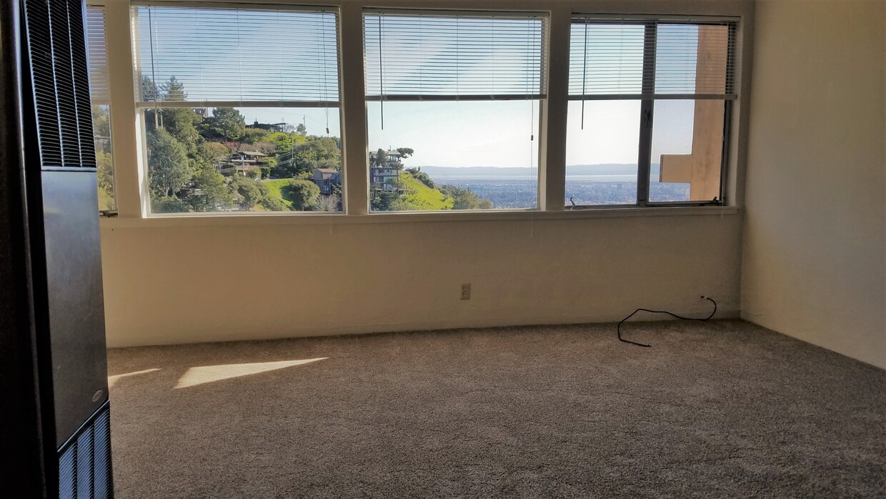
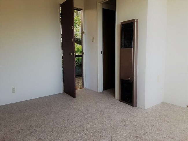
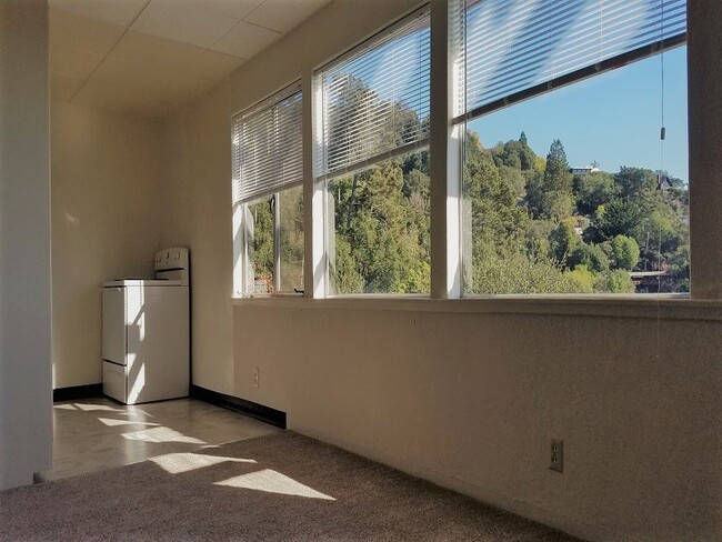
This lofty, studio apartment, sits high in the Berkeley hills and has a great view of the bay area. Arden path (15 or 20 minute walk) connects the University to the mini complex of 10 studios. A car is probably necessary because of the location and the lack of laundry facilities on site. The unit can be viewed between the hours of 11:30am to 4pm daily by appointment. A year lease and deposit of $1500.00 are required for rental. Fresh air, convenient hiking trails, minutes from downtown Berkeley, this is a great place to live.
360 Panoramic Way is an apartment community located in Alameda County and the 94704 ZIP Code.
Apartment Features
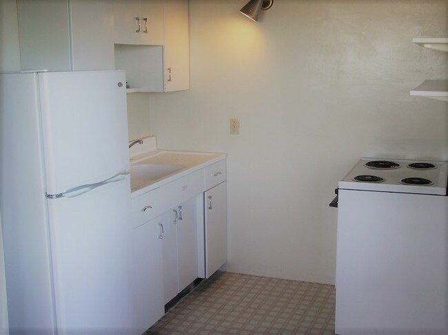
Refrigerator
Tub/Shower
Tile Floors
Smoke Free
- Heating
- Smoke Free
- Cable Ready
- Storage Space
- Tub/Shower
- Kitchen
- Oven
- Refrigerator
- Instant Hot Water
- Carpet
- Tile Floors
- Bay Window
- Views
- Laundry Facilities
- Deck
Location
Get Directions
The Southside community is located near the University of California, Berkeley. Students and residents can enjoy a variety of fare offered at restaurants that surround this 40,000-student public research campus. Public transportation is abound thanks to the Bay Area Rapid Transit rail station and bus stops near Southside.
You’ll discover numerous coffee shops, two cinemas, and cool museums near the college’s campus buildings and bookstores. Residents and students are close by to the Claremont Canyon Regional Preserve, which is an exceptional hiking destination that overlooks the San Francisco Bay.
Learn more about living in SouthsideBelow are rent ranges for similar nearby apartments
| Beds | Average Size | Lowest | Typical | Premium |
|---|---|---|---|---|
| Studio Studio Studio | 1972 Sq Ft | $1,070 | $1,120 | $1,170 |
| 1 Bed 1 Bed 1 Bed | 443 Sq Ft | $829 | $1,719 | $2,450 |
| 2 Beds 2 Beds 2 Beds | 506-515 Sq Ft | $821 | $2,240 | $3,700 |
| 3 Beds 3 Beds 3 Beds | 879-898 Sq Ft | $1,417 | $5,412 | $6,400 |
| 4 Beds 4 Beds 4 Beds | 1543 Sq Ft | $995 | $1,779 | $2,250 |
Amenities
- Heating
- Smoke Free
- Cable Ready
- Storage Space
- Tub/Shower
- Kitchen
- Oven
- Refrigerator
- Instant Hot Water
- Carpet
- Tile Floors
- Bay Window
- Views
- Laundry Facilities
- Deck
Expenses
Utilities Included
Water, Trash Removal, Sewer
Included
Education
| Colleges & Universities | Distance | ||
|---|---|---|---|
| Colleges & Universities | Distance | ||
| Drive: | 6 min | 1.7 mi | |
| Drive: | 7 min | 2.3 mi | |
| Drive: | 14 min | 4.6 mi | |
| Drive: | 15 min | 6.3 mi |
360 Panoramic Way Unit D is within 6 minutes or 1.7 miles from UC Berkeley. It is also near Berkeley City College and Samuel Merritt University.
Transportation options available in Berkeley include Downtown Berkeley, located 2.3 miles from 360 Panoramic Way Unit D. 360 Panoramic Way Unit D is near Metro Oakland International, located 15.4 miles or 26 minutes away, and San Francisco International, located 25.9 miles or 44 minutes away.
| Transit / Subway | Distance | ||
|---|---|---|---|
| Transit / Subway | Distance | ||
|
|
Drive: | 7 min | 2.3 mi |
|
|
Drive: | 7 min | 2.3 mi |
|
|
Drive: | 9 min | 2.7 mi |
|
|
Drive: | 10 min | 3.1 mi |
|
|
Drive: | 10 min | 3.1 mi |
| Commuter Rail | Distance | ||
|---|---|---|---|
| Commuter Rail | Distance | ||
|
|
Drive: | 12 min | 4.0 mi |
|
|
Drive: | 14 min | 4.5 mi |
|
|
Drive: | 15 min | 7.1 mi |
| Drive: | 23 min | 10.4 mi | |
| Drive: | 26 min | 13.5 mi |
| Airports | Distance | ||
|---|---|---|---|
| Airports | Distance | ||
|
Metro Oakland International
|
Drive: | 26 min | 15.4 mi |
|
San Francisco International
|
Drive: | 44 min | 25.9 mi |
Time and distance from 360 Panoramic Way Unit D.
| Shopping Centers | Distance | ||
|---|---|---|---|
| Shopping Centers | Distance | ||
| Drive: | 5 min | 1.8 mi | |
| Drive: | 6 min | 2.0 mi | |
| Drive: | 10 min | 3.4 mi |
360 Panoramic Way Unit D has 3 shopping centers within 3.4 miles, which is about a 10-minute drive. The miles and minutes will be for the farthest away property.
| Parks and Recreation | Distance | ||
|---|---|---|---|
| Parks and Recreation | Distance | ||
|
People's Park
|
Drive: | 4 min | 1.3 mi |
|
Botanical Garden at Berkeley
|
Drive: | 5 min | 1.6 mi |
|
Willard Park
|
Drive: | 5 min | 1.7 mi |
|
Lawrence Hall of Science
|
Drive: | 7 min | 2.4 mi |
|
Claremont Canyon Regional Preserve
|
Drive: | 9 min | 2.9 mi |
360 Panoramic Way Unit D has 5 parks within 2.9 miles, including Botanical Garden at Berkeley, Claremont Canyon Regional Preserve, and People's Park.
| Hospitals | Distance | ||
|---|---|---|---|
| Hospitals | Distance | ||
| Drive: | 6 min | 2.0 mi | |
| Drive: | 11 min | 3.6 mi | |
| Drive: | 13 min | 4.2 mi |
360 Panoramic Way Unit D has 3 hospitals within 4.2 miles, the nearest is Alta Bates Summit Medical Center - Alta Bates Campus which is 2.0 miles away and a 6 minute drive.
| Military Bases | Distance | ||
|---|---|---|---|
| Military Bases | Distance | ||
| Drive: | 17 min | 5.4 mi | |
| Drive: | 22 min | 8.8 mi |
360 Panoramic Way Unit D is 5.4 miles from Military Reservation, and is convenient to other military bases, including Oakland Army Base.
You May Also Like
Similar Rentals Nearby


What Are Walk Score®, Transit Score®, and Bike Score® Ratings?
Walk Score® measures the walkability of any address. Transit Score® measures access to public transit. Bike Score® measures the bikeability of any address.
What is a Sound Score Rating?
A Sound Score Rating aggregates noise caused by vehicle traffic, airplane traffic and local sources

360 Panoramic Way
Berkeley, CA 94704