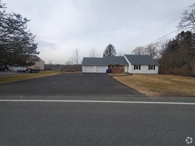
$1,900 / Month
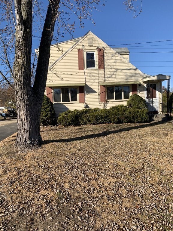
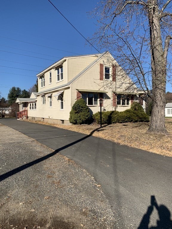
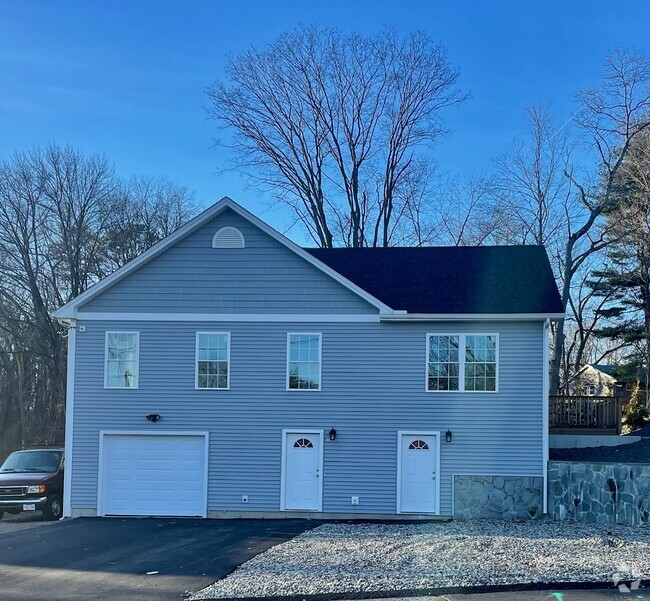
36 Cranston St
Westfield, MA 01085
2 Weeks Ago
Favorites
36 Cranston St

Favorites
Check Back Soon for Upcoming Availability
| Beds | Baths | Average SF |
|---|---|---|
| 3 Bedrooms 3 Bedrooms 3 Br | 1.5 Baths 1.5 Baths 1.5 Ba | 1,344 SF |
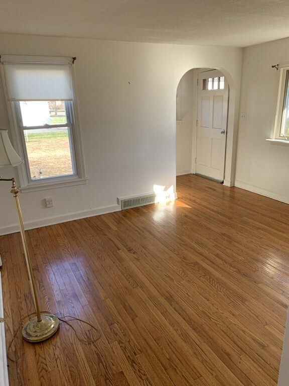
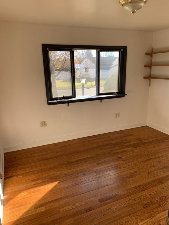
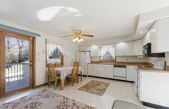
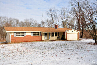
About This Property
Spacious 2 story Cape cod home with 3/4 bedrooms and a very large family room. Natural gas heat with central air and laundry in the basement. This home has a large yard and a driveway for 4 cars. Garage is not included in this rental. Wonderful location close to Westfield High School,MA. Pike,minutes to downtown and only 20 minutes to Easthampton. Close to shopping and restaurants. Link to apply for rental:
36 Cranston St is a house located in Hampden County and the 01085 ZIP Code. This area is served by the Westfield attendance zone.
Location
Get Directions
Situated in the Pioneer Valley of Western Massachusetts, Westfield exudes a rural charm on the cusp of several larger communities. Recreational opportunities abound in Westfield, with access to Stanley Park, Hampton Ponds State Park, the Westfield River, the Little River, Amelia Park Arena and Garden, and multiple country clubs. Westfield is also nearby Robinson State Park, Forest Park, and the Connecticut River in addition to Six Flags New England, which provide many additional options for outdoor fun.
Westfield offers plenty of local shops and eateries to peruse in the downtown district, and the national retailers in Holyoke Mall are just a short drive away too. Westfield is home to Westfield State University, which presents a host of cultural and educational opportunities to the local community. Commuting and traveling from Westfield is easy with convenience to I-90, Westfield Barnes Regional Airport, and Bradley International Airport.
Learn more about living in Westfield
Education
| Colleges & Universities | Distance | ||
|---|---|---|---|
| Colleges & Universities | Distance | ||
| Drive: | 9 min | 4.5 mi | |
| Drive: | 18 min | 9.0 mi | |
| Drive: | 25 min | 12.7 mi | |
| Drive: | 25 min | 12.7 mi |
36 Cranston St is within 9 minutes or 4.5 miles from Westfield State University. It is also near Holyoke Community College and Springfield College.
Schools


Public Elementary School
Grades PK-2
313 Students
Nearby
Public Elementary School
Grades K-4
166 Students
Nearby
Public Middle School
Grades 6-8
676 Students
Nearby
Public High School
Grades 9-12
1,027 Students
Attendance Zone
Private Elementary & Middle School
Grades PK-8
192 Students
Nearby
Private Elementary & Middle School
Grades K-8
Nearby
Private High School
Grades 9-12
332 Students
Nearby
School data provided by
 The GreatSchools Rating helps parents compare schools within a state based on a variety of school quality indicators and provides a helpful picture of how effectively each school serves all of its students. Ratings are on a scale of 1 (below average) to 10 (above average) and can include test scores, college readiness, academic progress, advanced courses, equity, discipline and attendance data. We also advise parents to visit schools, consider other information on school performance and programs, and consider family needs as part of the school selection process.
View GreatSchools Rating Methodology
View GreatSchools Rating Methodology
You May Also Like
Similar Rentals Nearby
What Are Walk Score®, Transit Score®, and Bike Score® Ratings?
Walk Score® measures the walkability of any address. Transit Score® measures access to public transit. Bike Score® measures the bikeability of any address.
What is a Sound Score Rating?
A Sound Score Rating aggregates noise caused by vehicle traffic, airplane traffic and local sources

36 Cranston St
Westfield, MA 01085