
The Vitagraph
1277 E 14th St,
Brooklyn, NY 11230
$2,770 - $3,668
1-3 Beds

Find your new place at 36 Clark St. You'll find this community on Clark St. in Brooklyn. The professional leasing team is ready to help you find your ideal place. This community has a variety of amenities and features including: smoke-free options, hardwood floors, and stainless steel appliances. It's time to love where you live. Stop by for a visit today.
36 Clark St is an apartment community located in Kings County and the 11201 ZIP Code. This area is served by the New York City Geographic District #13 attendance zone.
Dishwasher
High Speed Internet Access
Hardwood Floors
Microwave
If you’re looking to live in a neighborhood with the best views of the Brooklyn Bridge and Manhattan Skyline, then look no further than Brooklyn Heights. This neighborhood provides elegant brownstones along tree-lined streets and some of the best views in the city. Brooklyn Heights is a gorgeous neighborhood often referred to as New York City’s first suburb for its rich, historical roots.
What is it like living in Brooklyn Heights? Well, the neighborhood is home to an array of bistros and boutiques, with many along Montague Street. The neighborhood’s most iconic feature is the Brooklyn Heights Promenade, a paved walkway along the East River, where residents love to walk their dogs and go on bike rides.
A big plus to being a renter in Brooklyn Heights is that it’s just one subway stop away from Manhattan. Easy access to ferries and Citi Bike docks also makes getting around from Brooklyn Heights simple for all residents.
Learn more about living in Brooklyn HeightsCompare neighborhood and city base rent averages by bedroom.
| Brooklyn Heights | Brooklyn, NY | |
|---|---|---|
| Studio | $2,874 | $2,674 |
| 1 Bedroom | $3,621 | $2,996 |
| 2 Bedrooms | $5,467 | $3,925 |
| 3 Bedrooms | $10,746 | $4,864 |
| Colleges & Universities | Distance | ||
|---|---|---|---|
| Colleges & Universities | Distance | ||
| Walk: | 9 min | 0.5 mi | |
| Walk: | 9 min | 0.5 mi | |
| Walk: | 11 min | 0.6 mi | |
| Walk: | 14 min | 0.8 mi |


Transportation options available in Brooklyn include Clark Street, located 0.1 mile from 36 Clark St. 36 Clark St is near LaGuardia, located 10.4 miles or 20 minutes away, and Newark Liberty International, located 14.7 miles or 26 minutes away.
| Transit / Subway | Distance | ||
|---|---|---|---|
| Transit / Subway | Distance | ||
|
|
Walk: | 1 min | 0.1 mi |
|
|
Walk: | 7 min | 0.4 mi |
| Walk: | 8 min | 0.4 mi | |
|
|
Walk: | 10 min | 0.5 mi |
|
|
Walk: | 12 min | 0.7 mi |
| Commuter Rail | Distance | ||
|---|---|---|---|
| Commuter Rail | Distance | ||
|
|
Drive: | 7 min | 2.2 mi |
|
|
Drive: | 12 min | 3.7 mi |
|
|
Drive: | 12 min | 3.8 mi |
|
|
Drive: | 13 min | 4.4 mi |
|
|
Drive: | 18 min | 6.5 mi |
| Airports | Distance | ||
|---|---|---|---|
| Airports | Distance | ||
|
LaGuardia
|
Drive: | 20 min | 10.4 mi |
|
Newark Liberty International
|
Drive: | 26 min | 14.7 mi |
Scores provided by
Traffic
BusyAirport
CalmBusinesses
BusyScores provided by
HowLoud What is a Sound Score Rating? A Sound Score Rating aggregates noise caused by vehicle traffic, airplane traffic and local sources. How It WorksTime and distance from 36 Clark St.
| Shopping Centers | Distance | ||
|---|---|---|---|
| Shopping Centers | Distance | ||
| Drive: | 3 min | 1.3 mi | |
| Drive: | 7 min | 2.5 mi | |
| Drive: | 8 min | 2.7 mi |
| Parks and Recreation | Distance | ||
|---|---|---|---|
| Parks and Recreation | Distance | ||
|
Cadman Plaza Park
|
Walk: | 6 min | 0.3 mi |
|
Brooklyn Bridge Park
|
Walk: | 9 min | 0.5 mi |
|
Commodore Barry Park
|
Drive: | 4 min | 1.2 mi |
|
Cobble Hill Park
|
Drive: | 4 min | 1.3 mi |
|
Fort Greene Park
|
Drive: | 5 min | 1.4 mi |
| Hospitals | Distance | ||
|---|---|---|---|
| Hospitals | Distance | ||
| Drive: | 5 min | 1.6 mi | |
| Drive: | 10 min | 3.4 mi | |
| Drive: | 8 min | 3.5 mi |
| Military Bases | Distance | ||
|---|---|---|---|
| Military Bases | Distance | ||
| Drive: | 12 min | 4.5 mi | |
| Drive: | 24 min | 12.1 mi |
What Are Walk Score®, Transit Score®, and Bike Score® Ratings?
Walk Score® measures the walkability of any address. Transit Score® measures access to public transit. Bike Score® measures the bikeability of any address.
What is a Sound Score Rating?
A Sound Score Rating aggregates noise caused by vehicle traffic, airplane traffic and local sources.

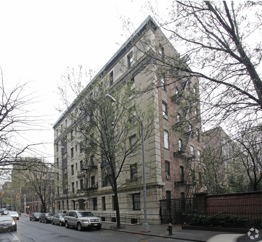
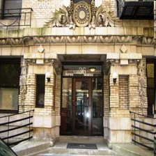
36 Clark St
Brooklyn, NY 11201


