

$3,495
Total Monthly Price
3560 Opal St
Los Angeles, CA 90023
Favorites
626-602-8524
-
Bedrooms
2
-
Bathrooms
2
-
Square Feet
1,142 sq ft
-
Available
Available Now
Highlight
- Pets Allowed
3560 Opal St

Favorites
About This Home
6 Month Lease,
$6,990 deposit,
Available Now
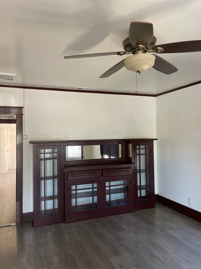
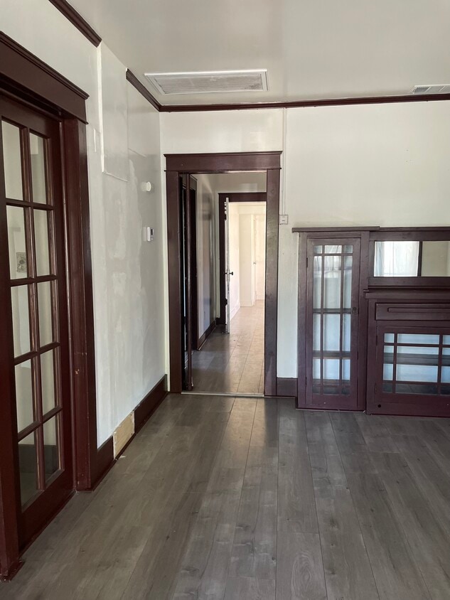
What's special Enclosed backyardDetached one-car garage Charming single-family home in the heart of Boyle Heights, an up-and-coming neighborhood just minutes (approx. 5 miles) from Downtown Los Angeles. Convenient access to the 60, 5, and 101 freeways makes commuting easy. The home features 2 bedrooms and 2 bathrooms (per public record), plus an additional bedroom created from an enclosed porch and a spacious bonus/workroom (approx. 25' x 15'), ideal for a home office, creative studio, or extended living space. Bright interior with abundant natural light, newer A/C and heating system, enclosed backyard, and a detached one-car garage. The garage has previously been used as a studio and offers flexible use for workspace or storage. Located near shopping, dining, Downtown LA's Garment District, and popular attractions including LA Live, La Brea Tar Pits, Chinatown, and Olvera Street. Gardener: Gardener service included Parking: Detached one-car garage included NOTE: “Pets considered with owner approval. Breed, size, and number restrictions may apply. Additional deposit and/or pet rent may be required.”
3560 Opal St is a house located in Los Angeles County and the 90023 ZIP Code.
* Price shown is total price based on community-supplied monthly required fees. Excludes user-selected optional fees and variable or usage-based fees and required charges due at or prior to move-in or at move-out. Price, availability, fees, and any applicable rent special are subject to change without notice.
* Square footage definitions vary. Displayed square footage is approximate.
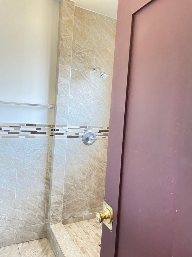
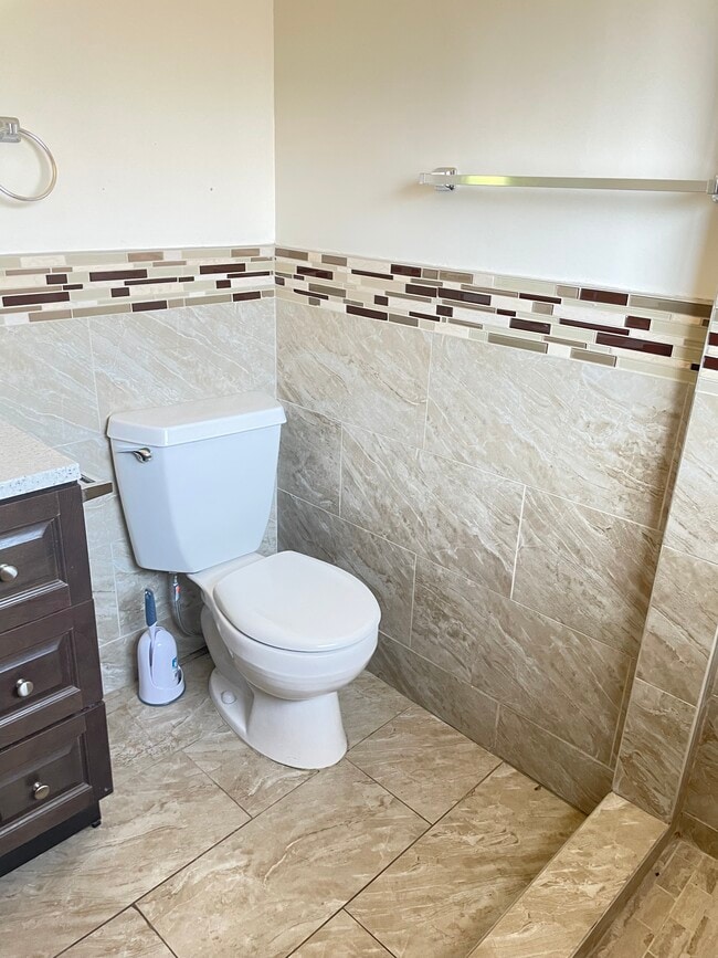
House Features
Air Conditioning
Washer/Dryer Hookup
Tub/Shower
Office
- Washer/Dryer Hookup
- Air Conditioning
- Heating
- Ceiling Fans
- Storage Space
- Tub/Shower
- Office
- Porch
Fees and Policies
The fees listed below are community-provided and may exclude utilities or add-ons. All payments are made directly to the property and are non-refundable unless otherwise specified.
- Dogs Allowed
-
Fees not specified
- Cats Allowed
-
Fees not specified
- Parking
-
Garage--
Details
Property Information
-
Built in 1922
Contact
- Phone Number
Location
Get Directions
Southeast Los Angeles is directly south of the Fashion District and east of the University of Southern California (USC). This large neighborhood is minutes from downtown Los Angeles, Hollywood, and Beverly Hills, with easy access to the 110 Freeway. This great location places you near sunny beaches, nature trails, and a bevy of leading employers. Students can access both USC and California State University Long Beach from their Southeast LA apartment.
This densely populated, diverse neighborhood features everything from food trucks and corner markets to wide sidewalks and residential areas filled with bungalows, ranch, and Spanish Colonial architecture. Southeast LA features palm trees and mountain views, tampered with gritty undertones to give it a cool, funky vibe.
As for outdoor fun, take your pick between Catalina Island, Venus Beach, or the Santa Monica Pier. Nearby, you’ll find more sunny beaches like White Point, Cabrillo, and Long Beach.
Learn more about living in Southeast Los Angeles
Education
| Colleges & Universities | Distance | ||
|---|---|---|---|
| Colleges & Universities | Distance | ||
| Drive: | 8 min | 4.1 mi | |
| Drive: | 9 min | 4.3 mi | |
| Drive: | 8 min | 4.4 mi | |
| Drive: | 11 min | 5.7 mi |
3560 Opal St is within 8 minutes or 4.1 miles from USC, Health Sciences Campus. It is also near East Los Angeles College and UEI, Huntington Park.
Transportation options available in Los Angeles include Indiana, located 1.6 miles from 3560 Opal St. 3560 Opal St is near Long Beach (Daugherty Field), located 17.9 miles or 27 minutes away, and Los Angeles International, located 18.4 miles or 29 minutes away.
| Transit / Subway | Distance | ||
|---|---|---|---|
| Transit / Subway | Distance | ||
|
|
Drive: | 3 min | 1.6 mi |
|
|
Drive: | 5 min | 2.7 mi |
|
|
Drive: | 5 min | 2.8 mi |
| Drive: | 5 min | 2.8 mi | |
|
|
Drive: | 6 min | 3.1 mi |
| Commuter Rail | Distance | ||
|---|---|---|---|
| Commuter Rail | Distance | ||
|
|
Drive: | 8 min | 4.2 mi |
|
|
Drive: | 10 min | 4.3 mi |
|
|
Drive: | 9 min | 5.5 mi |
|
|
Drive: | 10 min | 5.8 mi |
| Drive: | 11 min | 8.1 mi |
| Airports | Distance | ||
|---|---|---|---|
| Airports | Distance | ||
|
Long Beach (Daugherty Field)
|
Drive: | 27 min | 17.9 mi |
|
Los Angeles International
|
Drive: | 29 min | 18.4 mi |
Getting Around
 What do Walkability, Transit, Drivability, and Bikeability mean?
Walkability measures the walking distance to day-to-day needs.
Transit measures access to public transportation.
Drivability measures congestion, parking availability, and access to major roads.
Bikeability measures the suitability for cycling.
How It Works
What do Walkability, Transit, Drivability, and Bikeability mean?
Walkability measures the walking distance to day-to-day needs.
Transit measures access to public transportation.
Drivability measures congestion, parking availability, and access to major roads.
Bikeability measures the suitability for cycling.
How It Works
Moderately Walkable
Walkability
60
/ 100
Good Public Transit
Transit
60
/ 100
Exceptionally Drivable
Drivability
90
/ 100
Fairly Bikeable
Bikeability
40
/ 100
Scores provided by
Active
Soundscore™
68
/ 100
Traffic
BusyAirport
CalmBusinesses
ActiveScores provided by
HowLoud What is a Sound Score Rating? A Sound Score Rating aggregates noise caused by vehicle traffic, airplane traffic and local sources. How It WorksTime and distance from 3560 Opal St.
| Shopping Centers | Distance | ||
|---|---|---|---|
| Shopping Centers | Distance | ||
| Walk: | 6 min | 0.3 mi | |
| Drive: | 3 min | 1.4 mi |
3560 Opal St has 2 shopping centers within 1.4 miles, which is about a 3-minute drive. The miles and minutes will be for the farthest away property.
| Parks and Recreation | Distance | ||
|---|---|---|---|
| Parks and Recreation | Distance | ||
|
Hollenbeck Lake
|
Drive: | 5 min | 2.3 mi |
|
Augustus Hawkins Natural Park
|
Drive: | 10 min | 5.8 mi |
|
Vista Hermosa Natural Park
|
Drive: | 10 min | 5.8 mi |
|
California Science Center
|
Drive: | 12 min | 6.7 mi |
|
Elysian Park
|
Drive: | 15 min | 7.3 mi |
3560 Opal St has 5 parks within 7.3 miles, including Hollenbeck Lake, Augustus Hawkins Natural Park, and Vista Hermosa Natural Park.
| Hospitals | Distance | ||
|---|---|---|---|
| Hospitals | Distance | ||
| Walk: | 16 min | 0.9 mi | |
| Drive: | 3 min | 1.4 mi | |
| Drive: | 7 min | 3.9 mi |
3560 Opal St has 3 hospitals within 3.9 miles, the nearest is Los Angeles Community Hospital which is 0.9 mile away and a 16 minute walk.
| Military Bases | Distance | ||
|---|---|---|---|
| Military Bases | Distance | ||
| Drive: | 27 min | 19.1 mi | |
| Drive: | 31 min | 21.6 mi | |
| Drive: | 37 min | 25.0 mi |
3560 Opal St has 3 military bases within 25.0 miles, the nearest is Los Angeles Air Force Base which is 19.1 miles away and a 27 minute drive.
Amenities
- Washer/Dryer Hookup
- Air Conditioning
- Heating
- Ceiling Fans
- Storage Space
- Tub/Shower
- Office
- Porch
3560 Opal St Photos
What Are Walk Score®, Transit Score®, and Bike Score® Ratings?
Walk Score® measures the walkability of any address. Transit Score® measures access to public transit. Bike Score® measures the bikeability of any address.
What is a Sound Score Rating?
A Sound Score Rating aggregates noise caused by vehicle traffic, airplane traffic and local sources.
3560 Opal St
Los Angeles, CA 90023