
The Riverdale Tower
3745 Riverdale Ave,
The Bronx, NY 10463
$2,200 - $4,500
Studio - 2 Beds


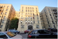
At 3560 Olinville Ave, experience great living. The address for this community is on Olinville Ave in the 10467 area of Bronx. The community staff will be ready to help you find your perfect place. Come for a visit to see the current floorplan options. Contact us or drop by the leasing office to check the current floorplan availability and find your new home at 3560 Olinville Ave.
3560 Olinville Ave is an apartment community located in Bronx County and the 10467 ZIP Code. This area is served by the New York City Geographic District #11 attendance zone.
Olinville is a narrow North Bronx neighborhood running along the Bronx River. The neighborhood layout is fairly typical for the borough, but residents enjoy direct access to huge greenspaces practically right next door: Bronx Park, Thain Family Forest, and Van Cortlandt Park are all easily within walking distance, and the river is lined with an extensive network of footpaths.
The corridor of eclectic shops and restaurants along White Plains Road makes it easy to walk down the street for groceries or to grab a bite to eat. Rent is fairly affordable by New York standards, and Fordham University’s campus is only a few blocks to the southwest, making Olinville a great option for college students.
Learn more about living in OlinvilleCompare neighborhood and city base rent averages by bedroom.
| Olinville | Bronx, NY | |
|---|---|---|
| Studio | $1,762 | $1,635 |
| 1 Bedroom | $1,601 | $1,636 |
| 2 Bedrooms | $2,461 | $2,089 |
| 3 Bedrooms | $2,726 | $2,373 |
| Colleges & Universities | Distance | ||
|---|---|---|---|
| Colleges & Universities | Distance | ||
| Drive: | 5 min | 2.2 mi | |
| Drive: | 6 min | 2.4 mi | |
| Drive: | 6 min | 2.5 mi | |
| Drive: | 5 min | 2.6 mi |


Transportation options available in Bronx include Gun Hill Road (2,5 Line), located 0.2 mile from 3560 Olinville Ave. 3560 Olinville Ave is near LaGuardia, located 12.2 miles or 22 minutes away, and Westchester County, located 20.7 miles or 32 minutes away.
| Transit / Subway | Distance | ||
|---|---|---|---|
| Transit / Subway | Distance | ||
|
|
Walk: | 4 min | 0.2 mi |
|
|
Walk: | 8 min | 0.5 mi |
|
|
Walk: | 11 min | 0.6 mi |
|
|
Walk: | 17 min | 0.9 mi |
|
|
Drive: | 3 min | 1.1 mi |
| Commuter Rail | Distance | ||
|---|---|---|---|
| Commuter Rail | Distance | ||
|
|
Walk: | 5 min | 0.3 mi |
|
|
Drive: | 4 min | 1.6 mi |
|
|
Drive: | 3 min | 1.7 mi |
|
|
Drive: | 4 min | 2.0 mi |
|
|
Drive: | 4 min | 2.4 mi |
| Airports | Distance | ||
|---|---|---|---|
| Airports | Distance | ||
|
LaGuardia
|
Drive: | 22 min | 12.2 mi |
|
Westchester County
|
Drive: | 32 min | 20.7 mi |
Time and distance from 3560 Olinville Ave.
| Shopping Centers | Distance | ||
|---|---|---|---|
| Shopping Centers | Distance | ||
| Drive: | 4 min | 2.0 mi | |
| Drive: | 5 min | 2.2 mi | |
| Drive: | 5 min | 2.4 mi |
| Parks and Recreation | Distance | ||
|---|---|---|---|
| Parks and Recreation | Distance | ||
|
Williamsbridge Oval
|
Walk: | 13 min | 0.7 mi |
|
Van Cortlandt Park
|
Drive: | 3 min | 2.2 mi |
|
Bronx Park
|
Drive: | 7 min | 2.3 mi |
|
New York Botanical Garden
|
Drive: | 9 min | 2.5 mi |
|
Seton Falls Park
|
Drive: | 5 min | 2.6 mi |
| Hospitals | Distance | ||
|---|---|---|---|
| Hospitals | Distance | ||
| Walk: | 15 min | 0.8 mi | |
| Drive: | 6 min | 2.7 mi | |
| Drive: | 6 min | 2.7 mi |
| Military Bases | Distance | ||
|---|---|---|---|
| Military Bases | Distance | ||
| Drive: | 20 min | 10.2 mi |
What Are Walk Score®, Transit Score®, and Bike Score® Ratings?
Walk Score® measures the walkability of any address. Transit Score® measures access to public transit. Bike Score® measures the bikeability of any address.
What is a Sound Score Rating?
A Sound Score Rating aggregates noise caused by vehicle traffic, airplane traffic and local sources
3560 Olinville Ave
Bronx, NY 10467


