
Isle House
39 Bruton St,
San Francisco, CA 94130
$3,395 - $7,635
Studio - 3 Beds
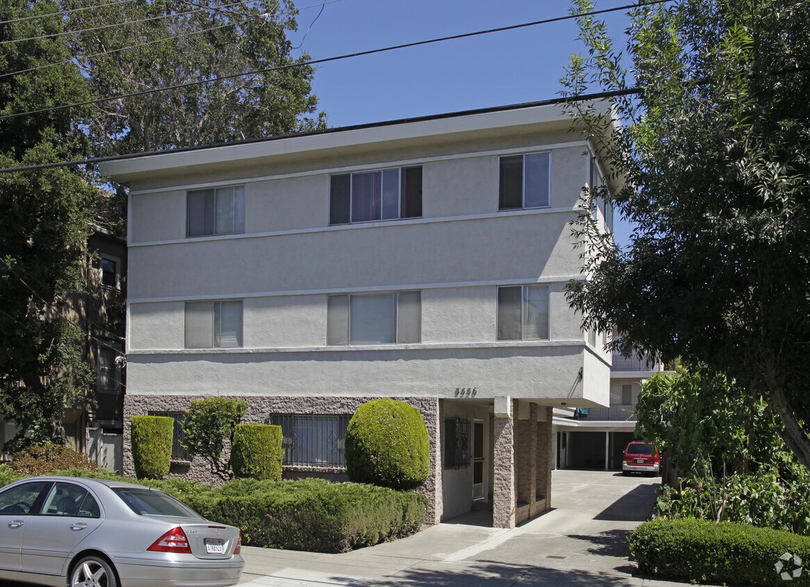
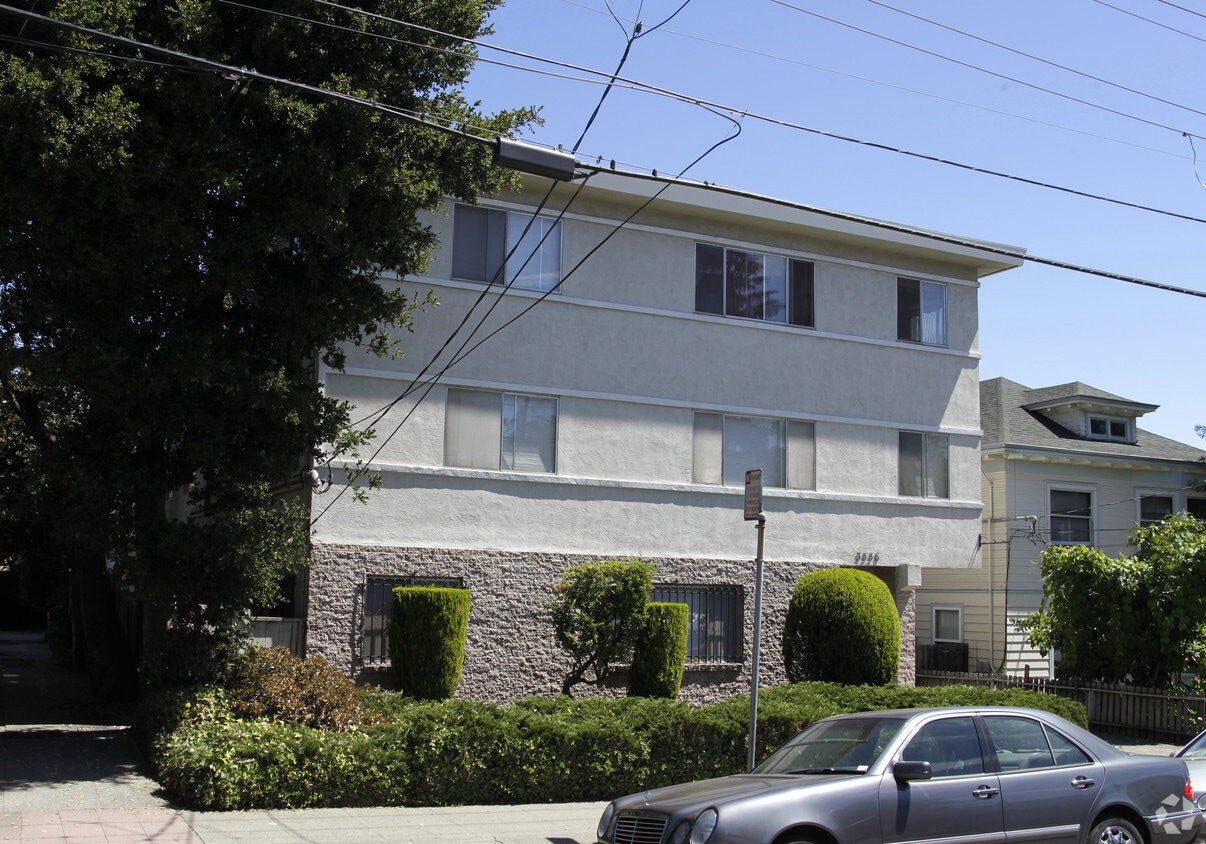

Experience your new place at 3556 Dimond Ave in Oakland, CA. A convenient Dimond Ave location in the 94602 Zip code of Oakland is a popular place for those looking for their new place. The leasing team is ready to help match you with the perfect new place. Make sure you to see the available floorplan options. Experience a better way of living at 3556 Dimond Ave. Stop by the leasing office to schedule a tour today.
3556 Dimond Ave is an apartment community located in Alameda County and the 94602 ZIP Code. This area is served by the Oakland Unified attendance zone.
The Lower Hills District of Oakland is made up of several small neighborhoods, including Piedmont, Crocker Heights, Oakmont, and Redwood Heights. Situated just seven miles to the east of Downtown Oakland on the north side of Interstate 580, the Lower Hills District maintains a small town feel despite its location among one of the Bay Area’s biggest communities. Windy, tree-lined streets house both new apartments and homes dating back to the '30s and '40s. Residents don’t have to travel far for everyday needs thanks to Oakland’s fast-growing economy. There is a plethora of shopping and dining options scattered around this sprawling community. You’ll find most of the amenities close to the MacArthur Freeway (Interstate 580) or near Park Boulevard. Access to the freeway and Bay Area Rapid Transit make getting around the rest of the Bay Area a breeze.
Learn more about living in Lower Hills DistrictCompare neighborhood and city base rent averages by bedroom.
| Lower Hills District | Oakland, CA | |
|---|---|---|
| Studio | $1,501 | $1,698 |
| 1 Bedroom | $1,577 | $2,083 |
| 2 Bedrooms | $1,871 | $2,682 |
| 3 Bedrooms | $2,805 | $3,217 |
| Colleges & Universities | Distance | ||
|---|---|---|---|
| Colleges & Universities | Distance | ||
| Drive: | 8 min | 2.7 mi | |
| Drive: | 6 min | 3.1 mi | |
| Drive: | 8 min | 3.5 mi | |
| Drive: | 7 min | 3.7 mi |


Transportation options available in Oakland include Fruitvale Station, located 2.1 miles from 3556 Dimond Ave. 3556 Dimond Ave is near Metro Oakland International, located 8.0 miles or 14 minutes away, and San Francisco International, located 25.3 miles or 37 minutes away.
| Transit / Subway | Distance | ||
|---|---|---|---|
| Transit / Subway | Distance | ||
|
|
Drive: | 4 min | 2.1 mi |
|
|
Drive: | 7 min | 3.5 mi |
|
|
Drive: | 7 min | 3.5 mi |
|
|
Drive: | 7 min | 3.5 mi |
|
|
Drive: | 7 min | 3.8 mi |
| Commuter Rail | Distance | ||
|---|---|---|---|
| Commuter Rail | Distance | ||
|
|
Drive: | 8 min | 3.8 mi |
|
|
Drive: | 9 min | 6.3 mi |
|
|
Drive: | 12 min | 8.4 mi |
| Drive: | 19 min | 12.8 mi | |
| Drive: | 19 min | 12.9 mi |
| Airports | Distance | ||
|---|---|---|---|
| Airports | Distance | ||
|
Metro Oakland International
|
Drive: | 14 min | 8.0 mi |
|
San Francisco International
|
Drive: | 37 min | 25.3 mi |
Time and distance from 3556 Dimond Ave.
| Shopping Centers | Distance | ||
|---|---|---|---|
| Shopping Centers | Distance | ||
| Walk: | 4 min | 0.2 mi | |
| Drive: | 4 min | 2.1 mi | |
| Drive: | 6 min | 2.7 mi |
| Parks and Recreation | Distance | ||
|---|---|---|---|
| Parks and Recreation | Distance | ||
|
Lakeside Park
|
Drive: | 4 min | 2.7 mi |
|
Morcom Rose Garden
|
Drive: | 5 min | 2.8 mi |
|
Rotary Nature Center
|
Drive: | 5 min | 3.0 mi |
|
Chabot Space & Science Center
|
Drive: | 11 min | 4.3 mi |
|
Joaquin Miller Park
|
Drive: | 11 min | 4.4 mi |
| Hospitals | Distance | ||
|---|---|---|---|
| Hospitals | Distance | ||
| Walk: | 18 min | 1.0 mi | |
| Walk: | 19 min | 1.0 mi | |
| Drive: | 5 min | 3.3 mi |
| Military Bases | Distance | ||
|---|---|---|---|
| Military Bases | Distance | ||
| Drive: | 16 min | 6.9 mi | |
| Drive: | 16 min | 8.8 mi |
What Are Walk Score®, Transit Score®, and Bike Score® Ratings?
Walk Score® measures the walkability of any address. Transit Score® measures access to public transit. Bike Score® measures the bikeability of any address.
What is a Sound Score Rating?
A Sound Score Rating aggregates noise caused by vehicle traffic, airplane traffic and local sources


