$2,750
Total Monthly Price
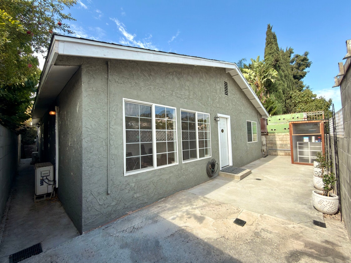
3552 Whiteside St
Los Angeles, CA 90063
Favorites
-
Bedrooms
2
-
Bathrooms
1
-
Square Feet
816 sq ft
-
Available
Available Now
Highlights
- Pets Allowed
- Hardwood Floors
- Security System
3552 Whiteside St

Favorites
About This Home
12 Month Lease,
$2,650 deposit,
Available Now
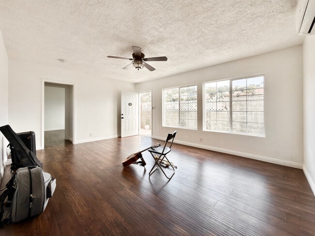
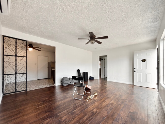
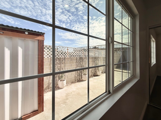
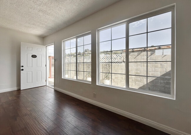
Tucked in the very back of the property for those that want safe, cozy, and undisturbed privacy. This back house has been improved, updated, and is now for rent today! This unit has 2 bedrooms, 1 full bathroom, a full kitchen, living room, and a small personal outdoor area. The outdoor area can be used for gym, lounging, or anything personal. Includes full access to newly built laundry room. Private parking space included. Overall vibe: Clean, secluded, spacious. The property is regularly maintained by housekeepers and gardeners. You have the option to use the weekly housekeepers to clean your space for free. Located in the heart of LA with super easy access to the I-10 freeway and 10 minutes from DTLA. Near McDonalds, Costco, Atlantic Times Square, Home Depot, and ELAC. Features and Upgrades: New full-house water filtration system Brand new roofing shingles Upgraded windows and front door All utilities included (water, gas, electricity) Ultra fast 1000 Mbps Fios high-speed internet included Bi-weekly professional cleaning service included Shared brand-new washer and shared dryer Modern kitchen with updated cabinetry and appliances Clean, updated bathroom Hardwood-style flooring throughout Plenty of natural light and functional layout Ductless mini splits Living Arrangement: Shared wall with owner-occupant Owner-occupant is quiet, respectful, and easygoing Private living space with clearly defined boundaries Own private entrance Designated parking on shared lot Lease Details: Occupancy: Maximum 2 tenants No utility setup required — everything is covered
3552 Whiteside St is a house located in Los Angeles County and the 90063 ZIP Code. This area is served by the Los Angeles Unified Rocp School District attendance zone.
* Price shown is total price based on community-supplied monthly required fees. Excludes user-selected optional fees and variable or usage-based fees and required charges due at or prior to move-in or at move-out. Price, availability, fees, and any applicable rent special are subject to change without notice.
* Square footage definitions vary. Displayed square footage is approximate.
House Features
High Speed Internet Access
Hardwood Floors
Wi-Fi
Tub/Shower
- High Speed Internet Access
- Wi-Fi
- Heating
- Ceiling Fans
- Cable Ready
- Security System
- Tub/Shower
- Handrails
- Framed Mirrors
- Kitchen
- Hardwood Floors
- Laundry Facilities
- Maid Service
Fees and Policies
The fees listed below are community-provided and may exclude utilities or add-ons. All payments are made directly to the property and are non-refundable unless otherwise specified.
- Dogs Allowed
-
Fees not specified
- Cats Allowed
-
Fees not specified
Details
Utilities Included
-
Gas
-
Water
-
Electricity
-
Heat
-
Trash Removal
-
Sewer
-
Air Conditioning
Contact
- Contact
Location
Get Directions
Southeast Los Angeles is directly south of the Fashion District and east of the University of Southern California (USC). This large neighborhood is minutes from downtown Los Angeles, Hollywood, and Beverly Hills, with easy access to the 110 Freeway. This great location places you near sunny beaches, nature trails, and a bevy of leading employers. Students can access both USC and California State University Long Beach from their Southeast LA apartment.
This densely populated, diverse neighborhood features everything from food trucks and corner markets to wide sidewalks and residential areas filled with bungalows, ranch, and Spanish Colonial architecture. Southeast LA features palm trees and mountain views, tampered with gritty undertones to give it a cool, funky vibe.
As for outdoor fun, take your pick between Catalina Island, Venus Beach, or the Santa Monica Pier. Nearby, you’ll find more sunny beaches like White Point, Cabrillo, and Long Beach.
Learn more about living in Southeast Los Angeles
Education
| Colleges & Universities | Distance | ||
|---|---|---|---|
| Colleges & Universities | Distance | ||
| Drive: | 10 min | 6.1 mi | |
| Drive: | 10 min | 6.2 mi | |
| Drive: | 12 min | 8.4 mi | |
| Drive: | 15 min | 11.9 mi |
3552 Whiteside St is within 10 minutes or 6.2 miles from Cal State Los Angeles. It is also near USC, Health Sciences Campus and East Los Angeles College.
Schools


Charter Elementary School
Grades K-5
75 Students
Nearby
Public Elementary School
Grades K-5
229 Students
Attendance Zone
Public Middle School
Grades 6-8
857 Students
Attendance Zone
Public High School
Grades 9-12
913 Students
Attendance Zone
Public High School
Grades 9-12
1,260 Students
Attendance Zone
Private Elementary & Middle School
Grades PK-8
217 Students
Nearby
Private Elementary & Middle School
Grades K-8
226 Students
Nearby
Private High School
Grades 9-12
279 Students
Nearby
School data provided by
 The GreatSchools Rating helps parents compare schools within a state based on a variety of school quality indicators and provides a helpful picture of how effectively each school serves all of its students. Ratings are on a scale of 1 (below average) to 10 (above average) and can include test scores, college readiness, academic progress, advanced courses, equity, discipline and attendance data. We also advise parents to visit schools, consider other information on school performance and programs, and consider family needs as part of the school selection process.
View GreatSchools Rating Methodology
Data provided by GreatSchools.org © 2026. All rights reserved.
View GreatSchools Rating Methodology
Data provided by GreatSchools.org © 2026. All rights reserved.
Transportation options available in Los Angeles include East La Civic Center, located 6.7 miles from 3552 Whiteside St. 3552 Whiteside St is near Bob Hope, located 24.8 miles or 32 minutes away, and Los Angeles International, located 26.3 miles or 39 minutes away.
| Transit / Subway | Distance | ||
|---|---|---|---|
| Transit / Subway | Distance | ||
|
|
Drive: | 11 min | 6.7 mi |
| Drive: | 11 min | 8.5 mi | |
|
|
Drive: | 12 min | 8.9 mi |
|
|
Drive: | 13 min | 9.1 mi |
|
|
Drive: | 13 min | 9.3 mi |
| Commuter Rail | Distance | ||
|---|---|---|---|
| Commuter Rail | Distance | ||
| Walk: | 20 min | 1.0 mi | |
|
|
Drive: | 15 min | 9.0 mi |
|
|
Drive: | 13 min | 10.2 mi |
|
|
Drive: | 15 min | 10.4 mi |
|
|
Drive: | 18 min | 12.8 mi |
| Airports | Distance | ||
|---|---|---|---|
| Airports | Distance | ||
|
Bob Hope
|
Drive: | 32 min | 24.8 mi |
|
Los Angeles International
|
Drive: | 39 min | 26.3 mi |
Getting Around
 What do Walkability, Transit, Drivability, and Bikeability mean?
Walkability measures the walking distance to day-to-day needs.
Transit measures access to public transportation.
Drivability measures congestion, parking availability, and access to major roads.
Bikeability measures the suitability for cycling.
How It Works
What do Walkability, Transit, Drivability, and Bikeability mean?
Walkability measures the walking distance to day-to-day needs.
Transit measures access to public transportation.
Drivability measures congestion, parking availability, and access to major roads.
Bikeability measures the suitability for cycling.
How It Works
Fairly Walkable
Walkability
40
/ 100
Good Public Transit
Transit
60
/ 100
Exceptionally Drivable
Drivability
100
/ 100
Not Bikeable
Bikeability
0
/ 100
Scores provided by
Busy
Soundscore™
54
/ 100
Traffic
BusyAirport
CalmBusinesses
ActiveScores provided by
HowLoud What is a Sound Score Rating? A Sound Score Rating aggregates noise caused by vehicle traffic, airplane traffic and local sources. How It WorksTime and distance from 3552 Whiteside St.
| Shopping Centers | Distance | ||
|---|---|---|---|
| Shopping Centers | Distance | ||
| Drive: | 9 min | 6.3 mi | |
| Drive: | 12 min | 8.6 mi | |
| Drive: | 12 min | 8.9 mi |
3552 Whiteside St has 3 shopping centers within 8.9 miles, which is about a 12-minute drive. The miles and minutes will be for the farthest away property.
| Parks and Recreation | Distance | ||
|---|---|---|---|
| Parks and Recreation | Distance | ||
|
Hollenbeck Lake
|
Drive: | 13 min | 9.5 mi |
|
Audubon Center at Debs Park
|
Drive: | 17 min | 12.3 mi |
|
Elysian Park
|
Drive: | 20 min | 12.3 mi |
|
Elyria Canyon Park
|
Drive: | 19 min | 13.1 mi |
|
Chavez Ravine Arboretum
|
Drive: | 17 min | 13.2 mi |
3552 Whiteside St has 5 parks within 13.2 miles, including Hollenbeck Lake, Audubon Center at Debs Park, and Elysian Park.
| Hospitals | Distance | ||
|---|---|---|---|
| Hospitals | Distance | ||
| Drive: | 11 min | 8.5 mi | |
| Drive: | 12 min | 8.6 mi | |
| Drive: | 13 min | 9.5 mi |
3552 Whiteside St has 3 hospitals within 9.5 miles, the nearest is Keck Hospital of USC which is 8.5 miles away and a 11 minute drive.
| Military Bases | Distance | ||
|---|---|---|---|
| Military Bases | Distance | ||
| Drive: | 36 min | 27.8 mi | |
| Drive: | 40 min | 28.8 mi | |
| Drive: | 46 min | 32.3 mi |
3552 Whiteside St has 3 military bases within 32.3 miles, the nearest is Los Angeles Air Force Base which is 27.8 miles away and a 36 minute drive.
Amenities
- High Speed Internet Access
- Wi-Fi
- Heating
- Ceiling Fans
- Cable Ready
- Security System
- Tub/Shower
- Handrails
- Framed Mirrors
- Kitchen
- Hardwood Floors
- Laundry Facilities
- Maid Service
3552 Whiteside St Photos
-
Main entrance
-
Living room
-
Living room to kitchen
-
Out of living room window
-
Out of living room window
-
Kitchen
-
Full house water filtration system
-
Laundry room
-
AC

3552 Whiteside St
Los Angeles, CA 90063