$1,885 / Month
3526 Copeland Pl Unit #3
Los Angeles, CA 90032
2 Weeks Ago
Favorites
3526 Copeland Pl Unit #3

Favorites
Check Back Soon for Upcoming Availability
| Beds | Baths | Average SF |
|---|---|---|
| 2 Bedrooms 2 Bedrooms 2 Br | 1 Bath 1 Bath 1 Ba | 885 SF |
Fees and Policies
The fees below are based on community-supplied data and may exclude additional fees and utilities.
- Parking
-
Surface Lot--
Details
Utilities Included
-
Water
-
Trash Removal
-
Sewer
Property Information
-
5 units
About This Property
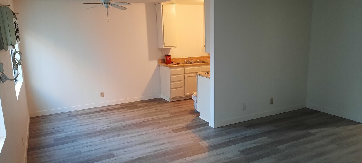
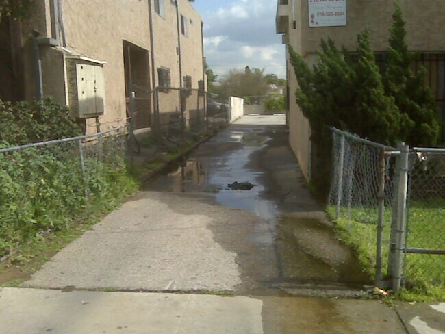
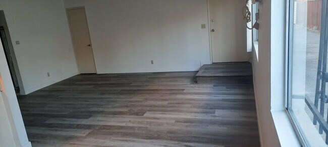
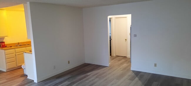
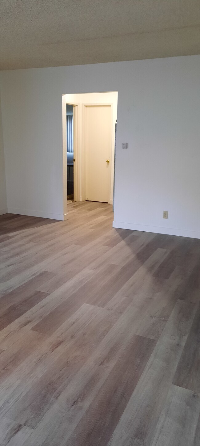
Ground floor, large unit, new waterproof plank flooring, new carpeting in the 2 bedrooms, newly painted throughout, new white oven, will contribute to new fridge if you need one, new blinds in LR and dinette, new bathroom sink cabinet, tub and surround re-glazed, large BR closets, coat closet, hall linen closets, 2 assigned parking spaces in rear of building, cul-de-sac, close to Huntington Dr., 3 residents max, only 5 units in building, this unit in rear of building -- near parking lot
3526 Copeland Pl is an apartment community located in Los Angeles County and the 90032 ZIP Code.
Apartment Features
Air Conditioning
High Speed Internet Access
Tub/Shower
Disposal
- High Speed Internet Access
- Air Conditioning
- Heating
- Ceiling Fans
- Smoke Free
- Cable Ready
- Tub/Shower
- Disposal
- Pantry
- Kitchen
- Oven
- Range
Location
Get Directions
A quiet suburb outside of Los Angeles, Monterey Hills is known for its rolling hills, winding residential streets, and elevated city views. Check out Elephant Hill, a popular place to bike or hike that offers beautiful views of the neighborhood. Herman Park is nestled along Highway 110 in the north end of the neighborhood, offering tennis courts, playgrounds, and a dog park. And for more outdoor recreation, visit the biking paths and hiking trails at Ernest E. Debs Regional Park, bordering Monterey Hills.
Monterey Hills is a more secluded part of Northeast Los Angeles with larger lots, single-family homes, and tree-lined streets. However, if you cross over Highway 110, you’ll find theatres, restaurants, services, and more. Monterey Hills is located just seven miles northeast of Downtown Los Angeles and eight miles east of major attractions such as Griffith Park, the Los Angeles Zoo, the Greek Theatre, and Glendale Galleria.
Learn more about living in Monterey HillsBelow are rent ranges for similar nearby apartments
Amenities
- High Speed Internet Access
- Air Conditioning
- Heating
- Ceiling Fans
- Smoke Free
- Cable Ready
- Tub/Shower
- Disposal
- Pantry
- Kitchen
- Oven
- Range
Expenses
Utilities Included
Water, Trash Removal, Sewer
Included
Education
| Colleges & Universities | Distance | ||
|---|---|---|---|
| Colleges & Universities | Distance | ||
| Drive: | 9 min | 3.4 mi | |
| Drive: | 9 min | 3.7 mi | |
| Drive: | 9 min | 4.4 mi | |
| Drive: | 13 min | 6.1 mi |
3526 Copeland Pl Unit #3 is within 9 minutes or 3.4 miles from Cal State Los Angeles. It is also near Art Center College of Design and USC, Health Sciences Campus.
Transportation options available in Los Angeles include South Pasadena, located 2.7 miles from 3526 Copeland Pl Unit #3. 3526 Copeland Pl Unit #3 is near Bob Hope, located 19.2 miles or 30 minutes away, and Los Angeles International, located 22.0 miles or 38 minutes away.
| Transit / Subway | Distance | ||
|---|---|---|---|
| Transit / Subway | Distance | ||
|
|
Drive: | 7 min | 2.7 mi |
|
|
Drive: | 10 min | 4.2 mi |
|
|
Drive: | 10 min | 4.6 mi |
|
|
Drive: | 11 min | 4.8 mi |
|
|
Drive: | 13 min | 5.6 mi |
| Commuter Rail | Distance | ||
|---|---|---|---|
| Commuter Rail | Distance | ||
|
|
Drive: | 14 min | 5.9 mi |
|
|
Drive: | 12 min | 6.0 mi |
|
|
Drive: | 16 min | 8.5 mi |
|
|
Drive: | 18 min | 9.4 mi |
| Drive: | 16 min | 9.9 mi |
| Airports | Distance | ||
|---|---|---|---|
| Airports | Distance | ||
|
Bob Hope
|
Drive: | 30 min | 19.2 mi |
|
Los Angeles International
|
Drive: | 38 min | 22.0 mi |
Time and distance from 3526 Copeland Pl Unit #3.
| Shopping Centers | Distance | ||
|---|---|---|---|
| Shopping Centers | Distance | ||
| Drive: | 4 min | 1.5 mi | |
| Drive: | 5 min | 1.6 mi | |
| Drive: | 5 min | 2.0 mi |
3526 Copeland Pl Unit #3 has 3 shopping centers within 2.0 miles, which is about a 5-minute drive. The miles and minutes will be for the farthest away property.
| Parks and Recreation | Distance | ||
|---|---|---|---|
| Parks and Recreation | Distance | ||
|
Audubon Center at Debs Park
|
Drive: | 11 min | 4.6 mi |
|
Hollenbeck Lake
|
Drive: | 11 min | 5.7 mi |
|
Huntington Botanical Gardens
|
Drive: | 15 min | 6.0 mi |
|
Elysian Park
|
Drive: | 17 min | 6.6 mi |
|
Elyria Canyon Park
|
Drive: | 16 min | 7.2 mi |
3526 Copeland Pl Unit #3 has 5 parks within 7.2 miles, including Audubon Center at Debs Park, Elyria Canyon Park, and Huntington Botanical Gardens.
| Hospitals | Distance | ||
|---|---|---|---|
| Hospitals | Distance | ||
| Drive: | 4 min | 1.9 mi | |
| Drive: | 8 min | 4.0 mi | |
| Drive: | 9 min | 4.3 mi |
3526 Copeland Pl Unit #3 has 3 hospitals within 4.3 miles, the nearest is Alhambra Hospital Medical Center which is 1.9 miles away and a 4 minute drive.
| Military Bases | Distance | ||
|---|---|---|---|
| Military Bases | Distance | ||
| Drive: | 35 min | 23.6 mi | |
| Drive: | 39 min | 26.3 mi |
3526 Copeland Pl Unit #3 is 23.6 miles from Los Angeles Air Force Base, and is convenient to other military bases, including Los Alamitos Army Airfield.
You May Also Like
Similar Rentals Nearby


 - Violet on Virgil")


 - AVA Burbank")


What Are Walk Score®, Transit Score®, and Bike Score® Ratings?
Walk Score® measures the walkability of any address. Transit Score® measures access to public transit. Bike Score® measures the bikeability of any address.
What is a Sound Score Rating?
A Sound Score Rating aggregates noise caused by vehicle traffic, airplane traffic and local sources

3526 Copeland Pl
Los Angeles, CA 90032