
Hue39
3909 San Fernando Rd,
Glendale, CA 91204
$2,495 - $3,500
1-2 Beds
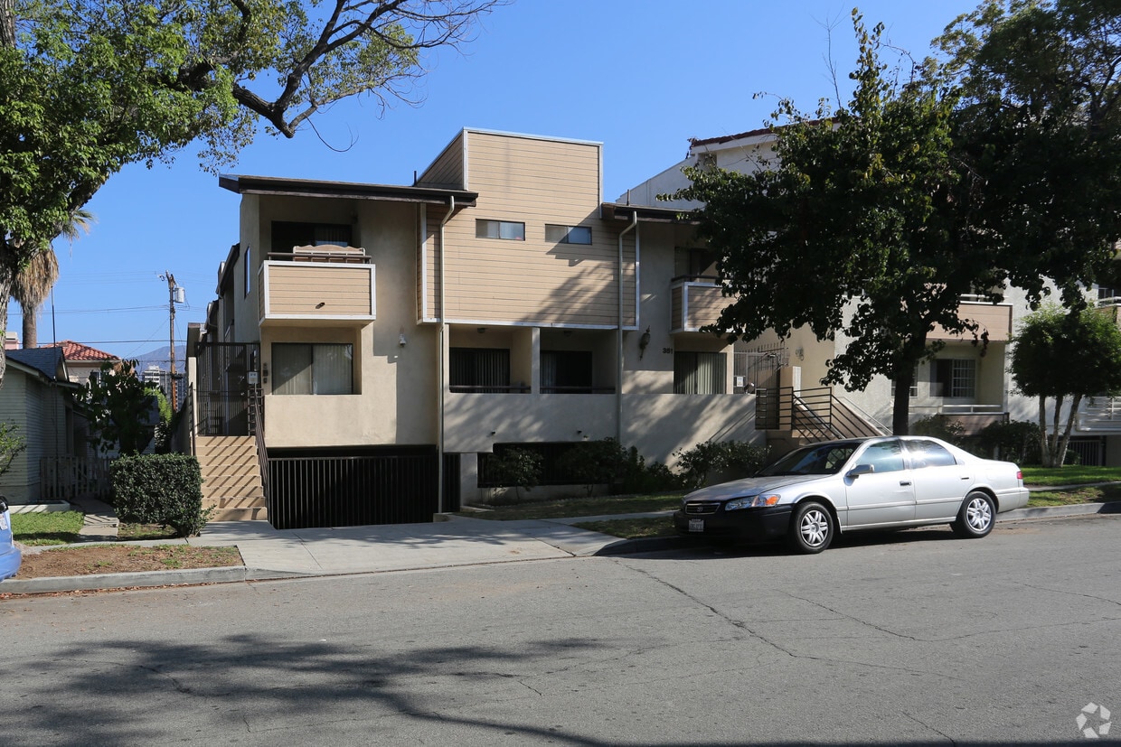
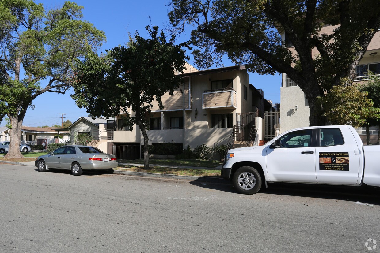

Welcome to 351 Myrtle St in Glendale, CA. Located in Glendale's 91203 Zip code, moving here gives you plenty of nearby experiences. The leasing team is waiting to show you all that this community has to offer. Make sure you to see the available floorplan options. Contact us or stop by today.
351 Myrtle St is an apartment community located in Los Angeles County and the 91203 ZIP Code. This area is served by the Glendale Unified School District attendance zone.
Vineyard provides residents with a central location and easy access to plenty of amenities. Vineyard has its own amenities scattered throughout the neighborhood and is directly adjacent to Downtown Glendale, giving residents easy access to plenty of restaurants and stores. Glendale Galleria neighbors Vineyard and has a wide selection of designer and popular brands and trendy eateries. Highway 134 allows residents to travel across Los Angeles County with ease. Vineyard is convenient to some of Los Angeles’ most popular destinations including Griffith Park, Burbank, and Downtown Los Angeles. This suburban neighborhood is known for its great schools, lush parks, and variety of rental options. Vineyard has affordable to upscale apartments, houses, condos, and townhomes available for rent.
Learn more about living in VineyardCompare neighborhood and city base rent averages by bedroom.
| Vineyard | Glendale, CA | |
|---|---|---|
| Studio | $2,244 | $2,022 |
| 1 Bedroom | $2,409 | $2,114 |
| 2 Bedrooms | $2,718 | $2,683 |
| 3 Bedrooms | $3,878 | $3,450 |
| Colleges & Universities | Distance | ||
|---|---|---|---|
| Colleges & Universities | Distance | ||
| Drive: | 6 min | 2.6 mi | |
| Drive: | 10 min | 4.6 mi | |
| Drive: | 8 min | 4.9 mi | |
| Drive: | 15 min | 8.6 mi |


Transportation options available in Glendale include Vermont/Sunset Station, located 5.2 miles from 351 Myrtle St. 351 Myrtle St is near Bob Hope, located 9.8 miles or 15 minutes away, and Los Angeles International, located 20.4 miles or 38 minutes away.
| Transit / Subway | Distance | ||
|---|---|---|---|
| Transit / Subway | Distance | ||
|
|
Drive: | 10 min | 5.2 mi |
|
|
Drive: | 10 min | 5.7 mi |
|
|
Drive: | 11 min | 5.7 mi |
|
|
Drive: | 13 min | 7.1 mi |
|
|
Drive: | 13 min | 7.7 mi |
| Commuter Rail | Distance | ||
|---|---|---|---|
| Commuter Rail | Distance | ||
|
|
Drive: | 5 min | 2.3 mi |
|
|
Drive: | 7 min | 4.3 mi |
|
|
Drive: | 11 min | 7.0 mi |
| Drive: | 11 min | 7.6 mi | |
|
|
Drive: | 15 min | 9.2 mi |
| Airports | Distance | ||
|---|---|---|---|
| Airports | Distance | ||
|
Bob Hope
|
Drive: | 15 min | 9.8 mi |
|
Los Angeles International
|
Drive: | 38 min | 20.4 mi |
Scores provided by
Traffic
-Airport
-Businesses
-Scores provided by
HowLoud What is a Sound Score Rating? A Sound Score Rating aggregates noise caused by vehicle traffic, airplane traffic and local sources. How It WorksTime and distance from 351 Myrtle St.
| Shopping Centers | Distance | ||
|---|---|---|---|
| Shopping Centers | Distance | ||
| Walk: | 9 min | 0.5 mi | |
| Walk: | 10 min | 0.5 mi | |
| Walk: | 12 min | 0.7 mi |
| Parks and Recreation | Distance | ||
|---|---|---|---|
| Parks and Recreation | Distance | ||
|
Los Angeles Zoo
|
Drive: | 13 min | 4.4 mi |
|
Bird Sanctuary
|
Drive: | 10 min | 4.7 mi |
|
Marsh Park
|
Drive: | 10 min | 5.5 mi |
|
Griffith Observatory
|
Drive: | 14 min | 5.9 mi |
|
Griffith Park
|
Drive: | 24 min | 8.1 mi |
| Hospitals | Distance | ||
|---|---|---|---|
| Hospitals | Distance | ||
| Drive: | 4 min | 1.7 mi | |
| Drive: | 7 min | 2.4 mi | |
| Drive: | 7 min | 4.6 mi |
| Military Bases | Distance | ||
|---|---|---|---|
| Military Bases | Distance | ||
| Drive: | 35 min | 24.2 mi | |
| Drive: | 47 min | 33.7 mi | |
| Drive: | 49 min | 35.0 mi |
Pets Allowed Fitness Center Pool Maintenance on site High-Speed Internet Controlled Access EV Charging
What Are Walk Score®, Transit Score®, and Bike Score® Ratings?
Walk Score® measures the walkability of any address. Transit Score® measures access to public transit. Bike Score® measures the bikeability of any address.
What is a Sound Score Rating?
A Sound Score Rating aggregates noise caused by vehicle traffic, airplane traffic and local sources.


