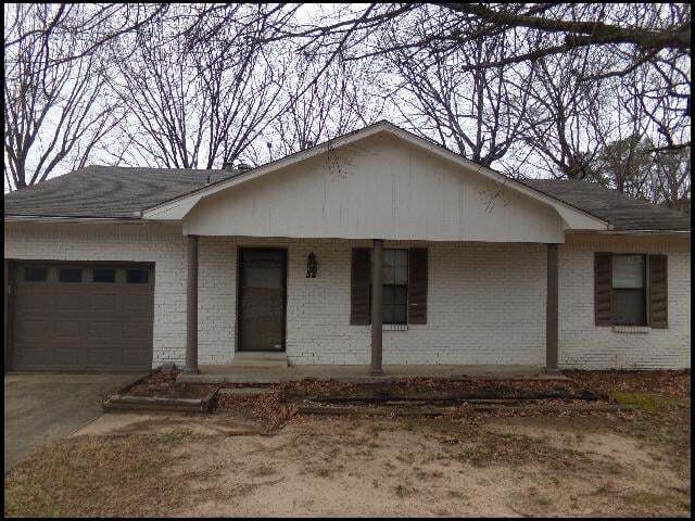
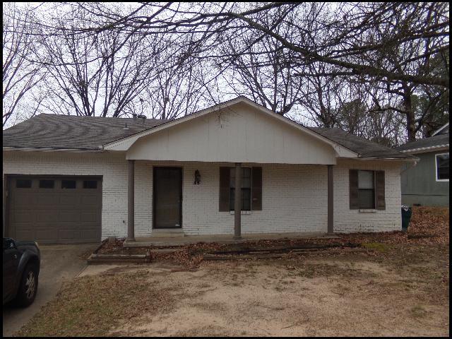
35 Point W Cir
Little Rock, AR 72211
-
Bedrooms
3
-
Bathrooms
2
-
Square Feet
--
-
Available
Available Now

About This Home
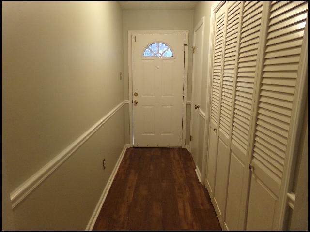
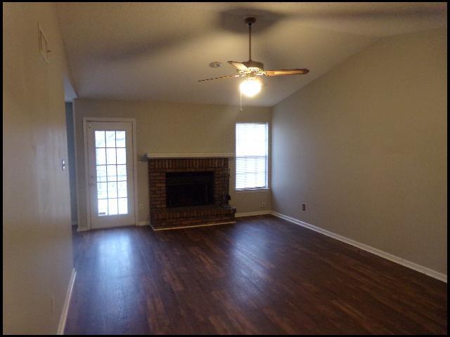
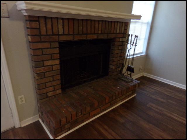
*WEST LITTLE ROCK*MOVE IN SPECIAL: FULL FIRST MONTHS RENT FREE FOR APPROVED APPLICANT!! BEAUTIFUL HOME IN POINT WEST SUBDIVISION!! This 3 Bedroom And 2 Bath Home Features Over 1200 Square Feet Of Living Space! Vinyl And Tile Floors Throughout! Electric Range, Refrigerator, And Dishwasher Provided In Kitchen! Washer And Dryer Provided For Convenience! Shaded Backyard With Back Deck For Entertainment! 1 Car Garage For Parking Or Storage! PET FRIENDLY!! DIRECTIONS:! Heading West On W Markham, Turn Left Onto Atkins Rd, Then Turn Left Onto Kanis Rd. Make A Left At The 1st Cross Street Onto Point W Dr, Then Left Onto Point West Cir. Home Is On The Left! AVAILABLE NOW!!!
Unique Features
- Dining: Eat-In
- Dish/Disp: Both
- Family: Living Room
- Fence: Rear
- Floors: Vinyl/Tile
- HVAC: Central
- Parking: Garage - 1 Car
- Pets: Case By Case W/ Fee and Inc Rent
- Range: Electric
- Refrig: Included
- Stories: 1
- Washer: Included
35 Point W Cir is a house located in Pulaski County and the 72211 ZIP Code. This area is served by the Lisa Academy Charter attendance zone.
Contact
- Phone Number
- Website View Property Website
- Contact
-
Source

West Little Rock is comprised of a vast swath of land stretching from Interstate 430 out towards Williams Junction and over Lake Maumelle. There’s an incredible variety of neighborhoods, communities, and landscapes in what’s considered West Little Rock, including waterfront communities on the lake, pastoral reprieves of the Arkansas countryside, and the more suburban communities nearing the city center. There’s a little something for everyone in West Little Rock, but most renters will be enticed by the apartment communities and affordable renters just west of the Interstate that mix the serenity of living outside the city while still being close enough to enjoy its amenities.
Learn more about living in West Little Rock- Dining: Eat-In
- Dish/Disp: Both
- Family: Living Room
- Fence: Rear
- Floors: Vinyl/Tile
- HVAC: Central
- Parking: Garage - 1 Car
- Pets: Case By Case W/ Fee and Inc Rent
- Range: Electric
- Refrig: Included
- Stories: 1
- Washer: Included
| Colleges & Universities | Distance | ||
|---|---|---|---|
| Colleges & Universities | Distance | ||
| Drive: | 11 min | 6.5 mi | |
| Drive: | 11 min | 6.7 mi | |
| Drive: | 13 min | 8.7 mi | |
| Drive: | 23 min | 15.3 mi |


View GreatSchools Rating Methodology
Data provided by GreatSchools.org © 2026. All rights reserved.
Transportation options available in Little Rock include 2Nd St & Center St, located 9.5 miles from 35 Point W Cir. 35 Point W Cir is near Bill and Hillary Clinton Ntl/Adams Field, located 13.3 miles or 20 minutes away.
| Transit / Subway | Distance | ||
|---|---|---|---|
| Transit / Subway | Distance | ||
| Drive: | 14 min | 9.5 mi | |
| Drive: | 14 min | 9.5 mi | |
| Drive: | 14 min | 9.8 mi | |
| Drive: | 14 min | 9.8 mi | |
| Drive: | 15 min | 10.2 mi |
| Commuter Rail | Distance | ||
|---|---|---|---|
| Commuter Rail | Distance | ||
|
|
Drive: | 14 min | 8.6 mi |
|
|
Drive: | 49 min | 41.7 mi |
| Airports | Distance | ||
|---|---|---|---|
| Airports | Distance | ||
|
Bill and Hillary Clinton Ntl/Adams Field
|
Drive: | 20 min | 13.3 mi |
Scores provided by
Traffic
ActiveAirport
CalmBusinesses
CalmScores provided by
HowLoud What is a Sound Score Rating? A Sound Score Rating aggregates noise caused by vehicle traffic, airplane traffic and local sources. How It WorksTime and distance from 35 Point W Cir.
| Shopping Centers | Distance | ||
|---|---|---|---|
| Shopping Centers | Distance | ||
| Walk: | 8 min | 0.5 mi | |
| Walk: | 10 min | 0.6 mi | |
| Walk: | 12 min | 0.7 mi |
| Parks and Recreation | Distance | ||
|---|---|---|---|
| Parks and Recreation | Distance | ||
|
Little Rock Zoo
|
Drive: | 9 min | 5.8 mi |
|
Central High School National Historic Site
|
Drive: | 12 min | 7.7 mi |
|
Museum of Discovery
|
Drive: | 14 min | 10.0 mi |
|
Pinnacle Mountain State Park
|
Drive: | 22 min | 10.4 mi |
|
Burns Park
|
Drive: | 19 min | 12.5 mi |
| Hospitals | Distance | ||
|---|---|---|---|
| Hospitals | Distance | ||
| Drive: | 4 min | 1.7 mi | |
| Drive: | 10 min | 6.3 mi | |
| Drive: | 10 min | 6.5 mi |
| Military Bases | Distance | ||
|---|---|---|---|
| Military Bases | Distance | ||
| Drive: | 34 min | 19.6 mi | |
| Drive: | 39 min | 27.2 mi | |
| Drive: | 42 min | 27.6 mi |
35 Point W Cir Photos
Nearby Apartments
Within 50 Miles of 35 Point W Cir Little Rock, AR 72211
-
13410 Teton Dr
Little Rock, AR 72211
$2,500 Total Monthly Price
3 Br 12 Month Lease 0.5 mi
-
725 S Valentine St
Little Rock, AR 72205
$2,149
3 Br 5.8 mi
-
826 W 23rd St
North Little Rock, AR 72114
$1,400
3 Br 8.2 mi
-
5704 Belle Point Rd
North Little Rock, AR 72116
$2,495
4 Br 10.2 mi
-
2071 Deborah Ln
Little Rock, AR 72206
$1,005
3 Br 12.5 mi
-
1032 Deborah Ln
Little Rock, AR 72206
$1,005
3 Br 12.7 mi
What Are Walk Score®, Transit Score®, and Bike Score® Ratings?
Walk Score® measures the walkability of any address. Transit Score® measures access to public transit. Bike Score® measures the bikeability of any address.
What is a Sound Score Rating?
A Sound Score Rating aggregates noise caused by vehicle traffic, airplane traffic and local sources.

35 Point W Cir
Little Rock, AR 72211