

$2,100
/ Month
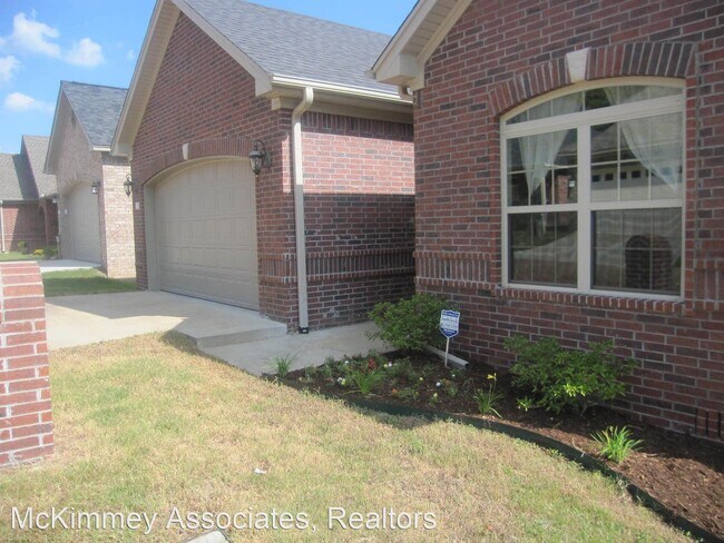
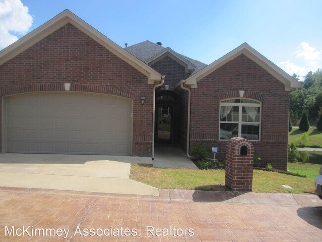
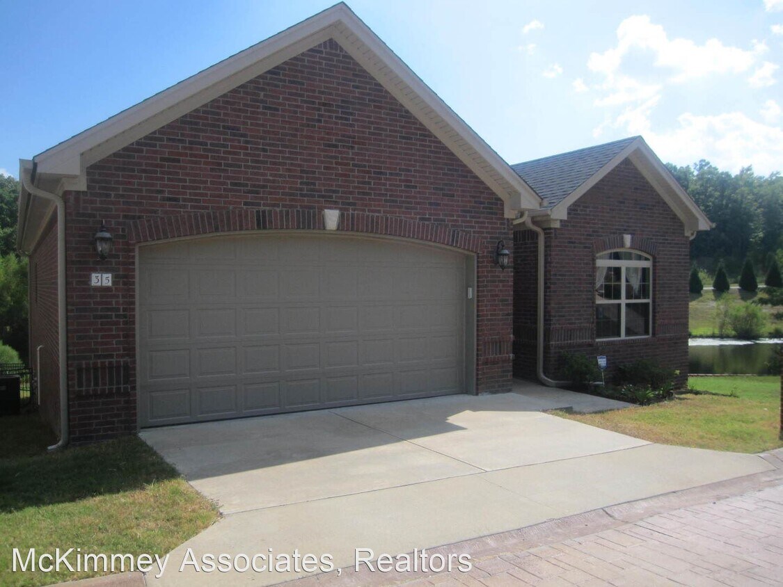
35 Pennsylvania Ct
Little Rock, AR 72223
Favorites
35 Pennsylvania Ct

Favorites
Check Back Soon for Upcoming Availability
| Beds | Baths | Average SF |
|---|---|---|
| 3 Bedrooms 3 Bedrooms 3 Br | 2 Baths 2 Baths 2 Ba | 1,665 SF |
Fees and Policies
The fees listed below are community-provided and may exclude utilities or add-ons. All payments are made directly to the property and are non-refundable unless otherwise specified.
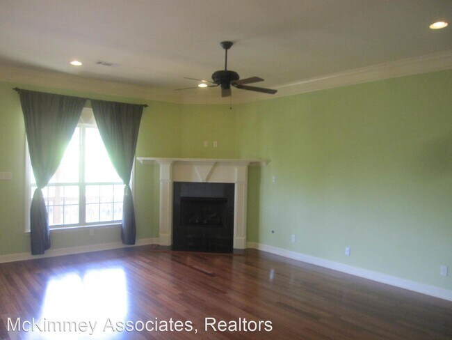
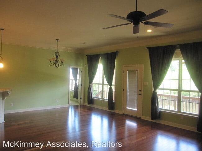
About This Property
- QUESTIONS CONTACT LANCE GARNER - Wonderful Family Home Located In a Gated Neighborhood (RLNE1832552) Other Amenities: Other (gated neighborhood, lake). Appliances: Refrigerator, Washer & Dryer.
35 Pennsylvania Ct is a house located in Pulaski County and the 72223 ZIP Code. This area is served by the Pulaski County Special School District attendance zone.
Unique Features
- Amenities - gated neighborhood, lake
House Features
- Washer/Dryer
35 Pennsylvania Ct,
Little Rock,
AR
72223
West Little Rock is comprised of a vast swath of land stretching from Interstate 430 out towards Williams Junction and over Lake Maumelle. There’s an incredible variety of neighborhoods, communities, and landscapes in what’s considered West Little Rock, including waterfront communities on the lake, pastoral reprieves of the Arkansas countryside, and the more suburban communities nearing the city center. There’s a little something for everyone in West Little Rock, but most renters will be enticed by the apartment communities and affordable renters just west of the Interstate that mix the serenity of living outside the city while still being close enough to enjoy its amenities.
Learn more about living in West Little RockBelow are rent ranges for similar nearby apartments
Amenities
- Washer/Dryer
- Amenities - gated neighborhood, lake
Education
| Colleges & Universities | Distance | ||
|---|---|---|---|
| Colleges & Universities | Distance | ||
| Drive: | 15 min | 7.8 mi | |
| Drive: | 16 min | 8.0 mi | |
| Drive: | 17 min | 9.9 mi | |
| Drive: | 27 min | 16.6 mi |
35 Pennsylvania Ct is within 15 minutes or 7.8 miles from UA Little Rock. It is also near Univ. of Ark. Medical Scis. and Philander Smith College.
Schools


Public Elementary School
Grades K-5
314 Students
Nearby
Public Elementary School
Grades K-5
1,454 Students
Nearby
Public Elementary School
Grades PK-5
402 Students
Attendance Zone
Public Middle School
Grades 6-8
631 Students
Attendance Zone
Public High School
Grades 9-12
1,003 Students
Attendance Zone
Public High School
Grades 9-12
684 Students
Nearby
Private Elementary, Middle & High School
Grades PK-12
1,374 Students
Nearby
Private Elementary School
Grades PK-5
24 Students
Nearby
School data provided by
 The GreatSchools Rating helps parents compare schools within a state based on a variety of school quality indicators and provides a helpful picture of how effectively each school serves all of its students. Ratings are on a scale of 1 (below average) to 10 (above average) and can include test scores, college readiness, academic progress, advanced courses, equity, discipline and attendance data. We also advise parents to visit schools, consider other information on school performance and programs, and consider family needs as part of the school selection process.
View GreatSchools Rating Methodology
Data provided by GreatSchools.org © 2026. All rights reserved.
View GreatSchools Rating Methodology
Data provided by GreatSchools.org © 2026. All rights reserved.
Transportation options available in Little Rock include 2Nd St & Center St, located 10.7 miles from 35 Pennsylvania Ct. 35 Pennsylvania Ct is near Bill and Hillary Clinton Ntl/Adams Field, located 14.6 miles or 24 minutes away.
| Transit / Subway | Distance | ||
|---|---|---|---|
| Transit / Subway | Distance | ||
| Drive: | 18 min | 10.7 mi | |
| Drive: | 18 min | 10.7 mi | |
| Drive: | 18 min | 11.0 mi | |
| Drive: | 18 min | 11.1 mi | |
| Drive: | 19 min | 11.5 mi |
| Commuter Rail | Distance | ||
|---|---|---|---|
| Commuter Rail | Distance | ||
|
|
Drive: | 18 min | 9.9 mi |
|
|
Drive: | 52 min | 42.4 mi |
| Airports | Distance | ||
|---|---|---|---|
| Airports | Distance | ||
|
Bill and Hillary Clinton Ntl/Adams Field
|
Drive: | 24 min | 14.6 mi |
Walkability Near 35 Pennsylvania Ct Little Rock, AR 72223
Getting Around
 What do Walkability, Transit, Drivability, and Bikeability mean?
Walkability measures the walking distance to day-to-day needs.
Transit measures access to public transportation.
Drivability measures congestion, parking availability, and access to major roads.
Bikeability measures the suitability for cycling.
How It Works
What do Walkability, Transit, Drivability, and Bikeability mean?
Walkability measures the walking distance to day-to-day needs.
Transit measures access to public transportation.
Drivability measures congestion, parking availability, and access to major roads.
Bikeability measures the suitability for cycling.
How It Works
Somewhat Walkable
Walkability
20
/ 100
Minimal Public Transit
Transit
0
/ 100
Very Drivable
Drivability
80
/ 100
Somewhat Bikeable
Bikeability
30
/ 100
Scores provided by
-
Soundscore™
-
/ 100
Traffic
-Airport
-Businesses
-Scores provided by
HowLoud What is a Sound Score Rating? A Sound Score Rating aggregates noise caused by vehicle traffic, airplane traffic and local sources. How It WorksTime and distance from 35 Pennsylvania Ct.
| Shopping Centers | Distance | ||
|---|---|---|---|
| Shopping Centers | Distance | ||
| Drive: | 4 min | 1.6 mi | |
| Drive: | 6 min | 2.2 mi | |
| Drive: | 6 min | 2.3 mi |
35 Pennsylvania Ct has 3 shopping centers within 2.3 miles, which is about a 6-minute drive. The miles and minutes will be for the farthest away property.
| Parks and Recreation | Distance | ||
|---|---|---|---|
| Parks and Recreation | Distance | ||
|
Little Rock Zoo
|
Drive: | 13 min | 7.1 mi |
|
Central High School National Historic Site
|
Drive: | 16 min | 8.9 mi |
|
Pinnacle Mountain State Park
|
Drive: | 25 min | 12.4 mi |
|
Burns Park
|
Drive: | 23 min | 13.7 mi |
35 Pennsylvania Ct has 4 parks within 13.7 miles, including Little Rock Zoo, Central High School National Historic Site, and Pinnacle Mountain State Park.
| Hospitals | Distance | ||
|---|---|---|---|
| Hospitals | Distance | ||
| Drive: | 8 min | 3.2 mi | |
| Drive: | 14 min | 7.6 mi | |
| Drive: | 14 min | 7.8 mi |
35 Pennsylvania Ct has 3 hospitals within 7.8 miles, the nearest is Arkansas Heart Hospital which is 3.2 miles away and a 8 minute drive.
| Military Bases | Distance | ||
|---|---|---|---|
| Military Bases | Distance | ||
| Drive: | 38 min | 20.9 mi | |
| Drive: | 43 min | 28.5 mi | |
| Drive: | 46 min | 28.8 mi |
35 Pennsylvania Ct has 3 military bases within 28.8 miles, the nearest is Camp Joseph T. Robinson Hill which is 20.9 miles away and a 38 minute drive.
You May Also Like
Similar Rentals Nearby


What Are Walk Score®, Transit Score®, and Bike Score® Ratings?
Walk Score® measures the walkability of any address. Transit Score® measures access to public transit. Bike Score® measures the bikeability of any address.
What is a Sound Score Rating?
A Sound Score Rating aggregates noise caused by vehicle traffic, airplane traffic and local sources.
35 Pennsylvania Ct
Little Rock, AR 72223