$2,250
Total Monthly Price
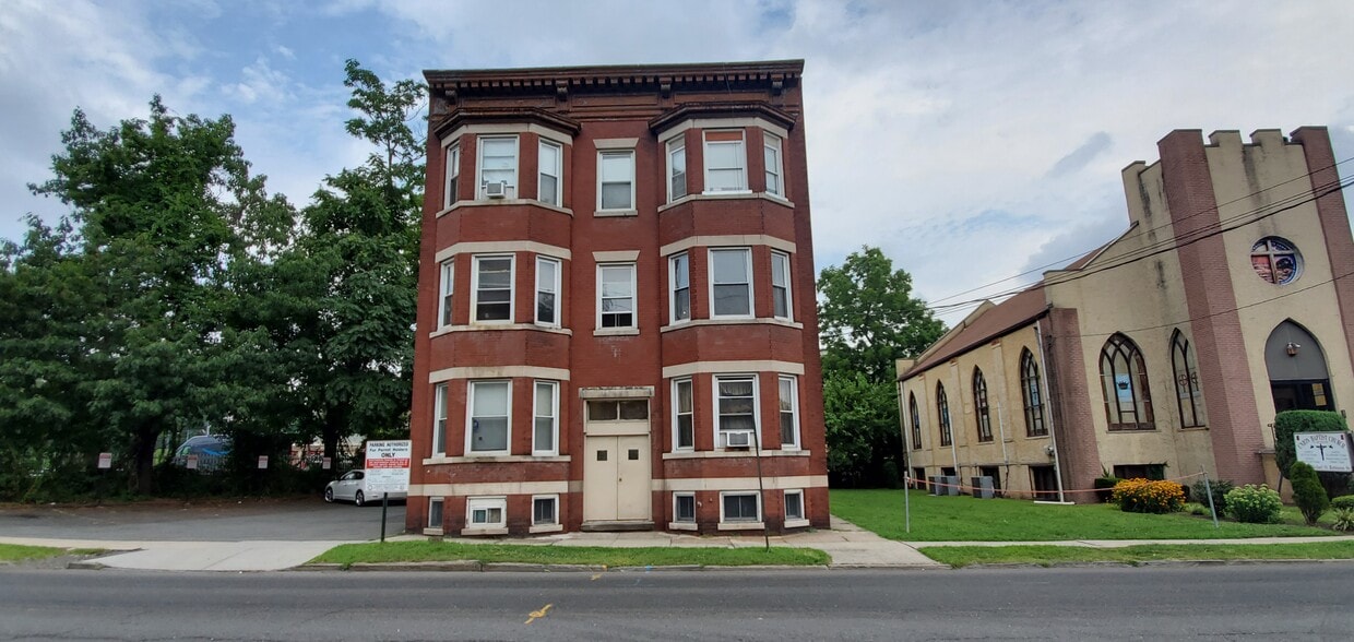
35 Conger St Unit 2L
Bloomfield, NJ 07003
Today
|
Edit
Favorites
551-289-8209
-
Bedrooms
2
-
Bathrooms
1
-
Square Feet
750 sq ft
-
Available
Available Now
Highlight
- Pets Allowed
35 Conger St Unit 2L

Favorites
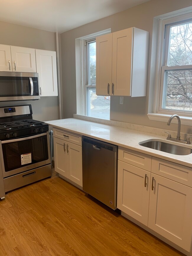
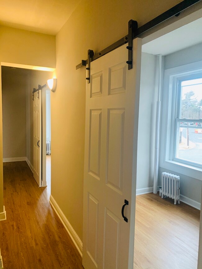
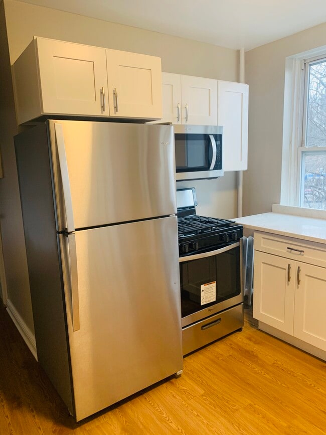
About This Home
12 Month Lease,
$4,500 deposit,
Available Now
Great apartment in downtown Bloomfield! Walk-up building apartment is on second floor, right across the street from a beautiful park!
35 Conger St is an apartment community located in Essex County and the 07003 ZIP Code.
* Price shown is total price based on community-supplied monthly required fees. Excludes user-selected optional fees and variable or usage-based fees and required charges due at or prior to move-in or at move-out. Price, availability, fees, and any applicable rent special are subject to change without notice.
* Square footage definitions vary. Displayed square footage is approximate.
Apartment Features
- Walk-Up
Fees and Policies
The fees listed below are community-provided and may exclude utilities or add-ons. All payments are made directly to the property and are non-refundable unless otherwise specified. Use the Cost Calculator to determine costs based on your needs.
- Dogs Allowed
-
Fees not specified
- Cats Allowed
-
Fees not specified
- Parking
-
Surface Lot$75/mo
Details
Utilities Included
-
Gas
-
Water
-
Heat
-
Sewer
Property Information
-
6 units
Contact
- Phone Number
- Contact
Location
Get Directions
Located 12 miles from Manhattan, Bloomfield combines small-town atmosphere with metropolitan accessibility. This Essex County township features established neighborhoods with housing options from classic single-family homes to contemporary apartment communities. The historic Bloomfield Green, anchored by the Presbyterian Church dating to 1794, serves as the town center. With two NJ Transit stations connecting to New York City and Newark, Bloomfield offers convenient transportation options for commuters. Current rental data shows one-bedroom apartments averaging $2,012, while three-bedroom units average $2,828.
Brookdale Park, spanning 77 acres, provides recreational opportunities with walking paths and athletic facilities. The downtown area near Bloomfield College features local shops and dining establishments. The Garden State Parkway and other major routes make commuting convenient from Bloomfield.
Learn more about living in Bloomfield
Education
| Colleges & Universities | Distance | ||
|---|---|---|---|
| Colleges & Universities | Distance | ||
| Walk: | 8 min | 0.5 mi | |
| Drive: | 7 min | 3.9 mi | |
| Drive: | 8 min | 4.1 mi | |
| Drive: | 8 min | 4.4 mi |
35 Conger St Unit 2L is within 8 minutes or 0.5 mile from Bloomfield College. It is also near Rutgers, Newark Campus and N.J. Inst. of Technology.
Transportation options available in Bloomfield include Grove Street, located 1.2 miles from 35 Conger St Unit 2L. 35 Conger St Unit 2L is near Newark Liberty International, located 9.8 miles or 16 minutes away, and LaGuardia, located 25.6 miles or 44 minutes away.
| Transit / Subway | Distance | ||
|---|---|---|---|
| Transit / Subway | Distance | ||
|
|
Drive: | 2 min | 1.2 mi |
|
|
Drive: | 3 min | 1.6 mi |
|
|
Drive: | 4 min | 1.8 mi |
|
|
Drive: | 4 min | 1.9 mi |
|
|
Drive: | 3 min | 2.1 mi |
| Commuter Rail | Distance | ||
|---|---|---|---|
| Commuter Rail | Distance | ||
|
|
Walk: | 3 min | 0.2 mi |
|
|
Walk: | 16 min | 0.8 mi |
|
|
Drive: | 2 min | 1.2 mi |
|
|
Drive: | 3 min | 1.5 mi |
|
|
Drive: | 5 min | 2.3 mi |
| Airports | Distance | ||
|---|---|---|---|
| Airports | Distance | ||
|
Newark Liberty International
|
Drive: | 16 min | 9.8 mi |
|
LaGuardia
|
Drive: | 44 min | 25.6 mi |
Time and distance from 35 Conger St Unit 2L.
| Shopping Centers | Distance | ||
|---|---|---|---|
| Shopping Centers | Distance | ||
| Drive: | 3 min | 1.2 mi | |
| Drive: | 2 min | 1.2 mi | |
| Drive: | 4 min | 1.7 mi |
35 Conger St Unit 2L has 3 shopping centers within 1.7 miles, which is about a 4-minute drive. The miles and minutes will be for the farthest away property.
| Parks and Recreation | Distance | ||
|---|---|---|---|
| Parks and Recreation | Distance | ||
|
Branch Brook Park
|
Drive: | 5 min | 2.8 mi |
|
Van Vleck House & Gardens
|
Drive: | 5 min | 2.9 mi |
|
Edison National Historic Site
|
Drive: | 8 min | 3.2 mi |
|
Newark Museum and Dreyfuss Planetarium
|
Drive: | 7 min | 4.0 mi |
|
Kearny Marsh
|
Drive: | 12 min | 5.9 mi |
35 Conger St Unit 2L has 5 parks within 5.9 miles, including Branch Brook Park, Edison National Historic Site, and Van Vleck House & Gardens.
| Hospitals | Distance | ||
|---|---|---|---|
| Hospitals | Distance | ||
| Drive: | 5 min | 3.1 mi | |
| Drive: | 7 min | 3.9 mi | |
| Drive: | 7 min | 4.3 mi |
35 Conger St Unit 2L has 3 hospitals within 4.3 miles, the nearest is East Orange General Hospital which is 3.1 miles away and a 5 minute drive.
| Military Bases | Distance | ||
|---|---|---|---|
| Military Bases | Distance | ||
| Drive: | 21 min | 13.6 mi | |
| Drive: | 31 min | 15.6 mi | |
| Drive: | 37 min | 21.7 mi |
35 Conger St Unit 2L has 3 military bases within 21.7 miles, the nearest is Military Ocean Terminal which is 13.6 miles away and a 21 minute drive.
Amenities
- Walk-Up
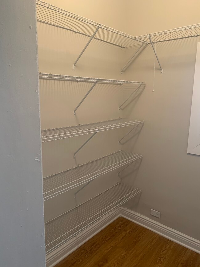
35 Conger St Unit 2L Photos
How do I access Social Services in New Jersey?
Statewide service is free, confidential, multilingual and always open. Three easy ways to reach Social Services in NJ: Dial 2-1-1; text your zip code to 898-211; or chat at https://www.nj211.org
What Are Walk Score®, Transit Score®, and Bike Score® Ratings?
Walk Score® measures the walkability of any address. Transit Score® measures access to public transit. Bike Score® measures the bikeability of any address.
What is a Sound Score Rating?
A Sound Score Rating aggregates noise caused by vehicle traffic, airplane traffic and local sources.

35 Conger St
Bloomfield, NJ 07003