$2,200 - $3,500
Total Monthly Price
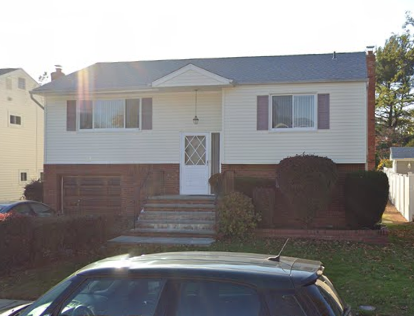
35 Ashwood Ct
East Northport, NY 11731
2 Weeks Ago
|
Edit
Favorites
35 Ashwood Ct

Favorites
Check Back Soon for Upcoming Availability
| Beds | Baths | Average SF |
|---|---|---|
| 1 Bedroom 1 Bedroom 1 Br | 1 Bath 1 Bath 1 Ba | 600 SF |
| 3 Bedrooms 3 Bedrooms 3 Br | 1 Bath 1 Bath 1 Ba | 1,200 SF |
Fees and Policies
The fees listed below are community-provided and may exclude utilities or add-ons. All payments are made directly to the property and are non-refundable unless otherwise specified.
Details
Property Information
-
2 units
35 Ashwood Ct is an apartment community located in Suffolk County and the 11731 ZIP Code.
Apartment Features
Washer/Dryer
Refrigerator
Tub/Shower
Smoke Free
- Washer/Dryer
- Smoke Free
- Cable Ready
- Tub/Shower
- Eat-in Kitchen
- Kitchen
- Oven
- Refrigerator
- Yard
35 Ashwood Ct,
East Northport,
NY
11731
Below are rent ranges for similar nearby apartments
| Beds | Average Size | Lowest | Typical | Premium |
|---|---|---|---|---|
| Studio Studio Studio | 626 Sq Ft | $1,580 | $1,692 | $2,437 |
| 1 Bed 1 Bed 1 Bed | 838-843 Sq Ft | $588 | $1,734 | $3,192 |
| 2 Beds 2 Beds 2 Beds | 1200 Sq Ft | $705 | $2,291 | $3,626 |
| 3 Beds 3 Beds 3 Beds | 1672 Sq Ft | $1,500 | $3,705 | $17,896 |
| 4 Beds 4 Beds 4 Beds | 2379 Sq Ft | $1,600 | $4,655 | $26,894 |
Amenities
- Washer/Dryer
- Smoke Free
- Cable Ready
- Tub/Shower
- Eat-in Kitchen
- Kitchen
- Oven
- Refrigerator
- Yard
Education
| Colleges & Universities | Distance | ||
|---|---|---|---|
| Colleges & Universities | Distance | ||
| Drive: | 18 min | 8.8 mi | |
| Drive: | 23 min | 12.4 mi | |
| Drive: | 24 min | 13.7 mi | |
| Drive: | 29 min | 17.0 mi |
35 Ashwood Ct is within 18 minutes or 8.8 miles from SUNY Suffolk Co., Grant Campus. It is also near Farmingdale State College and Touro University.
Walkability Near 35 Ashwood Ct East Northport, NY 11731
Getting Around
 What do Walkability, Transit, Drivability, and Bikeability mean?
Walkability measures the walking distance to day-to-day needs.
Transit measures access to public transportation.
Drivability measures congestion, parking availability, and access to major roads.
Bikeability measures the suitability for cycling.
How It Works
What do Walkability, Transit, Drivability, and Bikeability mean?
Walkability measures the walking distance to day-to-day needs.
Transit measures access to public transportation.
Drivability measures congestion, parking availability, and access to major roads.
Bikeability measures the suitability for cycling.
How It Works
Fairly Walkable
Walkability
50
/ 100
Limited Public Transit
Transit
20
/ 100
Moderately Drivable
Drivability
70
/ 100
Fairly Bikeable
Bikeability
50
/ 100
Scores provided by
-
Soundscore™
-
/ 100
Traffic
-Airport
-Businesses
-Scores provided by
HowLoud What is a Sound Score Rating? A Sound Score Rating aggregates noise caused by vehicle traffic, airplane traffic and local sources. How It WorksYou May Also Like
-
Fairfield Courtyard at Bayport
100 Terrace
Bayport, NY 11705
$2,415 - $3,110
1-2 Br 17.2 mi
-
The Confluence at Norwalk
26-26 Belden Ave
Norwalk, CT 06850
$2,436 - $4,763 Total Monthly Price
1-3 Br 17.5 mi
-
New Village at Patchogue
1 Village Grn
Patchogue, NY 11772
$2,899 - $5,099 Total Monthly Price
1-3 Br 18.1 mi
Similar Rentals Nearby
-
-
-
-
-
1 Bed$2,598+2 Beds$3,083+3 Beds$4,668+Total Monthly Price12 Month LeaseTotal Monthly Price NewPrices include base rent and required monthly fees of $103. Variable costs based on usage may apply.Base Rent:1 Bed$2,495+2 Beds$2,980+3 Beds$4,565+Specials
Pets Allowed Fitness Center Pool Dishwasher Refrigerator In Unit Washer & Dryer Walk-In Closets
-
1 Bed$3,045+2 Beds$4,495+3 Beds$6,995Total Monthly PriceTotal Monthly Price NewPrices include required monthly fees of $100.Base Rent:1 Bed$2,945+2 Beds$4,395+3 Beds$6,8952 Months Free
Fitness Center Pool In Unit Washer & Dryer Package Service Concierge EV Charging
-
1 Bed$2,815+2 Beds$4,285+Total Monthly PriceTotal Monthly Price NewPrices include required monthly fees of $100.Base Rent:1 Bed$2,715+2 Beds$4,185+
Fitness Center Pool In Unit Washer & Dryer Business Center Package Service Concierge EV Charging
-
1 Bed$2,400+2 Beds$3,300+3 Beds$4,200+Total Monthly PriceTotal Monthly Price NewPrices include base rent and required monthly fees. Variable costs based on usage may apply.1 Month Free
Pets Allowed Fitness Center Pool Dishwasher In Unit Washer & Dryer Walk-In Closets
-
-
1 Bed$2,175+2 Beds$3,275+3 Beds$4,275+Total Monthly PriceTotal Monthly Price NewPrices include required monthly fees of $75.Base Rent:1 Bed$2,100+2 Beds$3,200+3 Beds$4,200+
Pets Allowed Fitness Center Pool Dishwasher Refrigerator Kitchen


What Are Walk Score®, Transit Score®, and Bike Score® Ratings?
Walk Score® measures the walkability of any address. Transit Score® measures access to public transit. Bike Score® measures the bikeability of any address.
What is a Sound Score Rating?
A Sound Score Rating aggregates noise caused by vehicle traffic, airplane traffic and local sources.

35 Ashwood Ct
East Northport, NY 11731