

$2,700 / Month
34 Tremont St Unit 1
Chelsea, MA 02150
2 Weeks Ago
Favorites
34 Tremont St Unit 1

Favorites
Check Back Soon for Upcoming Availability
| Beds | Baths | Average SF |
|---|---|---|
| 2 Bedrooms 2 Bedrooms 2 Br | 2 Baths 2 Baths 2 Ba | 1,052 SF |
Fees and Policies
Details
Utilities Included
-
Water
About This Property
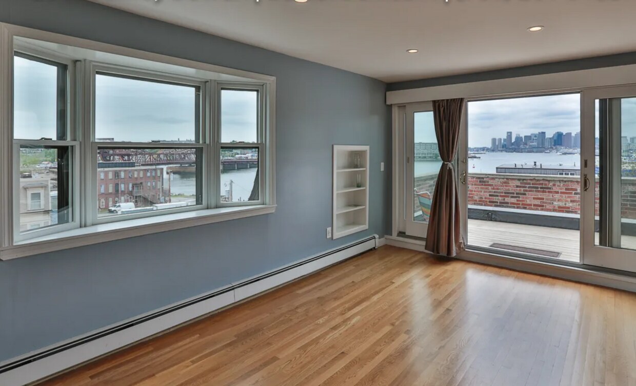
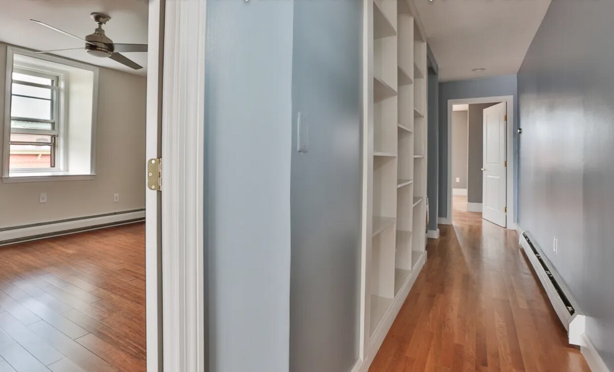
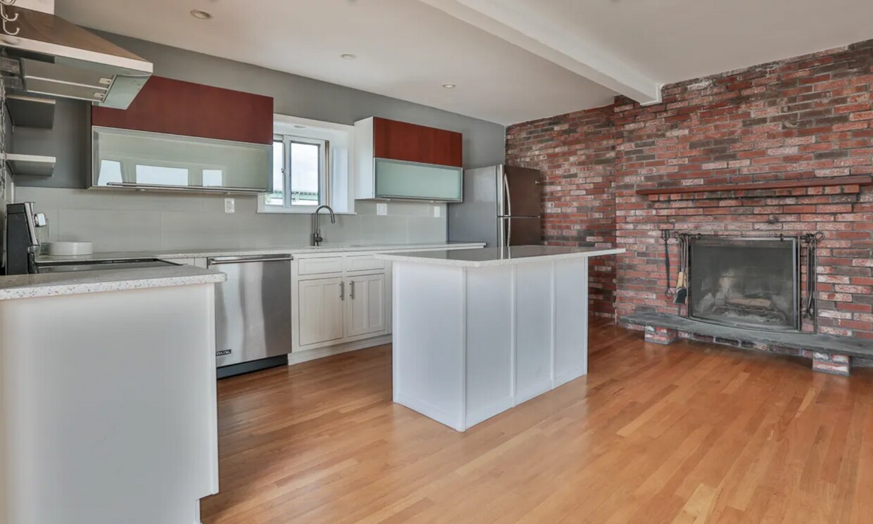
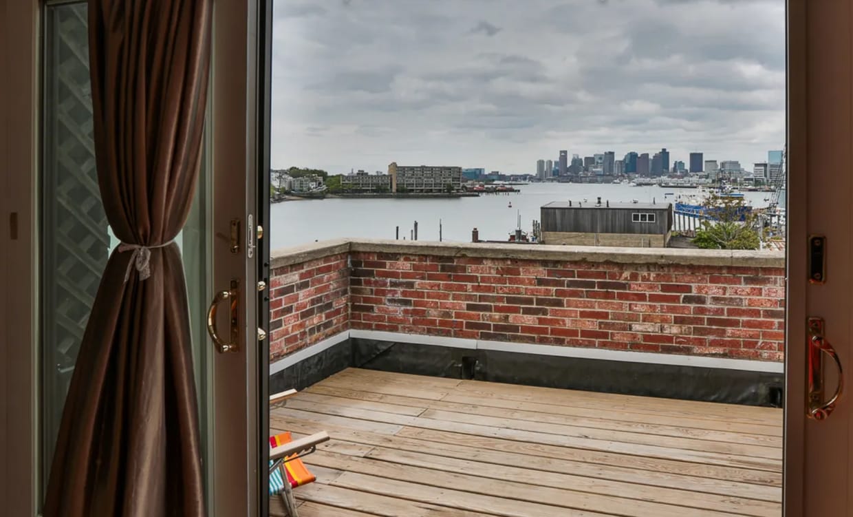
This hidden gem features amazing skyline views, natural sunlight, a modern kitchen as well updated bathrooms. The unit is in a brownstone in Chelsea's leafy Waterfront neighborhood (think Beacon Hill, the South End and Charlestown). This is the best location in the neighborhood and the unit comes with a deeded parking space, a wood-burning fireplace, hardwood floors, in-unit laundry, built-in book shelves, a large deck with furniture, recessed lighting and more. Don’t miss this opportunity. The #111 bus picks up in the neighborhood and connects Haymarket in under 15 minutes. Close to Commuter Rail and Silver Line. Walking distance to Chelsea's Polonia Park, Mary O'Malley State Park and walking / bike riding distance to Ciao Pizza & Pasta, Mystic Brewery, Starbucks, Market Basket, Chelsea Station, and more!
34 Tremont St is a condo located in Suffolk County and the 02150 ZIP Code.
Condo Features
Dishwasher
Hardwood Floors
Fireplace
Built-In Bookshelves
- Fireplace
- Dishwasher
- Kitchen
- Hardwood Floors
- Built-In Bookshelves
- Waterfront
- Deck
Location
Get Directions
While it may be the smallest city in Massachusetts, Chelsea is one of its most populated. This busy city is three miles northeast of Boston, wrapped by the Mystic River. This historic city was first settled in 1624, and much of its history is still evident in its Victorian architecture and narrow streets. Chelsea is filled with charm and personality, from its corner markets and tree-lined streets to its blend of historic brick buildings and sleek, modern complexes.
When you move to your apartment in Chelsea, you'll discover a fast-paced but friendly city filled with unique landmarks. This is the home of Bunker Hill Community College, Mystic Mall, and Mary O'Malley State Park. Commuters can take the MBTA train from Bellingham Square or the 111 bus into downtown Boston. The Tobin Bridge leads Chelsea residents to the Boston National Historical Park, the Bunker Hill Monument, the USS Constitution, and Downtown Boston in minutes.
Learn more about living in ChelseaBelow are rent ranges for similar nearby apartments
Amenities
- Fireplace
- Dishwasher
- Kitchen
- Hardwood Floors
- Built-In Bookshelves
- Waterfront
- Deck
Expenses
Utilities Included
Water
Included
Education
| Colleges & Universities | Distance | ||
|---|---|---|---|
| Colleges & Universities | Distance | ||
| Drive: | 8 min | 3.3 mi | |
| Drive: | 10 min | 3.8 mi | |
| Drive: | 8 min | 4.1 mi | |
| Drive: | 9 min | 5.3 mi |
34 Tremont St Unit 1 is within 8 minutes or 3.3 miles from Suffolk University. It is also near Bunker Hill Community College and Emerson College.
Transportation options available in Chelsea include Maverick Station, located 1.5 miles from 34 Tremont St Unit 1. 34 Tremont St Unit 1 is near General Edward Lawrence Logan International, located 2.9 miles or 7 minutes away.
| Transit / Subway | Distance | ||
|---|---|---|---|
| Transit / Subway | Distance | ||
|
|
Drive: | 4 min | 1.5 mi |
|
|
Drive: | 5 min | 1.8 mi |
|
|
Drive: | 7 min | 2.8 mi |
|
|
Drive: | 8 min | 3.2 mi |
|
|
Drive: | 8 min | 3.5 mi |
| Commuter Rail | Distance | ||
|---|---|---|---|
| Commuter Rail | Distance | ||
| Walk: | 17 min | 0.9 mi | |
|
|
Drive: | 7 min | 3.4 mi |
|
|
Drive: | 8 min | 3.9 mi |
|
|
Drive: | 8 min | 4.9 mi |
|
|
Drive: | 13 min | 5.4 mi |
| Airports | Distance | ||
|---|---|---|---|
| Airports | Distance | ||
|
General Edward Lawrence Logan International
|
Drive: | 7 min | 2.9 mi |
Time and distance from 34 Tremont St Unit 1.
| Shopping Centers | Distance | ||
|---|---|---|---|
| Shopping Centers | Distance | ||
| Walk: | 15 min | 0.8 mi | |
| Drive: | 3 min | 1.1 mi | |
| Drive: | 4 min | 1.6 mi |
34 Tremont St Unit 1 has 3 shopping centers within 1.6 miles, which is about a 4-minute walk. The miles and minutes will be for the farthest away property.
| Parks and Recreation | Distance | ||
|---|---|---|---|
| Parks and Recreation | Distance | ||
|
Boston African American National Historic Site
|
Drive: | 9 min | 3.5 mi |
|
Museum of Science
|
Drive: | 9 min | 3.5 mi |
|
New England Aquarium
|
Drive: | 8 min | 4.5 mi |
|
Boston National Historical Park
|
Drive: | 8 min | 4.5 mi |
|
Boston Harbor Islands National Recreation Area
|
Drive: | 8 min | 4.6 mi |
34 Tremont St Unit 1 has 5 parks within 4.6 miles, including New England Aquarium, Boston National Historical Park, and Boston African American National Historic Site.
| Hospitals | Distance | ||
|---|---|---|---|
| Hospitals | Distance | ||
| Drive: | 8 min | 3.2 mi | |
| Drive: | 8 min | 4.4 mi | |
| Drive: | 10 min | 5.4 mi |
34 Tremont St Unit 1 has 3 hospitals within 5.4 miles, the nearest is Shriners Hospital for Children - Boston which is 3.2 miles away and a 8 minute drive.
| Military Bases | Distance | ||
|---|---|---|---|
| Military Bases | Distance | ||
| Drive: | 26 min | 15.0 mi | |
| Drive: | 31 min | 16.0 mi |
34 Tremont St Unit 1 is 15.0 miles from Fort Miller, and is convenient to other military bases, including Hanscom Air Force Base.
You May Also Like
Similar Rentals Nearby


What Are Walk Score®, Transit Score®, and Bike Score® Ratings?
Walk Score® measures the walkability of any address. Transit Score® measures access to public transit. Bike Score® measures the bikeability of any address.
What is a Sound Score Rating?
A Sound Score Rating aggregates noise caused by vehicle traffic, airplane traffic and local sources
34 Tremont St
Chelsea, MA 02150