$2,800
/ Month
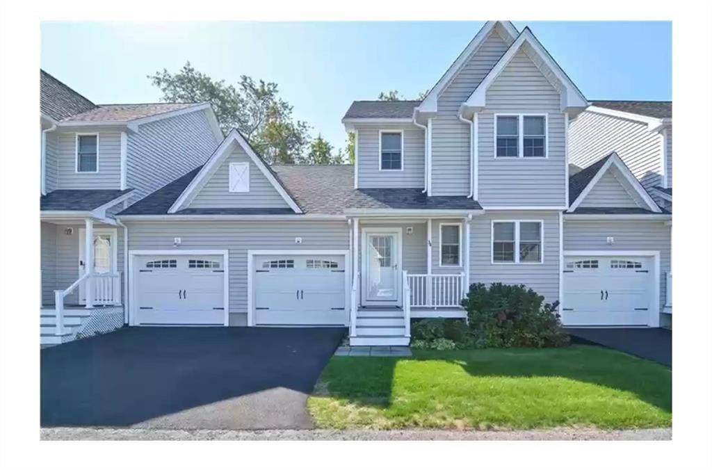
34 Seafare Ln
Portsmouth, RI 02871
Favorites
34 Seafare Ln

Favorites
Check Back Soon for Upcoming Availability
| Beds | Baths | Average SF |
|---|---|---|
| 2 Bedrooms 2 Bedrooms 2 Br | 2 Baths 2 Baths 2 Ba | 1,538 SF |
Fees and Policies
The fees listed below are community-provided and may exclude utilities or add-ons. All payments are made directly to the property and are non-refundable unless otherwise specified.
Pet policies are negotiable.
- Dogs Allowed
-
Fees not specified
-
Restrictions:true
- Cats Allowed
-
Fees not specified
-
Restrictions:true
About This Property
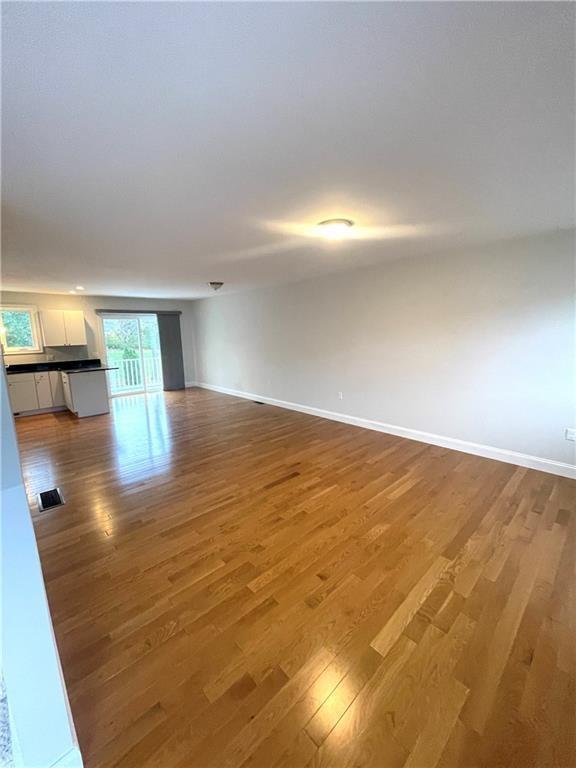
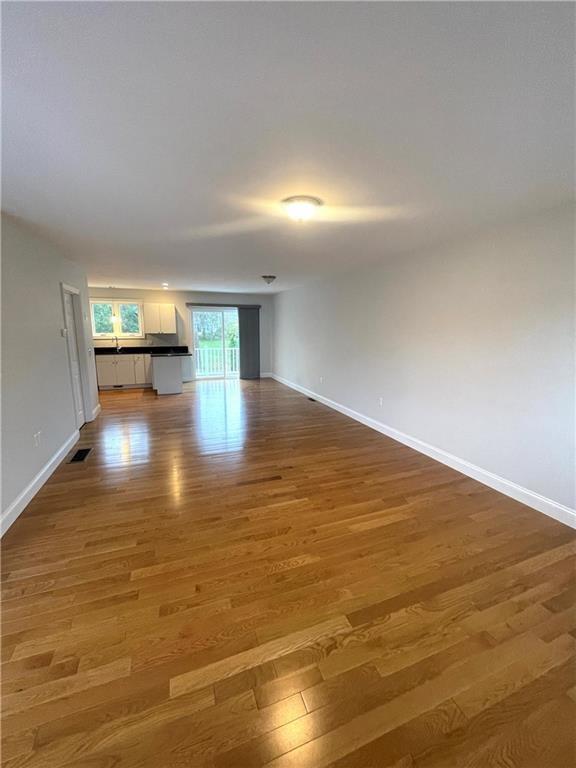
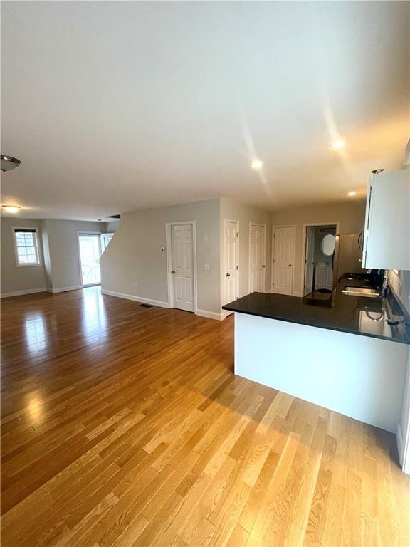
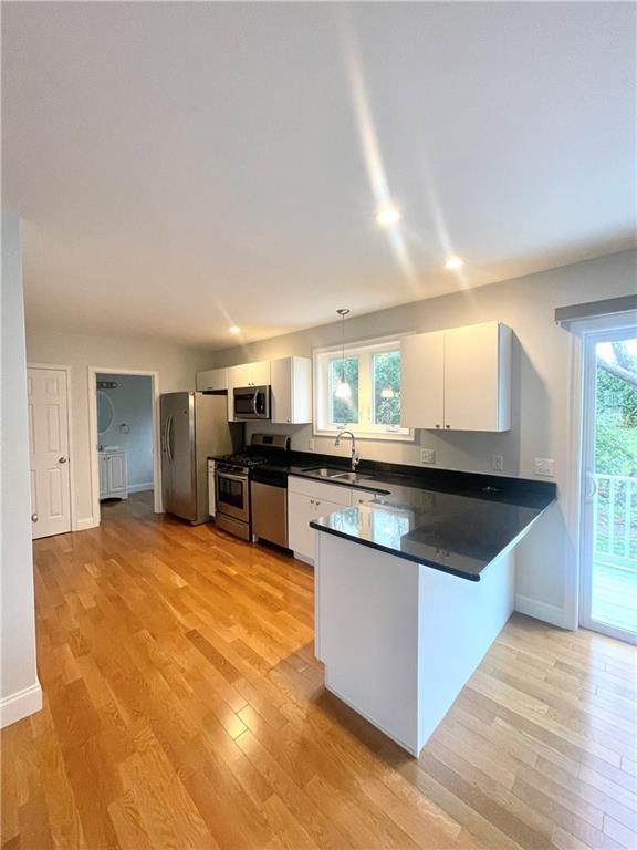
**Available December 15th 2024** Now is your opportunity to rent this spacious like new Townhome in sought after SeaFare. Convenient location to commute to Providence,Boston or South County. Open floorplan with Hardwood floors thru-out,granite and stainless kitchen,deck leading to a quiet outdoor space. The second floor features 2 bedrooms and bonus office/study and a full bath. Full basement and attached one car garage allow for a unique storage potential for condo living. Laundry in located in basement.
34 Seafare Ln is an apartment community located in Newport County and the 02871 ZIP Code.
Features
Air Conditioning
Dishwasher
Hardwood Floors
Microwave
- Air Conditioning
- Security System
- Fireplace
- Dishwasher
- Microwave
- Range
- Refrigerator
- Hardwood Floors
- Attic
- Views
- Pool
34 Seafare Ln,
Portsmouth,
RI
02871
Portsmouth sits on the northern end of Aquidneck Island in Newport County, sharing that landmass with Middletown and the well-known city of Newport to the south. As the second-oldest municipality in Rhode Island, it carries genuine historical weight — the town was one of four original settlements that formed the Colony of Rhode Island and Providence Plantations in the 17th century. Today it operates as a quiet, coastal community spread across roughly 39 square miles of land, with Narragansett Bay defining much of its character and geography.
Life here moves at a measured pace. Residents have easy access to the energy of Newport without being absorbed by it, and Providence sits within about 30 miles to the northwest. The housing mix reflects the town's suburban scale — single-family homes dominate, but apartment communities and smaller multi-unit rentals provide options for those seeking lower-maintenance living.
Learn more about living in Portsmouth
Amenities
- Air Conditioning
- Security System
- Fireplace
- Dishwasher
- Microwave
- Range
- Refrigerator
- Hardwood Floors
- Attic
- Views
- Pool
Education
| Colleges & Universities | Distance | ||
|---|---|---|---|
| Colleges & Universities | Distance | ||
| Drive: | 6 min | 2.9 mi | |
| Drive: | 20 min | 9.2 mi | |
| Drive: | 21 min | 11.8 mi | |
| Drive: | 26 min | 12.0 mi |
34 Seafare Ln is within 6 minutes or 2.9 miles from Roger Williams University. It is also near C.C. of Rhode Island, Newport and Bristol Community College.
Walkability Near 34 Seafare Ln Portsmouth, RI 02871
Getting Around
 What do Walkability, Transit, Drivability, and Bikeability mean?
Walkability measures the walking distance to day-to-day needs.
Transit measures access to public transportation.
Drivability measures congestion, parking availability, and access to major roads.
Bikeability measures the suitability for cycling.
How It Works
What do Walkability, Transit, Drivability, and Bikeability mean?
Walkability measures the walking distance to day-to-day needs.
Transit measures access to public transportation.
Drivability measures congestion, parking availability, and access to major roads.
Bikeability measures the suitability for cycling.
How It Works
Somewhat Walkable
Walkability
30
/ 100
Limited Public Transit
Transit
30
/ 100
Exceptionally Drivable
Drivability
100
/ 100
Somewhat Bikeable
Bikeability
20
/ 100
Scores provided by
-
Soundscore™
-
/ 100
Traffic
-Airport
-Businesses
-Scores provided by
HowLoud What is a Sound Score Rating? A Sound Score Rating aggregates noise caused by vehicle traffic, airplane traffic and local sources. How It WorksYou May Also Like
Similar Rentals Nearby


What Are Walk Score®, Transit Score®, and Bike Score® Ratings?
Walk Score® measures the walkability of any address. Transit Score® measures access to public transit. Bike Score® measures the bikeability of any address.
What is a Sound Score Rating?
A Sound Score Rating aggregates noise caused by vehicle traffic, airplane traffic and local sources.

34 Seafare Ln
Portsmouth, RI 02871