
Hue39
3909 San Fernando Rd,
Glendale, CA 91204
1-2 Beds $2,595 - $3,425
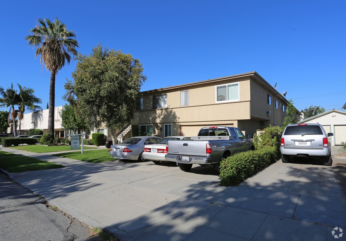
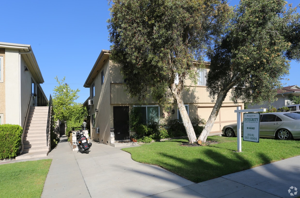
Find your new place at 339 N Howard St in Glendale, CA. You'll find this community in the Downtown Glendale area of Glendale. Let the professional leasing staff show you everything this community has to offer. Come see 339 N Howard St today.
339 N Howard St is an apartment community located in Los Angeles County and the 91206 ZIP Code. This area is served by the Glendale Unified attendance zone.
Living in Downtown Glendale means you’ll have many modern amenities and conveniences at your disposal. North Brand Boulevard is like the community business district, touting large companies, shopping destinations, restaurants, and nightlife.
The Museum of Neon Art is a cool place to visit and unique to the area, bursting with contemporary collections of glowing masterpieces. Down the road from their Downtown Glendale apartments, locals look forward to an evening of great music and entertainment at the Alex Theatre, or shopping at upscale and trendy boutiques at Glendale Galleria.
Restaurants in the community, such as the Famous and Kumadori, make up its vibrant food scene. Central Park Paseo affords renters and business professionals some outdoor leisure time as well as great city views. Route 34 is conveniently close to area homes, and can lead you to a number of attractions like the Los Angeles Zoo.
Learn more about living in Downtown Glendale| Colleges & Universities | Distance | ||
|---|---|---|---|
| Colleges & Universities | Distance | ||
| Drive: | 4 min | 1.7 mi | |
| Drive: | 9 min | 3.7 mi | |
| Drive: | 9 min | 6.1 mi | |
| Drive: | 14 min | 7.7 mi |


Transportation options available in Glendale include Vermont/Sunset Station, located 5.4 miles from 339 N Howard St. 339 N Howard St is near Bob Hope, located 11.0 miles or 17 minutes away, and Los Angeles International, located 23.7 miles or 38 minutes away.
| Transit / Subway | Distance | ||
|---|---|---|---|
| Transit / Subway | Distance | ||
|
|
Drive: | 11 min | 5.4 mi |
|
|
Drive: | 12 min | 5.7 mi |
|
|
Drive: | 12 min | 6.0 mi |
|
|
Drive: | 12 min | 6.8 mi |
|
|
Drive: | 14 min | 7.9 mi |
| Commuter Rail | Distance | ||
|---|---|---|---|
| Commuter Rail | Distance | ||
|
|
Drive: | 6 min | 2.3 mi |
|
|
Drive: | 9 min | 5.5 mi |
|
|
Drive: | 13 min | 8.2 mi |
|
|
Drive: | 18 min | 9.4 mi |
|
|
Drive: | 16 min | 9.7 mi |
| Airports | Distance | ||
|---|---|---|---|
| Airports | Distance | ||
|
Bob Hope
|
Drive: | 17 min | 11.0 mi |
|
Los Angeles International
|
Drive: | 38 min | 23.7 mi |
Time and distance from 339 N Howard St.
| Shopping Centers | Distance | ||
|---|---|---|---|
| Shopping Centers | Distance | ||
| Walk: | 4 min | 0.2 mi | |
| Walk: | 11 min | 0.6 mi | |
| Walk: | 12 min | 0.6 mi |
| Parks and Recreation | Distance | ||
|---|---|---|---|
| Parks and Recreation | Distance | ||
|
Bird Sanctuary
|
Drive: | 12 min | 5.0 mi |
|
Los Angeles Zoo
|
Drive: | 15 min | 5.2 mi |
|
Elyria Canyon Park
|
Drive: | 11 min | 5.3 mi |
|
Marsh Park
|
Drive: | 11 min | 5.7 mi |
|
Griffith Park
|
Drive: | 25 min | 8.4 mi |
| Hospitals | Distance | ||
|---|---|---|---|
| Hospitals | Distance | ||
| Drive: | 4 min | 1.3 mi | |
| Drive: | 6 min | 2.1 mi | |
| Drive: | 8 min | 4.9 mi |
| Military Bases | Distance | ||
|---|---|---|---|
| Military Bases | Distance | ||
| Drive: | 35 min | 25.3 mi |
What Are Walk Score®, Transit Score®, and Bike Score® Ratings?
Walk Score® measures the walkability of any address. Transit Score® measures access to public transit. Bike Score® measures the bikeability of any address.
What is a Sound Score Rating?
A Sound Score Rating aggregates noise caused by vehicle traffic, airplane traffic and local sources

339 N Howard St
Glendale, CA 91206


 - AVA Burbank")


 - Violet on Virgil")


