
$2,000
/ Month
338 Haverhill Rd
Chester, NH 03036
2 Weeks Ago
|
Edit
Favorites
338 Haverhill Rd

Favorites
Check Back Soon for Upcoming Availability
| Beds | Baths | Average SF |
|---|---|---|
| 1 Bedroom 1 Bedroom 1 Br | 1 Bath 1 Bath 1 Ba | 825 SF |
About This Property
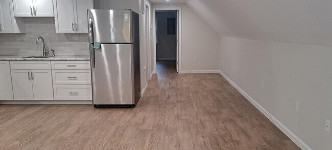
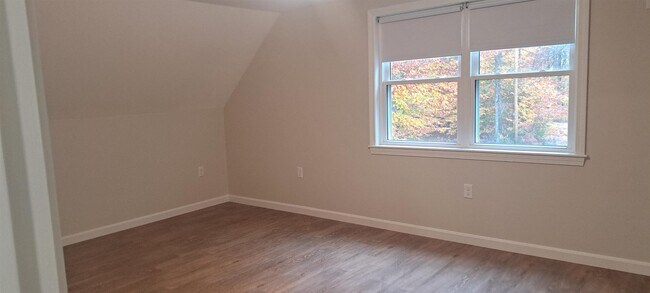
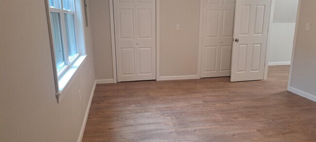
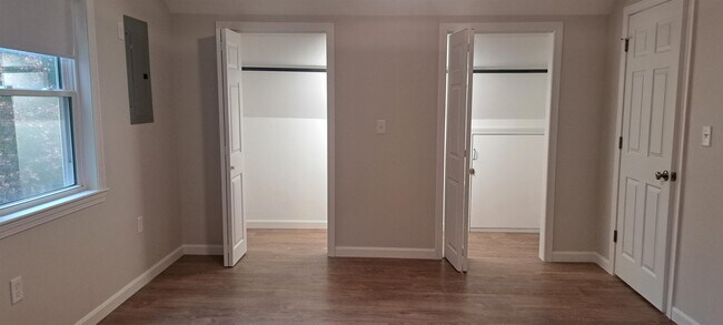
FOR RENT -- one bedroom apartment in Chester over a piano shop on 11+ private wooded acres. The apartment has been completely renovated with granite countertops, luxury vinyl plank flooring throughout and unique architectural features, plus central air. The kitchen and living room feature dimmable LED lighting. The laundry room is attached to a full bath with tub/shower and skylight. There is a large picture window in the living room overlooking a small field and woods. There is also a small deck. Monthly rent includes washer and dryer, and all utilities except for cable and internet. Pets may be allowed on a case by case basis. Tenant at will.
338 Haverhill Rd is an apartment community located in Rockingham County and the 03036 ZIP Code.
338 Haverhill Rd,
Chester,
NH
03036
Education
| Colleges & Universities | Distance | ||
|---|---|---|---|
| Colleges & Universities | Distance | ||
| Drive: | 31 min | 14.8 mi | |
| Drive: | 30 min | 15.8 mi | |
| Drive: | 34 min | 17.0 mi | |
| Drive: | 37 min | 19.0 mi |
338 Haverhill Rd is within 30 minutes or 15.8 miles from MCPHS University, Manchester. It is also near Southern New Hampshire Univ. and Northern Essex Comm. Coll..
Walkability Near 338 Haverhill Rd Chester, NH 03036
Getting Around
 What do Walkability, Transit, Drivability, and Bikeability mean?
Walkability measures the walking distance to day-to-day needs.
Transit measures access to public transportation.
Drivability measures congestion, parking availability, and access to major roads.
Bikeability measures the suitability for cycling.
How It Works
What do Walkability, Transit, Drivability, and Bikeability mean?
Walkability measures the walking distance to day-to-day needs.
Transit measures access to public transportation.
Drivability measures congestion, parking availability, and access to major roads.
Bikeability measures the suitability for cycling.
How It Works
Not Walkable
Walkability
10
/ 100
Exceptionally Drivable
Drivability
100
/ 100
Not Bikeable
Bikeability
10
/ 100
Scores provided by
Calm
Soundscore™
99
/ 100
Traffic
CalmAirport
CalmBusinesses
CalmScores provided by
HowLoud What is a Sound Score Rating? A Sound Score Rating aggregates noise caused by vehicle traffic, airplane traffic and local sources. How It WorksYou May Also Like
Similar Rentals Nearby


What Are Walk Score®, Transit Score®, and Bike Score® Ratings?
Walk Score® measures the walkability of any address. Transit Score® measures access to public transit. Bike Score® measures the bikeability of any address.
What is a Sound Score Rating?
A Sound Score Rating aggregates noise caused by vehicle traffic, airplane traffic and local sources.

338 Haverhill Rd
Chester, NH 03036