
$2,900
Total Monthly Price
12 Month Lease
336 Lagrange St
Boston, MA 02132
2 Weeks Ago
|
Edit
Favorites
617-676-2522
-
Bedrooms
2
-
Bathrooms
1
-
Square Feet
987 sq ft
-
Available
Available Now
336 Lagrange St

Favorites
About This Home
12 Month Lease,
$2,900 deposit,
Available Now
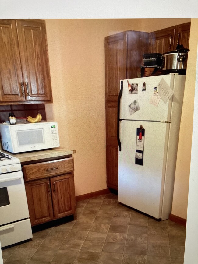
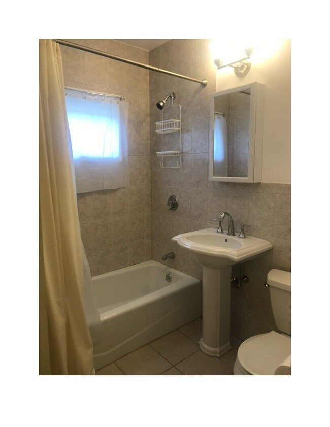
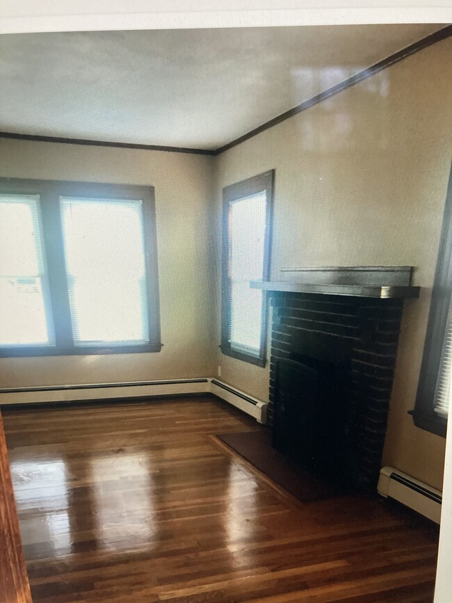
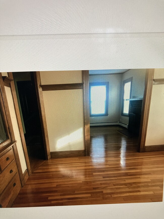
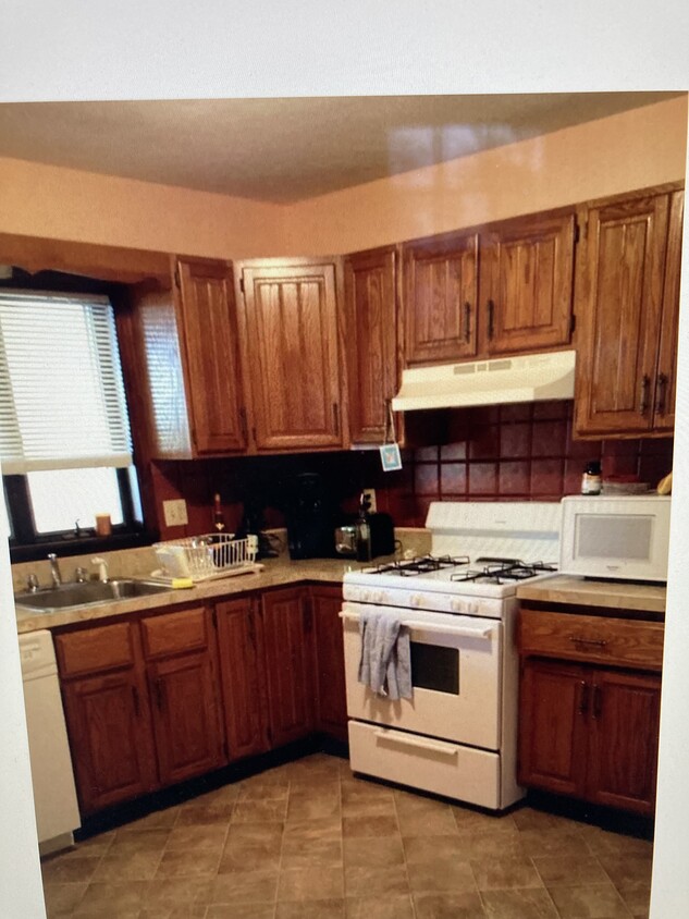
Flexible move in date!! Huge 2 bed with 3nd bedroom attached to one of the bedrooms for bonus room for office or extra storage, Beautiful hardwoods floors throughout unit, lots of window and closets, Laundry in unit, short walk to commuter train and on bus line.
336 Lagrange St is a townhome located in Suffolk County and the 02132 ZIP Code. This area is served by the Boston Public Schools attendance zone.
* Price shown is total price based on community-supplied monthly required fees. Excludes user-selected optional fees and variable or usage-based fees and required charges due at or prior to move-in or at move-out. Price, availability, fees, and any applicable rent special are subject to change without notice.
* Square footage definitions vary. Displayed square footage is approximate.
Townhome Features
- Washer/Dryer
- Office
Fees and Policies
The fees listed below are community-provided and may exclude utilities or add-ons. All payments are made directly to the property and are non-refundable unless otherwise specified.
Details
Utilities Included
-
Water
Contact
- Listed by Karen Dolan
- Phone Number
- Contact
Location
Get Directions
Upper Washington-Spring Street is a neighborhood southwest of Boston in West Roxbury. Residents will find that Upper Washington-Spring Street is home to many cozy residential areas and great amenities. The neighborhood’s northern border sits along the Charles River and surrounding parks like Millennium Park, giving residents easy access to outdoor recreation. The hospital that serves this area, West Roxbury VAMC, sits along the river as well. Within Upper Washington-Spring Street, residents will find that picturesque parks like Ohrenberger Woodland Park dot the area. To the east of town, residents can travel along VFW Parkway to get to eateries and retail stores.
This neighborhood is a great town for commuters as the MBTA has both bus stops and rail lines accessible to the area. Apartments and condos scattered throughout town make up the majority of Upper Washington-Spring Street’s diverse rental options.
Learn more about living in Upper Washington-Spring St
Education
| Colleges & Universities | Distance | ||
|---|---|---|---|
| Colleges & Universities | Distance | ||
| Drive: | 13 min | 5.2 mi | |
| Drive: | 13 min | 6.0 mi | |
| Drive: | 13 min | 6.1 mi | |
| Drive: | 14 min | 6.2 mi |
336 Lagrange St is within 13 minutes or 5.2 miles from Curry College. It is also near Boston College and Boston College, Brighton.
Schools


Public Elementary & Middle School
Grades PK-8
Attendance Zone
Public Elementary & Middle School
Grades PK-8
Attendance Zone
Public Middle & High School
Grades 6-12
Attendance Zone
Public Middle School
Grades 6-8
133 Students
Attendance Zone
Public High School
Grades 12
408 Students
Attendance Zone
Public High School
Grades 12
39 Students
Attendance Zone
Private Elementary School
Grades PK-5
Nearby
Private Middle & High School
Grades 6-12
Nearby
School data provided by
 The GreatSchools Rating helps parents compare schools within a state based on a variety of school quality indicators and provides a helpful picture of how effectively each school serves all of its students. Ratings are on a scale of 1 (below average) to 10 (above average) and can include test scores, college readiness, academic progress, advanced courses, equity, discipline and attendance data. We also advise parents to visit schools, consider other information on school performance and programs, and consider family needs as part of the school selection process.
View GreatSchools Rating Methodology
Data provided by GreatSchools.org © 2026. All rights reserved.
View GreatSchools Rating Methodology
Data provided by GreatSchools.org © 2026. All rights reserved.
Transportation options available in Boston include Forest Hills Station, located 3.3 miles from 336 Lagrange St. 336 Lagrange St is near General Edward Lawrence Logan International, located 11.6 miles or 25 minutes away.
| Transit / Subway | Distance | ||
|---|---|---|---|
| Transit / Subway | Distance | ||
|
|
Drive: | 8 min | 3.3 mi |
|
|
Drive: | 9 min | 3.8 mi |
|
|
Drive: | 10 min | 4.3 mi |
|
|
Drive: | 10 min | 4.5 mi |
|
|
Drive: | 12 min | 5.1 mi |
| Commuter Rail | Distance | ||
|---|---|---|---|
| Commuter Rail | Distance | ||
|
|
Walk: | 5 min | 0.3 mi |
|
|
Walk: | 11 min | 0.6 mi |
|
|
Drive: | 3 min | 1.2 mi |
|
|
Drive: | 5 min | 2.0 mi |
|
|
Drive: | 9 min | 3.5 mi |
| Airports | Distance | ||
|---|---|---|---|
| Airports | Distance | ||
|
General Edward Lawrence Logan International
|
Drive: | 25 min | 11.6 mi |
Getting Around
 What do Walkability, Transit, Drivability, and Bikeability mean?
Walkability measures the walking distance to day-to-day needs.
Transit measures access to public transportation.
Drivability measures congestion, parking availability, and access to major roads.
Bikeability measures the suitability for cycling.
How It Works
What do Walkability, Transit, Drivability, and Bikeability mean?
Walkability measures the walking distance to day-to-day needs.
Transit measures access to public transportation.
Drivability measures congestion, parking availability, and access to major roads.
Bikeability measures the suitability for cycling.
How It Works
Moderately Walkable
Walkability
70
/ 100
Good Public Transit
Transit
60
/ 100
Very Drivable
Drivability
80
/ 100
Moderately Bikeable
Bikeability
60
/ 100
Scores provided by
Active
Soundscore™
78
/ 100
Traffic
ActiveAirport
CalmBusinesses
ActiveScores provided by
HowLoud What is a Sound Score Rating? A Sound Score Rating aggregates noise caused by vehicle traffic, airplane traffic and local sources. How It WorksTime and distance from 336 Lagrange St.
| Shopping Centers | Distance | ||
|---|---|---|---|
| Shopping Centers | Distance | ||
| Walk: | 11 min | 0.6 mi | |
| Walk: | 22 min | 1.1 mi | |
| Drive: | 4 min | 1.9 mi |
336 Lagrange St has 3 shopping centers within 1.9 miles, which is about a 4-minute drive. The miles and minutes will be for the farthest away property.
| Parks and Recreation | Distance | ||
|---|---|---|---|
| Parks and Recreation | Distance | ||
|
Brook Farm Historic Site
|
Drive: | 3 min | 1.2 mi |
|
Stony Brook Reservation
|
Drive: | 4 min | 1.7 mi |
|
Arnold Arboretum of Harvard University
|
Drive: | 5 min | 2.6 mi |
|
Cutler Park Reservation
|
Drive: | 7 min | 3.7 mi |
|
Mass Audubon's Boston Nature Center and Wildlife Sanctuary
|
Drive: | 10 min | 4.0 mi |
336 Lagrange St has 5 parks within 4.0 miles, including Brook Farm Historic Site, Stony Brook Reservation, and Arnold Arboretum of Harvard University.
| Hospitals | Distance | ||
|---|---|---|---|
| Hospitals | Distance | ||
| Drive: | 4 min | 2.1 mi | |
| Drive: | 6 min | 2.9 mi | |
| Drive: | 10 min | 4.5 mi |
336 Lagrange St has 3 hospitals within 4.5 miles, the nearest is Bournewood Hospital which is 2.1 miles away and a 4 minute drive.
| Military Bases | Distance | ||
|---|---|---|---|
| Military Bases | Distance | ||
| Drive: | 23 min | 12.1 mi |
336 Lagrange St is 12.1 miles and a 23 minute drive from US Military Reservation.
Amenities
- Washer/Dryer
- Office
336 Lagrange St Photos
What Are Walk Score®, Transit Score®, and Bike Score® Ratings?
Walk Score® measures the walkability of any address. Transit Score® measures access to public transit. Bike Score® measures the bikeability of any address.
What is a Sound Score Rating?
A Sound Score Rating aggregates noise caused by vehicle traffic, airplane traffic and local sources.
336 Lagrange St
Boston, MA 02132