
$1,295 / Month
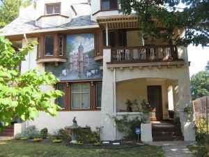
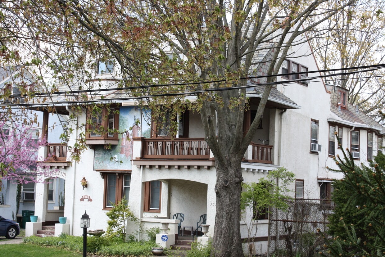
334 Thrall St Unit 2
Cincinnati, OH 45220
2 Weeks Ago
Favorites
334 Thrall St Unit 2

Favorites
Check Back Soon for Upcoming Availability
| Beds | Baths | Average SF |
|---|---|---|
| 2 Bedrooms 2 Bedrooms 2 Br | 1 Bath 1 Bath 1 Ba | 1,300 SF |
Fees and Policies
The fees below are based on community-supplied data and may exclude additional fees and utilities.
- Parking
-
Street--
Details
Utilities Included
-
Water
-
Heat
-
Trash Removal
-
Sewer
Property Information
-
5 units
About This Property
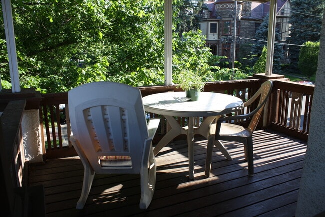
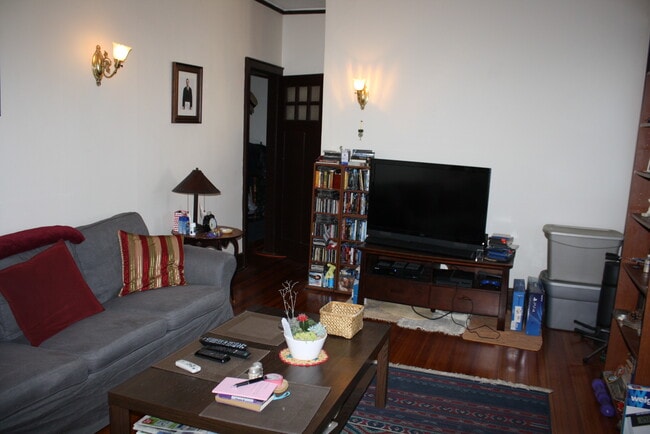
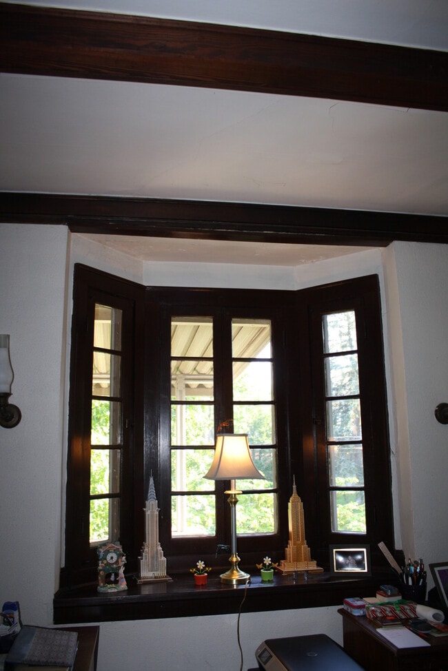
Two bedrooms with living room, eat in kitchen & full bath. Located in the heart of the Clifton gaslight and just 2 blocks to Ludlow’s business district and bus transportation. Large walk in pantry and plenty of closet space. Nestled in a quiet, well maintained building. Managed by individual owners; not by large management company. No smoking or pets allowed. $1295 per month, one year’s lease required, available August 1, 2021. Heat, water, recycling and trash included. Application and references required. Please contact Elaine Painter—owner’s daughter/real estate Broker.
334 Thrall St is an apartment community located in Hamilton County and the 45220 ZIP Code.
Apartment Features
Smoke Free
Eat-in Kitchen
Cable Ready
Kitchen
- Smoke Free
- Cable Ready
- Pantry
- Eat-in Kitchen
- Kitchen
- Laundry Facilities
- Recycling
Location
Get Directions
In Clifton there’s plenty to do and see. The rolling hills, lush parks and green spaces, hip shopping, and affordable apartments create a vibrancy in Clifton that can’t be ignored.
In addition to its active art scene, the neighborhood is encompassing of Mount Storm Park, Edgewood Grove Park, and the Cincinnati State Technical and Community College. Locals enjoy the direct access to Interstate 75, making commutes in and around the city a breeze.
Clifton is just north of the 90-acre Burnet Woods Park and the University of Cincinnati campus. When you have a craving for something sweet or savory, head on over to the Clifton Gaslight District for every kind of cuisine imaginable. Clifton sits atop a hill overlooking the Northside, and Ludlow Avenue has been dubbed Cincinnati’s first “Main Street.
Learn more about living in CliftonBelow are rent ranges for similar nearby apartments
| Beds | Average Size | Lowest | Typical | Premium |
|---|---|---|---|---|
| Studio Studio Studio | 468-471 Sq Ft | $695 | $1,034 | $1,479 |
| 1 Bed 1 Bed 1 Bed | 687-691 Sq Ft | $675 | $1,161 | $2,740 |
| 2 Beds 2 Beds 2 Beds | 1002 Sq Ft | $895 | $1,644 | $4,120 |
| 3 Beds 3 Beds 3 Beds | 1174-1182 Sq Ft | $899 | $1,656 | $3,000 |
| 4 Beds 4 Beds 4 Beds | 1577-1581 Sq Ft | $575 | $1,852 | $29,530 |
Amenities
- Smoke Free
- Cable Ready
- Pantry
- Eat-in Kitchen
- Kitchen
- Laundry Facilities
- Recycling
Expenses
Utilities Included
Water, Heat, Trash Removal, Sewer
Included
Education
| Colleges & Universities | Distance | ||
|---|---|---|---|
| Colleges & Universities | Distance | ||
| Drive: | 4 min | 1.5 mi | |
| Drive: | 5 min | 1.6 mi | |
| Drive: | 7 min | 2.0 mi | |
| Drive: | 9 min | 3.1 mi |
334 Thrall St Unit 2 is within 7 minutes or 2.0 miles from Cincinnati State. It is also near University of Cincinnati and Univ. of Cincinnati, Medical.
Transportation options available in Cincinnati include Findlay Market-Race Station, Race & Elder, located 2.6 miles from 334 Thrall St Unit 2. 334 Thrall St Unit 2 is near Cincinnati/Northern Kentucky International, located 18.1 miles or 33 minutes away.
| Transit / Subway | Distance | ||
|---|---|---|---|
| Transit / Subway | Distance | ||
| Drive: | 7 min | 2.6 mi | |
| Drive: | 7 min | 2.7 mi | |
| Drive: | 8 min | 2.7 mi | |
| Drive: | 7 min | 2.8 mi | |
| Drive: | 8 min | 3.1 mi |
| Commuter Rail | Distance | ||
|---|---|---|---|
| Commuter Rail | Distance | ||
|
|
Drive: | 9 min | 4.0 mi |
| Airports | Distance | ||
|---|---|---|---|
| Airports | Distance | ||
|
Cincinnati/Northern Kentucky International
|
Drive: | 33 min | 18.1 mi |
Time and distance from 334 Thrall St Unit 2.
| Shopping Centers | Distance | ||
|---|---|---|---|
| Shopping Centers | Distance | ||
| Walk: | 21 min | 1.1 mi | |
| Drive: | 4 min | 1.7 mi | |
| Drive: | 6 min | 2.4 mi |
334 Thrall St Unit 2 has 3 shopping centers within 2.4 miles, which is about a 6-minute walk. The miles and minutes will be for the farthest away property.
| Parks and Recreation | Distance | ||
|---|---|---|---|
| Parks and Recreation | Distance | ||
|
Burnet Woods
|
Walk: | 13 min | 0.7 mi |
|
Cincinnati Zoo and Botanical Garden
|
Walk: | 17 min | 0.9 mi |
|
Trailside Nature Center
|
Drive: | 4 min | 1.5 mi |
|
William H. Taft National Historic Site
|
Drive: | 8 min | 2.7 mi |
|
Buttercup Valley
|
Drive: | 8 min | 2.9 mi |
334 Thrall St Unit 2 has 5 parks within 2.9 miles, including Burnet Woods, Cincinnati Zoo and Botanical Garden, and Trailside Nature Center.
| Hospitals | Distance | ||
|---|---|---|---|
| Hospitals | Distance | ||
| Walk: | 14 min | 0.8 mi | |
| Drive: | 5 min | 1.8 mi | |
| Drive: | 5 min | 2.0 mi |
334 Thrall St Unit 2 has 3 hospitals within 2.0 miles, the nearest is Good Samaritan Hospital which is 0.8 mile away and a 14 minute walk.
| Military Bases | Distance | ||
|---|---|---|---|
| Military Bases | Distance | ||
| Drive: | 67 min | 50.8 mi | |
| Drive: | 73 min | 55.9 mi | |
| Drive: | 76 min | 59.2 mi |
334 Thrall St Unit 2 has 3 military bases within 59.2 miles, the nearest is Gentile Air Force Station which is 50.8 miles away and a 67 minute drive.
You May Also Like
Similar Rentals Nearby


What Are Walk Score®, Transit Score®, and Bike Score® Ratings?
Walk Score® measures the walkability of any address. Transit Score® measures access to public transit. Bike Score® measures the bikeability of any address.
What is a Sound Score Rating?
A Sound Score Rating aggregates noise caused by vehicle traffic, airplane traffic and local sources
334 Thrall St
Cincinnati, OH 45220