
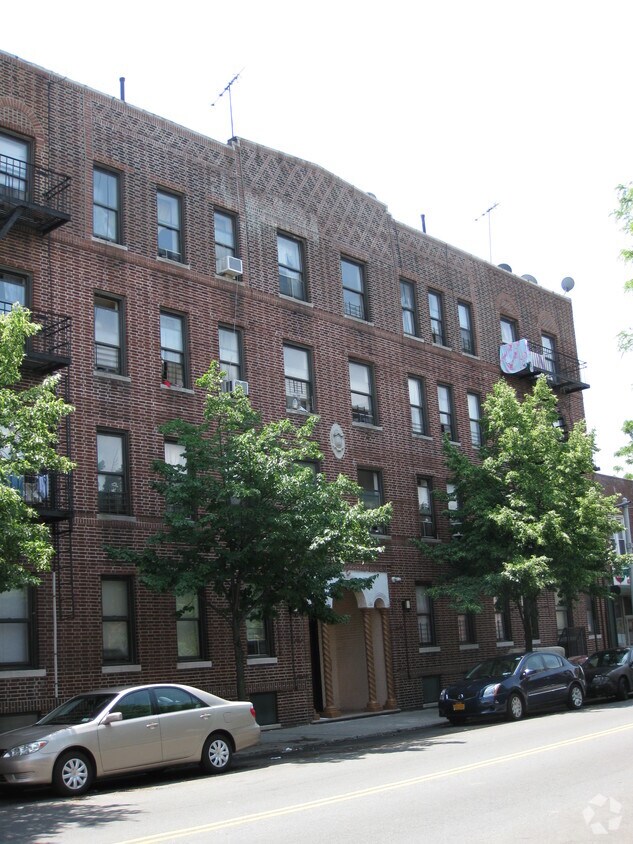
The Vitagraph
1277 E 14th St,
Brooklyn, NY 11230
$3,295 - $4,304
2-3 Beds

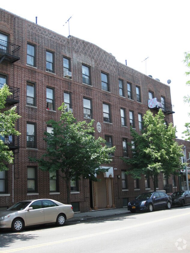
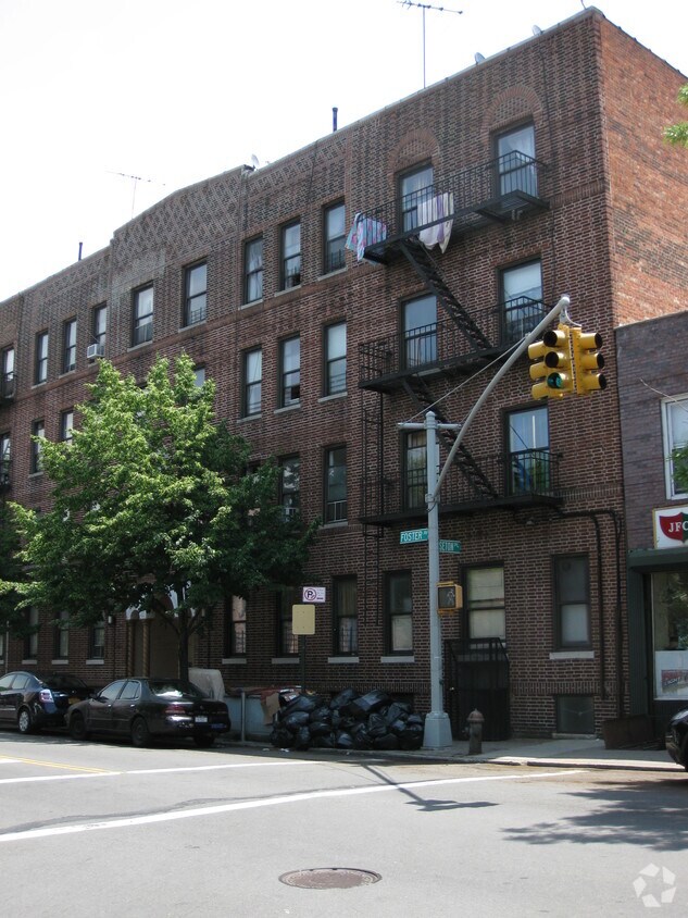

334 Foster Ave is ready to be your home. This apartment community is located in Brooklyn on Foster Ave in the 11230 area. Schedule a time to check out the current floorplan options. From amenities to floorplan options, the leasing team is ready to help you in finding your perfect place. Contact us or stop by today.
334 Foster Ave is an apartment community located in Kings County and the 11230 ZIP Code. This area is served by the New York City Geographic District #20 attendance zone.
High Speed Internet Access
Smoke Free
Heating
Cable Ready
Located just two miles north of Coney Island and stretches of sand along Brighton Beach and Manhattan Beach, Midwood is one of Brooklyn's much-loved -- and surprisingly lesser known -- neighborhoods. In some ways, it's traditional New York: extremely walkable, bicycle-friendly, and near mass transit. It features tall, brick buildings with wrought-iron fire escapes, and the wide sidewalks lead past friendly neighborhood bakeries, delis, and boutiques. But in other ways, it feels much more suburban, with its tree-filled neighborhoods, elegant single-family homes, and a historic shopping district filled with locally-owned businesses.
Subway stations are scattered throughout Midwood and provide a 45-minute ride to Manhattan. Residents can drive south on Ocean Parkway to enjoy a day at the beach, and students appreciate easy access to Brooklyn College, set just outside of Midwood. This diverse melting pot provides a little bit of everything when searching for a restaurant, shop, or grocer.
Learn more about living in Midwood| Colleges & Universities | Distance | ||
|---|---|---|---|
| Colleges & Universities | Distance | ||
| Drive: | 6 min | 1.5 mi | |
| Drive: | 9 min | 3.8 mi | |
| Drive: | 12 min | 5.3 mi | |
| Drive: | 12 min | 5.4 mi |


Transportation options available in Brooklyn include 18 Avenue (F Line), located 0.2 mile from 334 Foster Ave. 334 Foster Ave is near John F Kennedy International, located 13.9 miles or 25 minutes away, and Newark Liberty International, located 19.5 miles or 32 minutes away.
| Transit / Subway | Distance | ||
|---|---|---|---|
| Transit / Subway | Distance | ||
|
|
Walk: | 4 min | 0.2 mi |
|
|
Walk: | 5 min | 0.3 mi |
|
|
Walk: | 12 min | 0.6 mi |
|
|
Walk: | 12 min | 0.6 mi |
|
|
Drive: | 5 min | 1.2 mi |
| Commuter Rail | Distance | ||
|---|---|---|---|
| Commuter Rail | Distance | ||
|
|
Drive: | 12 min | 5.0 mi |
|
|
Drive: | 12 min | 5.1 mi |
|
|
Drive: | 14 min | 6.6 mi |
|
|
Drive: | 17 min | 8.4 mi |
|
|
Drive: | 19 min | 9.0 mi |
| Airports | Distance | ||
|---|---|---|---|
| Airports | Distance | ||
|
John F Kennedy International
|
Drive: | 25 min | 13.9 mi |
|
Newark Liberty International
|
Drive: | 32 min | 19.5 mi |
Scores provided by
Traffic
BusyAirport
CalmBusinesses
BusyScores provided by
HowLoud What is a Sound Score Rating? A Sound Score Rating aggregates noise caused by vehicle traffic, airplane traffic and local sources. How It WorksTime and distance from 334 Foster Ave.
| Shopping Centers | Distance | ||
|---|---|---|---|
| Shopping Centers | Distance | ||
| Drive: | 5 min | 1.3 mi | |
| Drive: | 7 min | 1.9 mi | |
| Drive: | 7 min | 2.1 mi |
| Parks and Recreation | Distance | ||
|---|---|---|---|
| Parks and Recreation | Distance | ||
|
Sunset Park
|
Drive: | 6 min | 2.5 mi |
|
Prospect Park Audubon Center at the Boathouse
|
Drive: | 7 min | 3.1 mi |
|
Prospect Park Zoo
|
Drive: | 7 min | 3.2 mi |
|
Wingate Park
|
Drive: | 9 min | 3.7 mi |
|
Prospect Park
|
Drive: | 10 min | 4.2 mi |
| Hospitals | Distance | ||
|---|---|---|---|
| Hospitals | Distance | ||
| Drive: | 6 min | 2.7 mi | |
| Drive: | 6 min | 2.8 mi | |
| Drive: | 8 min | 3.4 mi |
| Military Bases | Distance | ||
|---|---|---|---|
| Military Bases | Distance | ||
| Drive: | 12 min | 5.0 mi | |
| Drive: | 15 min | 8.1 mi | |
| Drive: | 20 min | 9.2 mi |
What Are Walk Score®, Transit Score®, and Bike Score® Ratings?
Walk Score® measures the walkability of any address. Transit Score® measures access to public transit. Bike Score® measures the bikeability of any address.
What is a Sound Score Rating?
A Sound Score Rating aggregates noise caused by vehicle traffic, airplane traffic and local sources.
334 Foster Ave
Brooklyn, NY 11230


