
Williamsburg
200 W Galbraith Rd,
Cincinnati, OH 45215
$658 - $2,879
Studio - 3 Beds
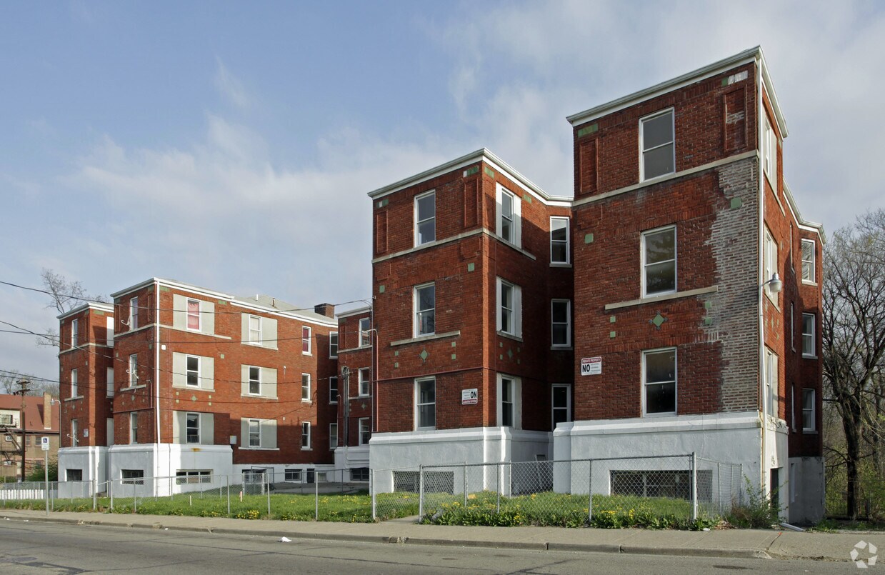
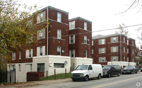
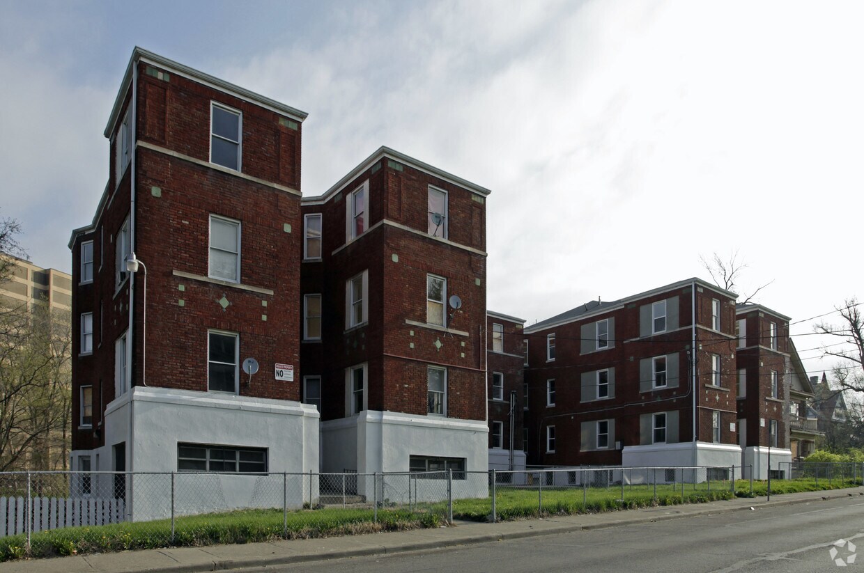

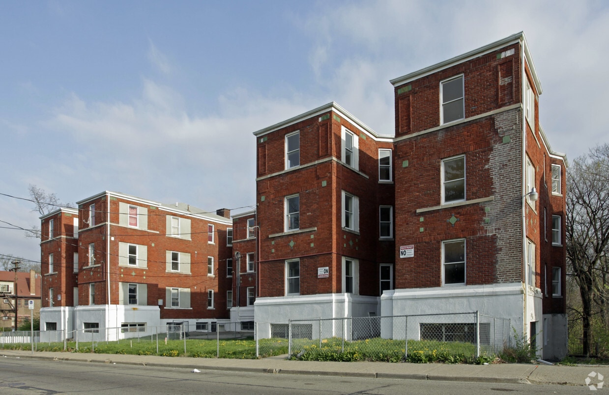
Enjoy Cincinnati living at 334-342 Forest Ave. You'll find this community in the 45229 area of Cincinnati. The leasing staff will assist you in finding your perfect home. It's time to find your new home. Contact or stop by the 334-342 Forest Ave leasing office to learn more about our community.
334-342 Forest Ave is an apartment community located in Hamilton County and the 45229 ZIP Code. This area is served by the Cincinnati Public Schools attendance zone.
Air Conditioning
High Speed Internet Access
Refrigerator
Smoke Free
Cincinnati sits on the northern bank of the Ohio River, where rolling hills meet a city that helped establish the Midwest long before other major metros existed. Settled in 1788, the Queen City sits west of the Appalachian Mountains and combines historic culture with urban living.
Today, neighborhoods like Over-the-Rhine, Hyde Park, and Mount Adams each bring a distinct character to city life. Over-the-Rhine is packed with restored 19th-century architecture, Findlay Market, and Music Hall. Mount Adams perches beside Eden Park with stunning river views, while Hyde Park Square draws locals and tourists alike with local cafes and walkable streets.
Renters will find a wide range of housing options across the city, from converted lofts and townhouses in Over-the-Rhine to sleek high-rise apartment communities along the riverfront at The Banks. Clifton and Oakley offer everything from charming older buildings to newer developments with modern amenities.
Learn more about living in Cincinnati| Colleges & Universities | Distance | ||
|---|---|---|---|
| Colleges & Universities | Distance | ||
| Walk: | 16 min | 0.8 mi | |
| Drive: | 4 min | 1.4 mi | |
| Drive: | 5 min | 1.7 mi | |
| Drive: | 8 min | 2.9 mi |


Transportation options available in Cincinnati include Findlay Market-Race Station - Race & Elder, located 2.8 miles from 334-342 Forest Ave. 334-342 Forest Ave is near Cincinnati/Northern Kentucky International, located 18.0 miles or 33 minutes away.
| Transit / Subway | Distance | ||
|---|---|---|---|
| Transit / Subway | Distance | ||
| Drive: | 8 min | 2.8 mi | |
| Drive: | 8 min | 2.9 mi | |
| Drive: | 9 min | 2.9 mi | |
| Drive: | 8 min | 3.0 mi | |
| Drive: | 9 min | 3.3 mi |
| Commuter Rail | Distance | ||
|---|---|---|---|
| Commuter Rail | Distance | ||
|
|
Drive: | 11 min | 5.1 mi |
| Airports | Distance | ||
|---|---|---|---|
| Airports | Distance | ||
|
Cincinnati/Northern Kentucky International
|
Drive: | 33 min | 18.0 mi |
Scores provided by
Traffic
-Airport
-Businesses
-Scores provided by
HowLoud What is a Sound Score Rating? A Sound Score Rating aggregates noise caused by vehicle traffic, airplane traffic and local sources. How It WorksTime and distance from 334-342 Forest Ave.
| Shopping Centers | Distance | ||
|---|---|---|---|
| Shopping Centers | Distance | ||
| Walk: | 17 min | 0.9 mi | |
| Drive: | 5 min | 2.3 mi | |
| Drive: | 6 min | 2.3 mi |
| Parks and Recreation | Distance | ||
|---|---|---|---|
| Parks and Recreation | Distance | ||
|
Cincinnati Zoo and Botanical Garden
|
Walk: | 13 min | 0.7 mi |
|
Burnet Woods
|
Drive: | 4 min | 1.4 mi |
|
Trailside Nature Center
|
Drive: | 5 min | 1.8 mi |
|
Avon Woods Natural Area/Preserve
|
Drive: | 5 min | 2.1 mi |
|
William H. Taft National Historic Site
|
Drive: | 7 min | 2.3 mi |
| Hospitals | Distance | ||
|---|---|---|---|
| Hospitals | Distance | ||
| Walk: | 8 min | 0.4 mi | |
| Walk: | 15 min | 0.8 mi | |
| Drive: | 4 min | 1.8 mi |
| Military Bases | Distance | ||
|---|---|---|---|
| Military Bases | Distance | ||
| Drive: | 67 min | 50.8 mi | |
| Drive: | 73 min | 55.8 mi | |
| Drive: | 75 min | 59.1 mi |
What Are Walk Score®, Transit Score®, and Bike Score® Ratings?
Walk Score® measures the walkability of any address. Transit Score® measures access to public transit. Bike Score® measures the bikeability of any address.
What is a Sound Score Rating?
A Sound Score Rating aggregates noise caused by vehicle traffic, airplane traffic and local sources.
334-342 Forest Ave
Cincinnati, OH 45229


