$1,549
/ Month
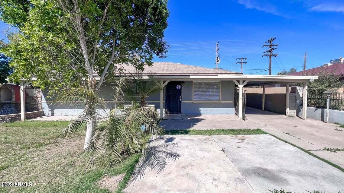
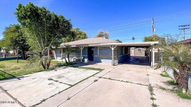
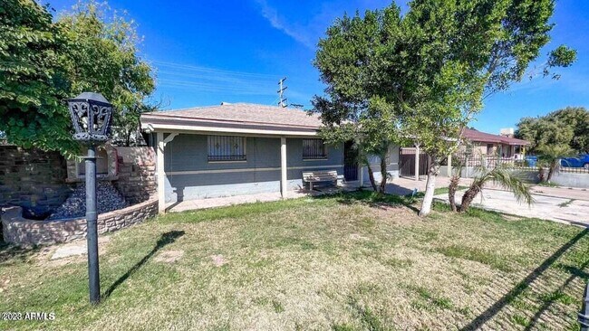
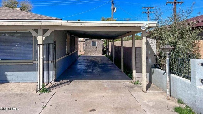
3330 W Rancho Dr
Phoenix, AZ 85017
2 Weeks Ago
Favorites
3330 W Rancho Dr

Favorites
Check Back Soon for Upcoming Availability
| Beds | Baths | Average SF |
|---|---|---|
| 3 Bedrooms 3 Bedrooms 3 Br | 1.75 Baths 1.75 Baths 1.75 Ba | — |
About This Property
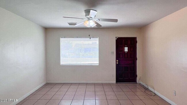
This home features 3 large Bedrooms and 2 remodeled Bathrooms with a large living room/kitchen. This block home sits at a large corner lot! The home boasts fresh paint with ceiling fans and tile flooring throughout the home! Washer/dryer hookup only. It has a fenced front yard! Includes carport parking, storage shed large back yard, and RV gate. It is conveniently located walking distance to Walmart, close to Grand Canyon University, Christown Mall, La Pradera Park, Palo Verde Gold Course with easy access to the I-17!
3330 W Rancho Dr is a house located in Maricopa County and the 85017 ZIP Code. This area is served by the Phoenix Union High attendance zone.
Location
Get Directions
Westside is a neighborhood within Glendale, which was voted “Arizona’s Antique Capital” by Sunset magazine and USA Today. Many higher education schools are located near Westside, including Glendale Community College, Carrington College, and Arizona State University West campus. You’ll discover numerous pocket parks in the area, plus larger ones like Glendale Heroes Regional Park and Grand Canal Linear Park. Shopping and dining destinations are plentiful, especially at Arrowhead Towne Center Mall.
Learn more about living in WestsideBelow are rent ranges for similar nearby apartments
Education
| Colleges & Universities | Distance | ||
|---|---|---|---|
| Colleges & Universities | Distance | ||
| Walk: | 18 min | 1.0 mi | |
| Drive: | 9 min | 5.1 mi | |
| Drive: | 9 min | 5.1 mi | |
| Drive: | 12 min | 5.5 mi |
3330 W Rancho Dr is within 18 minutes or 1.0 mile from Grand Canyon University. It is also near Argosy University and DeVry University, Arizona.
Schools


Public Elementary & Middle School
Grades PK-8
657 Students
Attendance Zone
Public High School
Grades 9-12
276 Students
Attendance Zone
Public High School
Grades 9-12
2,282 Students
Attendance Zone
Private Elementary & Middle School
Grades PK-8
480 Students
Nearby
Private Elementary, Middle & High School
Grades K-12
Nearby
School data provided by
 The GreatSchools Rating helps parents compare schools within a state based on a variety of school quality indicators and provides a helpful picture of how effectively each school serves all of its students. Ratings are on a scale of 1 (below average) to 10 (above average) and can include test scores, college readiness, academic progress, advanced courses, equity, discipline and attendance data. We also advise parents to visit schools, consider other information on school performance and programs, and consider family needs as part of the school selection process.
View GreatSchools Rating Methodology
Data provided by GreatSchools.org © 2025. All rights reserved.
View GreatSchools Rating Methodology
Data provided by GreatSchools.org © 2025. All rights reserved.
Transportation options available in Phoenix include Montebello/19Th Ave, located 2.1 miles from 3330 W Rancho Dr. 3330 W Rancho Dr is near Phoenix Sky Harbor International, located 13.7 miles or 21 minutes away, and Phoenix-Mesa Gateway, located 40.5 miles or 54 minutes away.
| Transit / Subway | Distance | ||
|---|---|---|---|
| Transit / Subway | Distance | ||
|
|
Drive: | 4 min | 2.1 mi |
|
|
Drive: | 6 min | 3.0 mi |
|
|
Drive: | 7 min | 3.4 mi |
|
|
Drive: | 8 min | 3.9 mi |
|
|
Drive: | 8 min | 4.0 mi |
| Commuter Rail | Distance | ||
|---|---|---|---|
| Commuter Rail | Distance | ||
|
|
Drive: | 54 min | 41.6 mi |
| Airports | Distance | ||
|---|---|---|---|
| Airports | Distance | ||
|
Phoenix Sky Harbor International
|
Drive: | 21 min | 13.7 mi |
|
Phoenix-Mesa Gateway
|
Drive: | 54 min | 40.5 mi |
Time and distance from 3330 W Rancho Dr.
| Shopping Centers | Distance | ||
|---|---|---|---|
| Shopping Centers | Distance | ||
| Walk: | 5 min | 0.3 mi | |
| Walk: | 19 min | 1.0 mi | |
| Drive: | 2 min | 1.3 mi |
3330 W Rancho Dr has 3 shopping centers within 1.3 miles, which is about a 2-minute walk. The miles and minutes will be for the farthest away property.
| Parks and Recreation | Distance | ||
|---|---|---|---|
| Parks and Recreation | Distance | ||
|
Maryvale Park
|
Drive: | 8 min | 3.9 mi |
|
Steele Indian School Park
|
Drive: | 12 min | 5.8 mi |
|
Desert Storm Park
|
Drive: | 11 min | 5.9 mi |
|
Japanese Friendship Garden
|
Drive: | 12 min | 7.6 mi |
|
Margaret T. Hance Park
|
Drive: | 14 min | 9.2 mi |
3330 W Rancho Dr has 5 parks within 9.2 miles, including Maryvale Park, Steele Indian School Park, and Desert Storm Park.
| Hospitals | Distance | ||
|---|---|---|---|
| Hospitals | Distance | ||
| Drive: | 3 min | 1.8 mi | |
| Drive: | 5 min | 2.5 mi | |
| Drive: | 11 min | 6.2 mi |
3330 W Rancho Dr has 3 hospitals within 6.2 miles, the nearest is Abrazo Central Campus which is 1.8 miles away and a 3 minute drive.
| Military Bases | Distance | ||
|---|---|---|---|
| Military Bases | Distance | ||
| Drive: | 22 min | 13.5 mi | |
| Drive: | 26 min | 13.7 mi | |
| Drive: | 100 min | 74.3 mi |
3330 W Rancho Dr has 3 military bases within 74.3 miles, the nearest is Phoenix Sky Harbor Airport Air Guard Station which is 13.5 miles away and a 22 minute drive.
You May Also Like
Similar Rentals Nearby
-
-
-
-
-
-
-
1 / 51

-
-
-


What Are Walk Score®, Transit Score®, and Bike Score® Ratings?
Walk Score® measures the walkability of any address. Transit Score® measures access to public transit. Bike Score® measures the bikeability of any address.
What is a Sound Score Rating?
A Sound Score Rating aggregates noise caused by vehicle traffic, airplane traffic and local sources

3330 W Rancho Dr
Phoenix, AZ 85017