
TENTEN Campus Glendale
414 N Orange St,
Glendale, CA 91203
$3,128 - $5,277 Total Monthly Price
Studio - 2 Beds
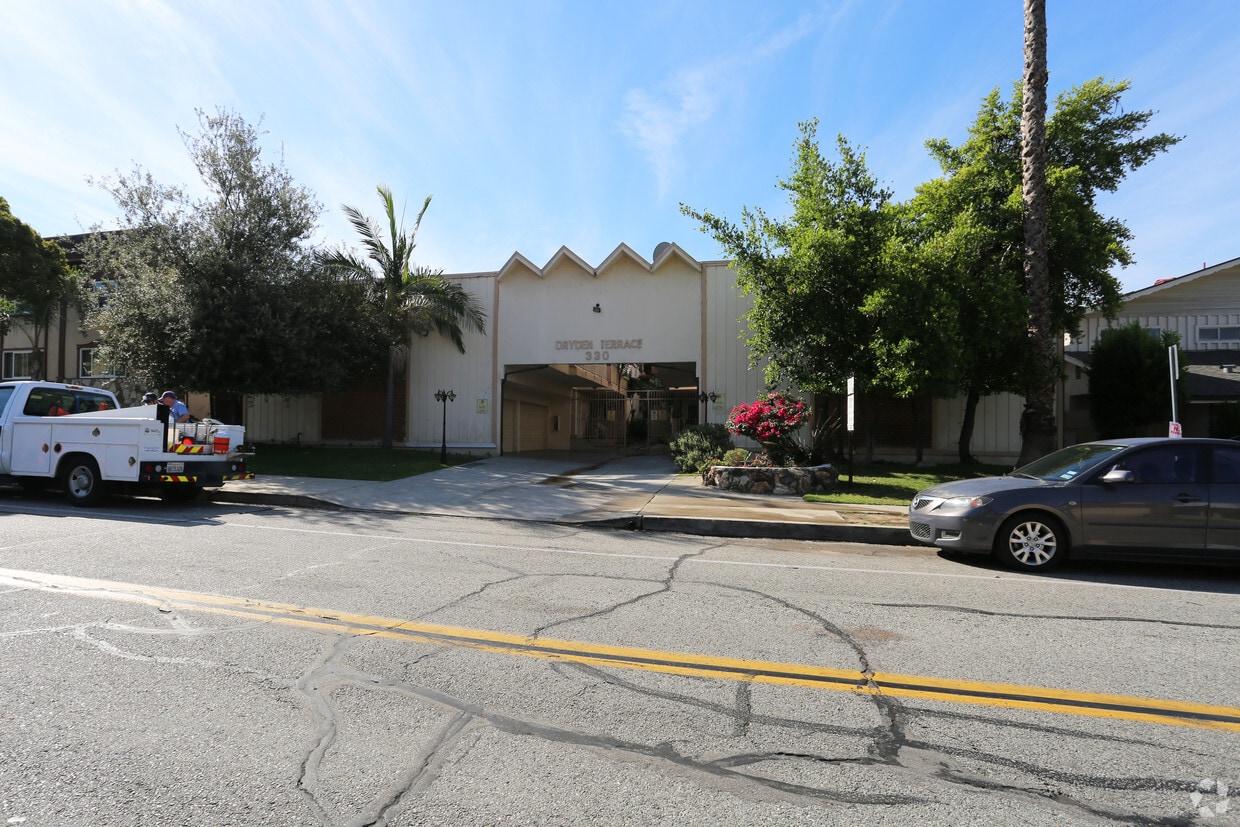
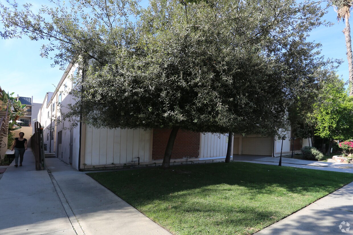

Discover your new place at 330 E Dryden St in Glendale, CA. This community is located in the Rossmoyne area of Glendale. The professional leasing team is available to help you find your new place. Your new home awaits you at 330 E Dryden St. Contact us or stop in to schedule a tour.
330 E Dryden St is an apartment community located in Los Angeles County and the 91207 ZIP Code. This area is served by the Glendale Unified School District attendance zone.
The urban neighborhood of Rossmoyne is filled with residential areas, located just north of downtown Glendale. Travel into downtown to explore the shops at Glendale Galleria, try various cuisines from an abundance of restaurants, check out local museums, or catch a movie at Pacific Theatres.
Enjoy open green space, a playground, and athletic courts at Nibley Park in the heart of Rossmoyne. This peaceful neighborhood is situated just 11 miles north of downtown Los Angeles, offering residents small town charm with access to metropolitan attractions. Discover famous museums, local restaurants, and popular community parks in this bustling downtown.
With views of the San Gabriel Mountains and access to downtown Los Angeles, residents of Rossmoyne enjoy beautiful natural landscapes, scenic views, and upscale amenities. Unique apartments, condos, and houses are available for rent in this Southern California neighborhood.
Learn more about living in RossmoyneCompare neighborhood and city base rent averages by bedroom.
| Rossmoyne | Glendale, CA | |
|---|---|---|
| Studio | $1,885 | $2,014 |
| 1 Bedroom | $1,963 | $2,097 |
| 2 Bedrooms | $2,346 | $2,659 |
| 3 Bedrooms | $3,440 | $3,448 |
| Colleges & Universities | Distance | ||
|---|---|---|---|
| Colleges & Universities | Distance | ||
| Drive: | 5 min | 1.9 mi | |
| Drive: | 10 min | 4.5 mi | |
| Drive: | 8 min | 5.3 mi | |
| Drive: | 15 min | 8.6 mi |


Transportation options available in Glendale include Southwest Museum Station, located 6.6 miles from 330 E Dryden St. 330 E Dryden St is near Bob Hope, located 10.2 miles or 16 minutes away, and Los Angeles International, located 25.3 miles or 39 minutes away.
| Transit / Subway | Distance | ||
|---|---|---|---|
| Transit / Subway | Distance | ||
|
|
Drive: | 14 min | 6.6 mi |
|
|
Drive: | 11 min | 6.8 mi |
|
|
Drive: | 12 min | 7.3 mi |
|
|
Drive: | 12 min | 7.3 mi |
|
|
Drive: | 13 min | 7.6 mi |
| Commuter Rail | Distance | ||
|---|---|---|---|
| Commuter Rail | Distance | ||
|
|
Drive: | 7 min | 3.0 mi |
|
|
Drive: | 8 min | 4.7 mi |
|
|
Drive: | 12 min | 7.4 mi |
| Drive: | 11 min | 7.9 mi | |
|
|
Drive: | 17 min | 10.2 mi |
| Airports | Distance | ||
|---|---|---|---|
| Airports | Distance | ||
|
Bob Hope
|
Drive: | 16 min | 10.2 mi |
|
Los Angeles International
|
Drive: | 39 min | 25.3 mi |
Scores provided by
Traffic
-Airport
-Businesses
-Scores provided by
HowLoud What is a Sound Score Rating? A Sound Score Rating aggregates noise caused by vehicle traffic, airplane traffic and local sources. How It WorksTime and distance from 330 E Dryden St.
| Shopping Centers | Distance | ||
|---|---|---|---|
| Shopping Centers | Distance | ||
| Walk: | 16 min | 0.8 mi | |
| Walk: | 17 min | 0.9 mi | |
| Walk: | 18 min | 1.0 mi |
| Parks and Recreation | Distance | ||
|---|---|---|---|
| Parks and Recreation | Distance | ||
|
Los Angeles Zoo
|
Drive: | 15 min | 5.0 mi |
|
Descanso Gardens
|
Drive: | 11 min | 5.7 mi |
|
Bird Sanctuary
|
Drive: | 12 min | 6.3 mi |
|
Marsh Park
|
Drive: | 11 min | 6.5 mi |
|
Griffith Park
|
Drive: | 25 min | 9.7 mi |
| Hospitals | Distance | ||
|---|---|---|---|
| Hospitals | Distance | ||
| Drive: | 6 min | 2.0 mi | |
| Drive: | 6 min | 2.7 mi | |
| Drive: | 9 min | 5.1 mi |
| Military Bases | Distance | ||
|---|---|---|---|
| Military Bases | Distance | ||
| Drive: | 36 min | 26.9 mi |
Pets Allowed Fitness Center Pool In Unit Washer & Dryer Clubhouse Balcony
What Are Walk Score®, Transit Score®, and Bike Score® Ratings?
Walk Score® measures the walkability of any address. Transit Score® measures access to public transit. Bike Score® measures the bikeability of any address.
What is a Sound Score Rating?
A Sound Score Rating aggregates noise caused by vehicle traffic, airplane traffic and local sources.


