

$3,800
Total Monthly Price
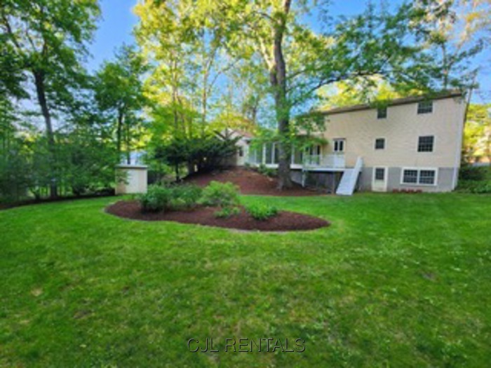
33 High St
Acton, MA 01720
Favorites
33 High St

Favorites
Check Back Soon for Upcoming Availability
| Beds | Baths | Average SF |
|---|---|---|
| 4 Bedrooms 4 Bedrooms 4 Br | 3 Baths 3 Baths 3 Ba | — |
About This Property
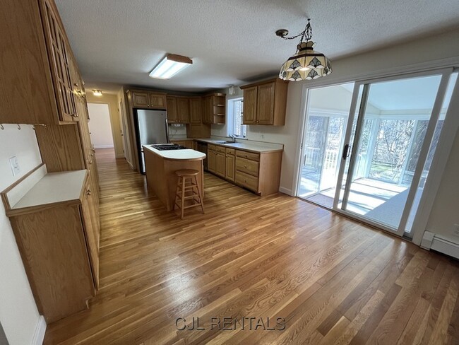
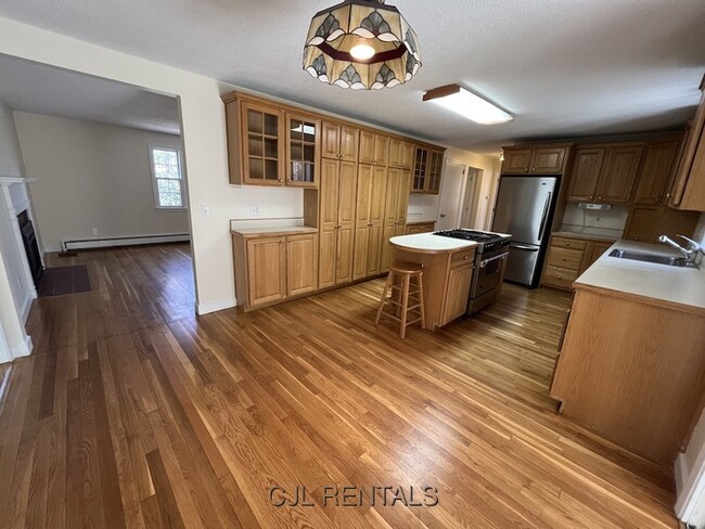
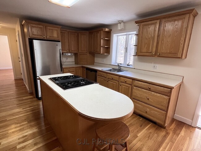
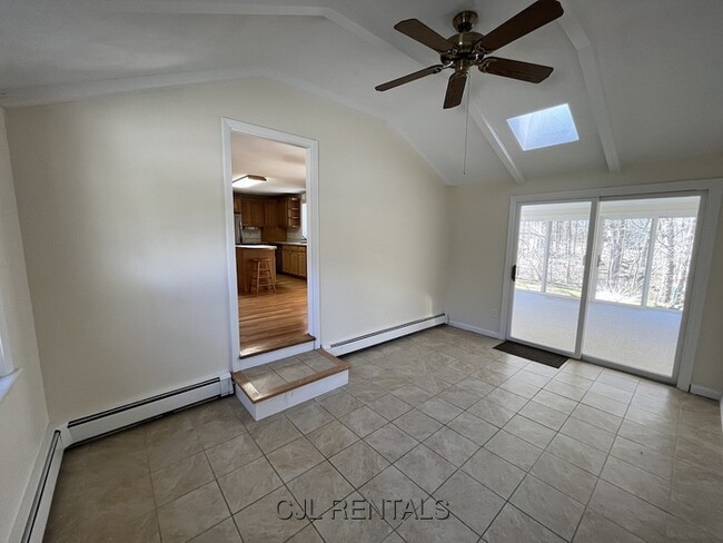
Available July 1st - Spacious single family home perfect for a family looking to live in Acton's great community! With gleaming hardwood floors throughout, fresh coats of paint, and a brand new ceiling in the basement, you will immediately feel at home! 2 car garage parking with additional driveway space, with a back deck in a spacious back yard so you can enjoy the peace and quiet. Listed as four bedroom plus, use one of the many rooms in the house as your personal at home office, or commute to work using the South Acton MBTA station within walking distance. More than enough storage space in the basement or it can even be used as additional living space. Pets are negotiable. To schedule a showing please call/text Tim Scalisi at or email .
33 High St is a condo located in Middlesex County and the 01720 ZIP Code. This area is served by the Acton-Boxborough School District attendance zone.
33 High St,
Acton,
MA
01720
Tucked along Route 2 in Middlesex County, Acton is a New England town where tree-lined trails, open fields, and an unhurried pace make everyday life feel intentional. NARA Park anchors the community, drawing residents for summer swimming and winter sledding. Historic Concord sits next door, adding cultural richness that's easy to explore on weekends. The MBTA commuter rail connects south Acton directly to Boston in about 45 minutes, making it a practical base for those wanting quieter surroundings with city access.
The rental landscape features spacious townhomes and garden-style apartments nestled in wooded settings, offering privacy that's hard to find closer to Boston. Options range from studios to multi-bedroom layouts. Acton-Boxborough Regional High School consistently ranks among Massachusetts' top public schools, reflecting the town's investment in education. Incorporated in 1735, Acton carries centuries of history within its 21 square miles.
Learn more about living in ActonBelow are rent ranges for similar nearby apartments
| Beds | Average Size | Lowest | Typical | Premium |
|---|---|---|---|---|
| Studio Studio Studio | 515 Sq Ft | $2,350 | $2,369 | $2,375 |
| 1 Bed 1 Bed 1 Bed | 721-722 Sq Ft | $1,500 | $2,756 | $11,474 |
| 2 Beds 2 Beds 2 Beds | 1074 Sq Ft | $1,700 | $3,572 | $16,768 |
| 3 Beds 3 Beds 3 Beds | 1376-1379 Sq Ft | $3,150 | $5,299 | $18,627 |
| 4 Beds 4 Beds 4 Beds | 3308 Sq Ft | $5,400 | $5,800 | $6,500 |
Education
| Colleges & Universities | Distance | ||
|---|---|---|---|
| Colleges & Universities | Distance | ||
| Drive: | 24 min | 13.0 mi | |
| Drive: | 31 min | 14.0 mi | |
| Drive: | 30 min | 15.4 mi | |
| Drive: | 30 min | 16.7 mi |
33 High St is within 24 minutes or 13.0 miles from Framingham State College. It is also near Middlesex C.C., Bedford Campus and Brandeis University.
Schools


Public Elementary School
Grades K-5
420 Students
Nearby
Public Elementary School
Grades PK-5
455 Students
Nearby
Public Middle School
Grades 6-8
820 Students
Nearby
Public High School
Grades 9-12
1,611 Students
Attendance Zone
Private Elementary & Middle School
Grades PK-8
94 Students
Nearby
Private Elementary School
Grades PK-5
Nearby
Private Middle & High School
Grades 6-12
71 Students
Nearby
School data provided by
 The GreatSchools Rating helps parents compare schools within a state based on a variety of school quality indicators and provides a helpful picture of how effectively each school serves all of its students. Ratings are on a scale of 1 (below average) to 10 (above average) and can include test scores, college readiness, academic progress, advanced courses, equity, discipline and attendance data. We also advise parents to visit schools, consider other information on school performance and programs, and consider family needs as part of the school selection process.
View GreatSchools Rating Methodology
Data provided by GreatSchools.org © 2026. All rights reserved.
View GreatSchools Rating Methodology
Data provided by GreatSchools.org © 2026. All rights reserved.
Walkability Near 33 High St Acton, MA 01720
Getting Around
 What do Walkability, Transit, Drivability, and Bikeability mean?
Walkability measures the walking distance to day-to-day needs.
Transit measures access to public transportation.
Drivability measures congestion, parking availability, and access to major roads.
Bikeability measures the suitability for cycling.
How It Works
What do Walkability, Transit, Drivability, and Bikeability mean?
Walkability measures the walking distance to day-to-day needs.
Transit measures access to public transportation.
Drivability measures congestion, parking availability, and access to major roads.
Bikeability measures the suitability for cycling.
How It Works
Somewhat Walkable
Walkability
30
/ 100
Limited Public Transit
Transit
30
/ 100
Exceptionally Drivable
Drivability
100
/ 100
Fairly Bikeable
Bikeability
50
/ 100
Scores provided by
-
Soundscore™
-
/ 100
Traffic
-Airport
-Businesses
-Scores provided by
HowLoud What is a Sound Score Rating? A Sound Score Rating aggregates noise caused by vehicle traffic, airplane traffic and local sources. How It WorksYou May Also Like
Similar Rentals Nearby


What Are Walk Score®, Transit Score®, and Bike Score® Ratings?
Walk Score® measures the walkability of any address. Transit Score® measures access to public transit. Bike Score® measures the bikeability of any address.
What is a Sound Score Rating?
A Sound Score Rating aggregates noise caused by vehicle traffic, airplane traffic and local sources.
33 High St
Acton, MA 01720