
The Landings at Riverwalk
300 Riverfront Blvd,
Elmwood Park, NJ 07407
$2,250 - $4,800
1-2 Beds
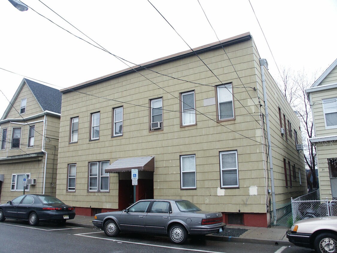
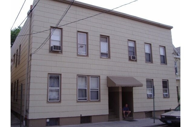

Find your home at 33-35 Arthur St in Clifton. The address for this community is in Clifton at 33-35 Arthur St. in the 07011 area. Here at this community, the leasing team will be ready to help you find the perfect fit. Schedule a time to see the current floorplan options. Get a head start on your move right now. Contact or stop by 33-35 Arthur St to check the availability and set up a tour today!
33-35 Arthur St is an apartment community located in Passaic County and the 07011 ZIP Code. This area is served by the Clifton Public School District attendance zone.
Located 15 miles west of Manhattan, Clifton combines suburban living with easy access to New York City. This established New Jersey community offers various housing options, from apartments to single-family homes.
Clifton's landscape features the historic Weasel Brook Park, designed by the Olmsted Brothers landscaping firm. The city maintains its agricultural heritage through active farms, including Ploch's Farm, operating since 1867. Main Avenue serves as the downtown hub, with local shops and dining options. Commuters benefit from access to Routes 3 and 46 and the Garden State Parkway. The city is home to Clifton High School, one of New Jersey's largest single-facility high schools. Residents enjoy seasonal farmers' markets, numerous parks, and convenient public transportation options to Manhattan.
Learn more about living in CliftonCompare neighborhood and city base rent averages by bedroom.
| Botany Village | Clifton, NJ | |
|---|---|---|
| Studio | $1,268 | $1,742 |
| 1 Bedroom | $1,492 | $2,039 |
| 2 Bedrooms | $2,049 | $2,712 |
| 3 Bedrooms | $2,722 | $3,206 |
| Colleges & Universities | Distance | ||
|---|---|---|---|
| Colleges & Universities | Distance | ||
| Drive: | 4 min | 2.2 mi | |
| Drive: | 8 min | 3.2 mi | |
| Drive: | 8 min | 4.4 mi | |
| Drive: | 9 min | 5.0 mi |


Transportation options available in Clifton include Grove Street, located 9.9 miles from 33-35 Arthur St. 33-35 Arthur St is near Newark Liberty International, located 17.3 miles or 21 minutes away, and LaGuardia, located 24.8 miles or 37 minutes away.
| Transit / Subway | Distance | ||
|---|---|---|---|
| Transit / Subway | Distance | ||
|
|
Drive: | 16 min | 9.9 mi |
|
|
Drive: | 14 min | 10.0 mi |
|
|
Drive: | 15 min | 10.4 mi |
|
|
Drive: | 15 min | 10.4 mi |
|
|
Drive: | 15 min | 11.5 mi |
| Commuter Rail | Distance | ||
|---|---|---|---|
| Commuter Rail | Distance | ||
|
|
Drive: | 4 min | 1.8 mi |
|
|
Drive: | 4 min | 1.9 mi |
|
|
Drive: | 4 min | 2.2 mi |
|
|
Drive: | 5 min | 2.3 mi |
| Drive: | 11 min | 4.1 mi |
| Airports | Distance | ||
|---|---|---|---|
| Airports | Distance | ||
|
Newark Liberty International
|
Drive: | 21 min | 17.3 mi |
|
LaGuardia
|
Drive: | 37 min | 24.8 mi |
Scores provided by
Traffic
-Airport
-Businesses
-Scores provided by
HowLoud What is a Sound Score Rating? A Sound Score Rating aggregates noise caused by vehicle traffic, airplane traffic and local sources. How It WorksTime and distance from 33-35 Arthur St.
| Shopping Centers | Distance | ||
|---|---|---|---|
| Shopping Centers | Distance | ||
| Walk: | 8 min | 0.5 mi | |
| Walk: | 9 min | 0.5 mi | |
| Walk: | 13 min | 0.7 mi |
| Parks and Recreation | Distance | ||
|---|---|---|---|
| Parks and Recreation | Distance | ||
|
Presby Memorial Iris Gardens
|
Drive: | 10 min | 5.9 mi |
|
Rifle Camp Park Observatory
|
Drive: | 12 min | 7.2 mi |
|
Van Saun County Park
|
Drive: | 15 min | 9.7 mi |
|
Bergen County Zoo
|
Drive: | 15 min | 9.8 mi |
|
Teaneck Creek Conservancy
|
Drive: | 15 min | 10.7 mi |
| Hospitals | Distance | ||
|---|---|---|---|
| Hospitals | Distance | ||
| Drive: | 4 min | 2.1 mi | |
| Drive: | 5 min | 3.1 mi | |
| Drive: | 10 min | 6.9 mi |
| Military Bases | Distance | ||
|---|---|---|---|
| Military Bases | Distance | ||
| Drive: | 30 min | 19.6 mi | |
| Drive: | 28 min | 20.6 mi | |
| Drive: | 43 min | 28.7 mi |
What Are Walk Score®, Transit Score®, and Bike Score® Ratings?
Walk Score® measures the walkability of any address. Transit Score® measures access to public transit. Bike Score® measures the bikeability of any address.
What is a Sound Score Rating?
A Sound Score Rating aggregates noise caused by vehicle traffic, airplane traffic and local sources.

33-35 Arthur St
Clifton, NJ 07011


