$1,850 / Month
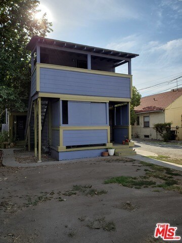
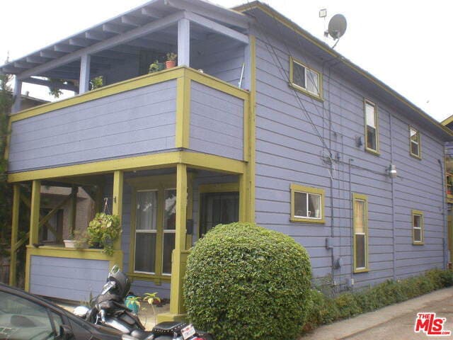
329 S Ave 20
Los Angeles, CA 90031
2 Weeks Ago
Favorites
329 S Ave 20

Favorites
Check Back Soon for Upcoming Availability
| Beds | Baths | Average SF |
|---|---|---|
| 1 Bedroom 1 Bedroom 1 Br | 1 Bath 1 Bath 1 Ba | — |
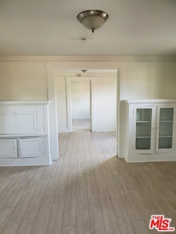
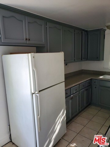
About This Property
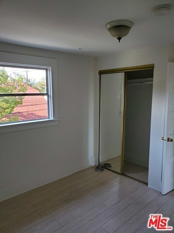
Charming and cozy vintage craftsman" 1-bed upper unit located near the Brewery Art Lofts in Lincoln Heights. Small complex with lots of fruit trees and outdoor space to enjoy. May consider well behaved pet. Available now."
329 S Ave 20 is an apartment community located in Los Angeles County and the 90031 ZIP Code.
Features
- Den
Location
Get Directions
Nestled between the Los Angeles River and Interstate 5, Taylor Junction is an extensive neighborhood offering rentals ranging from affordable to upscale. Taylor Junction sits directly east of Elysian Park, offering residents proximity to Dodger Stadium and Los Angeles State Historic Park as well. Longstanding restaurants and a family-owned winery, San Antonio Winery, make this neighborhood feel like home. With a close-knit community and several public and private schools, Taylor Junction is a family-friendly option for renters wanting to remain close to Downtown Los Angeles, located only three miles away. Taylor Junction offers proximity to Chinatown, the Arts District, and Lincoln Heights.
Learn more about living in Taylor JunctionBelow are rent ranges for similar nearby apartments
Amenities
- Den
Education
| Colleges & Universities | Distance | ||
|---|---|---|---|
| Colleges & Universities | Distance | ||
| Drive: | 4 min | 1.2 mi | |
| Drive: | 7 min | 3.6 mi | |
| Drive: | 7 min | 3.6 mi | |
| Drive: | 8 min | 4.2 mi |
329 S Ave 20 is within 4 minutes or 1.2 miles from USC, Health Sciences Campus. It is also near Golden Gate Univ, Los Angeles and The Fashion Institute.
Transportation options available in Los Angeles include Lincoln Heights/Cypress Park Station, located 1.0 miles from 329 S Ave 20. 329 S Ave 20 is near Bob Hope, located 15.3 miles or 21 minutes away, and Los Angeles International, located 17.7 miles or 29 minutes away.
| Transit / Subway | Distance | ||
|---|---|---|---|
| Transit / Subway | Distance | ||
|
|
Walk: | 19 min | 1.0 mi |
|
|
Drive: | 3 min | 1.3 mi |
|
|
Drive: | 4 min | 1.4 mi |
|
|
Drive: | 6 min | 1.8 mi |
|
|
Drive: | 4 min | 2.0 mi |
| Commuter Rail | Distance | ||
|---|---|---|---|
| Commuter Rail | Distance | ||
|
|
Drive: | 5 min | 1.8 mi |
|
|
Drive: | 7 min | 1.9 mi |
|
|
Drive: | 9 min | 4.7 mi |
| Drive: | 8 min | 5.9 mi | |
|
|
Drive: | 16 min | 9.9 mi |
| Airports | Distance | ||
|---|---|---|---|
| Airports | Distance | ||
|
Bob Hope
|
Drive: | 21 min | 15.3 mi |
|
Los Angeles International
|
Drive: | 29 min | 17.7 mi |
Time and distance from 329 S Ave 20.
| Shopping Centers | Distance | ||
|---|---|---|---|
| Shopping Centers | Distance | ||
| Walk: | 10 min | 0.6 mi | |
| Walk: | 11 min | 0.6 mi | |
| Walk: | 12 min | 0.6 mi |
329 S Ave 20 has 3 shopping centers within 0.6 mile, which is about a 12-minute walk. The miles and minutes will be for the farthest away property.
| Parks and Recreation | Distance | ||
|---|---|---|---|
| Parks and Recreation | Distance | ||
|
Hollenbeck Lake
|
Drive: | 5 min | 2.4 mi |
|
Chavez Ravine Arboretum
|
Drive: | 5 min | 2.6 mi |
|
Elysian Park
|
Drive: | 8 min | 2.6 mi |
|
Audubon Center at Debs Park
|
Drive: | 5 min | 2.9 mi |
|
Elyria Canyon Park
|
Drive: | 8 min | 3.4 mi |
329 S Ave 20 has 5 parks within 3.4 miles, including Elysian Park, Hollenbeck Lake, and Audubon Center at Debs Park.
| Hospitals | Distance | ||
|---|---|---|---|
| Hospitals | Distance | ||
| Drive: | 3 min | 1.3 mi | |
| Drive: | 4 min | 1.5 mi | |
| Drive: | 7 min | 3.4 mi |
329 S Ave 20 has 3 hospitals within 3.4 miles, the nearest is LAC + USC Medical Center which is 1.3 miles away and a 3 minute drive.
| Military Bases | Distance | ||
|---|---|---|---|
| Military Bases | Distance | ||
| Drive: | 27 min | 19.2 mi |
329 S Ave 20 is 19.2 miles and a 27 minute drive from Los Angeles Air Force Base.
You May Also Like
Similar Rentals Nearby


 - Violet on Virgil")


 - AVA Burbank")

What Are Walk Score®, Transit Score®, and Bike Score® Ratings?
Walk Score® measures the walkability of any address. Transit Score® measures access to public transit. Bike Score® measures the bikeability of any address.
What is a Sound Score Rating?
A Sound Score Rating aggregates noise caused by vehicle traffic, airplane traffic and local sources

329 S Ave 20
Los Angeles, CA 90031