$4,400
/ Month
329 Burns St SE
Washington, DC 20019
Today
|
Edit
Favorites
202-276-2295
-
Bedrooms
4
-
Bathrooms
2
-
Square Feet
--
-
Available
Available Mar 29
Highlight
- Basement
329 Burns St SE

Favorites
About This Home
Available Mar 29
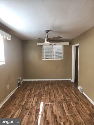
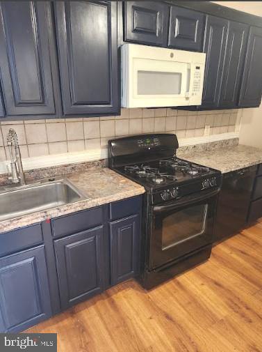
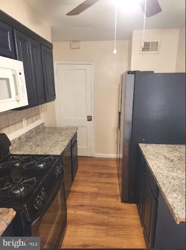
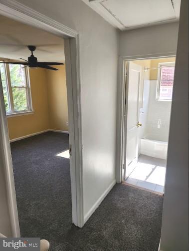
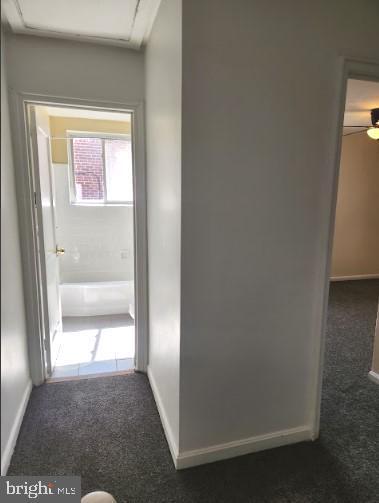
Check out this amazing home located in Ft. Dupont Park! Enjoy the spacious rooms and home complete with a view of Ft. Dupont Park, directly across the street! This home also has an enclosed rear porch, great for sitting outside and enjoying the outdoors. Walking distance to Metro & Train. This home will not last long! Set up your private showing, today!
329 Burns St Se is a townhome located in District of Columbia County and the 20019 ZIP Code. This area is served by the District Of Columbia Public Schools attendance zone.
* Price shown is base rent. Excludes user-selected optional fees and variable or usage-based fees and required charges due at or prior to move-in or at move-out. Price, availability, fees, and any applicable rent special are subject to change without notice.
* Square footage definitions vary. Displayed square footage is approximate.
Townhome Features
- Basement
Contact
- Listed by shataa S whittle | Samson Properties
- Phone Number
- Contact
-
Source
 Bright MLS, Inc.
Copyright © 2026 Bright MLS, Inc.
Location
Get Directions
The residential neighborhood of Fort Dupont sits just east of the Anacostia River in Southeast Washington, DC. The neighborhood has ample green space provided by two adjacent parks — Fort Circle Park and Fort Chaplin Park — and distinguishes itself within the Greater Anacostia area by housing the only public indoor ice rink in Washington, DC.
There’s a diverse mix of rentals in Fort Dupont, from more recent and upscale developments to long-standing apartment homes closer to the Anacostia River. Proximity to the Benning Road Metro Station makes Fort Dupont perfect for the Capitol Hill commuter who wishes to reside outside the bustle of DC.
Learn more about living in Fort Dupont
Amenities
- Basement
Education
| Colleges & Universities | Distance | ||
|---|---|---|---|
| Colleges & Universities | Distance | ||
| Drive: | 9 min | 4.0 mi | |
| Drive: | 9 min | 4.9 mi | |
| Drive: | 9 min | 4.9 mi | |
| Drive: | 9 min | 5.4 mi |
329 Burns St SE is within 9 minutes or 4.0 miles from Gallaudet University. It is also near Georgetown and Georgetown Law.
Schools


Public Middle School
Grades 6-8
Nearby
Public High School
Grades 9-12
Nearby
School data provided by
 The GreatSchools Rating helps parents compare schools within a state based on a variety of school quality indicators and provides a helpful picture of how effectively each school serves all of its students. Ratings are on a scale of 1 (below average) to 10 (above average) and can include test scores, college readiness, academic progress, advanced courses, equity, discipline and attendance data. We also advise parents to visit schools, consider other information on school performance and programs, and consider family needs as part of the school selection process.
View GreatSchools Rating Methodology
Data provided by GreatSchools.org © 2026. All rights reserved.
View GreatSchools Rating Methodology
Data provided by GreatSchools.org © 2026. All rights reserved.
Transportation options available in Washington include Benning Road, located 0.7 mile from 329 Burns St SE. 329 Burns St SE is near Ronald Reagan Washington Ntl, located 9.2 miles or 18 minutes away, and Baltimore/Washington International Thurgood Marshall, located 29.0 miles or 43 minutes away.
| Transit / Subway | Distance | ||
|---|---|---|---|
| Transit / Subway | Distance | ||
|
|
Walk: | 14 min | 0.7 mi |
|
|
Drive: | 4 min | 1.7 mi |
| Drive: | 4 min | 2.2 mi | |
|
|
Drive: | 6 min | 2.4 mi |
|
|
Drive: | 5 min | 2.6 mi |
| Commuter Rail | Distance | ||
|---|---|---|---|
| Commuter Rail | Distance | ||
|
|
Drive: | 7 min | 4.2 mi |
|
|
Drive: | 9 min | 4.4 mi |
|
|
Drive: | 11 min | 5.0 mi |
| Drive: | 13 min | 6.7 mi | |
| Drive: | 14 min | 8.1 mi |
| Airports | Distance | ||
|---|---|---|---|
| Airports | Distance | ||
|
Ronald Reagan Washington Ntl
|
Drive: | 18 min | 9.2 mi |
|
Baltimore/Washington International Thurgood Marshall
|
Drive: | 43 min | 29.0 mi |
Getting Around
 What do Walkability, Transit, Drivability, and Bikeability mean?
Walkability measures the walking distance to day-to-day needs.
Transit measures access to public transportation.
Drivability measures congestion, parking availability, and access to major roads.
Bikeability measures the suitability for cycling.
How It Works
What do Walkability, Transit, Drivability, and Bikeability mean?
Walkability measures the walking distance to day-to-day needs.
Transit measures access to public transportation.
Drivability measures congestion, parking availability, and access to major roads.
Bikeability measures the suitability for cycling.
How It Works
Moderately Walkable
Walkability
60
/ 100
Good Public Transit
Transit
60
/ 100
Very Drivable
Drivability
80
/ 100
Moderately Bikeable
Bikeability
70
/ 100
Scores provided by
-
Soundscore™
-
/ 100
Traffic
-Airport
-Businesses
-Scores provided by
HowLoud What is a Sound Score Rating? A Sound Score Rating aggregates noise caused by vehicle traffic, airplane traffic and local sources. How It WorksTime and distance from 329 Burns St SE.
| Shopping Centers | Distance | ||
|---|---|---|---|
| Shopping Centers | Distance | ||
| Walk: | 14 min | 0.7 mi | |
| Walk: | 17 min | 0.9 mi | |
| Drive: | 3 min | 1.3 mi |
329 Burns St SE has 3 shopping centers within 1.3 miles, which is about a 3-minute drive. The miles and minutes will be for the farthest away property.
| Parks and Recreation | Distance | ||
|---|---|---|---|
| Parks and Recreation | Distance | ||
|
Fort Dupont Park
|
Walk: | 13 min | 0.7 mi |
|
Kingman and Heritage Island Park
|
Drive: | 4 min | 2.2 mi |
|
Frederick Douglass National Historic Site
|
Drive: | 9 min | 3.3 mi |
|
Washington Youth Garden
|
Drive: | 6 min | 3.7 mi |
|
National Arboretum
|
Drive: | 11 min | 4.4 mi |
329 Burns St SE has 5 parks within 4.4 miles, including Fort Dupont Park, Kingman and Heritage Island Park, and Frederick Douglass National Historic Site.
| Hospitals | Distance | ||
|---|---|---|---|
| Hospitals | Distance | ||
| Drive: | 12 min | 4.6 mi | |
| Drive: | 12 min | 5.1 mi | |
| Drive: | 11 min | 5.4 mi |
329 Burns St SE has 3 hospitals within 5.4 miles, the nearest is St. Elizabeth's Hospital which is 4.6 miles away and a 12 minute drive.
| Military Bases | Distance | ||
|---|---|---|---|
| Military Bases | Distance | ||
| Drive: | 9 min | 4.2 mi | |
| Drive: | 11 min | 4.8 mi |
329 Burns St SE is 4.2 miles from Washington Navy Yard, and is convenient to other military bases, including Anacostia Naval Station.
You May Also Like
Similar Rentals Nearby
-
-
-
-
-
1 / 49

-
-

-

-
-


What Are Walk Score®, Transit Score®, and Bike Score® Ratings?
Walk Score® measures the walkability of any address. Transit Score® measures access to public transit. Bike Score® measures the bikeability of any address.
What is a Sound Score Rating?
A Sound Score Rating aggregates noise caused by vehicle traffic, airplane traffic and local sources.

329 Burns St SE
Washington, DC 20019