
Williamsburg
200 W Galbraith Rd,
Cincinnati, OH 45215
$658 - $2,852
Studio - 3 Beds
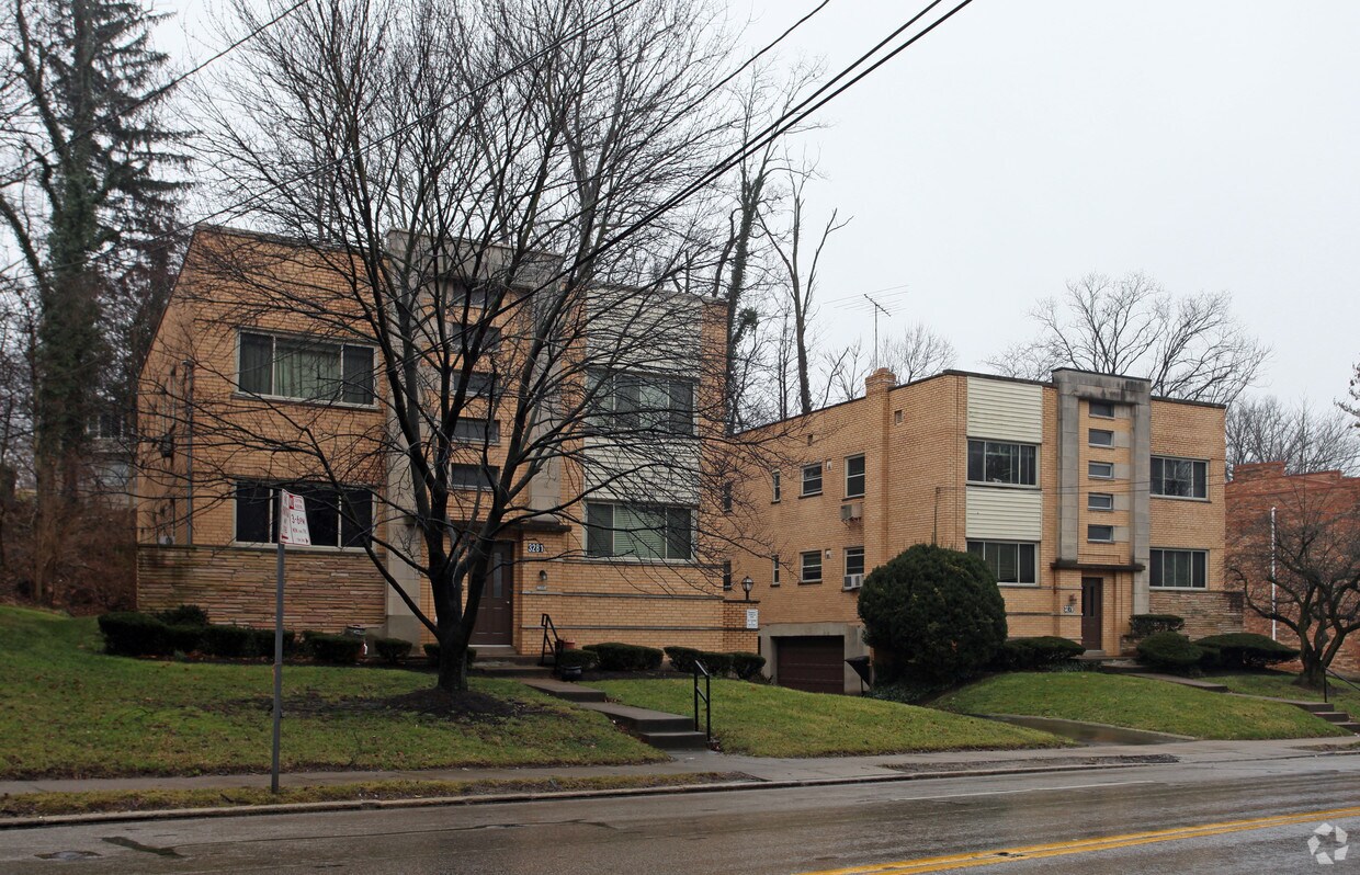
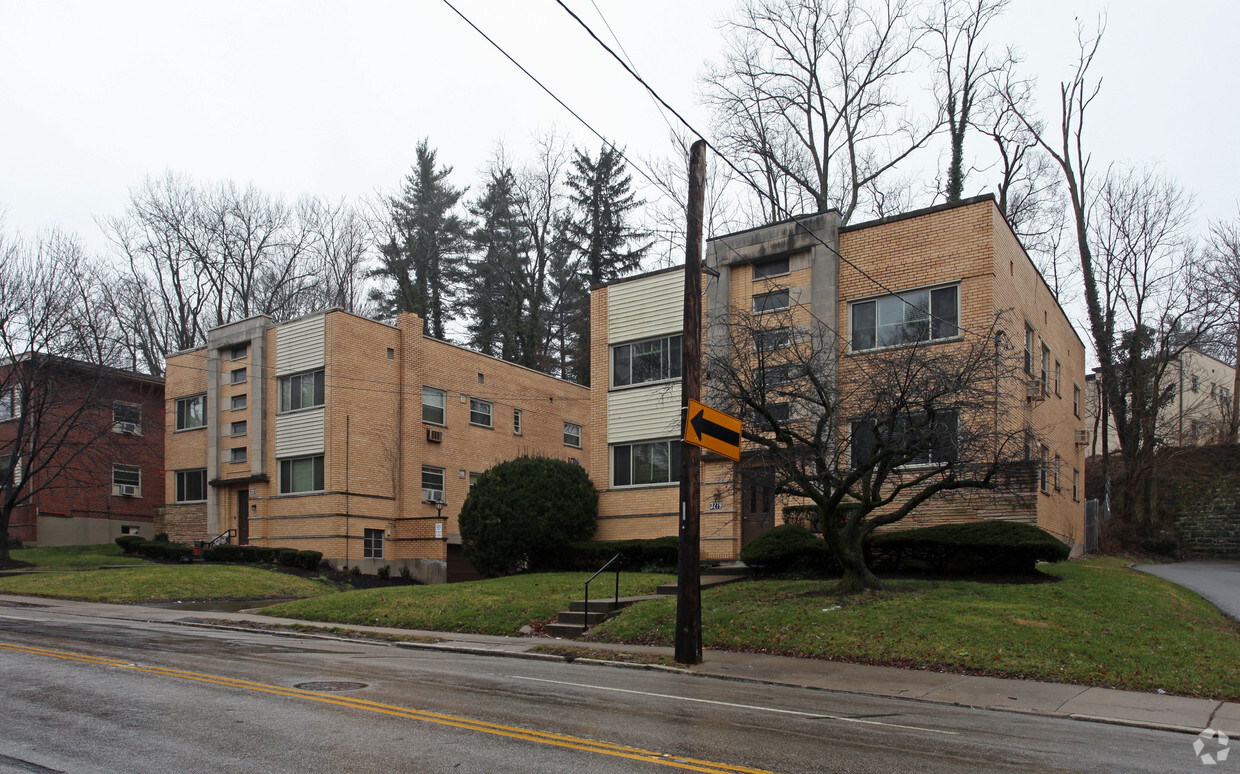

Experience 3279-3281 Linwood Ave. These apartments are located at 3279-3281 Linwood Ave in Cincinnati. Come for a visit to see the current floorplan options. The leasing team is waiting to show you all that this community has in store. At 3279-3281 Linwood Ave you'll feel right at home.
3279-3281 Linwood Ave is an apartment community located in Hamilton County and the 45226 ZIP Code. This area is served by the Cincinnati Public Schools attendance zone.
Home to several historic landmarks and houses, Columbia-Tusculum is Cincinnati’s oldest neighborhood. Nicknamed the San Francisco of Cincinnati, Columbia-Tusculum is a vibrant enclave known for its multicolored Victorian houses and trendy cafes and bars. Although the neighborhood is known for its colorful historic homes, condos and apartments are also available for rent. Locals flock to independent nightlife spots like Streetside Brewery and Local Post, an old post office turned bar. Columbia-Tusculum’s liveliness is amplified but its active community council hosts multiple events throughout the year including holiday parties, bar crawls, and street festivals. For even more shopping, dining, and entertainment options, residents can easily travel into Downtown Cincinnati, which is only five miles away.
Columbia-Tusculum is located along the Ohio River, so residents have easy access to the outdoors.
Learn more about living in Columbia-TusculumCompare neighborhood and city base rent averages by bedroom.
| Columbia-Tusculum | Cincinnati, OH | |
|---|---|---|
| Studio | $602 | $1,068 |
| 1 Bedroom | $1,194 | $1,143 |
| 2 Bedrooms | $1,555 | $1,436 |
| 3 Bedrooms | $2,019 | $1,750 |
| Colleges & Universities | Distance | ||
|---|---|---|---|
| Colleges & Universities | Distance | ||
| Drive: | 11 min | 3.8 mi | |
| Drive: | 13 min | 5.8 mi | |
| Drive: | 13 min | 5.9 mi | |
| Drive: | 20 min | 8.6 mi |


Transportation options available in Cincinnati include Richter & Phillips Station - 6Th & Main, located 5.9 miles from 3279-3281 Linwood Ave. 3279-3281 Linwood Ave is near Cincinnati/Northern Kentucky International, located 19.9 miles or 37 minutes away.
| Transit / Subway | Distance | ||
|---|---|---|---|
| Transit / Subway | Distance | ||
| Drive: | 12 min | 5.9 mi | |
| Drive: | 11 min | 6.0 mi | |
| Drive: | 12 min | 6.0 mi | |
| Drive: | 12 min | 6.1 mi | |
| Drive: | 12 min | 6.1 mi |
| Commuter Rail | Distance | ||
|---|---|---|---|
| Commuter Rail | Distance | ||
|
|
Drive: | 16 min | 7.9 mi |
| Airports | Distance | ||
|---|---|---|---|
| Airports | Distance | ||
|
Cincinnati/Northern Kentucky International
|
Drive: | 37 min | 19.9 mi |
Scores provided by
Traffic
-Airport
-Businesses
-Scores provided by
HowLoud What is a Sound Score Rating? A Sound Score Rating aggregates noise caused by vehicle traffic, airplane traffic and local sources. How It WorksTime and distance from 3279-3281 Linwood Ave.
| Shopping Centers | Distance | ||
|---|---|---|---|
| Shopping Centers | Distance | ||
| Drive: | 4 min | 1.4 mi | |
| Drive: | 5 min | 1.8 mi | |
| Drive: | 6 min | 2.0 mi |
| Parks and Recreation | Distance | ||
|---|---|---|---|
| Parks and Recreation | Distance | ||
|
Cincinnati Observatory
|
Drive: | 3 min | 1.3 mi |
|
Ault Park
|
Drive: | 4 min | 1.5 mi |
|
Otto Armleder Park
|
Drive: | 6 min | 2.4 mi |
|
Stanbery Park
|
Drive: | 8 min | 3.7 mi |
|
Eden Park
|
Drive: | 10 min | 4.4 mi |
| Hospitals | Distance | ||
|---|---|---|---|
| Hospitals | Distance | ||
| Drive: | 11 min | 4.2 mi | |
| Drive: | 12 min | 5.5 mi | |
| Drive: | 12 min | 5.7 mi |
| Military Bases | Distance | ||
|---|---|---|---|
| Military Bases | Distance | ||
| Drive: | 74 min | 53.3 mi | |
| Drive: | 80 min | 58.4 mi | |
| Drive: | 82 min | 61.7 mi |
What Are Walk Score®, Transit Score®, and Bike Score® Ratings?
Walk Score® measures the walkability of any address. Transit Score® measures access to public transit. Bike Score® measures the bikeability of any address.
What is a Sound Score Rating?
A Sound Score Rating aggregates noise caused by vehicle traffic, airplane traffic and local sources.

3279-3281 Linwood Ave
Cincinnati, OH 45226


