

$1,695
/ Month
3265 Bainbridge Ave Unit A41
Bronx, NY 10467
2 Weeks Ago
|
Edit
Favorites
3265 Bainbridge Ave Unit A41

Favorites
Check Back Soon for Upcoming Availability
| Beds | Baths | Average SF |
|---|---|---|
| 2 Bedrooms 2 Bedrooms 2 Br | 1 Bath 1 Bath 1 Ba | 755 SF |
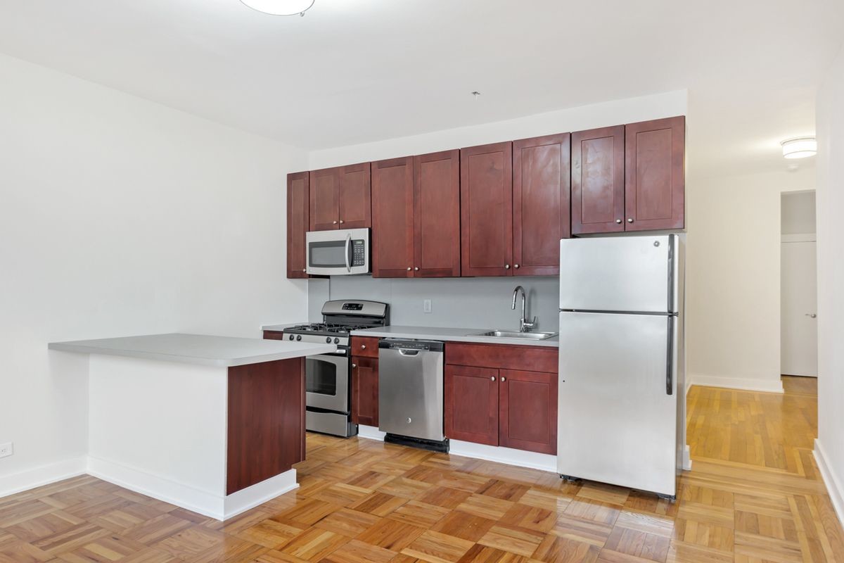
About This Property
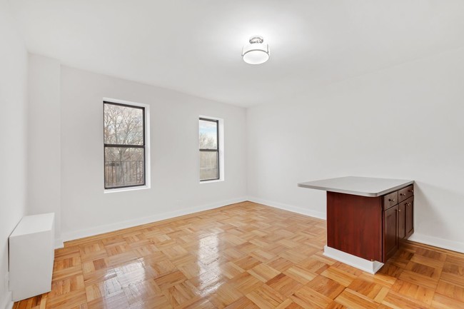
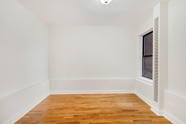
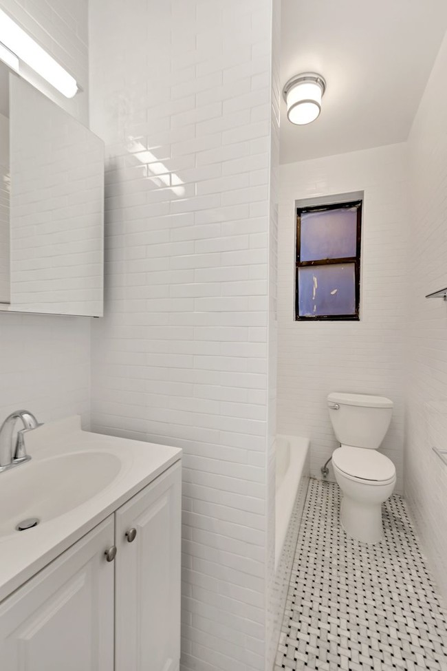
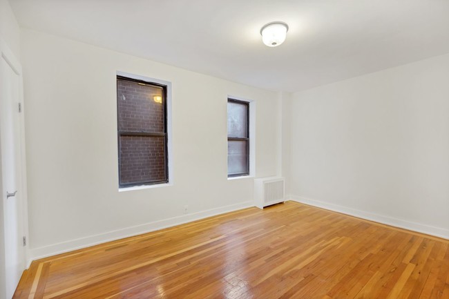
No Application Fees!!! Tree-lined Street!! Re-developed building!!! Courtyard!!!- Modern Eat-in kitchen which opens up to the living room, Hardwood floors, Long King size master bedroom with 2 closets, Full size second bedroom, great foyer space, and marble bathroom. - Within walking distance to the supermarket, laundromat, 4/B/D trains, and more. Reach me 917...743...1566!!
3265 Bainbridge Ave is a condo located in Bronx County and the 10467 ZIP Code. This area is served by the New York City Geographic District #10 attendance zone.
Location
Get Directions
Surrounded by green space and parkland, Norwood’s insular geography gives the neighborhood a small-town feel while remaining connected to the other New York City boroughs via major highways and subway lines. Norwood is nestled between Van Cortlandt Park, New York Botanical Garden, Bronx River Forest, and the Mosholu Parkway. The Williamsbridge Playground in the center of Norwood anchors the neighborhood, and many residents frequent the park on a regular basis. The green space has a playground, the park has a recreation center, skate park, running track, and sports fields. Along with multiple grocers, restaurants, delis, and stores, Norwood is home to several medical facilities including Montefiore Hospital. Similar to most New York neighborhoods, Norwood mainly has apartments and condos available for rent, but there are a few single-family houses as well.
Learn more about living in NorwoodBelow are rent ranges for similar nearby apartments
Education
| Colleges & Universities | Distance | ||
|---|---|---|---|
| Colleges & Universities | Distance | ||
| Drive: | 3 min | 1.2 mi | |
| Drive: | 5 min | 1.9 mi | |
| Drive: | 4 min | 2.0 mi | |
| Drive: | 4 min | 2.0 mi |
3265 Bainbridge Ave Unit A41 is within 3 minutes or 1.2 miles from Lehman College. It is also near Monroe College, Bronx Campus and Manhattan College.
Schools


Public Elementary, Middle & High School
Grades K-12
597 Students
Nearby
Public Elementary & Middle School
Grades K-8
699 Students
Nearby
Public Middle School
Grades 6-8
588 Students
Attendance Zone
Public High School
Grades 9-12
1,052 Students
Nearby
Public High School
Grades 9-12
444 Students
Nearby
Private Elementary & Middle School
Grades PK-8
280 Students
Nearby
Private High School
Grades 9-12
322 Students
Nearby
School data provided by
 The GreatSchools Rating helps parents compare schools within a state based on a variety of school quality indicators and provides a helpful picture of how effectively each school serves all of its students. Ratings are on a scale of 1 (below average) to 10 (above average) and can include test scores, college readiness, academic progress, advanced courses, equity, discipline and attendance data. We also advise parents to visit schools, consider other information on school performance and programs, and consider family needs as part of the school selection process.
View GreatSchools Rating Methodology
Data provided by GreatSchools.org © 2025. All rights reserved.
View GreatSchools Rating Methodology
Data provided by GreatSchools.org © 2025. All rights reserved.
Transportation options available in Bronx include 205 Street-Norwood, located 0.2 mile from 3265 Bainbridge Ave Unit A41. 3265 Bainbridge Ave Unit A41 is near LaGuardia, located 12.6 miles or 23 minutes away, and Westchester County, located 21.6 miles or 33 minutes away.
| Transit / Subway | Distance | ||
|---|---|---|---|
| Transit / Subway | Distance | ||
|
|
Walk: | 4 min | 0.2 mi |
|
|
Walk: | 9 min | 0.5 mi |
|
|
Walk: | 13 min | 0.7 mi |
|
|
Walk: | 13 min | 0.7 mi |
|
|
Walk: | 20 min | 1.0 mi |
| Commuter Rail | Distance | ||
|---|---|---|---|
| Commuter Rail | Distance | ||
|
|
Walk: | 10 min | 0.5 mi |
|
|
Walk: | 15 min | 0.8 mi |
|
|
Drive: | 3 min | 1.5 mi |
|
|
Drive: | 4 min | 2.0 mi |
|
|
Drive: | 6 min | 2.9 mi |
| Airports | Distance | ||
|---|---|---|---|
| Airports | Distance | ||
|
LaGuardia
|
Drive: | 23 min | 12.6 mi |
|
Westchester County
|
Drive: | 33 min | 21.6 mi |
Time and distance from 3265 Bainbridge Ave Unit A41.
| Shopping Centers | Distance | ||
|---|---|---|---|
| Shopping Centers | Distance | ||
| Drive: | 3 min | 1.4 mi | |
| Drive: | 3 min | 1.5 mi | |
| Drive: | 4 min | 1.6 mi |
3265 Bainbridge Ave Unit A41 has 3 shopping centers within 1.6 miles, which is about a 4-minute drive. The miles and minutes will be for the farthest away property.
| Parks and Recreation | Distance | ||
|---|---|---|---|
| Parks and Recreation | Distance | ||
|
Williamsbridge Oval
|
Walk: | 3 min | 0.2 mi |
|
St. James Park
|
Drive: | 3 min | 1.5 mi |
|
Poe Park
|
Drive: | 3 min | 1.6 mi |
|
New York Botanical Garden
|
Drive: | 8 min | 2.1 mi |
|
Bronx Park
|
Drive: | 8 min | 2.8 mi |
3265 Bainbridge Ave Unit A41 has 5 parks within 2.8 miles, including Williamsbridge Oval, Poe Park, and St. James Park.
| Hospitals | Distance | ||
|---|---|---|---|
| Hospitals | Distance | ||
| Walk: | 4 min | 0.2 mi | |
| Drive: | 6 min | 2.3 mi | |
| Drive: | 7 min | 3.4 mi |
3265 Bainbridge Ave Unit A41 has 3 hospitals within 3.4 miles, the nearest is Montefiore Medical Center which is 0.2 mile away and a 4 minute walk.
| Military Bases | Distance | ||
|---|---|---|---|
| Military Bases | Distance | ||
| Drive: | 21 min | 10.9 mi |
3265 Bainbridge Ave Unit A41 is 10.9 miles and a 21 minute drive from Fort Totten US Govt Reservation.
You May Also Like
Similar Rentals Nearby


What Are Walk Score®, Transit Score®, and Bike Score® Ratings?
Walk Score® measures the walkability of any address. Transit Score® measures access to public transit. Bike Score® measures the bikeability of any address.
What is a Sound Score Rating?
A Sound Score Rating aggregates noise caused by vehicle traffic, airplane traffic and local sources
3265 Bainbridge Ave
Bronx, NY 10467