$1,395
/ Month
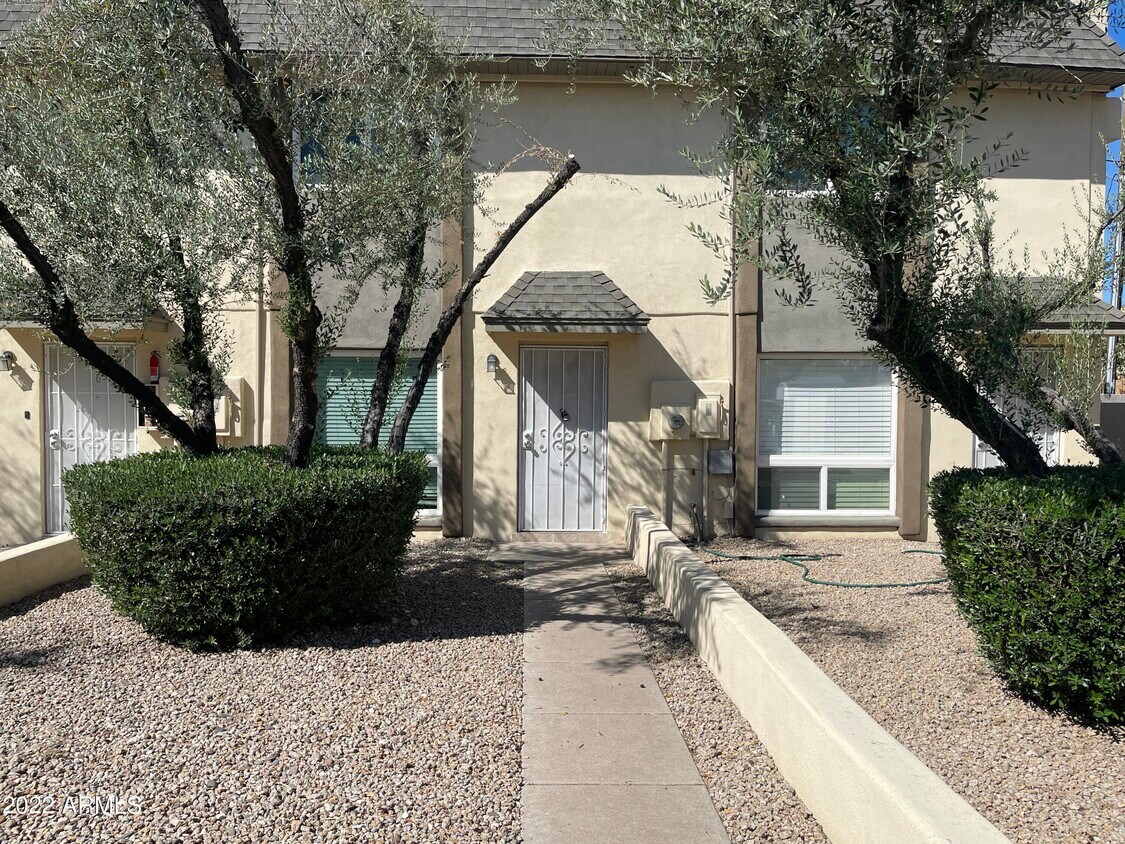
3222 E Harvard St
Phoenix, AZ 85008
2 Weeks Ago
Favorites
3222 E Harvard St

Favorites
Check Back Soon for Upcoming Availability
| Beds | Baths | Average SF |
|---|---|---|
| 2 Bedrooms 2 Bedrooms 2 Br | 1.5 Baths 1.5 Baths 1.5 Ba | — |
About This Property
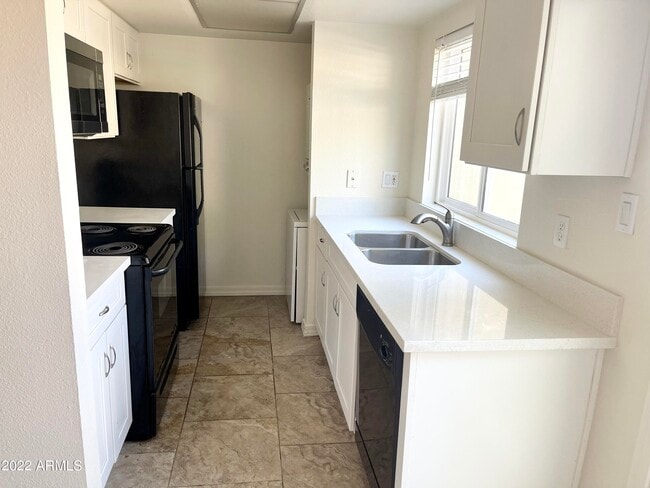
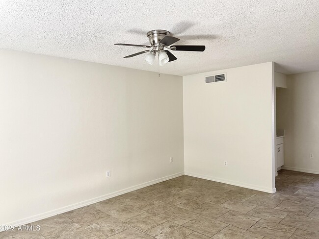
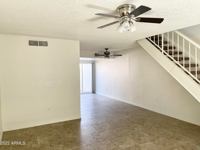
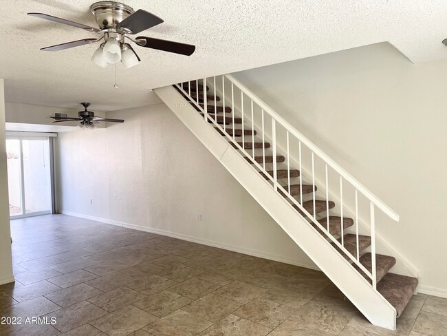
No Application Fees! 2 bedroom, 1.5 bathroom Phoenix Townhome in Harvard Heights. Great location with easy access to the 51, 202, 10 freeways, close to ASU, Sky Harbor Airport, Phoenix Zoo, Tempe Town Lake and more. This two story townhouse has tile flooring throughout with no carpeting, neutral paint throughout and ceiling fans in each room. Kitchen features dining area, direct access to back patio, quartz counter tops, electric range, stove top microwave, dishwasher and refrigerator. Both bedrooms located on the second floor with great natural light. Stacked washer and dryer included. Private backyard / patio off the dining area.
3222 E Harvard St is a townhome located in Maricopa County and the 85008 ZIP Code. This area is served by the Phoenix Union High attendance zone.
Location
Get Directions
Situated just east of the downtown area, Central Phoenix offers residents a laidback atmosphere within minutes of all kinds of metropolitan amenities. Central Phoenix is convenient to an array of area attractions, including Papago Park, Phoenix Zoo, Desert Botanical Garden, Celebrity Theatre, Pueblo Grande Museum, and bustling Downtown Phoenix.
Central Phoenix provides a bevy of rental options, such as apartments, townhomes, and houses. Quick access to multiple major highways, the light rail, and Phoenix Sky Harbor International Airport makes commuting and traveling from Central Phoenix easy.
Learn more about living in East SideBelow are rent ranges for similar nearby apartments
Education
| Colleges & Universities | Distance | ||
|---|---|---|---|
| Colleges & Universities | Distance | ||
| Drive: | 5 min | 2.8 mi | |
| Drive: | 7 min | 4.6 mi | |
| Drive: | 8 min | 4.9 mi | |
| Drive: | 11 min | 5.2 mi |
3222 E Harvard St is within 5 minutes or 2.8 miles from Gateway Community College. It is also near University of Arizona and Arizona State Univ., Downtown.
Schools


Public Elementary & Middle School
Grades PK-8
822 Students
Attendance Zone
Public High School
Grades 9-12
276 Students
Attendance Zone
Public High School
Grades 9-12
2,238 Students
Attendance Zone
Private Elementary & Middle School
Grades PK-9
Nearby
Private Middle & High School
Grades 7-12
120 Students
Nearby
School data provided by
 The GreatSchools Rating helps parents compare schools within a state based on a variety of school quality indicators and provides a helpful picture of how effectively each school serves all of its students. Ratings are on a scale of 1 (below average) to 10 (above average) and can include test scores, college readiness, academic progress, advanced courses, equity, discipline and attendance data. We also advise parents to visit schools, consider other information on school performance and programs, and consider family needs as part of the school selection process.
View GreatSchools Rating Methodology
Data provided by GreatSchools.org © 2025. All rights reserved.
View GreatSchools Rating Methodology
Data provided by GreatSchools.org © 2025. All rights reserved.
Transportation options available in Phoenix include 38Th St/Washington, located 2.6 miles from 3222 E Harvard St. 3222 E Harvard St is near Phoenix Sky Harbor International, located 5.7 miles or 11 minutes away, and Phoenix-Mesa Gateway, located 30.5 miles or 43 minutes away.
| Transit / Subway | Distance | ||
|---|---|---|---|
| Transit / Subway | Distance | ||
|
|
Drive: | 5 min | 2.6 mi |
|
|
Drive: | 5 min | 2.8 mi |
|
|
Drive: | 5 min | 2.9 mi |
|
|
Drive: | 6 min | 3.2 mi |
| Drive: | 7 min | 3.6 mi |
| Commuter Rail | Distance | ||
|---|---|---|---|
| Commuter Rail | Distance | ||
|
|
Drive: | 44 min | 31.9 mi |
| Airports | Distance | ||
|---|---|---|---|
| Airports | Distance | ||
|
Phoenix Sky Harbor International
|
Drive: | 11 min | 5.7 mi |
|
Phoenix-Mesa Gateway
|
Drive: | 43 min | 30.5 mi |
Time and distance from 3222 E Harvard St.
| Shopping Centers | Distance | ||
|---|---|---|---|
| Shopping Centers | Distance | ||
| Walk: | 2 min | 0.0 mi | |
| Walk: | 1 min | 0.1 mi | |
| Walk: | 8 min | 0.5 mi |
3222 E Harvard St has 3 shopping centers within 0.5 mile, which is about a 8-minute drive. The miles and minutes will be for the farthest away property.
| Parks and Recreation | Distance | ||
|---|---|---|---|
| Parks and Recreation | Distance | ||
|
Tonto National Forest
|
Drive: | 6 min | 3.0 mi |
|
Eastlake Park
|
Drive: | 7 min | 4.1 mi |
|
Arcadia Park
|
Drive: | 8 min | 4.2 mi |
|
Children's Museum of Phoenix
|
Drive: | 8 min | 4.8 mi |
|
Desert Storm Park
|
Drive: | 11 min | 6.1 mi |
3222 E Harvard St has 5 parks within 6.1 miles, including Tonto National Forest, Arcadia Park, and Eastlake Park.
| Hospitals | Distance | ||
|---|---|---|---|
| Hospitals | Distance | ||
| Walk: | 19 min | 1.0 mi | |
| Drive: | 4 min | 1.9 mi | |
| Drive: | 4 min | 2.2 mi |
3222 E Harvard St has 3 hospitals within 2.2 miles, the nearest is Valley Hospital which is 1.0 mile away and a 19 minute walk.
| Military Bases | Distance | ||
|---|---|---|---|
| Military Bases | Distance | ||
| Drive: | 12 min | 5.8 mi | |
| Drive: | 34 min | 25.5 mi | |
| Drive: | 102 min | 78.0 mi |
3222 E Harvard St has 3 military bases within 78.0 miles, the nearest is Phoenix Sky Harbor Airport Air Guard Station which is 5.8 miles away and a 12 minute drive.
You May Also Like
Similar Rentals Nearby


What Are Walk Score®, Transit Score®, and Bike Score® Ratings?
Walk Score® measures the walkability of any address. Transit Score® measures access to public transit. Bike Score® measures the bikeability of any address.
What is a Sound Score Rating?
A Sound Score Rating aggregates noise caused by vehicle traffic, airplane traffic and local sources

3222 E Harvard St
Phoenix, AZ 85008