
The Vitagraph
1277 E 14th St,
Brooklyn, NY 11230
$2,481 - $4,308
1-3 Beds
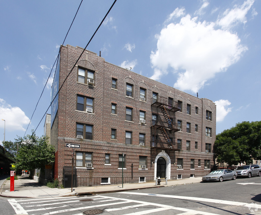
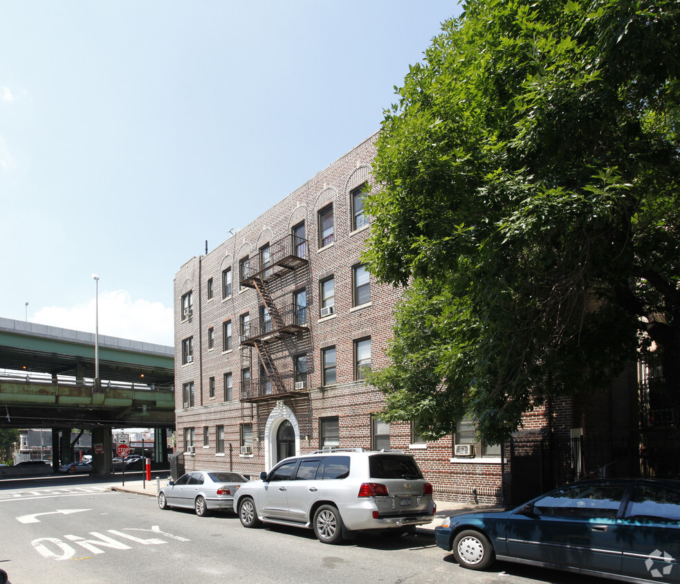
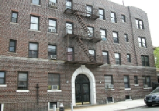
Check out 321 61st St. Located at 321 61st St. in Brooklyn, this community has much to offer its residents. 321 61st St offers a host of amenities including: high-speed internet access, convenient on-site parking options, and smoke-free options. The leasing team is ready to help you find your ideal place. It's time to come home to 321 61st St. Contact us or stop by the leasing office to see available floor plans.
321 61st St is an apartment community located in Kings County and the 11220 ZIP Code. This area is served by the New York City Geographic District #20 attendance zone.
High Speed Internet Access
Smoke Free
Heating
Kitchen
Situated on the Upper Bay of the Hudson River, Sunset Park is a vibrant neighborhood in southwestern Brooklyn. The neighborhood is home to a park of the same name, featuring 24.5 acres of space for outdoor recreation as well as stunning views of the Manhattan skyline.
Tucked between Park Slope and Bay Ridge, Sunset Park is known for its diverse restaurants, lively festivals, and numerous supermarkets. Sunset Park also contains Industry City, a complex of towering warehouses on cobblestone streets, which houses a slew of coffee shops, eateries, art galleries, and offices for hundreds of companies. Convenience to the D, N, and R subway lines places Sunset Park within minutes of all that NYC has to offer.
Learn more about living in Sunset ParkCompare neighborhood and city base rent averages by bedroom.
| Sunset Park | Brooklyn, NY | |
|---|---|---|
| Studio | $1,150 | $2,693 |
| 1 Bedroom | $1,563 | $3,044 |
| 2 Bedrooms | $1,660 | $3,977 |
| 3 Bedrooms | $1,427 | $4,922 |
| Colleges & Universities | Distance | ||
|---|---|---|---|
| Colleges & Universities | Distance | ||
| Drive: | 10 min | 4.2 mi | |
| Drive: | 13 min | 5.2 mi | |
| Drive: | 10 min | 5.2 mi | |
| Drive: | 13 min | 5.3 mi |


Transportation options available in Brooklyn include 59 Street (N,R Line), located 0.2 mile from 321 61st St. 321 61st St is near LaGuardia, located 15.5 miles or 27 minutes away, and Newark Liberty International, located 19.0 miles or 32 minutes away.
| Transit / Subway | Distance | ||
|---|---|---|---|
| Transit / Subway | Distance | ||
|
|
Walk: | 4 min | 0.2 mi |
|
|
Walk: | 9 min | 0.5 mi |
|
|
Walk: | 10 min | 0.5 mi |
|
|
Walk: | 15 min | 0.8 mi |
|
|
Walk: | 18 min | 0.9 mi |
| Commuter Rail | Distance | ||
|---|---|---|---|
| Commuter Rail | Distance | ||
|
|
Drive: | 11 min | 4.2 mi |
|
|
Drive: | 11 min | 6.4 mi |
|
|
Drive: | 14 min | 7.1 mi |
|
|
Drive: | 16 min | 7.7 mi |
|
|
Drive: | 18 min | 8.3 mi |
| Airports | Distance | ||
|---|---|---|---|
| Airports | Distance | ||
|
LaGuardia
|
Drive: | 27 min | 15.5 mi |
|
Newark Liberty International
|
Drive: | 32 min | 19.0 mi |
Scores provided by
Traffic
BusyAirport
CalmBusinesses
BusyScores provided by
HowLoud What is a Sound Score Rating? A Sound Score Rating aggregates noise caused by vehicle traffic, airplane traffic and local sources. How It WorksTime and distance from 321 61st St.
| Shopping Centers | Distance | ||
|---|---|---|---|
| Shopping Centers | Distance | ||
| Drive: | 3 min | 1.4 mi | |
| Drive: | 5 min | 2.0 mi | |
| Drive: | 4 min | 2.0 mi |
| Parks and Recreation | Distance | ||
|---|---|---|---|
| Parks and Recreation | Distance | ||
|
Owl's Head Park
|
Drive: | 4 min | 1.4 mi |
|
Sunset Park
|
Drive: | 4 min | 1.6 mi |
|
Dyker Beach Park
|
Drive: | 4 min | 2.4 mi |
|
Red Hook Park
|
Drive: | 7 min | 3.2 mi |
|
Narrows Botanical Gardens
|
Drive: | 9 min | 4.3 mi |
| Hospitals | Distance | ||
|---|---|---|---|
| Hospitals | Distance | ||
| Drive: | 5 min | 1.7 mi | |
| Drive: | 9 min | 3.6 mi | |
| Drive: | 12 min | 4.6 mi |
| Military Bases | Distance | ||
|---|---|---|---|
| Military Bases | Distance | ||
| Drive: | 7 min | 3.0 mi | |
| Drive: | 14 min | 7.3 mi | |
| Drive: | 14 min | 7.5 mi |
What Are Walk Score®, Transit Score®, and Bike Score® Ratings?
Walk Score® measures the walkability of any address. Transit Score® measures access to public transit. Bike Score® measures the bikeability of any address.
What is a Sound Score Rating?
A Sound Score Rating aggregates noise caused by vehicle traffic, airplane traffic and local sources.

321 61st St
Brooklyn, NY 11220


