
$2,500 / Month
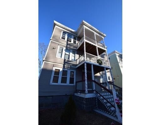
32 Whitman St Unit 2
Boston, MA 02124
2 Weeks Ago
Favorites
32 Whitman St Unit 2

Favorites
Check Back Soon for Upcoming Availability
| Beds | Baths | Average SF |
|---|---|---|
| 4 Bedrooms 4 Bedrooms 4 Br | 1 Bath 1 Bath 1 Ba | — |
Fees and Policies
The fees below are based on community-supplied data and may exclude additional fees and utilities.
Details
Utilities Included
-
Water
About This Property
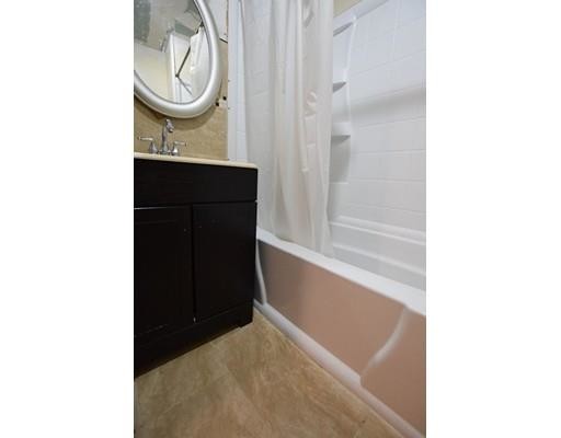
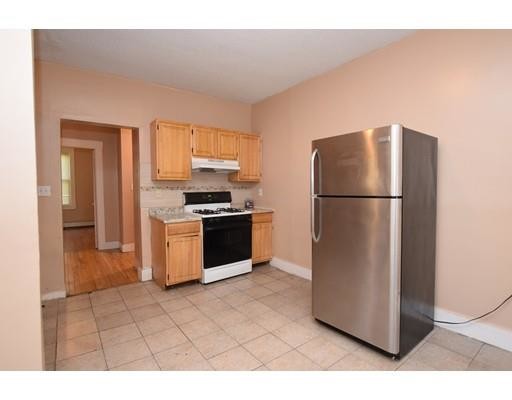
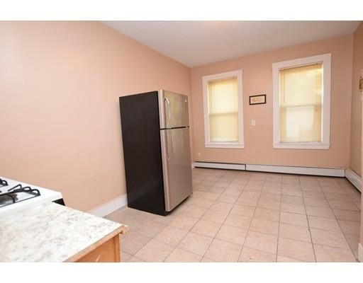
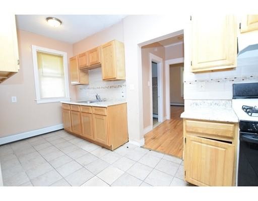
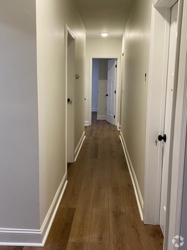
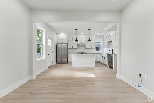
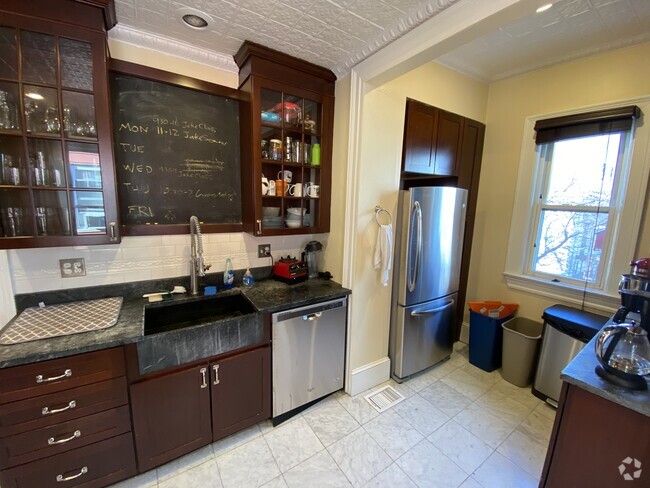
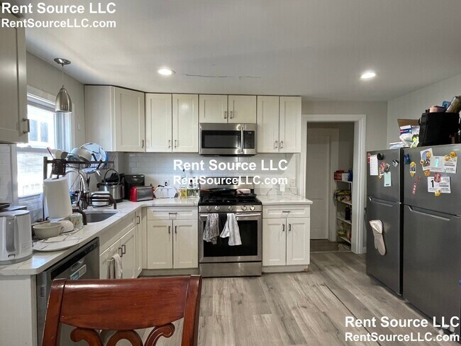
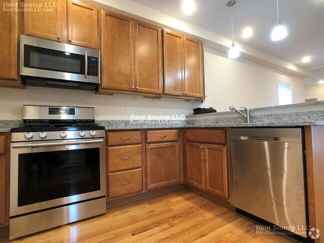
Oversized 4-BR apartment located on a cul-de-sac near several bus routes and Shawmut & Ashmont T Stations. This beautiful apartment features large rooms with new flooring, brand-new bathroom, new gas stove, and recently installed kitchen cabinets. Ample eat-in-kitchen with plenty of countertop and cabinet space. Front and rear decks. Fenced-in yard. Amazing value!
32 Whitman St is a condo located in Suffolk County and the 02124 ZIP Code. This area is served by the Boston Public Schools attendance zone.
Condo Features
- Cable Ready
- Range
- Refrigerator
- Pool
- Tennis Court
- Walking/Biking Trails
Location
Get Directions
The Codman Square-East Codman Hill neighborhood of Boston sits eight miles south of downtown. Several MBTA bus lines crisscross the area, providing residents easy access to other Boston neighborhoods. Packed with multi-family houses and apartments, the area features a commercial district at the intersection of Talbot Avenue and Washington Street.
Shop locally for groceries at Alexa Market and America's Food Basket, where you can find a wide range of international pantry staples. On those nights when you're too busy to cook, stop by China Station for spicy Kung Pao and fried rice. On weekends, head over to the historic Harambee Park to take part in recreational activities at the Sportsmen Tennis and Recreational Center. Sign up for tennis lessons, play a Friday night match, or use one of the treadmills in its fitness center.
Learn more about living in Codman Square-East Codman HillBelow are rent ranges for similar nearby apartments
Amenities
- Cable Ready
- Range
- Refrigerator
- Pool
- Tennis Court
- Walking/Biking Trails
Expenses
Utilities Included
Water
Included
Education
| Colleges & Universities | Distance | ||
|---|---|---|---|
| Colleges & Universities | Distance | ||
| Drive: | 10 min | 3.8 mi | |
| Drive: | 9 min | 4.4 mi | |
| Drive: | 9 min | 4.9 mi | |
| Drive: | 10 min | 5.0 mi |
32 Whitman St Unit 2 is within 10 minutes or 3.8 miles from UMass Boston. It is also near Wentworth Inst. of Technology and MCPHS University, Boston.
Schools


Public Elementary & Middle School
Grades PK-8
541 Students
Nearby
Charter Elementary, Middle & High School
Grades PK-12
336 Students
Nearby
Public Elementary School
Grades PK-3
187 Students
Nearby
Public Middle & High School
Grades 6-12
871 Students
Nearby
Private Elementary & Middle School
Grades PK-8
Nearby
Private Elementary School
Grades PK-5
112 Students
Nearby
Private High School
Grades 9-12
95 Students
Nearby
School data provided by
 The GreatSchools Rating helps parents compare schools within a state based on a variety of school quality indicators and provides a helpful picture of how effectively each school serves all of its students. Ratings are on a scale of 1 (below average) to 10 (above average) and can include test scores, college readiness, academic progress, advanced courses, equity, discipline and attendance data. We also advise parents to visit schools, consider other information on school performance and programs, and consider family needs as part of the school selection process.
View GreatSchools Rating Methodology
View GreatSchools Rating Methodology
Transportation options available in Boston include Shawmut, located 0.9 mile from 32 Whitman St Unit 2. 32 Whitman St Unit 2 is near General Edward Lawrence Logan International, located 9.0 miles or 18 minutes away.
| Transit / Subway | Distance | ||
|---|---|---|---|
| Transit / Subway | Distance | ||
| Walk: | 17 min | 0.9 mi | |
|
|
Drive: | 4 min | 1.7 mi |
|
|
Drive: | 4 min | 1.8 mi |
| Drive: | 4 min | 1.8 mi | |
|
|
Drive: | 4 min | 1.8 mi |
| Commuter Rail | Distance | ||
|---|---|---|---|
| Commuter Rail | Distance | ||
| Walk: | 9 min | 0.5 mi | |
|
|
Walk: | 16 min | 0.9 mi |
| Drive: | 5 min | 1.8 mi | |
| Drive: | 4 min | 2.0 mi | |
| Drive: | 6 min | 3.0 mi |
| Airports | Distance | ||
|---|---|---|---|
| Airports | Distance | ||
|
General Edward Lawrence Logan International
|
Drive: | 18 min | 9.0 mi |
Time and distance from 32 Whitman St Unit 2.
| Shopping Centers | Distance | ||
|---|---|---|---|
| Shopping Centers | Distance | ||
| Walk: | 18 min | 1.0 mi | |
| Drive: | 5 min | 1.8 mi | |
| Drive: | 5 min | 2.0 mi |
32 Whitman St Unit 2 has 3 shopping centers within 2.0 miles, which is about a 5-minute walk. The miles and minutes will be for the farthest away property.
| Parks and Recreation | Distance | ||
|---|---|---|---|
| Parks and Recreation | Distance | ||
|
Mass Audubon's Boston Nature Center and Wildlife Sanctuary
|
Drive: | 5 min | 1.6 mi |
|
Franklin Park Zoo
|
Drive: | 4 min | 1.7 mi |
|
Lower Neponset River Trail
|
Drive: | 4 min | 1.8 mi |
|
Dorchester Shores Reservation
|
Drive: | 9 min | 3.4 mi |
|
Squantum Point Park
|
Drive: | 11 min | 4.7 mi |
32 Whitman St Unit 2 has 5 parks within 4.7 miles, including Franklin Park Zoo, Mass Audubon's Boston Nature Center and Wildlife Sanctuary, and Lower Neponset River Trail.
| Hospitals | Distance | ||
|---|---|---|---|
| Hospitals | Distance | ||
| Drive: | 3 min | 1.5 mi | |
| Drive: | 7 min | 3.2 mi | |
| Drive: | 8 min | 3.9 mi |
32 Whitman St Unit 2 has 3 hospitals within 3.9 miles, the nearest is Carney Hospital which is 1.5 miles away and a 3 minute drive.
You May Also Like
Similar Rentals Nearby


What Are Walk Score®, Transit Score®, and Bike Score® Ratings?
Walk Score® measures the walkability of any address. Transit Score® measures access to public transit. Bike Score® measures the bikeability of any address.
What is a Sound Score Rating?
A Sound Score Rating aggregates noise caused by vehicle traffic, airplane traffic and local sources
32 Whitman St
Boston, MA 02124