
Bridgepointe
1987 Bridgepointe Pky,
San Mateo, CA 94404
$3,500 - $5,915 Total Monthly Price
1-3 Beds

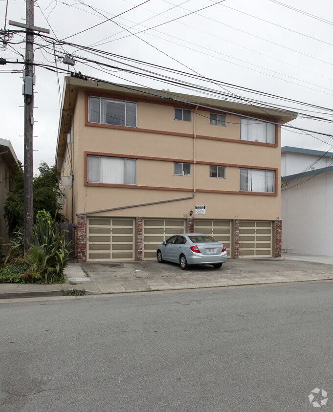
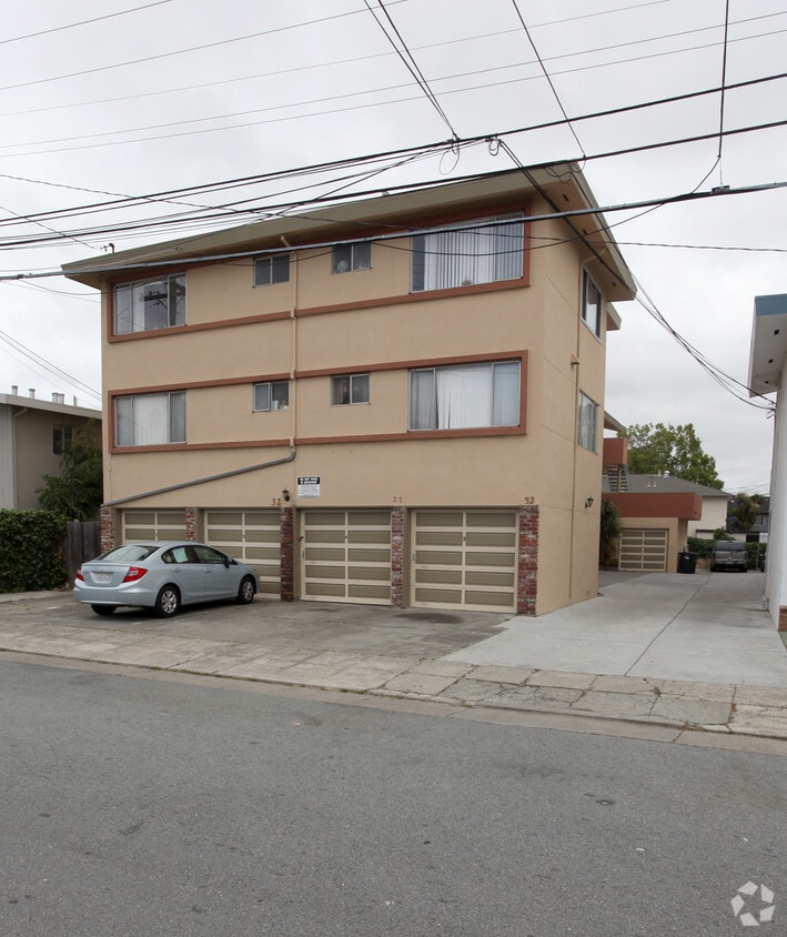
32 East Fortieth in San Mateo, CA is ready for your visit. The location in San Mateo's 94403 area has much to offer its residents. Make a visit to check out the apartment floorplan options. From pricing to features, the team of leasing professionals will be ready to help you find your perfect new place. It's time to find your next place. Contact or stop by the 32 East Fortieth leasing office to talk about leasing your next apartment.
32 East Fortieth is an apartment community located in San Mateo County and the 94403 ZIP Code. This area is served by the San Mateo-Foster City School District attendance zone.
Air Conditioning
Window Coverings
Heating
Kitchen
Hillsdale contains a perfect combination of local amenities, beautiful and sunny weather, and excellent apartment homes. Recognized for its stellar school district, residents choose this community to ensure an outstanding education for their children.
Not only are the great schools attractive, but also the excellent places to shop like Whole Foods and the Hillsdale Shopping Center Mall. Bay Meadows Park is a 12-acre green space with bountiful gardens and an outdoor bowling lane, minutes from the county event center and Hillsdale apartments.
The Hillsdale Rail Station allows for quick commutes throughout the neighborhood, and it’s only 18 miles from San Francisco.
Learn more about living in HillsdaleCompare neighborhood and city base rent averages by bedroom.
| Hillsdale | San Mateo, CA | |
|---|---|---|
| Studio | $2,442 | $2,543 |
| 1 Bedroom | $3,339 | $3,109 |
| 2 Bedrooms | $4,689 | $4,043 |
| 3 Bedrooms | $7,314 | $5,534 |
| Colleges & Universities | Distance | ||
|---|---|---|---|
| Colleges & Universities | Distance | ||
| Drive: | 7 min | 3.6 mi | |
| Drive: | 18 min | 9.9 mi | |
| Drive: | 20 min | 12.3 mi | |
| Drive: | 26 min | 15.4 mi |


Transportation options available in San Mateo include Millbrae (Caltrain Transfer Platform), located 9.0 miles from 32 East Fortieth. 32 East Fortieth is near San Francisco International, located 10.0 miles or 15 minutes away, and Metro Oakland International, located 25.7 miles or 34 minutes away.
| Transit / Subway | Distance | ||
|---|---|---|---|
| Transit / Subway | Distance | ||
|
|
Drive: | 13 min | 9.0 mi |
| Drive: | 14 min | 9.7 mi | |
| Drive: | 14 min | 9.9 mi | |
|
|
Drive: | 15 min | 10.0 mi |
|
|
Drive: | 16 min | 10.0 mi |
| Commuter Rail | Distance | ||
|---|---|---|---|
| Commuter Rail | Distance | ||
| Walk: | 20 min | 1.0 mi | |
| Drive: | 3 min | 1.2 mi | |
| Drive: | 4 min | 1.9 mi | |
| Drive: | 5 min | 2.0 mi | |
| Drive: | 5 min | 2.4 mi |
| Airports | Distance | ||
|---|---|---|---|
| Airports | Distance | ||
|
San Francisco International
|
Drive: | 15 min | 10.0 mi |
|
Metro Oakland International
|
Drive: | 34 min | 25.7 mi |
Scores provided by
Traffic
-Airport
-Businesses
-Scores provided by
HowLoud What is a Sound Score Rating? A Sound Score Rating aggregates noise caused by vehicle traffic, airplane traffic and local sources. How It WorksTime and distance from 32 East Fortieth.
| Shopping Centers | Distance | ||
|---|---|---|---|
| Shopping Centers | Distance | ||
| Walk: | 7 min | 0.4 mi | |
| Walk: | 8 min | 0.4 mi | |
| Walk: | 12 min | 0.6 mi |
| Parks and Recreation | Distance | ||
|---|---|---|---|
| Parks and Recreation | Distance | ||
|
San Mateo Arboretum
|
Drive: | 6 min | 2.9 mi |
|
Japanese Tea Garden (San Mateo)
|
Drive: | 7 min | 3.4 mi |
|
Shoreline Parks
|
Drive: | 8 min | 4.6 mi |
|
Crystal Springs Trail
|
Drive: | 12 min | 7.1 mi |
|
Pulgas Ridge Open Space Preserve
|
Drive: | 16 min | 7.6 mi |
| Hospitals | Distance | ||
|---|---|---|---|
| Hospitals | Distance | ||
| Walk: | 18 min | 0.9 mi | |
| Drive: | 12 min | 5.1 mi | |
| Drive: | 9 min | 5.2 mi |
| Military Bases | Distance | ||
|---|---|---|---|
| Military Bases | Distance | ||
| Drive: | 26 min | 17.3 mi | |
| Drive: | 45 min | 33.2 mi | |
| Drive: | 46 min | 33.4 mi |
What Are Walk Score®, Transit Score®, and Bike Score® Ratings?
Walk Score® measures the walkability of any address. Transit Score® measures access to public transit. Bike Score® measures the bikeability of any address.
What is a Sound Score Rating?
A Sound Score Rating aggregates noise caused by vehicle traffic, airplane traffic and local sources.
32 E 40th Ave
San Mateo, CA 94403


