
$1,495
/ Month
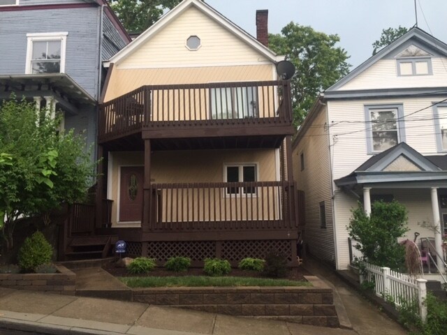
316 Stites Ave
Cincinnati, OH 45226
Favorites
316 Stites Ave

Favorites
Check Back Soon for Upcoming Availability
| Beds | Baths | Average SF |
|---|---|---|
| 1 Bedroom 1 Bedroom 1 Br | 1 Bath 1 Bath 1 Ba | 1,000 SF |
Fees and Policies
The fees listed below are community-provided and may exclude utilities or add-ons. All payments are made directly to the property and are non-refundable unless otherwise specified.
- Dogs Allowed
-
Fees not specified
- Cats Allowed
-
Fees not specified
Details
Utilities Included
-
Water
-
Trash Removal
-
Sewer
About This Property
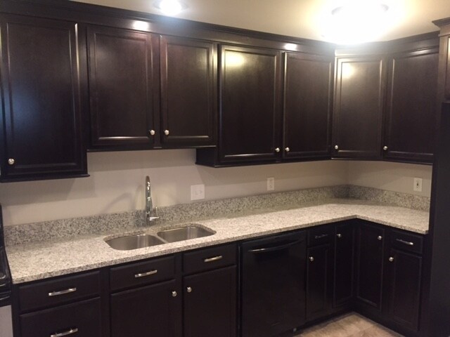
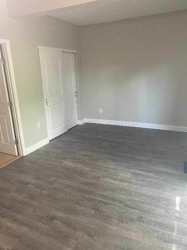
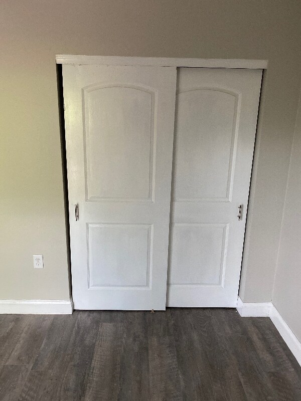
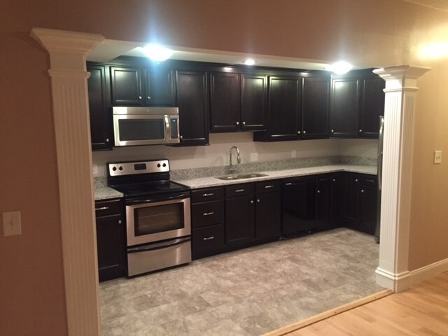
Property Id: 316488 This house is spectacular and close to Jeff Ruby's restaurant, Streetside Brewery, Starbucks, local shopping, The Pearl cafe, bike trails and parks. The huge kitchen is perfect for the gourmet chef with tons of cabinets and pantry. The unit features granite countertops, new flooring, and the basement for additional storage plus W/D as needed. Relax in the backyard with Patio for entertainment. Schedule a showing today as this will go fast
316 Stites Ave is an apartment community located in Hamilton County and the 45226 ZIP Code.
Features
Washer/Dryer
Dishwasher
Hardwood Floors
Refrigerator
- Washer/Dryer
- Cable Ready
- Fireplace
- Dishwasher
- Disposal
- Oven
- Refrigerator
- Freezer
- Hardwood Floors
- Tile Floors
- Vinyl Flooring
- Bicycle Storage
- Fenced Lot
- Lawn
316 Stites Ave,
Cincinnati,
OH
45226
Home to several historic landmarks and houses, Columbia-Tusculum is Cincinnati’s oldest neighborhood. Nicknamed the San Francisco of Cincinnati, Columbia-Tusculum is a vibrant enclave known for its multicolored Victorian houses and trendy cafes and bars. Although the neighborhood is known for its colorful historic homes, condos and apartments are also available for rent. Locals flock to independent nightlife spots like Streetside Brewery and Local Post, an old post office turned bar. Columbia-Tusculum’s liveliness is amplified but its active community council hosts multiple events throughout the year including holiday parties, bar crawls, and street festivals. For even more shopping, dining, and entertainment options, residents can easily travel into Downtown Cincinnati, which is only five miles away.
Columbia-Tusculum is located along the Ohio River, so residents have easy access to the outdoors.
Learn more about living in Columbia-TusculumBelow are rent ranges for similar nearby apartments
Amenities
- Washer/Dryer
- Cable Ready
- Fireplace
- Dishwasher
- Disposal
- Oven
- Refrigerator
- Freezer
- Hardwood Floors
- Tile Floors
- Vinyl Flooring
- Fenced Lot
- Lawn
- Bicycle Storage
Expenses
Utilities Included
Water, Trash Removal, Sewer
Included
Education
| Colleges & Universities | Distance | ||
|---|---|---|---|
| Colleges & Universities | Distance | ||
| Drive: | 12 min | 4.8 mi | |
| Drive: | 12 min | 4.9 mi | |
| Drive: | 12 min | 5.0 mi | |
| Drive: | 16 min | 7.8 mi |
316 Stites Ave is within 12 minutes or 4.8 miles from Xavier University. It is also near Univ. of Cincinnati, Medical and University of Cincinnati.
Transportation options available in Cincinnati include Richter & Phillips Station - 6Th & Main, located 5.3 miles from 316 Stites Ave. 316 Stites Ave is near Cincinnati/Northern Kentucky International, located 19.3 miles or 35 minutes away.
| Transit / Subway | Distance | ||
|---|---|---|---|
| Transit / Subway | Distance | ||
| Drive: | 10 min | 5.3 mi | |
| Drive: | 10 min | 5.4 mi | |
| Drive: | 11 min | 5.4 mi | |
| Drive: | 10 min | 5.4 mi | |
| Drive: | 11 min | 5.4 mi |
| Commuter Rail | Distance | ||
|---|---|---|---|
| Commuter Rail | Distance | ||
|
|
Drive: | 14 min | 7.3 mi |
| Airports | Distance | ||
|---|---|---|---|
| Airports | Distance | ||
|
Cincinnati/Northern Kentucky International
|
Drive: | 35 min | 19.3 mi |
Walkability Near 316 Stites Ave Cincinnati, OH 45226
Getting Around
 What do Walkability, Transit, Drivability, and Bikeability mean?
Walkability measures the walking distance to day-to-day needs.
Transit measures access to public transportation.
Drivability measures congestion, parking availability, and access to major roads.
Bikeability measures the suitability for cycling.
How It Works
What do Walkability, Transit, Drivability, and Bikeability mean?
Walkability measures the walking distance to day-to-day needs.
Transit measures access to public transportation.
Drivability measures congestion, parking availability, and access to major roads.
Bikeability measures the suitability for cycling.
How It Works
Somewhat Walkable
Walkability
30
/ 100
Limited Public Transit
Transit
30
/ 100
Very Drivable
Drivability
80
/ 100
Fairly Bikeable
Bikeability
40
/ 100
Scores provided by
-
Soundscore™
-
/ 100
Traffic
-Airport
-Businesses
-Scores provided by
HowLoud What is a Sound Score Rating? A Sound Score Rating aggregates noise caused by vehicle traffic, airplane traffic and local sources. How It WorksTime and distance from 316 Stites Ave.
| Shopping Centers | Distance | ||
|---|---|---|---|
| Shopping Centers | Distance | ||
| Walk: | 11 min | 0.6 mi | |
| Drive: | 7 min | 3.1 mi | |
| Drive: | 9 min | 3.2 mi |
316 Stites Ave has 3 shopping centers within 3.2 miles, which is about a 9-minute drive. The miles and minutes will be for the farthest away property.
| Parks and Recreation | Distance | ||
|---|---|---|---|
| Parks and Recreation | Distance | ||
|
Cincinnati Observatory
|
Drive: | 6 min | 2.5 mi |
|
Ault Park
|
Drive: | 7 min | 2.8 mi |
|
Otto Armleder Park
|
Drive: | 8 min | 2.8 mi |
|
California Woods Nature Preserve
|
Drive: | 7 min | 3.0 mi |
|
Stanbery Park
|
Drive: | 10 min | 4.3 mi |
316 Stites Ave has 5 parks within 4.3 miles, including Cincinnati Observatory, Otto Armleder Park, and Ault Park.
| Hospitals | Distance | ||
|---|---|---|---|
| Hospitals | Distance | ||
| Drive: | 11 min | 4.6 mi | |
| Drive: | 11 min | 4.8 mi | |
| Drive: | 12 min | 5.0 mi |
316 Stites Ave has 3 hospitals within 5.0 miles, the nearest is University of Cincinnati Medical Center which is 4.6 miles away and a 11 minute drive.
| Military Bases | Distance | ||
|---|---|---|---|
| Military Bases | Distance | ||
| Drive: | 76 min | 54.6 mi | |
| Drive: | 82 min | 59.7 mi | |
| Drive: | 85 min | 63.0 mi |
316 Stites Ave has 3 military bases within 63.0 miles, the nearest is Gentile Air Force Station which is 54.6 miles away and a 76 minute drive.
You May Also Like
Similar Rentals Nearby


What Are Walk Score®, Transit Score®, and Bike Score® Ratings?
Walk Score® measures the walkability of any address. Transit Score® measures access to public transit. Bike Score® measures the bikeability of any address.
What is a Sound Score Rating?
A Sound Score Rating aggregates noise caused by vehicle traffic, airplane traffic and local sources.
316 Stites Ave
Cincinnati, OH 45226