
$2,700
/ Month
315 E Okeefe St
East Palo Alto, CA 94303
2 Weeks Ago
Favorites
315 E Okeefe St

Favorites
Check Back Soon for Upcoming Availability
| Beds | Baths | Average SF |
|---|---|---|
| 2 Bedrooms 2 Bedrooms 2 Br | 1 Bath 1 Bath 1 Ba | — |
Fees and Policies
The fees below are based on community-supplied data and may exclude additional fees and utilities.
About This Property
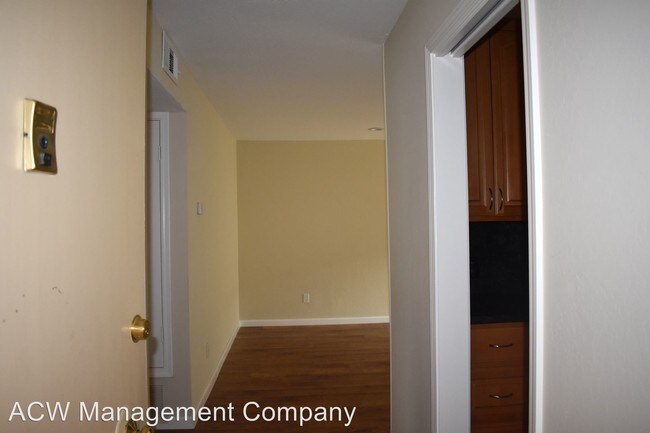
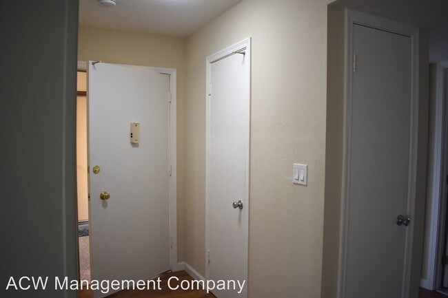
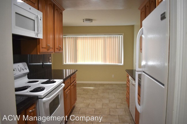
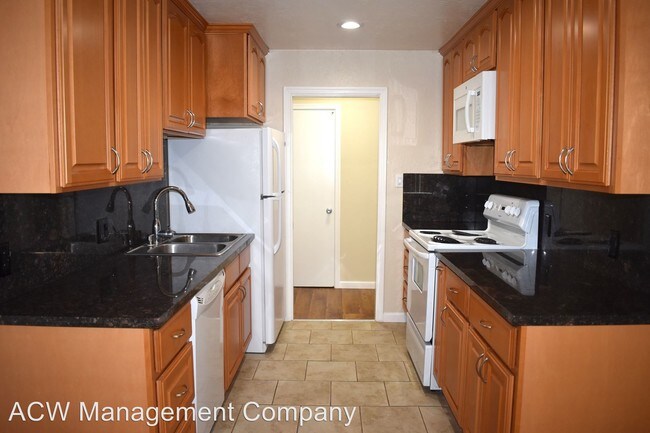
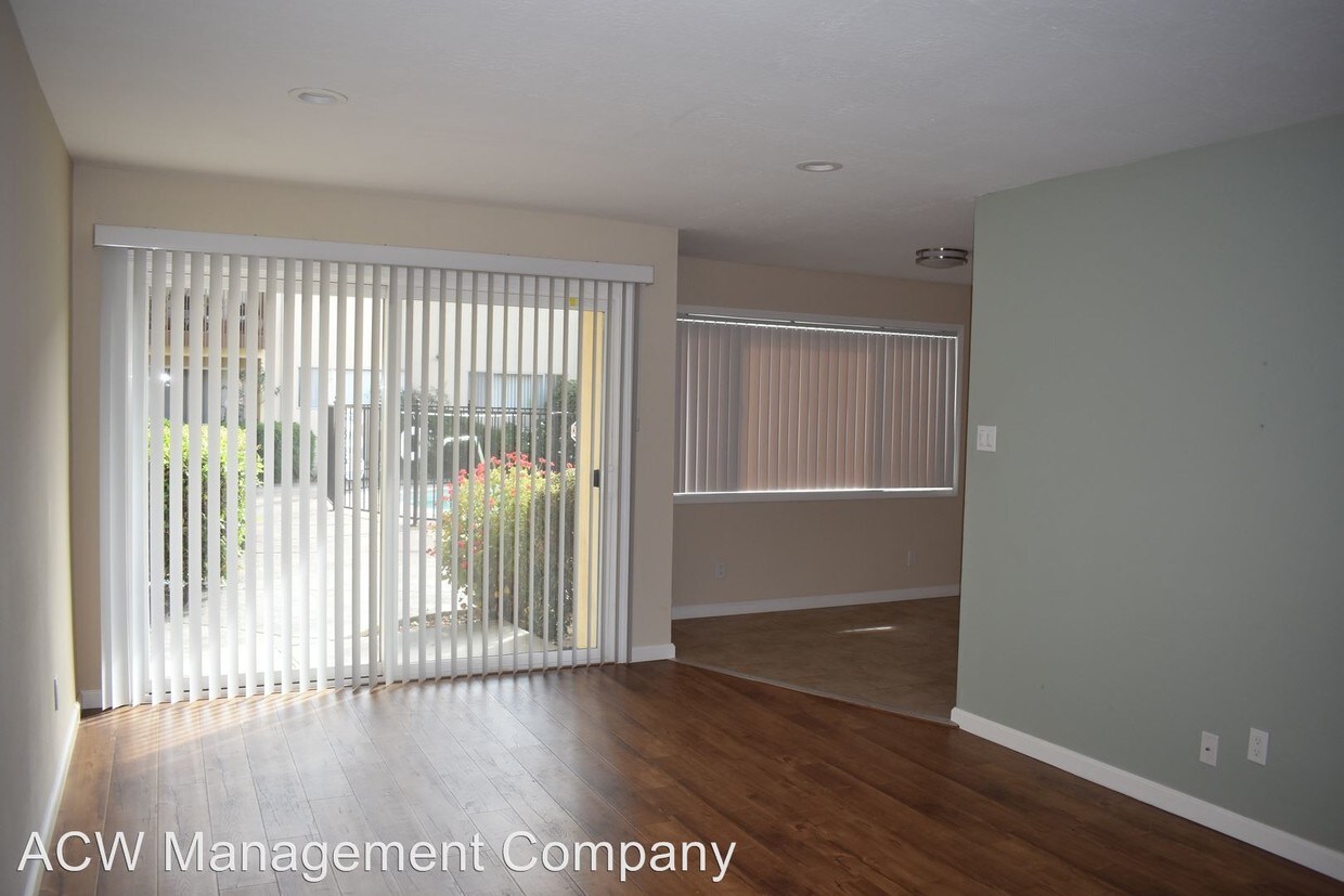
(650) 473-9983 - 2 Bedroom Apartment Available Now - 2 Bedroom Apartment Available Now Rent $2,700 Deposit $2,700 No pets allowed. One parking space included. Appliances included: Garbage and water Utilities included: Refrigerator, stove, over the range microwave, dishwasher Easy access to 101 and close to Downtown Palo Alto Application fee $25 No Pets Allowed (RLNE4383057) Pet policies: No Dogs Allowed, No Cats Allowed.
315 E Okeefe St is an apartment community located in San Mateo County and the 94303 ZIP Code.
Unique Features
- No Dogs Allowed, No Cats Allowed
Location
Get Directions
Situated on the coast of the San Francisco Bay on the San Francisco Peninsula, East Palo Alto is a bustling city on the rise with the influx of tech companies. Friendly neighbors and distant mountain views define this small coastal town.
With its central location between San Francisco and San Jose, entertainment options are endless. Explore the delicious cuisine and fantastic bars in San Jose, or visit the plentiful museums and waterfront green space in San Francisco. Stanford University is a quick commute for East Palo Alto residents, located just five miles southwest of town, so be sure to check out its beautiful campus in nearby Stanford.
East Palo Alto offers an accessible rocky shoreline overlooking the glistening San Francisco Bay, as well as sports fields, open green space, and playgrounds in its well-kept community parks.
Learn more about living in East Palo Alto
Amenities
- No Dogs Allowed, No Cats Allowed
Education
| Colleges & Universities | Distance | ||
|---|---|---|---|
| Colleges & Universities | Distance | ||
| Drive: | 11 min | 3.8 mi | |
| Drive: | 13 min | 3.9 mi | |
| Drive: | 10 min | 5.0 mi | |
| Drive: | 21 min | 9.4 mi |
315 E Okeefe St is within 13 minutes or 3.9 miles from Stanford University. It is also near Menlo College and Foothill College, Middlefield.
Transportation options available in East Palo Alto include Bayshore Nasa Station, located 7.3 miles from 315 E Okeefe St. 315 E Okeefe St is near Norman Y Mineta San Jose International, located 14.9 miles or 21 minutes away, and San Francisco International, located 19.0 miles or 26 minutes away.
| Transit / Subway | Distance | ||
|---|---|---|---|
| Transit / Subway | Distance | ||
| Drive: | 11 min | 7.3 mi | |
|
|
Drive: | 12 min | 7.4 mi |
| Drive: | 12 min | 7.7 mi | |
|
|
Drive: | 12 min | 7.7 mi |
|
|
Drive: | 13 min | 7.9 mi |
| Commuter Rail | Distance | ||
|---|---|---|---|
| Commuter Rail | Distance | ||
| Drive: | 7 min | 2.1 mi | |
| Drive: | 8 min | 2.9 mi | |
| Drive: | 9 min | 3.9 mi | |
| Drive: | 10 min | 4.3 mi | |
| Drive: | 11 min | 5.8 mi |
| Airports | Distance | ||
|---|---|---|---|
| Airports | Distance | ||
|
Norman Y Mineta San Jose International
|
Drive: | 21 min | 14.9 mi |
|
San Francisco International
|
Drive: | 26 min | 19.0 mi |
Time and distance from 315 E Okeefe St.
| Shopping Centers | Distance | ||
|---|---|---|---|
| Shopping Centers | Distance | ||
| Drive: | 6 min | 1.5 mi | |
| Drive: | 5 min | 1.8 mi | |
| Drive: | 5 min | 2.1 mi |
315 E Okeefe St has 3 shopping centers within 2.1 miles, which is about a 5-minute drive. The miles and minutes will be for the farthest away property.
| Parks and Recreation | Distance | ||
|---|---|---|---|
| Parks and Recreation | Distance | ||
|
Seminary Oaks Park
|
Drive: | 4 min | 1.3 mi |
|
Hopkins Creekside Park
|
Drive: | 5 min | 1.6 mi |
|
Rinconada Park
|
Drive: | 6 min | 1.7 mi |
|
Junior Museum and Zoo
|
Drive: | 6 min | 1.9 mi |
|
Gamble Garden
|
Drive: | 7 min | 2.2 mi |
315 E Okeefe St has 5 parks within 2.2 miles, including Seminary Oaks Park, Hopkins Creekside Park, and Rinconada Park.
| Hospitals | Distance | ||
|---|---|---|---|
| Hospitals | Distance | ||
| Drive: | 10 min | 3.0 mi | |
| Drive: | 12 min | 3.6 mi | |
| Drive: | 10 min | 5.4 mi |
315 E Okeefe St has 3 hospitals within 5.4 miles, the nearest is Lucile Salter Packard Children's Hospital at Stanford which is 3.0 miles away and a 10 minute drive.
| Military Bases | Distance | ||
|---|---|---|---|
| Military Bases | Distance | ||
| Drive: | 14 min | 7.8 mi |
315 E Okeefe St is 7.8 miles and a 14 minute drive from Ames Research Center.
You May Also Like
Similar Rentals Nearby


What Are Walk Score®, Transit Score®, and Bike Score® Ratings?
Walk Score® measures the walkability of any address. Transit Score® measures access to public transit. Bike Score® measures the bikeability of any address.
What is a Sound Score Rating?
A Sound Score Rating aggregates noise caused by vehicle traffic, airplane traffic and local sources
315 E Okeefe St
East Palo Alto, CA 94303