
$3,600
/ Month
315 Douglass St
Brooklyn, NY 11217
2 Weeks Ago
|
Edit
Favorites
315 Douglass St

Favorites
Check Back Soon for Upcoming Availability
| Beds | Baths | Average SF |
|---|---|---|
| 3 Bedrooms 3 Bedrooms 3 Br | 3 Baths 3 Baths 3 Ba | — |
About This Property
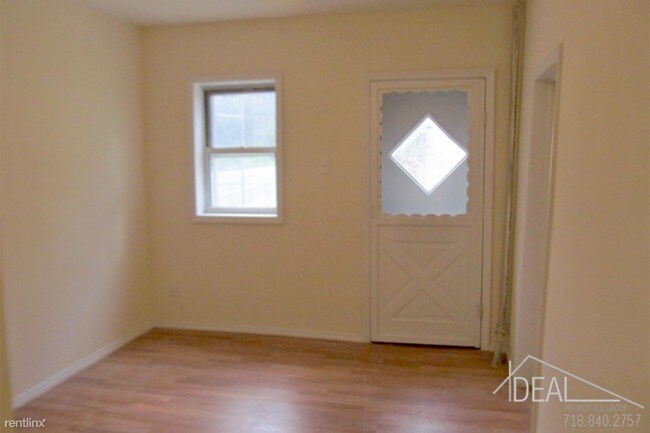
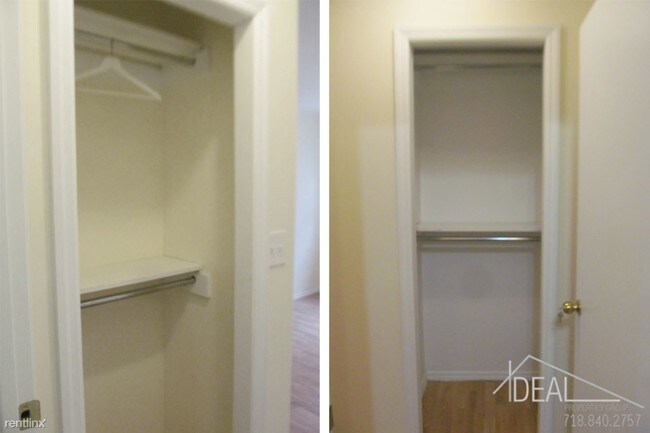
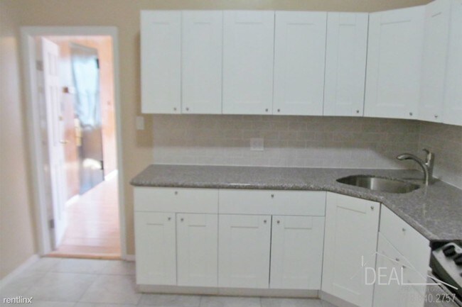
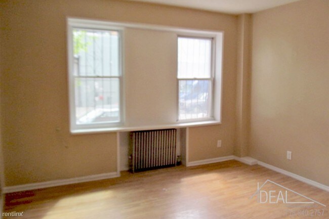
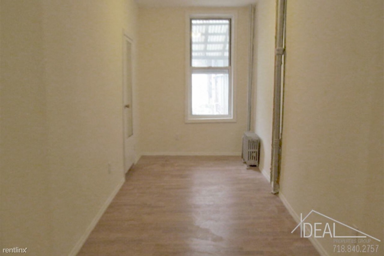
(347) 259-0280 - 3 Bedroom 3 Bathroom Apartment for Rent in Boerum Hill! This 3 bedroom apartment in Boerum Hill is a great share for students, roommates, and city commuters. This apartment is in the perfect location, in the heart of Downtown Brooklyn. Conveniently located near restaurants, shopping, schools, and nightlife entertainment. Close to the the Atlantic Center, Target, grocery store, The Barclays, and all major trains. This apartment includes a living room, kitchen, tiled bathroom, lots of closet space, wooden floors, sun light rooms, and Full size bedroom. Call today for a viewing! Pets Accepted: On approval ID: 246167 (RLNE3291973) Other Amenities - Other, Yard. Details regarding this property's Utilities - Water Included. Pet policies - Small Dogs Allowed, Cats Allowed, Other- Pets Accepted On approval, Large Dogs Allowed.
315 Douglass St is a condo located in Kings County and the 11217 ZIP Code. This area is served by the New York City Special Schools - District 75 attendance zone.
315 Douglass St,
Brooklyn,
NY
11217
Located in northwestern Brooklyn, just south of downtown, Boerum Hill offers the serenity of a suburb and the excitement of a bustling urban environment. Residents enjoy access to a host of eclectic restaurants and unique shops strewn along the main commercial thoroughfares—Smith Street and Atlantic Avenue.
In more residential parts of the neighborhood, historic brownstones and townhouses nestle up to quiet, tree-lined streets. Boerum Hill has two sister neighborhoods, Cobble Hill and Carol Gardens, which are both situated west of Boerum Hill. The iconic Barclays Center lies just east of Boerum Hill, hosting exciting events like Brooklyn Nets basketball games, boxing matches, and concerts. Convenient subway access makes getting around from Boerum Hill easy.
Learn more about living in Boerum HillBelow are rent ranges for similar nearby apartments
Education
| Colleges & Universities | Distance | ||
|---|---|---|---|
| Colleges & Universities | Distance | ||
| Drive: | 4 min | 1.2 mi | |
| Drive: | 5 min | 1.4 mi | |
| Drive: | 5 min | 1.5 mi | |
| Drive: | 6 min | 1.7 mi |
315 Douglass St is within 4 minutes or 1.2 miles from Long Island Univ., Brooklyn. It is also near ASA College Brooklyn and Brooklyn Law School.
Schools


Public Elementary & Middle School
Grades PK-8
468 Students
Nearby
Public Elementary School
Grades PK-5
570 Students
Attendance Zone
Public Middle School
Grades 6-8
522 Students
Nearby
Public High School
Grades 9-12
223 Students
Nearby
Private Elementary & Middle School
Grades PK-8
37 Students
Nearby
Private Elementary, Middle & High School
Grades PK-12
812 Students
Nearby
School data provided by
 The GreatSchools Rating helps parents compare schools within a state based on a variety of school quality indicators and provides a helpful picture of how effectively each school serves all of its students. Ratings are on a scale of 1 (below average) to 10 (above average) and can include test scores, college readiness, academic progress, advanced courses, equity, discipline and attendance data. We also advise parents to visit schools, consider other information on school performance and programs, and consider family needs as part of the school selection process.
View GreatSchools Rating Methodology
Data provided by GreatSchools.org © 2026. All rights reserved.
View GreatSchools Rating Methodology
Data provided by GreatSchools.org © 2026. All rights reserved.
Transportation options available in Brooklyn include Union Street, located 0.2 mile from 315 Douglass St. 315 Douglass St is near LaGuardia, located 10.9 miles or 22 minutes away, and Newark Liberty International, located 15.6 miles or 28 minutes away.
| Transit / Subway | Distance | ||
|---|---|---|---|
| Transit / Subway | Distance | ||
|
|
Walk: | 4 min | 0.2 mi |
|
|
Walk: | 8 min | 0.4 mi |
|
|
Walk: | 10 min | 0.5 mi |
|
|
Walk: | 11 min | 0.6 mi |
|
|
Walk: | 12 min | 0.6 mi |
| Commuter Rail | Distance | ||
|---|---|---|---|
| Commuter Rail | Distance | ||
|
|
Walk: | 11 min | 0.6 mi |
|
|
Drive: | 7 min | 2.1 mi |
|
|
Drive: | 13 min | 4.6 mi |
|
|
Drive: | 14 min | 4.7 mi |
|
|
Drive: | 20 min | 7.3 mi |
| Airports | Distance | ||
|---|---|---|---|
| Airports | Distance | ||
|
LaGuardia
|
Drive: | 22 min | 10.9 mi |
|
Newark Liberty International
|
Drive: | 28 min | 15.6 mi |
Walkability Near 315 Douglass St Brooklyn, NY 11217
Getting Around
 What do Walkability, Transit, Drivability, and Bikeability mean?
Walkability measures the walking distance to day-to-day needs.
Transit measures access to public transportation.
Drivability measures congestion, parking availability, and access to major roads.
Bikeability measures the suitability for cycling.
How It Works
What do Walkability, Transit, Drivability, and Bikeability mean?
Walkability measures the walking distance to day-to-day needs.
Transit measures access to public transportation.
Drivability measures congestion, parking availability, and access to major roads.
Bikeability measures the suitability for cycling.
How It Works
Exceptionally Walkable
Walkability
100
/ 100
Exceptional Public Transit
Transit
100
/ 100
Somewhat Drivable
Drivability
30
/ 100
Moderately Bikeable
Bikeability
70
/ 100
Scores provided by
-
Soundscore™
-
/ 100
Traffic
-Airport
-Businesses
-Scores provided by
HowLoud What is a Sound Score Rating? A Sound Score Rating aggregates noise caused by vehicle traffic, airplane traffic and local sources. How It WorksTime and distance from 315 Douglass St.
| Shopping Centers | Distance | ||
|---|---|---|---|
| Shopping Centers | Distance | ||
| Walk: | 14 min | 0.7 mi | |
| Drive: | 6 min | 1.9 mi |
315 Douglass St has 2 shopping centers within 1.9 miles, which is about a 6-minute drive. The miles and minutes will be for the farthest away property.
| Parks and Recreation | Distance | ||
|---|---|---|---|
| Parks and Recreation | Distance | ||
|
Gowanus Canal
|
Walk: | 13 min | 0.7 mi |
|
Fort Greene Park
|
Drive: | 4 min | 1.4 mi |
|
Cobble Hill Park
|
Drive: | 6 min | 1.4 mi |
|
Crispus Attucks Playground
|
Drive: | 5 min | 1.7 mi |
|
Commodore Barry Park
|
Drive: | 6 min | 1.7 mi |
315 Douglass St has 5 parks within 1.7 miles, including Gowanus Canal, Cobble Hill Park, and Fort Greene Park.
| Hospitals | Distance | ||
|---|---|---|---|
| Hospitals | Distance | ||
| Drive: | 4 min | 1.2 mi | |
| Drive: | 5 min | 1.5 mi | |
| Drive: | 10 min | 2.8 mi |
315 Douglass St has 3 hospitals within 2.8 miles, the nearest is Brooklyn Hospital Center - Downtown Campus which is 1.2 miles away and a 4 minute drive.
| Military Bases | Distance | ||
|---|---|---|---|
| Military Bases | Distance | ||
| Drive: | 12 min | 5.4 mi | |
| Drive: | 13 min | 6.4 mi |
315 Douglass St is 5.4 miles from Governors Island Support Center, and is convenient to other military bases, including Fort Hamilton.
You May Also Like
Similar Rentals Nearby


What Are Walk Score®, Transit Score®, and Bike Score® Ratings?
Walk Score® measures the walkability of any address. Transit Score® measures access to public transit. Bike Score® measures the bikeability of any address.
What is a Sound Score Rating?
A Sound Score Rating aggregates noise caused by vehicle traffic, airplane traffic and local sources.
315 Douglass St
Brooklyn, NY 11217