
Citrus Commons
14150 Riverside Dr,
Sherman Oaks, CA 91423
Studio - 2 Beds $2,945 - $6,995
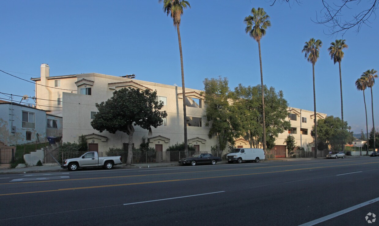
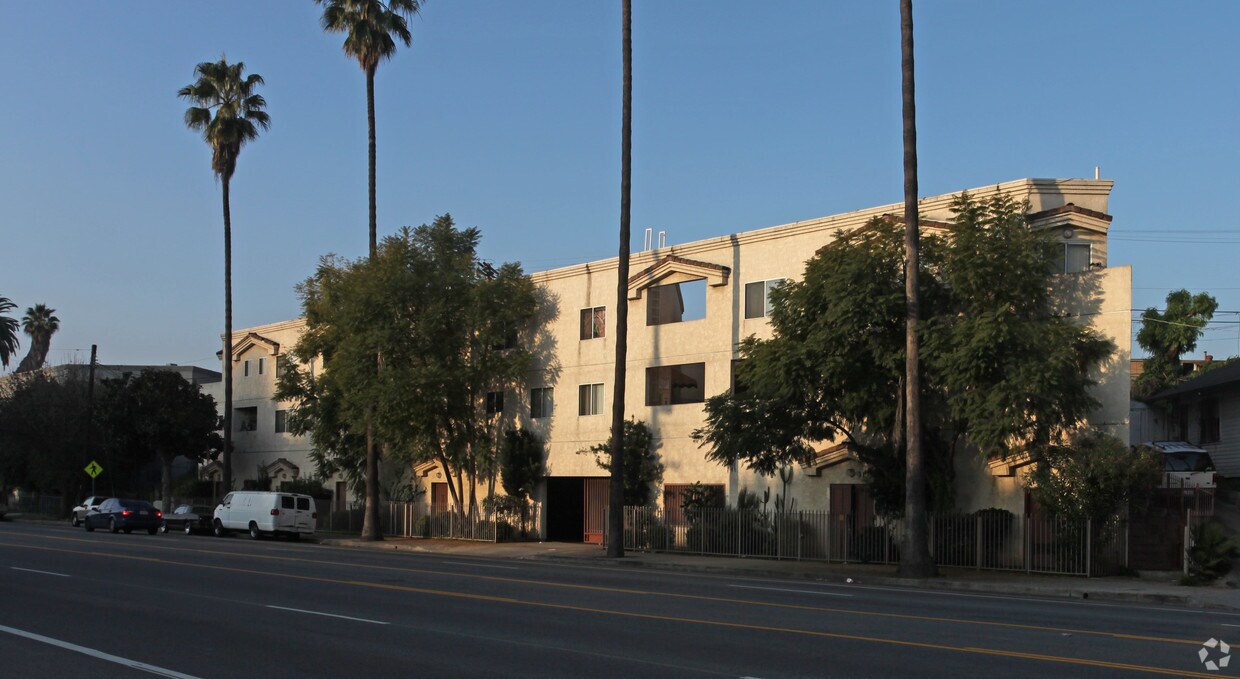

Discover your next home at 3121-3131 Eagle Rock Blvd in Los Angeles, CA. In Los Angeles's 90065 Zip code, living at this community gives you a variety of nearby highlights. The professional leasing staff is excited to help you find your perfect floorplan. Make a visit to see the current floorplan options. Your new home awaits you at 3121-3131 Eagle Rock Blvd. Stop by the leasing office to schedule a tour.
3121-3131 Eagle Rock Blvd is an apartment community located in Los Angeles County and the 90065 ZIP Code. This area is served by the Los Angeles Unified attendance zone.
A large sector of the city, Northeast Los Angeles encompasses neighborhoods like Echo Park and Highland Park. This expansive LA area offers rentals for every type of renter and every budget. Abundant apartments, houses, condos, and townhomes can be found in Northeast Los Angeles, ranging from affordable to upscale. Residents of this area can enjoy the great outdoors at locales like Ernest E. Debs Regional Park, Hermon Park, Rio De Los Angeles State Park, and Elysian Park. Although Northeast LA offers an escape from big-city living, residents can easily travel into downtown for work or leisure. Amenities and attractions like Dodger Stadium, Los Angeles State Historic Park, and Chinatown are all within reach of this sprawling district.
Learn more about living in Northeast Los Angeles| Colleges & Universities | Distance | ||
|---|---|---|---|
| Colleges & Universities | Distance | ||
| Drive: | 5 min | 2.4 mi | |
| Drive: | 8 min | 4.2 mi | |
| Drive: | 8 min | 4.8 mi | |
| Drive: | 10 min | 5.2 mi |


Transportation options available in Los Angeles include Lincoln Heights/Cypress Park Station, located 2.3 miles from 3121-3131 Eagle Rock Blvd. 3121-3131 Eagle Rock Blvd is near Bob Hope, located 13.8 miles or 19 minutes away, and Los Angeles International, located 19.5 miles or 31 minutes away.
| Transit / Subway | Distance | ||
|---|---|---|---|
| Transit / Subway | Distance | ||
|
|
Drive: | 4 min | 2.3 mi |
|
|
Drive: | 6 min | 3.2 mi |
|
|
Drive: | 6 min | 3.4 mi |
|
|
Drive: | 6 min | 3.9 mi |
|
|
Drive: | 8 min | 3.9 mi |
| Commuter Rail | Distance | ||
|---|---|---|---|
| Commuter Rail | Distance | ||
|
|
Drive: | 4 min | 2.2 mi |
|
|
Drive: | 8 min | 4.4 mi |
|
|
Drive: | 10 min | 4.5 mi |
|
|
Drive: | 12 min | 8.3 mi |
| Drive: | 12 min | 8.5 mi |
| Airports | Distance | ||
|---|---|---|---|
| Airports | Distance | ||
|
Bob Hope
|
Drive: | 19 min | 13.8 mi |
|
Los Angeles International
|
Drive: | 31 min | 19.5 mi |
Time and distance from 3121-3131 Eagle Rock Blvd.
| Shopping Centers | Distance | ||
|---|---|---|---|
| Shopping Centers | Distance | ||
| Walk: | 5 min | 0.3 mi | |
| Drive: | 2 min | 1.2 mi | |
| Drive: | 3 min | 1.4 mi |
| Parks and Recreation | Distance | ||
|---|---|---|---|
| Parks and Recreation | Distance | ||
|
Elyria Canyon Park
|
Drive: | 3 min | 1.3 mi |
|
Marsh Park
|
Drive: | 6 min | 2.4 mi |
|
Chavez Ravine Arboretum
|
Drive: | 5 min | 3.5 mi |
|
Audubon Center at Debs Park
|
Drive: | 7 min | 3.9 mi |
|
Elysian Park
|
Drive: | 9 min | 4.3 mi |
| Hospitals | Distance | ||
|---|---|---|---|
| Hospitals | Distance | ||
| Drive: | 4 min | 2.3 mi | |
| Drive: | 7 min | 3.7 mi | |
| Drive: | 6 min | 3.8 mi |
| Military Bases | Distance | ||
|---|---|---|---|
| Military Bases | Distance | ||
| Drive: | 28 min | 21.1 mi |
What Are Walk Score®, Transit Score®, and Bike Score® Ratings?
Walk Score® measures the walkability of any address. Transit Score® measures access to public transit. Bike Score® measures the bikeability of any address.
What is a Sound Score Rating?
A Sound Score Rating aggregates noise caused by vehicle traffic, airplane traffic and local sources


 - Violet on Virgil")


 - AVA Burbank")
