
Fayette Arms Apartments
2680 Fayette Dr,
Mountain View, CA 94040
$3,438
1-2 Beds

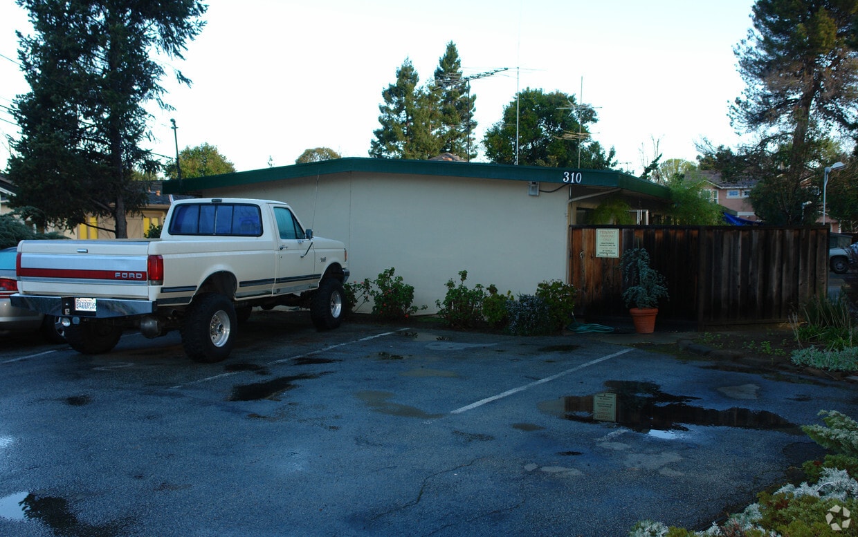

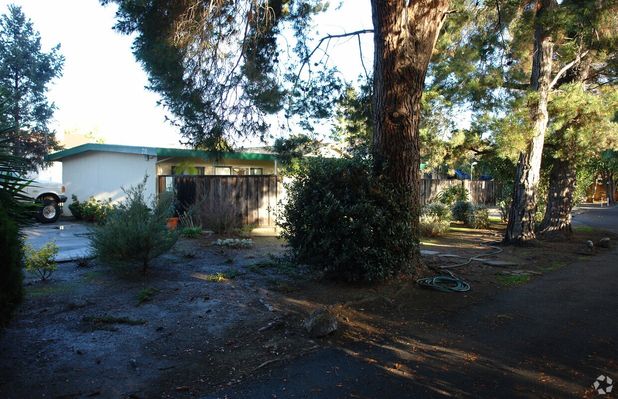
Discover your new apartment at 310 Gladys Avenue in Mountain View, CA. This community is located in Mountain View on Gladys Ave in the 94043 area. Schedule a time to view the available floorplans. You'll experience a wide selection of features and amenities at this community like convenient on-site parking options, rentable storage units, and smoke free options. Stop by to talk about your next apartment.
310 Gladys Avenue is an apartment community located in Santa Clara County and the 94043 ZIP Code. This area is served by the Mountain View Whisman School District attendance zone.
Air Conditioning
High Speed Internet Access
Smoke Free
Heating
Known for its fantastic views of the Santa Cruz Mountains, the Wagon Wheel neighborhood of Mountain View, California lies 12 miles southeast of Palo Alto via US-101S. Residents of Wagon Wheel's apartments and home rentals enjoy convenient transportation via light rail, bus, and private shuttle. Featuring an online chat group, this community values resident participation in planning activities such as ice cream socials, community breakfasts, and pumpkin festivals at the local park.
Two parks serve this neighborhood where residents can picnic, relax in an arbor, or join a pick-up baseball game. Whisman Park provides access to the Stevens Creek Trail, with its paved paths for walking, biking, or jogging through scenic natural areas.
Learn more about living in Wagon WheelCompare neighborhood and city base rent averages by bedroom.
| Wagon Wheel | Mountain View, CA | |
|---|---|---|
| Studio | $2,043 | $2,942 |
| 1 Bedroom | $2,754 | $3,445 |
| 2 Bedrooms | $3,517 | $4,408 |
| 3 Bedrooms | $4,077 | $5,269 |
| Colleges & Universities | Distance | ||
|---|---|---|---|
| Colleges & Universities | Distance | ||
| Drive: | 8 min | 3.8 mi | |
| Drive: | 13 min | 5.2 mi | |
| Drive: | 10 min | 6.3 mi | |
| Drive: | 17 min | 7.4 mi |


Transportation options available in Mountain View include Whisman Station, located 0.4 mile from 310 Gladys Avenue. 310 Gladys Avenue is near Norman Y Mineta San Jose International, located 8.8 miles or 13 minutes away, and San Francisco International, located 25.7 miles or 33 minutes away.
| Transit / Subway | Distance | ||
|---|---|---|---|
| Transit / Subway | Distance | ||
|
|
Walk: | 7 min | 0.4 mi |
|
|
Walk: | 13 min | 0.7 mi |
| Drive: | 3 min | 1.3 mi | |
| Drive: | 2 min | 1.4 mi | |
| Drive: | 4 min | 2.2 mi |
| Commuter Rail | Distance | ||
|---|---|---|---|
| Commuter Rail | Distance | ||
| Drive: | 4 min | 1.7 mi | |
| Drive: | 6 min | 2.8 mi | |
| Drive: | 7 min | 3.7 mi | |
| Drive: | 9 min | 4.8 mi | |
| Drive: | 12 min | 6.2 mi |
| Airports | Distance | ||
|---|---|---|---|
| Airports | Distance | ||
|
Norman Y Mineta San Jose International
|
Drive: | 13 min | 8.8 mi |
|
San Francisco International
|
Drive: | 33 min | 25.7 mi |
Scores provided by
Traffic
-Airport
-Businesses
-Scores provided by
HowLoud What is a Sound Score Rating? A Sound Score Rating aggregates noise caused by vehicle traffic, airplane traffic and local sources. How It WorksTime and distance from 310 Gladys Avenue.
| Shopping Centers | Distance | ||
|---|---|---|---|
| Shopping Centers | Distance | ||
| Drive: | 3 min | 1.6 mi |
| Parks and Recreation | Distance | ||
|---|---|---|---|
| Parks and Recreation | Distance | ||
|
Stevens Creek Shoreline Nature Study Area
|
Drive: | 9 min | 3.5 mi |
|
J. Pearce Mitchell Park
|
Drive: | 10 min | 4.5 mi |
|
Redwood Grove
|
Drive: | 12 min | 4.7 mi |
|
Sunnyvale Baylands Park
|
Drive: | 10 min | 4.8 mi |
|
Terman Park
|
Drive: | 11 min | 5.1 mi |
| Hospitals | Distance | ||
|---|---|---|---|
| Hospitals | Distance | ||
| Drive: | 4 min | 2.2 mi | |
| Drive: | 12 min | 7.3 mi | |
| Drive: | 13 min | 7.4 mi |
| Military Bases | Distance | ||
|---|---|---|---|
| Military Bases | Distance | ||
| Drive: | 7 min | 2.7 mi | |
| Drive: | 57 min | 41.8 mi | |
| Drive: | 58 min | 42.0 mi |
Fitness Center Pool In Unit Washer & Dryer High-Speed Internet Stainless Steel Appliances Package Service
What Are Walk Score®, Transit Score®, and Bike Score® Ratings?
Walk Score® measures the walkability of any address. Transit Score® measures access to public transit. Bike Score® measures the bikeability of any address.
What is a Sound Score Rating?
A Sound Score Rating aggregates noise caused by vehicle traffic, airplane traffic and local sources.
310 Gladys Ave
Mountain View, CA 94043


