$2,900
/ Month
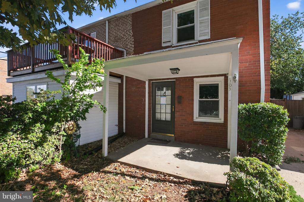
303 S Wayne St
Arlington, VA 22204
Today
Favorites
703-455-1346
-
Bedrooms
2
-
Bathrooms
1
-
Square Feet
--
-
Available
Available Oct 26
Highlights
- Contemporary Architecture
- Traditional Floor Plan
- Wood Flooring
- Living Room
- Landscaped
- Forced Air Heating and Cooling System
303 S Wayne St

Favorites
About This Home
Available Oct 26
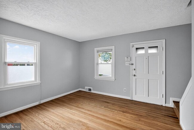
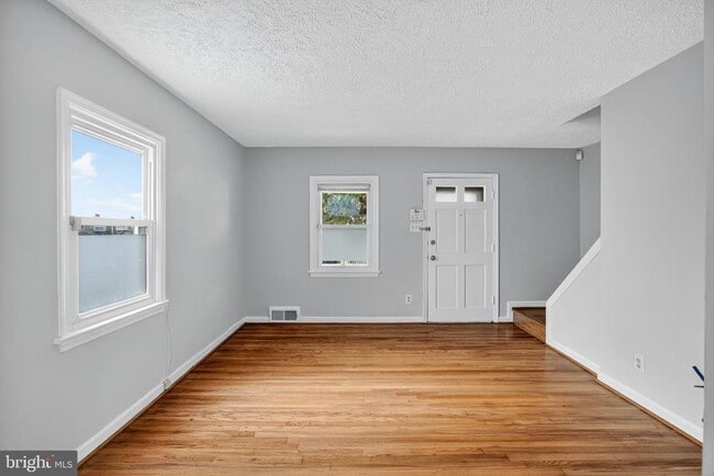
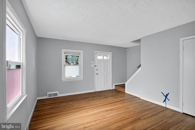
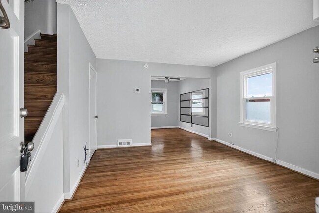
Newly Renovated Kitchen, Bathroom, New Hard Wood Floors, New Paint throughout. 2 Bedroom, 1 Bath. Generous sized bedrooms and lots of storage. Full sized Washer and Dryer. Fenced in back yard. Off street Parking, 2 spots! Pets, case by case. Walk to Joint Base Myer-Henderson Hall., minutes to Pentagon and major commuter routes. Landlord is exempt from accepting any source of funds pursuant to Virginia Code Section 36-96.2(I), and therefore does not accept housing vouchers at this property.
303 S Wayne St is a townhome located in Arlington County and the 22204 ZIP Code. This area is served by the Arlington County Public Schools attendance zone.
* Price shown is base rent. Excludes user-selected optional fees and variable or usage-based fees and required charges due at or prior to move-in or at move-out. Price, availability, fees, and any applicable rent special are subject to change without notice.
* Square footage definitions vary. Displayed square footage is approximate.
Home Details
Home Type
End Unit Townhome
Year Built
Built in 1940 | Remodeled in 2025
Bedrooms and Bathrooms
1 Full Bathroom
2 Bedrooms
Home Design
Contemporary Architecture
Architectural Shingle Roof
Brick Exterior Construction
Slab Foundation
Entry on the 1st floor
Interior Spaces
Traditional Floor Plan
Wood Flooring
Living Room
Dining Room
Ceiling Fan
1,374 Sq Ft Home
Property has 3 Levels
Vinyl Clad Windows
Insulated Windows
Kitchen
Gas Oven or Range
Dishwasher
Range Hood
Disposal
Laundry
Dryer
Washer
Listing and Financial Details
Security Deposit $2,900
12-Month Min and 36-Month Max Lease Term
Available 10/23/25
$50 Application Fee
Assessor Parcel Number 24-030-028
Tenant pays for all utilities, fireplace/flue cleaning, frozen waterpipe damage, gutter cleaning, lawn/tree/shrub care, light bulbs/filters/fuses/alarm care
Rent includes parking
No Smoking Allowed
Residential Lease
Lot Details
2,750 Sq Ft Lot
Landscaped
Property is in very good condition
Back Yard Fenced and Front Yard
Northwest Facing Home
Infill Lot
Board Fence
Parking
On-Street Parking
1 Off-Street Space
1 Parking Space
Schools
Henry Elementary School
Jefferson Middle School
Washington Lee High School
Utilities
Forced Air Heating and Cooling System
Natural Gas Water Heater
120/240V
Vented Exhaust Fan
Community Details
Overview
No Home Owners Association
Property Manager
Fort Craig Subdivision
Pet Policy
Pets allowed on a case-by-case basis
Pet Deposit $400
Contact
- Listed by Danny J Moore | Mid Atlantic Property Management
- Phone Number
- Contact
-
Source
 Bright MLS, Inc.
Copyright © 2025 Bright MLS, Inc.
Location
Get Directions
Amenities
- Dishwasher
The Penrose neighborhood in the Arlington County area has a historic reputation with a community-first environment. This neighborhood has been listed on the National Register of Historic Places and features beautiful landmarks, architecture, and more. Penrose provides a main line of amenities for residents near Columbia Pike, beautiful parks, and different entertainment options that add to the appeal of the area. Real estate in Penrose consists of an array of housing types that include single-family homes, condominiums, apartment buildings, and townhouses. Penrose has a diverse community, an excellent school system, and a family-friendly culture that residents find valuable.
Penrose sits about three miles southwest of Washington DC, with Columbia Pike to the south and Arlington Boulevard to the north.
Learn more about living in Penrose
Education
| Colleges & Universities | Distance | ||
|---|---|---|---|
| Colleges & Universities | Distance | ||
| Drive: | 5 min | 2.0 mi | |
| Drive: | 8 min | 3.5 mi | |
| Drive: | 9 min | 3.9 mi | |
| Drive: | 7 min | 4.1 mi |
303 S Wayne St is within 5 minutes or 2.0 miles from George Mason Univ., Arlington. It is also near NOVA, Alexandria Campus and Georgetown University.
Schools


Public Elementary School
Grades PK-5
614 Students
Attendance Zone
Public Middle School
Grades 6-8
1,053 Students
Attendance Zone
Public High School
Grades 9-12
2,766 Students
Attendance Zone
Private Elementary & Middle School
Grades PK-8
398 Students
Nearby
Private Elementary, Middle & High School
Grades PK-12
Nearby
School data provided by
 The GreatSchools Rating helps parents compare schools within a state based on a variety of school quality indicators and provides a helpful picture of how effectively each school serves all of its students. Ratings are on a scale of 1 (below average) to 10 (above average) and can include test scores, college readiness, academic progress, advanced courses, equity, discipline and attendance data. We also advise parents to visit schools, consider other information on school performance and programs, and consider family needs as part of the school selection process.
View GreatSchools Rating Methodology
Data provided by GreatSchools.org © 2025. All rights reserved.
View GreatSchools Rating Methodology
Data provided by GreatSchools.org © 2025. All rights reserved.
Transportation options available in Arlington include Clarendon, located 1.6 miles from 303 S Wayne St. 303 S Wayne St is near Ronald Reagan Washington Ntl, located 4.0 miles or 10 minutes away, and Washington Dulles International, located 24.0 miles or 41 minutes away.
| Transit / Subway | Distance | ||
|---|---|---|---|
| Transit / Subway | Distance | ||
|
|
Drive: | 4 min | 1.6 mi |
| Drive: | 4 min | 1.7 mi | |
|
|
Drive: | 4 min | 1.9 mi |
|
|
Drive: | 5 min | 2.0 mi |
|
|
Drive: | 6 min | 3.1 mi |
| Commuter Rail | Distance | ||
|---|---|---|---|
| Commuter Rail | Distance | ||
|
|
Drive: | 6 min | 2.6 mi |
|
|
Drive: | 9 min | 4.5 mi |
|
|
Drive: | 9 min | 4.5 mi |
|
|
Drive: | 14 min | 5.4 mi |
|
|
Drive: | 12 min | 6.3 mi |
| Airports | Distance | ||
|---|---|---|---|
| Airports | Distance | ||
|
Ronald Reagan Washington Ntl
|
Drive: | 10 min | 4.0 mi |
|
Washington Dulles International
|
Drive: | 41 min | 24.0 mi |
Time and distance from 303 S Wayne St.
| Shopping Centers | Distance | ||
|---|---|---|---|
| Shopping Centers | Distance | ||
| Walk: | 11 min | 0.6 mi | |
| Walk: | 13 min | 0.7 mi | |
| Walk: | 13 min | 0.7 mi |
303 S Wayne St has 3 shopping centers within 0.7 mile, which is about a 13-minute walk. The miles and minutes will be for the farthest away property.
| Parks and Recreation | Distance | ||
|---|---|---|---|
| Parks and Recreation | Distance | ||
|
Douglas Park
|
Drive: | 5 min | 2.0 mi |
|
Lubber Run Park
|
Drive: | 5 min | 2.3 mi |
|
Shirlington Park
|
Drive: | 6 min | 2.5 mi |
|
David M. Brown Planetarium
|
Drive: | 6 min | 2.5 mi |
|
Cherry Valley Park
|
Drive: | 6 min | 2.7 mi |
303 S Wayne St has 5 parks within 2.7 miles, including Douglas Park, Lubber Run Park, and David M. Brown Planetarium.
| Hospitals | Distance | ||
|---|---|---|---|
| Hospitals | Distance | ||
| Drive: | 8 min | 3.1 mi | |
| Drive: | 8 min | 3.4 mi | |
| Drive: | 10 min | 4.0 mi |
303 S Wayne St has 3 hospitals within 4.0 miles, the nearest is Capital Hospice which is 3.1 miles away and a 8 minute drive.
| Military Bases | Distance | ||
|---|---|---|---|
| Military Bases | Distance | ||
| Walk: | 15 min | 0.8 mi |
303 S Wayne St is 0.8 mile and a 15 minute walk from Fort Myer.
You May Also Like
Similar Rentals Nearby


What Are Walk Score®, Transit Score®, and Bike Score® Ratings?
Walk Score® measures the walkability of any address. Transit Score® measures access to public transit. Bike Score® measures the bikeability of any address.
What is a Sound Score Rating?
A Sound Score Rating aggregates noise caused by vehicle traffic, airplane traffic and local sources

303 S Wayne St
Arlington, VA 22204