Beacon
3510 Beacon Ave,
Fremont, CA 94538
$2,600 - $3,550
Studio - 2 Beds
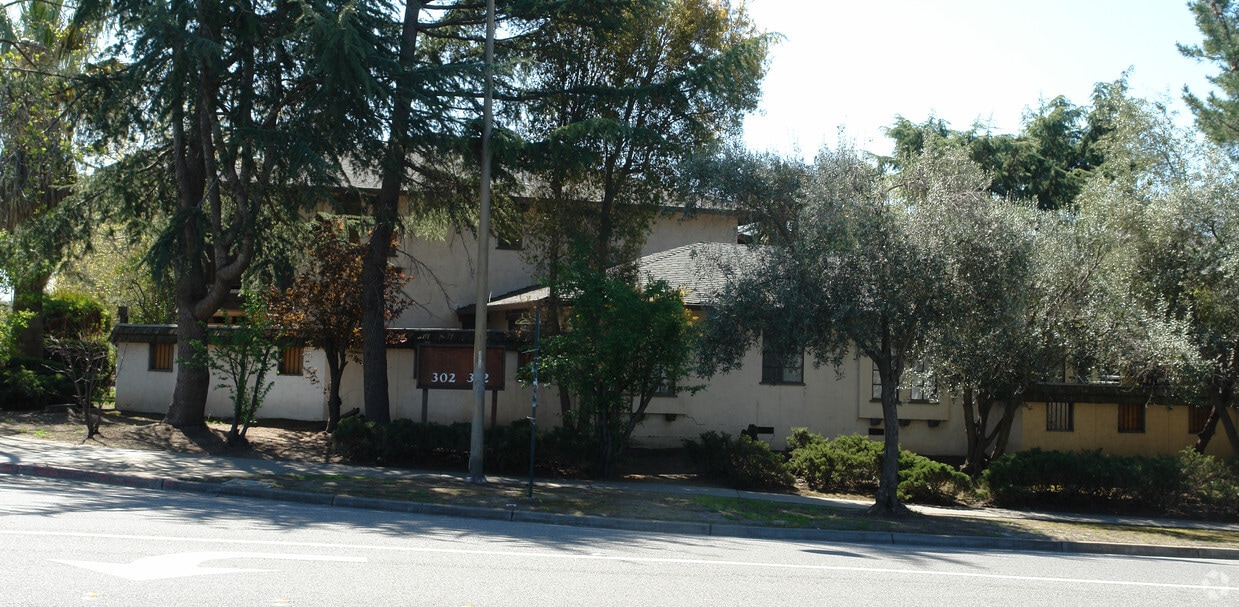
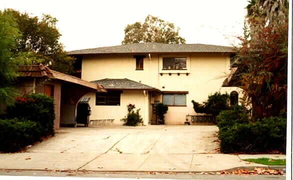
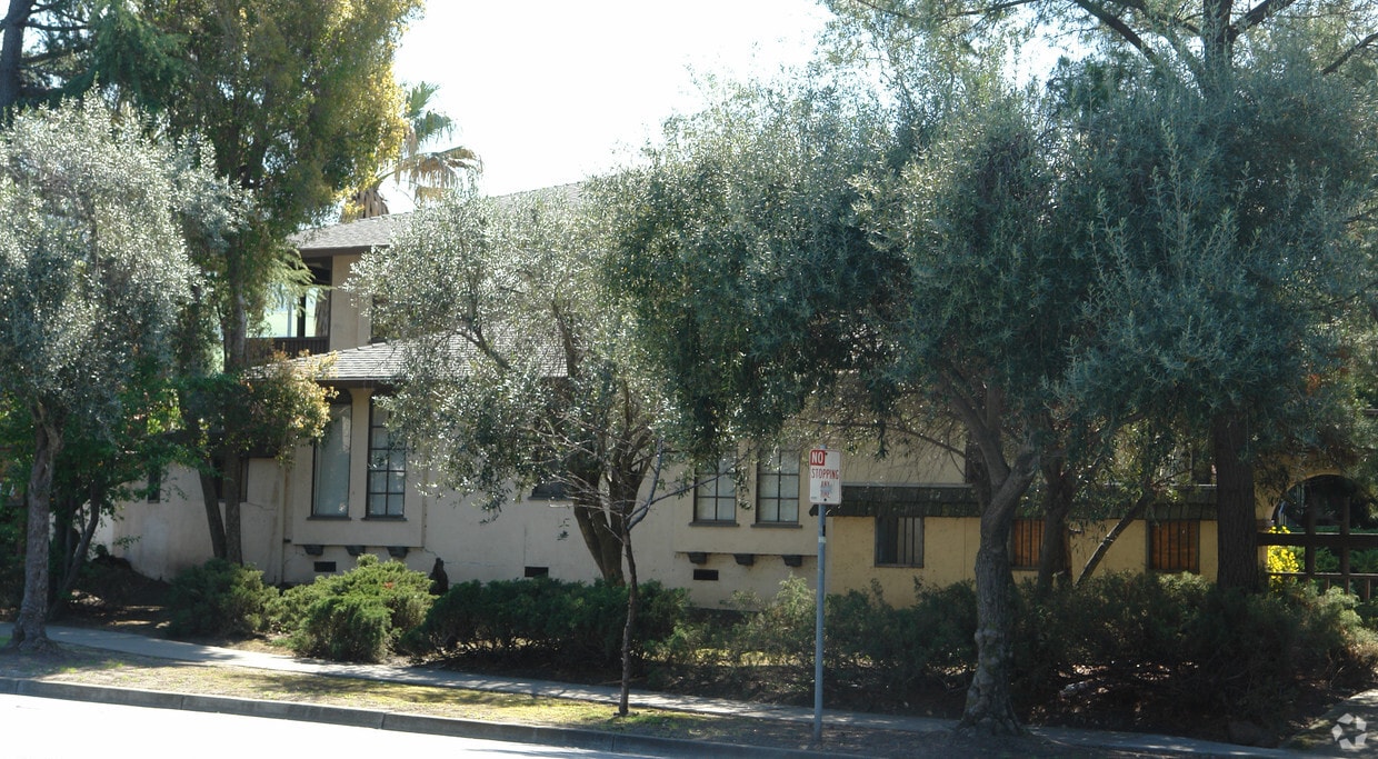

At 302 Washington Blvd, find your new home. In the 94539 Zip code of Fremont on Washington Blvd, local residents have easy access to a mixture of great nearby attractions. From location to floorplan options, the leasing team will assist you in finding the perfect new home. Come by to check out the apartment floorplan options. Drop by 302 Washington Blvd today.
302 Washington Blvd is an apartment community located in Alameda County and the 94539 ZIP Code. This area is served by the Fremont Unified attendance zone.
Fremont, positioned in the San Francisco Bay Area, combines suburban living with innovation and technology. As home to the Tesla Factory, the city maintains a strong industrial presence while offering numerous parks and outdoor spaces. Lake Elizabeth in Central Park provides recreational opportunities, while Mission Peak's trails showcase panoramic Bay Area views. The rental market remains competitive, with average rents ranging from $2,204 for studios to $3,770 for three-bedroom homes, with year-over-year increases between 1.5% and 4.4%.
The city's five districts each offer distinct characteristics. Historic Niles preserves its early film industry heritage, while Mission San Jose features the restored Mission San José, an architectural landmark from 1797. The Warm Springs area has developed into a technology center, and Central Fremont includes shopping destinations like the Fremont Hub and Pacific Commons.
Learn more about living in Fremont| Colleges & Universities | Distance | ||
|---|---|---|---|
| Colleges & Universities | Distance | ||
| Walk: | 16 min | 0.9 mi | |
| Drive: | 12 min | 5.9 mi | |
| Drive: | 17 min | 11.1 mi | |
| Drive: | 25 min | 12.9 mi |


Transportation options available in Fremont include Warm Springs / South Fremont, located 3.9 miles from 302 Washington Blvd. 302 Washington Blvd is near Norman Y Mineta San Jose International, located 15.1 miles or 21 minutes away, and Metro Oakland International, located 25.5 miles or 35 minutes away.
| Transit / Subway | Distance | ||
|---|---|---|---|
| Transit / Subway | Distance | ||
|
|
Drive: | 7 min | 3.9 mi |
|
|
Drive: | 10 min | 4.2 mi |
|
|
Drive: | 10 min | 4.5 mi |
|
|
Drive: | 16 min | 8.0 mi |
|
|
Drive: | 15 min | 9.7 mi |
| Commuter Rail | Distance | ||
|---|---|---|---|
| Commuter Rail | Distance | ||
| Drive: | 11 min | 5.3 mi | |
| Drive: | 11 min | 5.4 mi | |
| Drive: | 16 min | 11.7 mi | |
| Drive: | 16 min | 11.8 mi | |
| Drive: | 18 min | 12.7 mi |
| Airports | Distance | ||
|---|---|---|---|
| Airports | Distance | ||
|
Norman Y Mineta San Jose International
|
Drive: | 21 min | 15.1 mi |
|
Metro Oakland International
|
Drive: | 35 min | 25.5 mi |
Time and distance from 302 Washington Blvd.
| Shopping Centers | Distance | ||
|---|---|---|---|
| Shopping Centers | Distance | ||
| Walk: | 4 min | 0.2 mi | |
| Walk: | 16 min | 0.9 mi | |
| Drive: | 4 min | 2.0 mi |
| Parks and Recreation | Distance | ||
|---|---|---|---|
| Parks and Recreation | Distance | ||
|
Central Park (Lake Elizabeth)
|
Drive: | 9 min | 4.0 mi |
|
Mission Peak Regional Preserve
|
Drive: | 16 min | 4.5 mi |
|
Niles Canyon Railway
|
Drive: | 10 min | 5.1 mi |
|
Niles Community Park
|
Drive: | 12 min | 5.6 mi |
|
Sunol Regional Wilderness
|
Drive: | 24 min | 11.5 mi |
| Hospitals | Distance | ||
|---|---|---|---|
| Hospitals | Distance | ||
| Drive: | 8 min | 3.6 mi | |
| Drive: | 10 min | 4.5 mi |
| Military Bases | Distance | ||
|---|---|---|---|
| Military Bases | Distance | ||
| Drive: | 27 min | 17.9 mi |
What Are Walk Score®, Transit Score®, and Bike Score® Ratings?
Walk Score® measures the walkability of any address. Transit Score® measures access to public transit. Bike Score® measures the bikeability of any address.
What is a Sound Score Rating?
A Sound Score Rating aggregates noise caused by vehicle traffic, airplane traffic and local sources

302 Washington Blvd
Fremont, CA 94539


