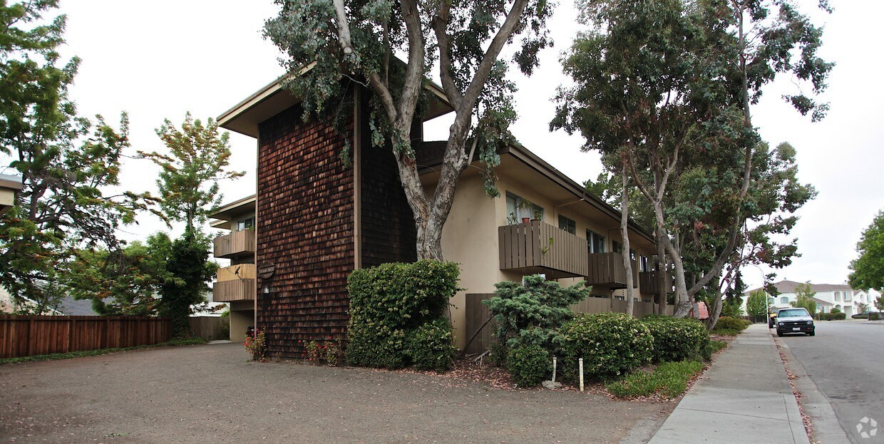
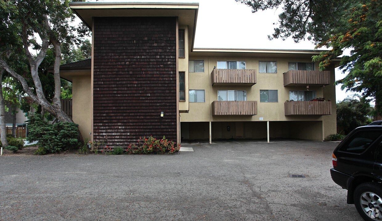
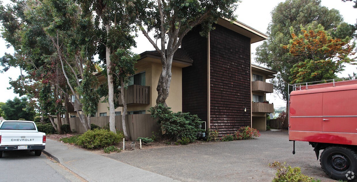
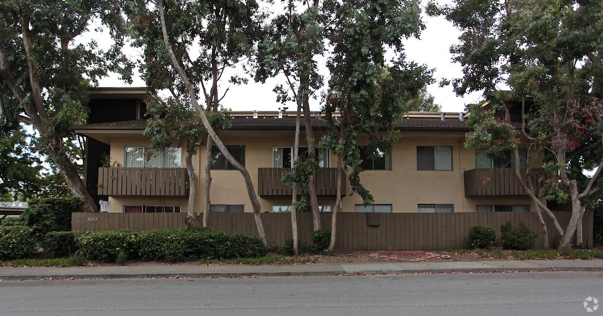
300 Oxford Way
300 Oxford Way,
Belmont,
CA
94002
2 Weeks Ago
Favorites
300 Oxford Way
Favorites
Check Back Soon for Upcoming Availability
Fees and Policies
The fees below are based on community-supplied data and may exclude additional fees and utilities.
- Parking
-
Surface LotEstacionamiento disponible--
Details
Property Information
-
Built in 1962
-
14 units/3 stories
About 300 Oxford Way Belmont, CA 94002
Discover your new home at 300 Oxford Way. This community is located in the 94002 area of Belmont. The professional leasing staff is available to help you find the perfect apartment. Contact us today to see available floor plans and see 300 Oxford Way.
300 Oxford Way is an apartment community located in San Mateo County and the 94002 ZIP Code. This area is served by the Belmont-Redwood Shores Elementary attendance zone.
Apartment Features
Acceso a Internet de alta velocidad
Suelos de madera maciza
Chimenea
Ventiladores de techo
- Acceso a Internet de alta velocidad
- Ventiladores de techo
- Libre de humo
- Preinstalación de cables
- Chimenea
- Suelos de madera maciza
Location
Get Directions
Situated midway between San Francisco and San Jose, Belmont is a tranquil community known for its wooded hills, vast stretches of open space, and expansive views of the San Francisco Bay. Belmont’s pervasive natural beauty and laidback atmosphere provide a calm reprieve from the bustle of city life.
Residents often flock to Twin Pines Park, Water Dog Lake Park, and nearby Laurelwood Park to enjoy scenic trails and various outdoor activities. Belmont’s close-knit community is frequently brought together for a wide variety of special city events and programs as well.
Belmont offers a host of diverse eateries and shops along its stretch of El Camino Real. Numerous metropolitan amenities are within close reach with quick access to the CalTrain and multiple major roadways.
Known for its wooded hills, views of the San Francisco Bay, and stretches of open space, Belmont is a quiet residential community in the midst of the culturally and technologically rich Bay Area.
Learn more about living in Belmont
Amenities
- Acceso a Internet de alta velocidad
- Ventiladores de techo
- Libre de humo
- Preinstalación de cables
- Chimenea
- Suelos de madera maciza
Education
| Colleges & Universities | Distance | ||
|---|---|---|---|
| Colleges & Universities | Distance | ||
| Drive: | 11 min | 6.7 mi | |
| Drive: | 18 min | 8.3 mi | |
| Drive: | 15 min | 8.8 mi | |
| Drive: | 24 min | 14.4 mi |
300 Oxford Way is within 11 minutes or 6.7 miles from College of San Mateo. It is also near Menlo College and Canada College.
Schools


Public Elementary & Middle School
Grades K-8
608 Students
Attendance Zone
Public Elementary School
Grades K-5
Nearby
Public Elementary, Middle & High School
Grades K-12
49 Students
Nearby
Public Elementary School
Grades K-5
355 Students
Nearby
Public Middle School
Grades 6-8
1,117 Students
Attendance Zone
Public High School
Grades 9-12
2,322 Students
Attendance Zone
Public High School
Grades 11-12
Nearby
Private Elementary, Middle & High School
Grades PK-12
80 Students
Nearby
Private Elementary & Middle School
Grades K-8
Nearby
Private High School
Grades 9-12
475 Students
Nearby
School data provided by
 The GreatSchools Rating helps parents compare schools within a state based on a variety of school quality indicators and provides a helpful picture of how effectively each school serves all of its students. Ratings are on a scale of 1 (below average) to 10 (above average) and can include test scores, college readiness, academic progress, advanced courses, equity, discipline and attendance data. We also advise parents to visit schools, consider other information on school performance and programs, and consider family needs as part of the school selection process.
View GreatSchools Rating Methodology
Data provided by GreatSchools.org © 2025. All rights reserved.
View GreatSchools Rating Methodology
Data provided by GreatSchools.org © 2025. All rights reserved.
Transportation options available in Belmont include Millbrae Bart Station, located 10.0 miles from 300 Oxford Way. 300 Oxford Way is near San Francisco International, located 11.1 miles or 16 minutes away, and Metro Oakland International, located 26.7 miles or 35 minutes away.
| Transit / Subway | Distance | ||
|---|---|---|---|
| Transit / Subway | Distance | ||
|
|
Drive: | 14 min | 10.0 mi |
|
|
Drive: | 14 min | 10.0 mi |
| Drive: | 15 min | 10.7 mi | |
|
|
Drive: | 16 min | 10.9 mi |
|
|
Drive: | 16 min | 11.1 mi |
| Commuter Rail | Distance | ||
|---|---|---|---|
| Commuter Rail | Distance | ||
| Walk: | 13 min | 0.7 mi | |
| Walk: | 14 min | 0.7 mi | |
| Drive: | 4 min | 1.8 mi | |
| Drive: | 6 min | 2.2 mi | |
| Drive: | 6 min | 3.9 mi |
| Airports | Distance | ||
|---|---|---|---|
| Airports | Distance | ||
|
San Francisco International
|
Drive: | 16 min | 11.1 mi |
|
Metro Oakland International
|
Drive: | 35 min | 26.7 mi |
Time and distance from 300 Oxford Way.
| Shopping Centers | Distance | ||
|---|---|---|---|
| Shopping Centers | Distance | ||
| Walk: | 7 min | 0.4 mi | |
| Walk: | 14 min | 0.7 mi | |
| Walk: | 14 min | 0.8 mi |
300 Oxford Way has 3 shopping centers within 0.8 mile, which is about a 14-minute walk. The miles and minutes will be for the farthest away property.
| Parks and Recreation | Distance | ||
|---|---|---|---|
| Parks and Recreation | Distance | ||
|
San Mateo Arboretum
|
Drive: | 8 min | 5.0 mi |
|
Japanese Tea Garden (San Mateo)
|
Drive: | 9 min | 5.4 mi |
|
Edgewood Park & Natural Preserve
|
Drive: | 11 min | 5.5 mi |
|
Shoreline Parks
|
Drive: | 9 min | 5.6 mi |
|
Pulgas Ridge Open Space Preserve
|
Drive: | 15 min | 7.0 mi |
300 Oxford Way has 5 parks within 7.0 miles, including San Mateo Arboretum, Japanese Tea Garden (San Mateo), and Shoreline Parks.
| Hospitals | Distance | ||
|---|---|---|---|
| Hospitals | Distance | ||
| Drive: | 5 min | 1.8 mi | |
| Drive: | 7 min | 4.1 mi | |
| Drive: | 10 min | 4.9 mi |
300 Oxford Way has 3 hospitals within 4.9 miles, the nearest is San Mateo Medical Center which is 1.8 miles away and a 5 minute drive.
| Military Bases | Distance | ||
|---|---|---|---|
| Military Bases | Distance | ||
| Drive: | 23 min | 16.2 mi |
300 Oxford Way is 16.2 miles and a 23 minute drive from Ames Research Center.
You May Also Like
Similar Rentals Nearby


What Are Walk Score®, Transit Score®, and Bike Score® Ratings?
Walk Score® measures the walkability of any address. Transit Score® measures access to public transit. Bike Score® measures the bikeability of any address.
What is a Sound Score Rating?
A Sound Score Rating aggregates noise caused by vehicle traffic, airplane traffic and local sources
Responded To This Review