
10 Halletts Point
10, 20, 30 Halletts Pt,
Astoria, NY 11102
$3,357 - $6,971
Studio - 2 Beds
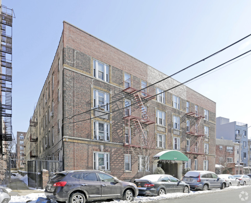
Charming building with a year-round landscaped courtyard, and on-site super. These apartments are large with high ceilings, large windows, beautiful kitchens, some with stainless steel appliances and granite counters. This building is well located in between the Broadway and 30th Avenue Subway Stops with the N & W trains. Close to restaurants, cafes, entertainment, grocery & supermarkets, pharmacies, and everything Astoria has to offer.
30-49 Crescent Street is an apartment community located in Queens County and the 11102 ZIP Code. This area is served by the New York City Geographic District #30 attendance zone.
Located in northwest Queens, one of the five boroughs of New York City, Astoria is situated a mere six miles across the East River from Manhattan. Lively and welcoming, down-to-earth and diverse, Astoria provides varied culinary options, great shopping, and relatively quiet residential streets.
Astoria has a rich history and has made great contributions to American culture. Home to Kaufman Astoria Studios, the original home of Paramount Pictures in 1920, the neighborhood was at the forefront of the motion picture industry. Today, the studio is one of the largest and most sophisticated production facilities on the East Coast. Steinway and Sons has been constructing its legendary pianos in Astoria since the late 19th century. The neighborhood has often been featured in film, television, and other media, either as Astoria or as a setting for another location in New York City.
Learn more about living in Downtown AstoriaCompare neighborhood and city base rent averages by bedroom.
| Downtown Astoria | Long Island City, NY | |
|---|---|---|
| Studio | $1,938 | $3,082 |
| 1 Bedroom | $2,260 | $3,710 |
| 2 Bedrooms | $3,060 | $5,081 |
| 3 Bedrooms | $3,601 | $7,395 |
| Colleges & Universities | Distance | ||
|---|---|---|---|
| Colleges & Universities | Distance | ||
| Drive: | 5 min | 2.1 mi | |
| Drive: | 8 min | 3.4 mi | |
| Drive: | 8 min | 3.6 mi | |
| Drive: | 9 min | 3.8 mi |


Transportation options available in Long Island City include 30 Av, located 0.3 mile from 30-49 Crescent Street. 30-49 Crescent Street is near LaGuardia, located 3.3 miles or 9 minutes away, and John F Kennedy International, located 14.6 miles or 22 minutes away.
| Transit / Subway | Distance | ||
|---|---|---|---|
| Transit / Subway | Distance | ||
| Walk: | 5 min | 0.3 mi | |
| Walk: | 9 min | 0.5 mi | |
| Walk: | 11 min | 0.6 mi | |
| Walk: | 17 min | 0.9 mi | |
| Drive: | 3 min | 1.1 mi |
| Commuter Rail | Distance | ||
|---|---|---|---|
| Commuter Rail | Distance | ||
|
|
Drive: | 5 min | 2.5 mi |
|
|
Drive: | 6 min | 2.8 mi |
|
|
Drive: | 7 min | 3.3 mi |
|
|
Drive: | 9 min | 3.8 mi |
|
|
Drive: | 9 min | 4.1 mi |
| Airports | Distance | ||
|---|---|---|---|
| Airports | Distance | ||
|
LaGuardia
|
Drive: | 9 min | 3.3 mi |
|
John F Kennedy International
|
Drive: | 22 min | 14.6 mi |
Scores provided by
Traffic
-Airport
-Businesses
-Scores provided by
HowLoud What is a Sound Score Rating? A Sound Score Rating aggregates noise caused by vehicle traffic, airplane traffic and local sources. How It WorksTime and distance from 30-49 Crescent Street.
| Shopping Centers | Distance | ||
|---|---|---|---|
| Shopping Centers | Distance | ||
| Walk: | 13 min | 0.7 mi | |
| Drive: | 5 min | 1.6 mi | |
| Drive: | 5 min | 1.7 mi |
| Parks and Recreation | Distance | ||
|---|---|---|---|
| Parks and Recreation | Distance | ||
|
Hallets Cove Playground
|
Walk: | 12 min | 0.6 mi |
|
Socrates Sculpture Park
|
Walk: | 15 min | 0.8 mi |
|
Astoria Park
|
Drive: | 3 min | 1.2 mi |
|
John Jay Park
|
Drive: | 10 min | 4.2 mi |
|
Carl Schurz Park
|
Drive: | 12 min | 5.0 mi |
| Hospitals | Distance | ||
|---|---|---|---|
| Hospitals | Distance | ||
| Drive: | 8 min | 3.6 mi | |
| Drive: | 10 min | 4.0 mi | |
| Drive: | 11 min | 5.1 mi |
| Military Bases | Distance | ||
|---|---|---|---|
| Military Bases | Distance | ||
| Drive: | 19 min | 9.7 mi | |
| Drive: | 22 min | 10.5 mi | |
| Drive: | 33 min | 16.0 mi |
What Are Walk Score®, Transit Score®, and Bike Score® Ratings?
Walk Score® measures the walkability of any address. Transit Score® measures access to public transit. Bike Score® measures the bikeability of any address.
What is a Sound Score Rating?
A Sound Score Rating aggregates noise caused by vehicle traffic, airplane traffic and local sources.

30-49 Crescent St
Long Island City, NY 11102


