

429 S Huntington Ave
429 S Huntington Ave
Boston, MA 02130
2 Weeks Ago
Favorites
429 S Huntington Ave

Favorites
Check Back Soon for Upcoming Availability
| Beds | Baths | Average SF |
|---|---|---|
| 3 Bedrooms 3 Bedrooms 3 Br | 1 Bath 1 Bath 1 Ba | — |
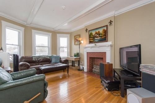
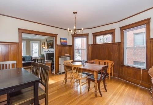
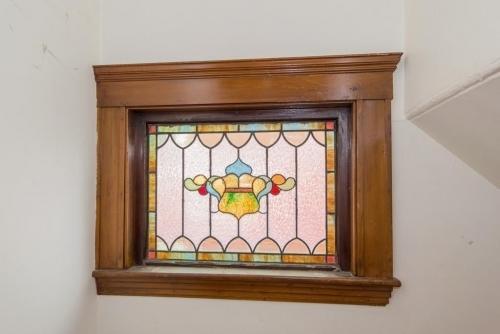
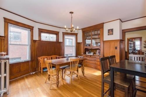
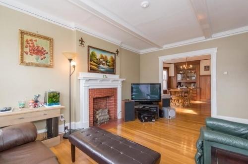
About This Property
APS57231138 - Please inquire for more information!Bus: 41 Centre St @ S Huntington Ave (0.04 mi)Bus: 39 S Huntington Ave @ Moraine St (0.06 mi)Subway: Orange Line Stony Brook (0.46 mi)Bus: 60 High St @ Cypress St (0.56 mi)Bus: 14 Heath St opp Hayden St (0.51 mi)
429 S Huntington Ave is a condo located in Suffolk County and the 02130 ZIP Code. This area is served by the Boston Public Schools attendance zone.
Location
Get Directions
Located about five miles southwest of downtown Boston, Jamaica Hills-Pond has many historic multi-family homes for rent. The commercial district lies along Centre Street and provides residents with a wide choice of local restaurants and stores.
Nature lovers will find much to explore in Jamaica Hills-Pond. Your apartment puts you within easy walking distance of Jamaica Pond, a 68-acre body of water surrounded by a 1.5-mile path perfect for walking or running. Go for a jog around the pond or rent a kayak from the boathouse and take to the water. Locals who prefer gardens head to the 281-acre Arnold Arboretum to stroll among plants and trees from around the world. Go birdwatching, admire the lilac collection, or sit under one of the maple trees on a lovely spring day. Afterward, walk over to Wonder Spice Cafe for Cambodian cuisine, and then visit J.P. Licks for ice cream.
Learn more about living in Jamaica Hills-PondBelow are rent ranges for similar nearby apartments
| Beds | Average Size | Lowest | Typical | Premium |
|---|---|---|---|---|
| Studio Studio Studio | 2048-2049 Sq Ft | $1,600 | $2,417 | $5,091 |
| 1 Bed 1 Bed 1 Bed | 2590-2591 Sq Ft | $1,150 | $2,912 | $6,124 |
| 2 Beds 2 Beds 2 Beds | 3436 Sq Ft | $2,200 | $3,491 | $7,297 |
| 3 Beds 3 Beds 3 Beds | 4638 Sq Ft | $1,300 | $3,946 | $6,566 |
| 4 Beds 4 Beds 4 Beds | 5972 Sq Ft | $1,050 | $6,154 | $11,550 |
Education
| Colleges & Universities | Distance | ||
|---|---|---|---|
| Colleges & Universities | Distance | ||
| Drive: | 4 min | 1.6 mi | |
| Drive: | 4 min | 2.0 mi | |
| Drive: | 4 min | 2.0 mi | |
| Drive: | 5 min | 2.3 mi |
429 S Huntington Ave is within 4 minutes or 1.6 miles from MCPHS University, Boston. It is also near MassArt and Wentworth Inst. of Technology.
Schools


Charter Elementary, Middle & High School
Grades 5-12
1,295 Students
Nearby
Public Elementary & Middle School
Grades PK-8
931 Students
Nearby
Public High School
Grades 9-12
90 Students
Nearby
Private Elementary & Middle School
Grades PK-8
Nearby
Private Elementary, Middle & High School
Grades 1-10
Nearby
Private Middle & High School
Grades 6-12
67 Students
Nearby
School data provided by
 The GreatSchools Rating helps parents compare schools within a state based on a variety of school quality indicators and provides a helpful picture of how effectively each school serves all of its students. Ratings are on a scale of 1 (below average) to 10 (above average) and can include test scores, college readiness, academic progress, advanced courses, equity, discipline and attendance data. We also advise parents to visit schools, consider other information on school performance and programs, and consider family needs as part of the school selection process.
View GreatSchools Rating Methodology
Data provided by GreatSchools.org © 2025. All rights reserved.
View GreatSchools Rating Methodology
Data provided by GreatSchools.org © 2025. All rights reserved.
Transportation options available in Boston include Stony Brook Station, located 0.5 mile from 429 S Huntington Ave. 429 S Huntington Ave is near General Edward Lawrence Logan International, located 7.8 miles or 16 minutes away.
| Transit / Subway | Distance | ||
|---|---|---|---|
| Transit / Subway | Distance | ||
|
|
Walk: | 9 min | 0.5 mi |
|
|
Walk: | 11 min | 0.6 mi |
|
|
Walk: | 14 min | 0.7 mi |
|
|
Walk: | 14 min | 0.7 mi |
|
|
Walk: | 17 min | 0.9 mi |
| Commuter Rail | Distance | ||
|---|---|---|---|
| Commuter Rail | Distance | ||
|
|
Drive: | 4 min | 1.4 mi |
|
|
Drive: | 5 min | 2.3 mi |
| Drive: | 8 min | 3.0 mi | |
|
|
Drive: | 7 min | 3.2 mi |
|
|
Drive: | 12 min | 5.8 mi |
| Airports | Distance | ||
|---|---|---|---|
| Airports | Distance | ||
|
General Edward Lawrence Logan International
|
Drive: | 16 min | 7.8 mi |
Time and distance from 429 S Huntington Ave.
| Shopping Centers | Distance | ||
|---|---|---|---|
| Shopping Centers | Distance | ||
| Drive: | 3 min | 1.6 mi | |
| Drive: | 5 min | 2.0 mi | |
| Drive: | 6 min | 2.5 mi |
429 S Huntington Ave has 3 shopping centers within 2.5 miles, which is about a 6-minute drive. The miles and minutes will be for the farthest away property.
| Parks and Recreation | Distance | ||
|---|---|---|---|
| Parks and Recreation | Distance | ||
|
Frederick Law Olmsted National Historic Site
|
Drive: | 4 min | 1.5 mi |
|
Roxbury Heritage State Park
|
Drive: | 4 min | 1.9 mi |
|
Arnold Arboretum of Harvard University
|
Drive: | 5 min | 2.3 mi |
|
Franklin Park Zoo
|
Drive: | 6 min | 2.5 mi |
|
Lower Neponset River Trail
|
Drive: | 6 min | 2.7 mi |
429 S Huntington Ave has 5 parks within 2.7 miles, including Frederick Law Olmsted National Historic Site, Roxbury Heritage State Park, and Lower Neponset River Trail.
| Hospitals | Distance | ||
|---|---|---|---|
| Hospitals | Distance | ||
| Walk: | 6 min | 0.3 mi | |
| Drive: | 3 min | 1.1 mi | |
| Drive: | 3 min | 1.5 mi |
429 S Huntington Ave has 3 hospitals within 1.5 miles, the nearest is Arbour Hospital which is 0.3 mile away and a 6 minute walk.
| Military Bases | Distance | ||
|---|---|---|---|
| Military Bases | Distance | ||
| Drive: | 28 min | 14.6 mi | |
| Drive: | 32 min | 16.4 mi |
429 S Huntington Ave is 14.6 miles from US Military Reservation, and is convenient to other military bases, including Hanscom Air Force Base.
You May Also Like
Similar Rentals Nearby


What Are Walk Score®, Transit Score®, and Bike Score® Ratings?
Walk Score® measures the walkability of any address. Transit Score® measures access to public transit. Bike Score® measures the bikeability of any address.
What is a Sound Score Rating?
A Sound Score Rating aggregates noise caused by vehicle traffic, airplane traffic and local sources
429 S Huntington Ave
Boston, MA 02130