$1,200
/ Month
295 Halsted St Unit 1
East Orange, NJ 07018
1 Day Ago
|
Edit
Favorites
-
Bedrooms
Studio
-
Bathrooms
1
-
Square Feet
--
295 Halsted St Unit 1

Favorites
About This Home
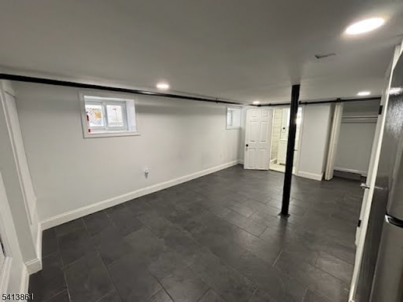
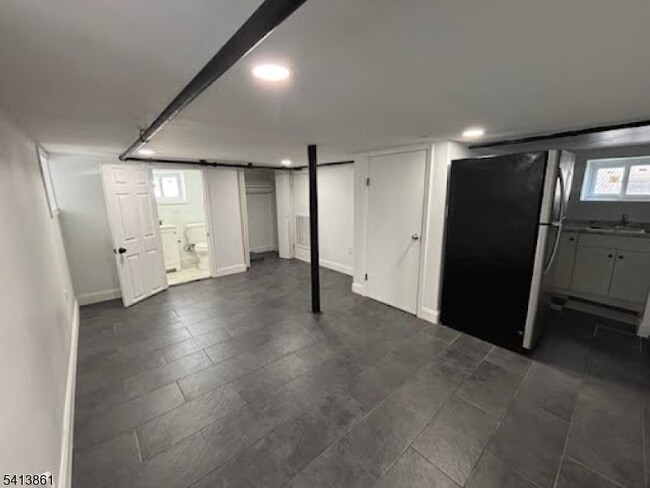
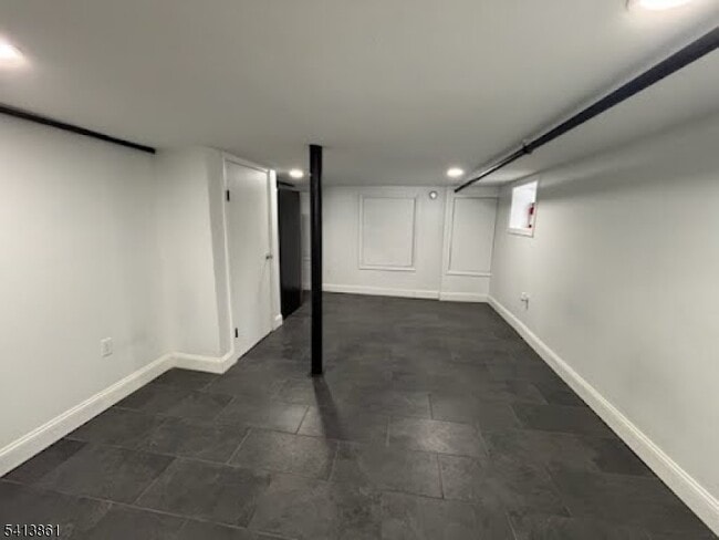
250 ft.² Studio, shared backyard, pets on landlord approval, $300 pet fee, available ASAP, shared backyard. Basement Unit. Utilities separate.
295 Halsted St is an apartment community located in Essex County and the 07018 ZIP Code.
* Price shown is base rent. Excludes user-selected optional fees and variable or usage-based fees and required charges due at or prior to move-in or at move-out. Price, availability, fees, and any applicable rent special are subject to change without notice.
* Square footage definitions vary. Displayed square footage is approximate.
Home Details
Year Built
Built in 1940 | Remodeled
Bedrooms and Bathrooms
1 Full Bathroom
Finished Basement
Walk-Out Basement
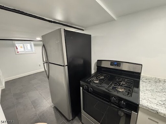
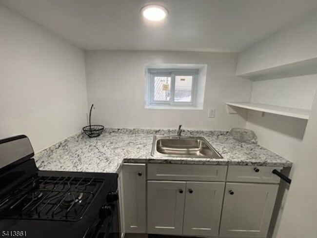
Kitchen
Gas Oven or Range
Listing and Financial Details
Assessor Parcel Number 1605-00736-0000-00036-0000-
Tenant pays for electric, gas, heat, hot water
Lot Details
3,049 Sq Ft Lot
Utilities
Window Unit Cooling System
Community Details
Pet Policy
Limit on the number of pets
Contact
- Listed by VANESSA GONZALEZ | GardenStateMLS#NJ
-
Source
Garden State Multiple Listing Service, LLC
Copyright © 2026 Garden State MLS, LLC. All rights reserved. All information provided by the listing agent/broker is deemed reliable but is not guaranteed and should be independently verified.
Location
Get Directions
East Orange, NJ, sits just 12 miles from Manhattan, combining historic charm with contemporary city living. Tree-lined streets showcase the area's architectural heritage, from pre-war apartment buildings to classic single-family homes.
The city features established neighborhoods like Greenwood, known for its architectural character, and the Central Avenue Commercial District. Elmwood Park provides recreational opportunities with its swimming pool, tennis courts, and walking track. The East Orange Campus High School stands on the historic grounds of the former Upsala College, while the Whitney E. Houston Academy of Creative & Performing Arts honors the legendary singer's local roots. Two NJ Transit train stations offer direct service to New York City, making the area particularly accessible for commuters.
Learn more about living in East Orange
Amenities
- Air Conditioning
- Range
- Refrigerator
Education
| Colleges & Universities | Distance | ||
|---|---|---|---|
| Colleges & Universities | Distance | ||
| Drive: | 5 min | 2.0 mi | |
| Drive: | 6 min | 2.9 mi | |
| Drive: | 5 min | 3.1 mi | |
| Drive: | 5 min | 3.1 mi |
295 Halsted St Unit 1 is within 5 minutes or 2.0 miles from Seton Hall University. It is also near N.J. Inst. of Technology and Essex County College.
Transportation options available in East Orange include Norfolk Street, located 2.6 miles from 295 Halsted St Unit 1. 295 Halsted St Unit 1 is near Newark Liberty International, located 8.4 miles or 15 minutes away, and LaGuardia, located 29.8 miles or 45 minutes away.
| Transit / Subway | Distance | ||
|---|---|---|---|
| Transit / Subway | Distance | ||
|
|
Drive: | 4 min | 2.6 mi |
|
|
Drive: | 5 min | 2.6 mi |
|
|
Drive: | 5 min | 2.8 mi |
|
|
Drive: | 5 min | 3.0 mi |
|
|
Drive: | 7 min | 3.9 mi |
| Commuter Rail | Distance | ||
|---|---|---|---|
| Commuter Rail | Distance | ||
|
|
Walk: | 13 min | 0.7 mi |
|
|
Drive: | 2 min | 1.1 mi |
|
|
Drive: | 4 min | 1.6 mi |
|
|
Drive: | 3 min | 1.6 mi |
|
|
Drive: | 7 min | 2.3 mi |
| Airports | Distance | ||
|---|---|---|---|
| Airports | Distance | ||
|
Newark Liberty International
|
Drive: | 15 min | 8.4 mi |
|
LaGuardia
|
Drive: | 45 min | 29.8 mi |
Time and distance from 295 Halsted St Unit 1.
| Shopping Centers | Distance | ||
|---|---|---|---|
| Shopping Centers | Distance | ||
| Walk: | 14 min | 0.8 mi | |
| Drive: | 2 min | 1.4 mi | |
| Drive: | 3 min | 1.7 mi |
295 Halsted St Unit 1 has 3 shopping centers within 1.7 miles, which is about a 3-minute drive. The miles and minutes will be for the farthest away property.
| Parks and Recreation | Distance | ||
|---|---|---|---|
| Parks and Recreation | Distance | ||
|
Edison National Historic Site
|
Drive: | 6 min | 2.8 mi |
|
Newark Museum and Dreyfuss Planetarium
|
Drive: | 6 min | 3.2 mi |
|
Branch Brook Park
|
Drive: | 9 min | 4.2 mi |
|
Turtle Back Zoo
|
Drive: | 10 min | 4.5 mi |
|
Greenwood Gardens
|
Drive: | 14 min | 6.2 mi |
295 Halsted St Unit 1 has 5 parks within 6.2 miles, including Edison National Historic Site, Newark Museum and Dreyfuss Planetarium, and Branch Brook Park.
| Hospitals | Distance | ||
|---|---|---|---|
| Hospitals | Distance | ||
| Walk: | 15 min | 0.8 mi | |
| Drive: | 4 min | 2.5 mi | |
| Drive: | 5 min | 3.0 mi |
295 Halsted St Unit 1 has 3 hospitals within 3.0 miles, the nearest is East Orange General Hospital which is 0.8 mile away and a 15 minute walk.
| Military Bases | Distance | ||
|---|---|---|---|
| Military Bases | Distance | ||
| Drive: | 20 min | 12.3 mi | |
| Drive: | 25 min | 14.2 mi | |
| Drive: | 31 min | 15.9 mi |
295 Halsted St Unit 1 has 3 military bases within 15.9 miles, the nearest is Military Ocean Terminal which is 12.3 miles away and a 20 minute drive.
You May Also Like
How do I access Social Services in New Jersey?
Statewide service is free, confidential, multilingual and always open. Three easy ways to reach Social Services in NJ: Dial 2-1-1; text your zip code to 898-211; or chat at https://www.nj211.org
Similar Rentals Nearby


What Are Walk Score®, Transit Score®, and Bike Score® Ratings?
Walk Score® measures the walkability of any address. Transit Score® measures access to public transit. Bike Score® measures the bikeability of any address.
What is a Sound Score Rating?
A Sound Score Rating aggregates noise caused by vehicle traffic, airplane traffic and local sources

295 Halsted St
East Orange, NJ 07018