$1,800
/ Month
2948 Wardall Ave Unit 1
Cincinnati, OH 45211
1 Day Ago
Favorites
614-450-0319
-
Bedrooms
1
-
Bathrooms
1
-
Square Feet
750 sq ft
-
Available
Available Now
2948 Wardall Ave Unit 1

Favorites
About This Home
$900 deposit,
Available Now
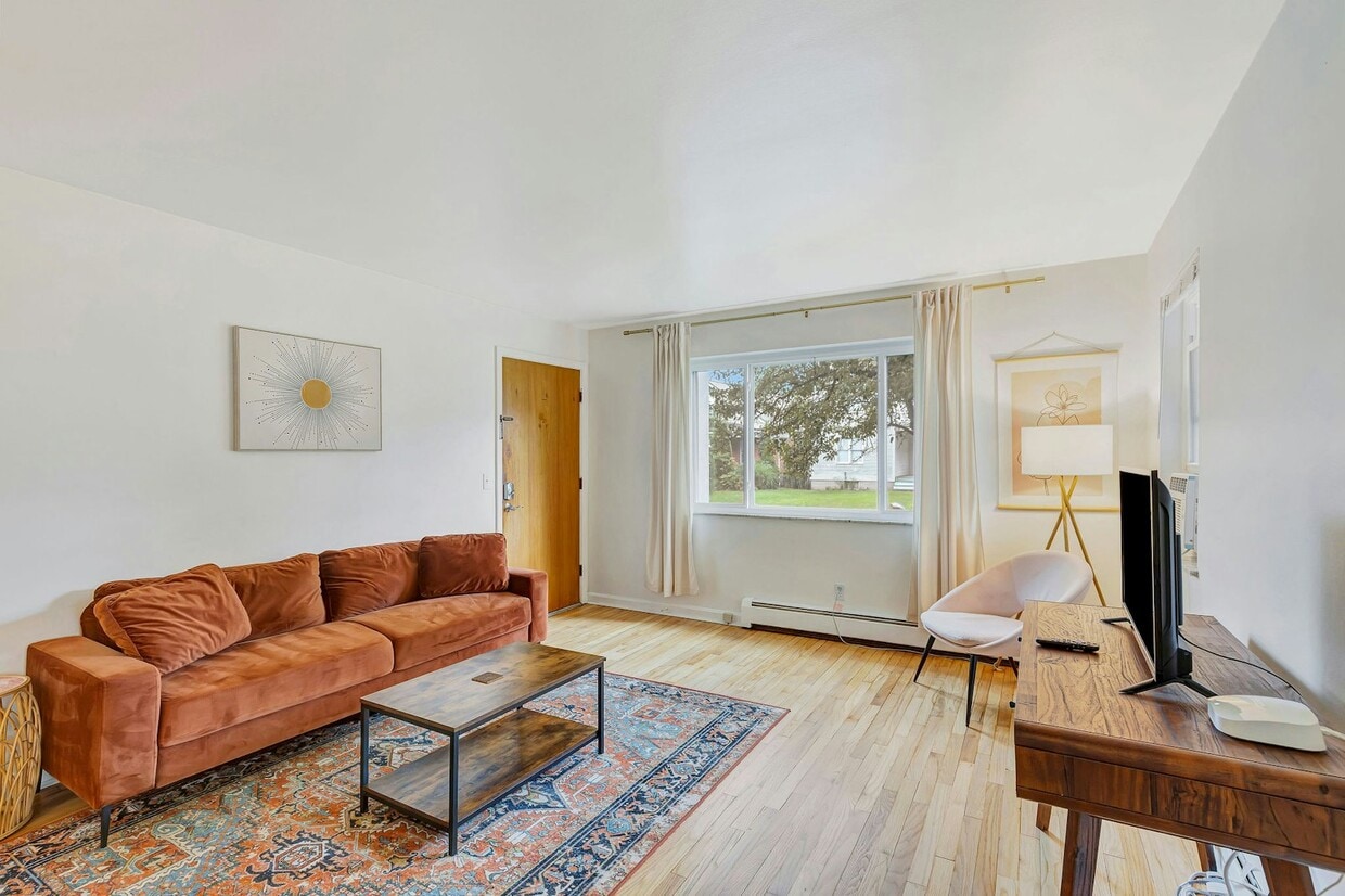
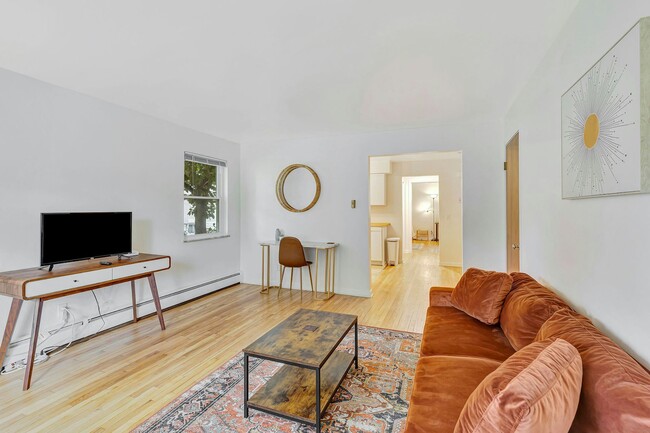
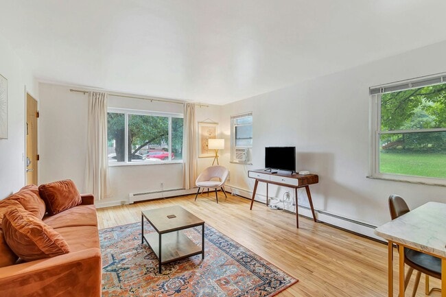
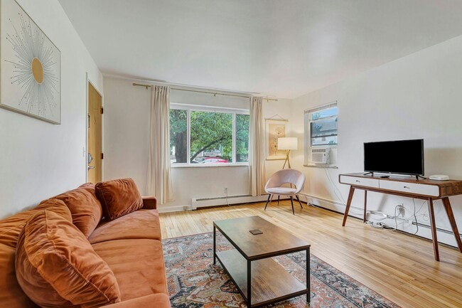
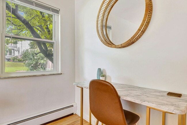
This newly renovated Fully Furnished 1BR/1BA (ground floor) is nestled on a very quiet street in Westwood, OH. 15 minutes commute to downtown and the same distance to the University of Cincinnati. Fully furnished unit located inside a garden style brick apartment building. The unit contains a smart Roku TV, WiFi, leather couch, full kitchen with dishwasher, and queen size bed. It's the perfect place for to relax and unwind after work. Ideal for interns, travel nurses, graduate students, and guests looking for interim housing. Pet friendly under 40lbs included. Ample street parking, garage space w/opener, and washer and dryer in the basement. -Leases 1-6 months in duration -Pet Friendly; 1 pet under 40lbs included -Utilities: Water, Heat, Electric, WiFi included -No Smoking of any kind -Fully Furnished -700+ Credit. Background and Credit Check mandatory. -No in person tours until application and credit check completed -No CMHA or other federal housing vouchers accepted -Ample Street Parking (Garage Space included)
2948 Wardall Ave is an apartment community located in Hamilton County and the 45211 ZIP Code.
* Price shown is base rent. Excludes user-selected optional fees and variable or usage-based fees and required charges due at or prior to move-in or at move-out. Price, availability, fees, and any applicable rent special are subject to change without notice.
* Square footage definitions vary. Displayed square footage is approximate.
Features
Air Conditioning
Dishwasher
Microwave
Refrigerator
- Air Conditioning
- Dishwasher
- Microwave
- Range
- Refrigerator
- Yard
Fees and Policies
The fees below are based on community-supplied data and may exclude additional fees and utilities.
- Dogs Allowed
-
Fees not specified
- Cats Allowed
-
Fees not specified
Details
Utilities Included
-
Gas
-
Water
-
Electricity
-
Heat
-
Trash Removal
Contact
- Listed by 2948 Wardall Management
- Phone Number
- Contact
Location
Get Directions
Amenities
- Air Conditioning
- Dishwasher
- Microwave
- Range
- Refrigerator
- Yard
Expenses
Utilities Included
Gas, Water, Electricity, Heat, Trash Removal
Included
Situated about five miles northwest of Downtown Cincinnati, Westwood is the largest neighborhood in the city. Residents flock to Westwood for its many affordable historic homes and modern apartments available for rent in addition to its close proximity to I-74, I-75, and all that Downtown Cincinnati has to offer.
While Westwood is a predominantly residential neighborhood, it is also home to a slew of convenient stores and restaurants. Shopping opportunities abound in Westwood, with plenty of national retailers in Western Hills Plaza and local shops in the growing Town Hall District. Numerous neighborhood parks provide ample space to enjoy the outdoors in town as well as the sprawling 1,400-acre Mount Airy Forest, which is partially located in Westwood.
Learn more about living in Westwood
Education
| Colleges & Universities | Distance | ||
|---|---|---|---|
| Colleges & Universities | Distance | ||
| Drive: | 13 min | 5.2 mi | |
| Drive: | 11 min | 5.4 mi | |
| Drive: | 13 min | 5.9 mi | |
| Drive: | 15 min | 6.3 mi |
2948 Wardall Ave Unit 1 is within 13 minutes or 5.2 miles from Cincinnati State. It is also near University of Cincinnati and Univ. of Cincinnati, Medical.
Transportation options available in Cincinnati include Brewery District Station, Elm & Henry, located 6.2 miles from 2948 Wardall Ave Unit 1. 2948 Wardall Ave Unit 1 is near Cincinnati/Northern Kentucky International, located 20.2 miles or 36 minutes away.
| Transit / Subway | Distance | ||
|---|---|---|---|
| Transit / Subway | Distance | ||
| Drive: | 13 min | 6.2 mi | |
| Drive: | 13 min | 6.3 mi | |
| Drive: | 13 min | 6.4 mi | |
| Drive: | 13 min | 6.4 mi | |
| Drive: | 13 min | 6.5 mi |
| Commuter Rail | Distance | ||
|---|---|---|---|
| Commuter Rail | Distance | ||
|
|
Drive: | 12 min | 6.1 mi |
| Airports | Distance | ||
|---|---|---|---|
| Airports | Distance | ||
|
Cincinnati/Northern Kentucky International
|
Drive: | 36 min | 20.2 mi |
Time and distance from 2948 Wardall Ave Unit 1.
| Shopping Centers | Distance | ||
|---|---|---|---|
| Shopping Centers | Distance | ||
| Drive: | 6 min | 2.0 mi | |
| Drive: | 7 min | 2.4 mi | |
| Drive: | 6 min | 2.4 mi |
2948 Wardall Ave Unit 1 has 3 shopping centers within 2.4 miles, which is about a 6-minute drive. The miles and minutes will be for the farthest away property.
| Parks and Recreation | Distance | ||
|---|---|---|---|
| Parks and Recreation | Distance | ||
|
Mt. Airy Forest
|
Drive: | 6 min | 2.5 mi |
|
Buttercup Valley
|
Drive: | 10 min | 4.1 mi |
|
LaBoiteaux Woods
|
Drive: | 12 min | 5.3 mi |
|
Imago Earth Center
|
Drive: | 14 min | 5.4 mi |
|
Wilson Commons
|
Drive: | 14 min | 6.2 mi |
2948 Wardall Ave Unit 1 has 5 parks within 6.2 miles, including Mt. Airy Forest, Buttercup Valley, and Imago Earth Center.
| Hospitals | Distance | ||
|---|---|---|---|
| Hospitals | Distance | ||
| Drive: | 7 min | 2.6 mi | |
| Drive: | 10 min | 4.7 mi | |
| Drive: | 13 min | 5.9 mi |
2948 Wardall Ave Unit 1 has 3 hospitals within 5.9 miles, the nearest is Mercy Health - West Hospital which is 2.6 miles away and a 7 minute drive.
| Military Bases | Distance | ||
|---|---|---|---|
| Military Bases | Distance | ||
| Drive: | 72 min | 54.9 mi | |
| Drive: | 78 min | 60.0 mi | |
| Drive: | 81 min | 63.3 mi |
2948 Wardall Ave Unit 1 has 3 military bases within 63.3 miles, the nearest is Gentile Air Force Station which is 54.9 miles away and a 72 minute drive.
You May Also Like
Similar Rentals Nearby


What Are Walk Score®, Transit Score®, and Bike Score® Ratings?
Walk Score® measures the walkability of any address. Transit Score® measures access to public transit. Bike Score® measures the bikeability of any address.
What is a Sound Score Rating?
A Sound Score Rating aggregates noise caused by vehicle traffic, airplane traffic and local sources

2948 Wardall Ave
Cincinnati, OH 45211